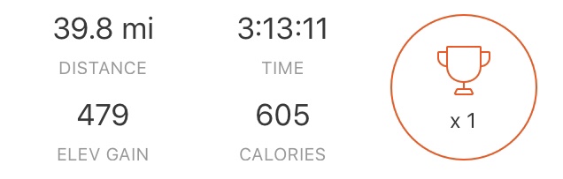
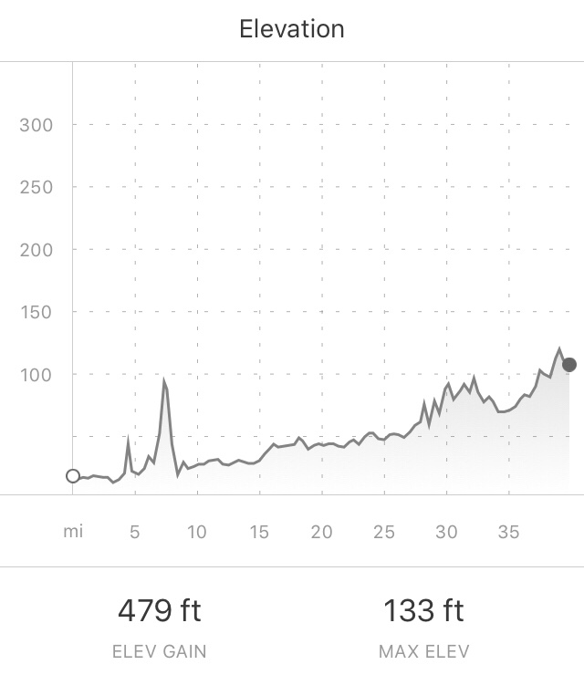
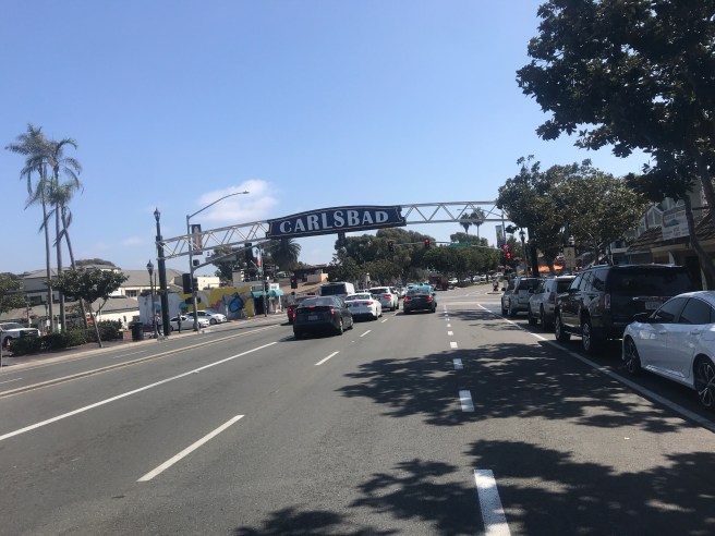
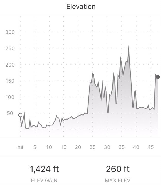
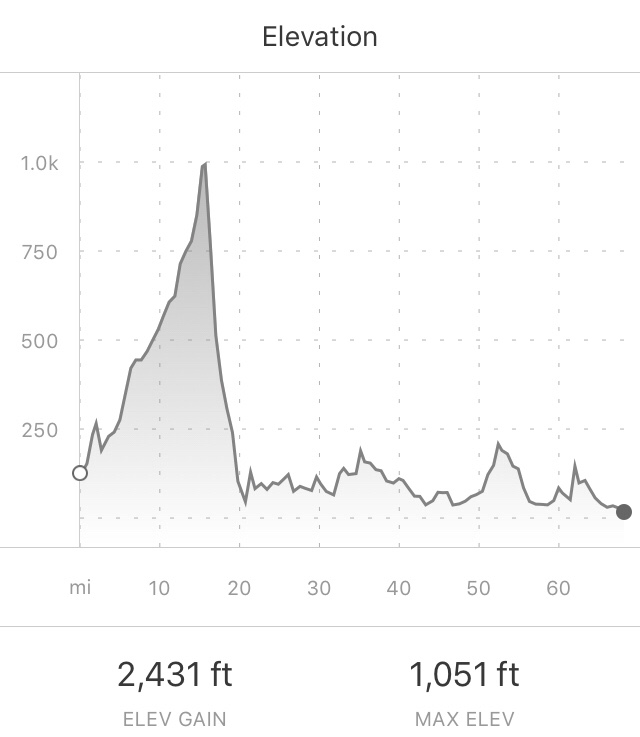
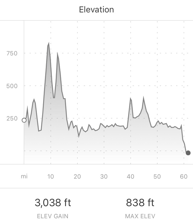
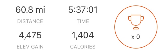
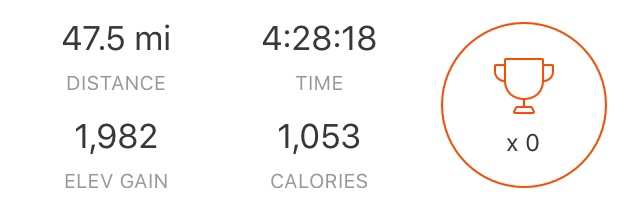
39.8 Miles
479 ft of Climbing
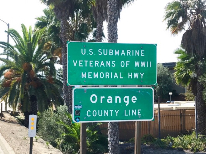
Last day of the ride, folks. No need for my tent, sleeping bag, stove, food, clothes, hygiene kit, etc. Today was Supposed to be just a little 28 mile ride to the Mexican Border. I rode with just my handlebar bag. A couple of riders had told me that they easily got to the border by following the bike path, with no navigation for most of the day. Yeah, right. That was bad information. There were turns in the bike paths, that, if you don’t take them, send you into rabbit hole cul-de-sacs, marinas, etc. After 34 days on a bike, those little missed turns were beyond irritating.
I started out a short block from the hostel, riding on the beachfront bike path. Early in the day, there is very little traffic on that path, so riding was quite enjoyable.

After passing through Mission Bay and Point Loma, I was supposed to catch a ferry to Coronado Island, but the map and street signs were in conflict. They had me turning right at this big San Diego Airport sign, which seemed incredulous, but that’s what my map told me, so I did it. Turned out that the ferry to Coronado Island was really just a boat, so I rode right past it twice. But eventually, I made my way to the island.


Right off the ferry, I caught a bike path that took me all the way through Coronado, past the Naval Amphibious Base, through the Silver Strand, and back into San Diego. It was smooth sailing–some mighty fine cycling.

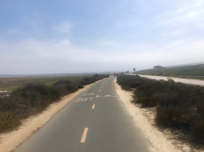


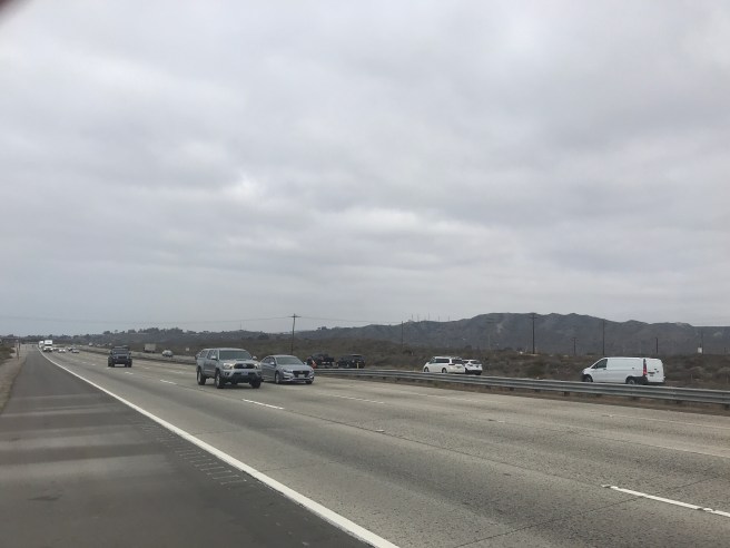
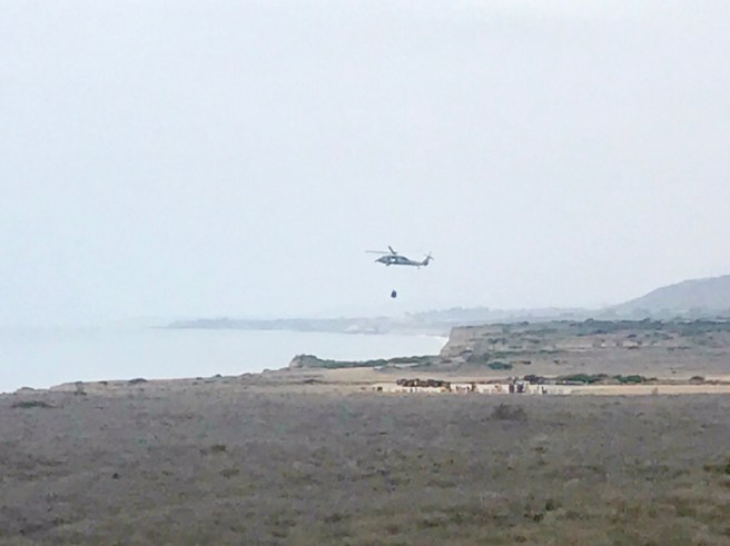
 After a stop for brunch at Denny’s, I headed south toward the border. And from that point until I actually arrived at the border, I felt like I was already in Mexico. I passed by dilapidated ranches, disassembled horse boarding/training facilities, and worn out houses and mobile homes, until I started running into a lot of US Border Patrol agents on horses and in vehicles and helicopters. It’s a busy place, down there.
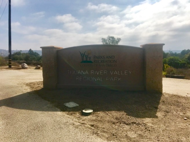
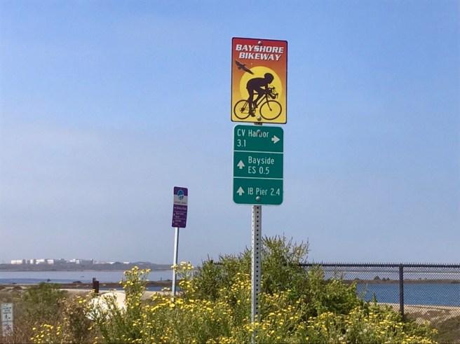
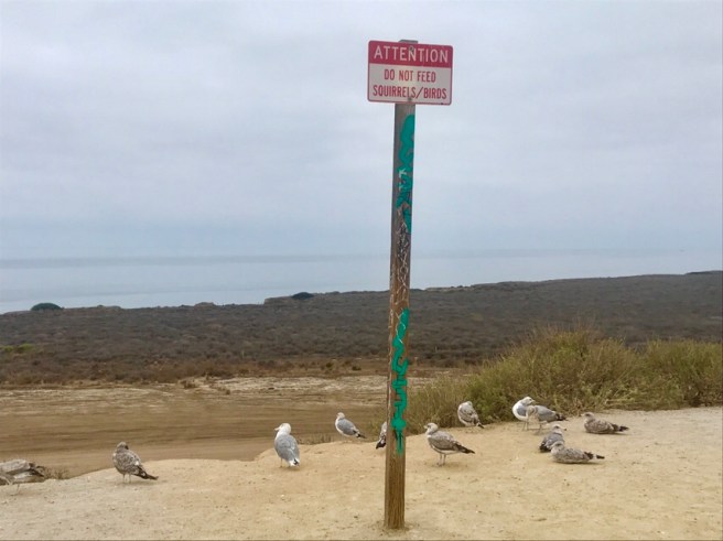
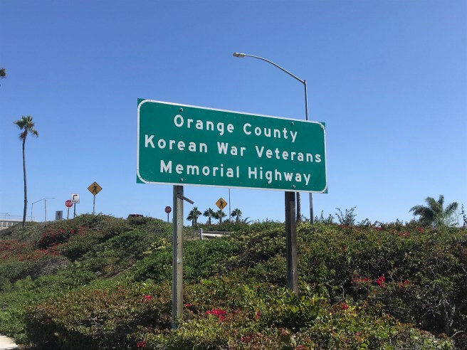
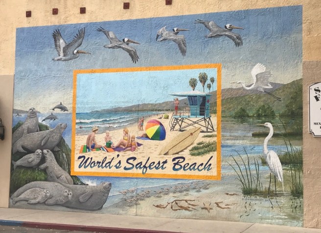
This is the entry to what was formerly probably a city or county park, but now it looks like it’s on no man’s land. Cars aren’t even allowed on the road. I felt like I was at Panmunjom, on the border of North and South Korea. Is this just propoganda? Are the large condos/apartments on the other side of the border real or just staged? What the heck is Imperial Beach? I thought it was a city or beach, but the sign was marking a huge field.


By the time I reached what seemed like the end of the road, I hadn’t seen a human in over 5 minutes, and this is where the ACA maps let me down. There really was no way to get to or cross the border, with all the threatening signs and fences–a US fence and a Mexican fence. Okay, so I’ll admit it was pretty darned anti climactic. But I’m over it. I turned around, and headed back to town. Finding the first transit stop I could, I hopped on a bus and rode buses, the trolley and my bike to pick a a rental suv that easily held my bike.

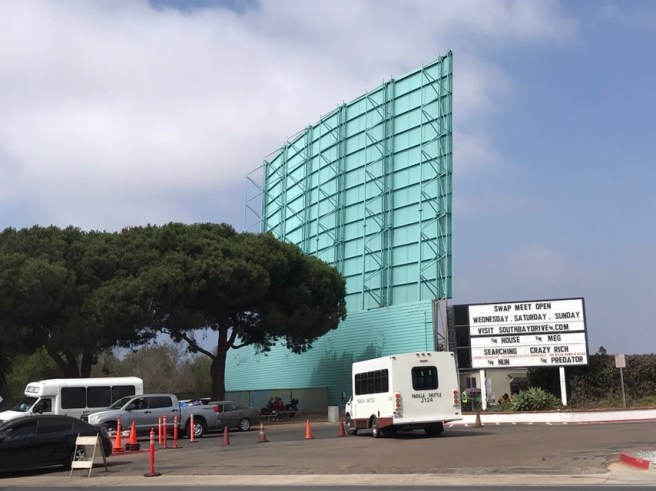
This is the Bullring By The Sea, where bullfights appear to be scheduled monthly. You obviously don’t cross the border here to get to them. You pay for a shuttle that takes you through an actual border crossing. Sounds kind of fun–the bullfight, not the border crossing.


After picking up my gear at the hostel, I headed over to Julie and Charlie’s, my sister and brother-in-law’s, house. It was great to see them and have a real chair to sit in, and a real shower to shower in, and clean floors to walk on, and a computer with a real screen and keyboard to work on–all those little things you take for granted when you’re not living in campgrounds and cheap motels. Thanks for the great hospitality, Julie and Charlie! Ending the ride at your place was a great way to wrap things up!


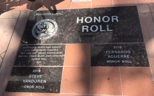
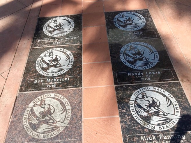
 In Surf City, aka Huntington Beach, Don Wonderful (that’s his Strava name) sought me out, when he saw I was on a loaded touring bike. He wanted to make sure I didn’t miss the cool Surf City sights, such as the Surfing Walk of Fame, which is similar to the Hollywood Walk of Fame, except the names here were surfing legends. Don was working on his own goal–winning a one-month Strava challenge to see who could ride the most miles in a month. He had ridden over 3000, and still had a few days to go.


 The beach behind the fountain and in the next photo is Surfrider Beach. Check out all the surfers in the second photo.
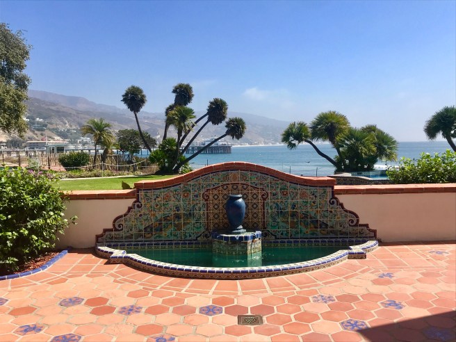

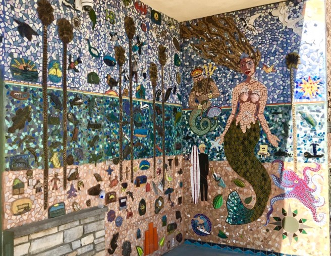
 I had to get a shot of this wave mural for my friend Larissa, who is going to learn to surf with me at Big Surf, next summer, right Larissa?
 I lost track of how many miles of today’s route were on a path like this one. I’m thinking at least half of my day. It felt like I was on vacation, riding a big fat tire city bike.


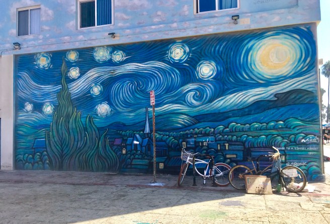
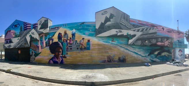
 I’ve heard and read about Venice Beach, and I’ve seen it on TV, but today, I actually got to ride down it. There were shops, eateries, gardens, street performers, vendors, artists, throngs of tourists, homeless and vagrant people, and lots of murals.


 In Vista Del Mar, I came across a man teaching hang gliding lessons. It stressed me out, watching him keep that hang glider up, with the wind threatening to smash it to the ground, or dump it in the ocean, or push in into the road. But the instructor always knew how to react to every wind force that hit the glider. His two students REALLY stressed me out. They didn’t, so each attempt ended pretty quickly, and came way too close, for me, to crashing in the ocean, onto the sand or into the road. I will file hang gliding away on the list of things I have no interest in ever trying, along with bungee jumping.
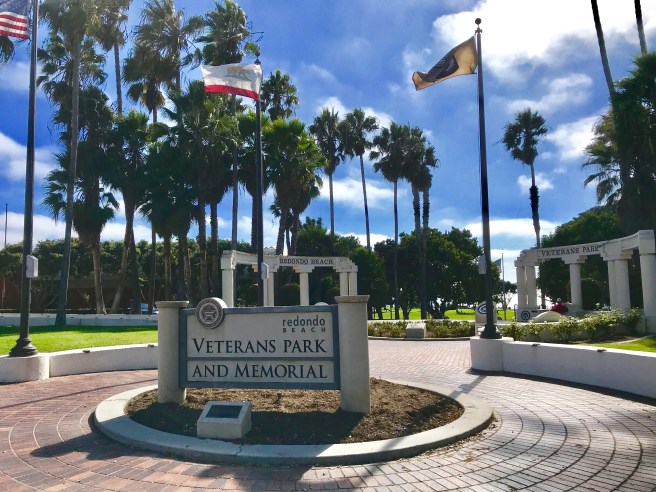
 Redondo Beach was my last beach for the day, before heading inland to get to Long Beach. And I like a town with a good Veteran’s Memorial. Once out of Redondo Beach, I slogged through heavy traffic on surface streets, as I made my way to the hospital.


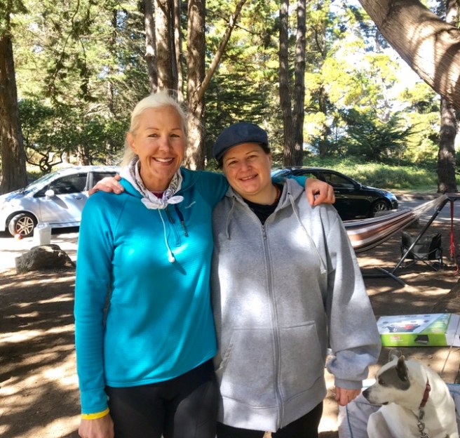
 I met up with Kok after church, on Sunday, and it was so good to see her! We talked and talked. She will soon have five grandkids. I now have three. I lost both of my parents during and just after the tour during which I met her. She is now her elderly Mother’s caregiver, which includes preparing Japanese dinner for her every night. She is good at everything she does, but instead of being a pro golfer, right now she is channeling her talent into a Japanese dance group that performs at different venues each month. She is such a great person and example to me. So after we had some lunch, she took me to Wal-Mart to buy a few grocery items for the road as well as a level and picture hanging putty. “What for?”, you ask. So we could go back to my Airbnb and straighten out the 70+ crooked pictures and pieces of art hanging on the walls, while the host is in Arizona with her son, who is dying of cancer. I’m not sure she’ll ever notice, but it was the least we could do for her. Thanks, Kok, for helping me with another of my insane projects.
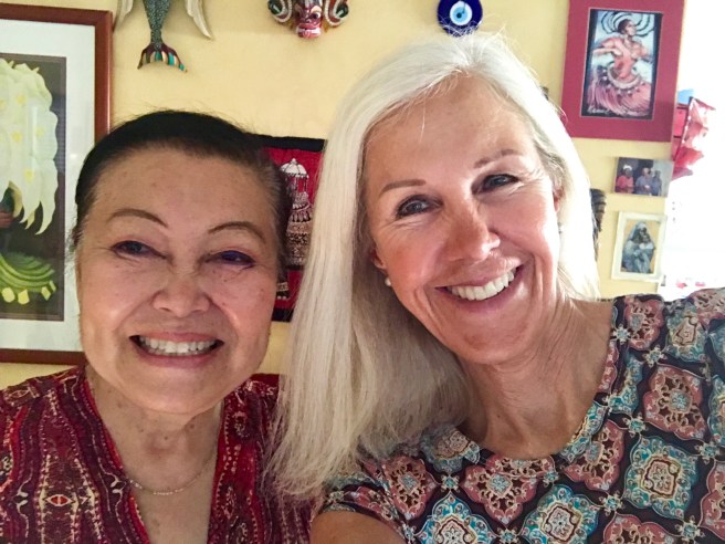


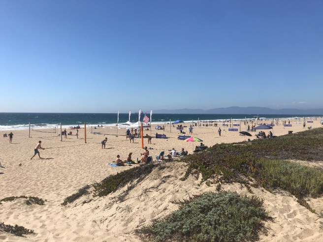
 Places to charge your devices are few and far between, when you’re camping. Today, the route was so straightforward, that all I needed were my Garmin, rear lights, and phone camera. Most of the day, I sat up, like I was cruising on a city bike, and just followed the beach. No need for navigation.
 The left side of the road had its own beauty, with eroding cliffs that, at times, looked like hoodoos were starting to form.
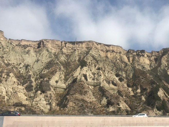
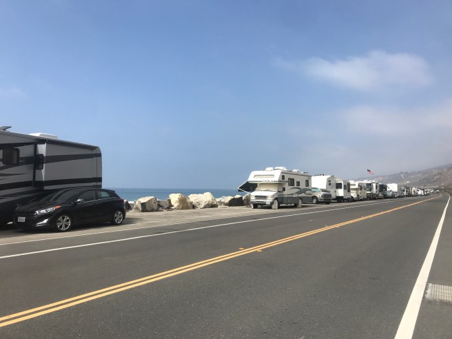
 Riding through Ventura County, I passed through ‘The Rincon Parkway–what seems like a mile-long section of road that is lined off along the beach for parallel parking of RVs. They set up and camp for days at a time–right next to the ocean. Okay, biking is great, but I want one of those RVs for chilaxing, which is what all those RVers were doing. I think I need some of that balance in my life. Watching the ocean; reading, napping and eating out by the ocean; swimming and boogie boarding in the ocean; and walking along the beach are all bike free activities that were calling out to me.


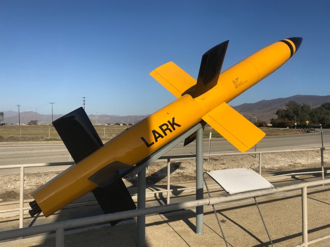
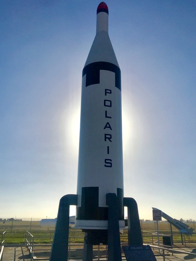
 When I reached Port Hueneme, it was time to forage for food, and there just happened to be a Denny’s for my moment of need. The next thing I came to was Naval Base Ventura County, the home of the Seabees.
 As I passed by Point Magu, another Navy facility, I stumbled upon this cool missile museum. There were static displays of a couple of missile launching aircraft and a bunch of missiles, some of which are still in service today.
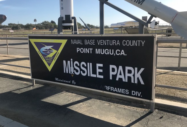


 Finally making it back to oceanside riding, I found my way to Leo Carillo State Beach, my digs for the night. I set up camp in a very remote hiker/biker campsite and locked myself in a bathroom with an outlet, for an hour, so I could charge my devices. I felt a little bad when I heard little kids outside, sounding like they were about to wet their pants. Sorry kids, but I was not giving up that outlet. Hope your Mom brought lots of extra clothes for you or she has been teaching you how cowboys and Indians went pottie.


 Riding along the coast can be hilly, but when there is a railroad track next to the road, it is usually _ _ _ _ (fill in the blank). What a great section of road for a leisurely ride. And look how glassy the ocean water was. I would have loved to have been wake boarding on that water.
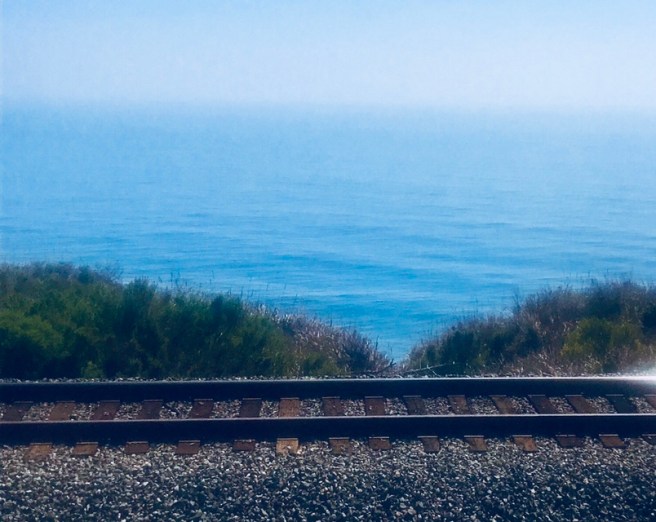 Today was the first time I passed bell markers for the Camino Real–the 600 mile road, built back in the late 1700s and early 1800s, that connects the 21 Spanish missions and 4 Presidios.
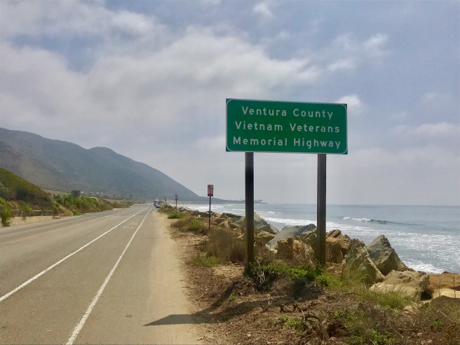
 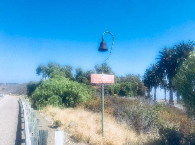 A portion of Highway 101, that I rode on today, is designated a part of the Purple Heart Trail, which runs from New York to California.
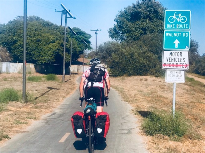
 In Goleta, the route switched from roads to bike paths and promenades, passing through the University of California Santa Barbara campus and most of the Santa Barbara waterfront. I felt like a tourist taking a gingerly ride during her vacation.
 c
c Arriving at the campsite, in time to watch the sun set and set up my tent in daylight, I met some ladies who were on their annual camping retreat, together. They set me up with ant repellant and a food box, to keep the ant infestation at the campground from overrunning the food and tents in the hiker/biker campsite. Strangers sure can be nice. Thank you ladies!


 Oceano was another sand dunes town, but what really struck me the most was the zoning. It was so sad to see a historic Tudor mansion surrounded by a mobile home park. The Planning and Zoning staff would be fired, if it were my town.
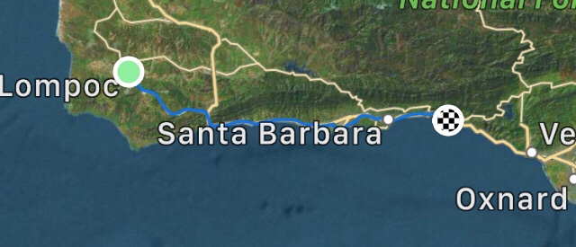
 When we crossed over into Santa Barbara County, we knew we were making progress on the day and toward the finish of the ride.
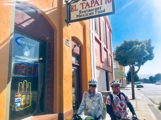
 Hunger was setting in, when we hit Guadalupe, and I haven’t had Mexican food yet, on this trip. So we scoped out a restaurant that served up a delicious meal and some of the best ever pork green chili with its salsa. Let me tell you, I would love to go back to that place again.
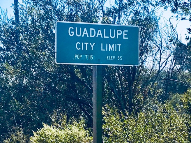
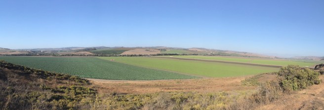
 Today’s route was mostly inland, so the predominant scenery was miles and miles and miles of strawberry fields and other fertile farmland. This is the second place I have seen farm workers actually out in the fields working on the individual plants, and that field had a gazillion plants for them to use their personal touch on.
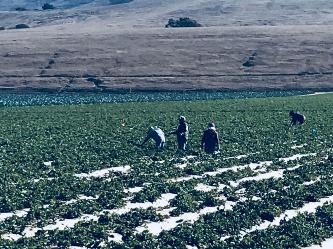


 Then once I got riding, I kept running into people along the way. This gal, riding a Harley with a pink helmet, and I had to ham for her boyfriend.
 I stopped for lunch at Ragged Point and enjoyed a little touring cyclist reunion. That and the most delicious hamburger I’ve eaten in years.
  After lunch, I passed into the Los Padres National Forest and made my way to the Piedras Blancas Light Station. No joy, it closed after Labor Day, and there is no getting close to it.

 But up the road was something way better than a lighthouse–a preserve for elephant seals. And were there elephant seals to behold? Oh yeah, hundreds of them. They were mostly sunning and napping, I presume, but the ones that were moving were really fun to watch.


 After a stop for deli dinner, groceries and shop cloths, I got to Morro Bay just after the sunset. The two hiker/biker sites were full, so I begged the two fellas that were in them to let me camp with them, too. After dinner, I ‘luxuriated’ in a long, hot, campground coin-operated shower, then retreated to my tent to plan for tomorrow. It’s slated to be an almost 74 mile day. Surely there is a way around that. Perhaps there’s a shortcut no one has yet discovered.


 I love the surfboard rack on this one. Need one of those for my touring bike, for when I take it and my surf board to California some day.
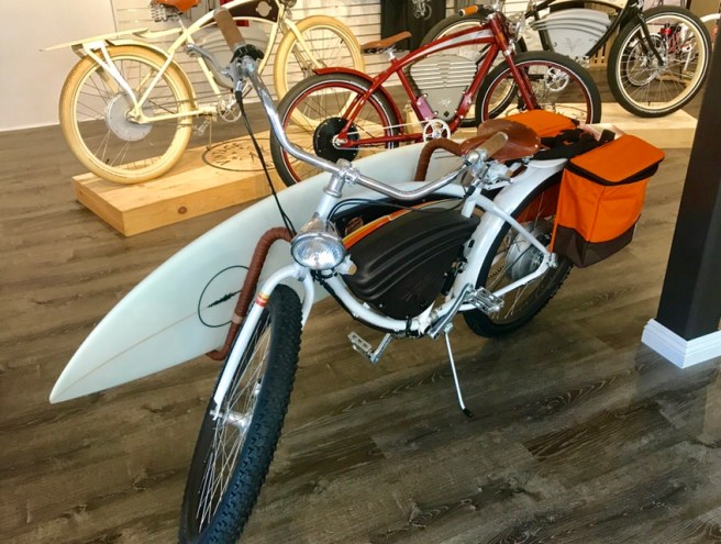 These are Bromptons–the original British-made folding bike. The US made Bicycle Friday is actually a legitimate touring bike, so the shop owner told me. See? I’m learning new things on this trip.
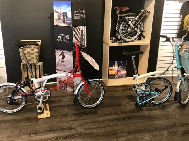 Boy, I need to get one of these side cars to take the grandkids out riding.
 And you can buy some of this recycled bicycle parts art, made by and Israeli artist, for a mere $2000ish per piece. If only I had a bigger house with room for another piece of art…and if only I wasn’t riding my bike for a few more hundred miles. These things were HEAVY.

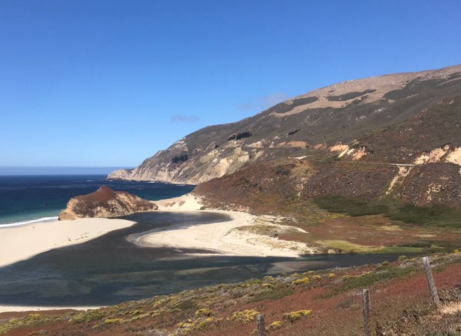
 After enjoying that bike shop, I hit the road for a camping destination past Big Sur. The ocean was to my right, as always, and the spectacular scenery changed throughout the day. Let me just say that there is nothing like seeing this kind of scenery at 11 MPH.


 And then I passed Point Sur. When I saw it on a map, I expected some cool cliffs, but what I found was a lighthouse and Naval Facility. The lightstation has been in continuous operation since 1889, and is the only turn-of-the-century light station in California that is still open to the public—weekends only. The naval facility was established in 1957 as part of a worldwide network of listening stations that monitored the movement of Soviet submarines. One building of the facility is still used for sound surveillance, by the Navy, and is the only remaining listening operation on the West Coast. All the other buildings were transferred to he California State Parks back in 1980.
  When I arrived Big Sur, hunger had set in. This hippie bus is the snack shop.
 You know, the road to Big Sur was pretty climby, and I was tired, so for the rest of the day, I decided to relax and take it easy. At the Big Sur Visitor’s Center, I met up with Tonya and Natasha, a couple of adorable gals from Russia. We stopped and talked for a few minutes and traded photos.
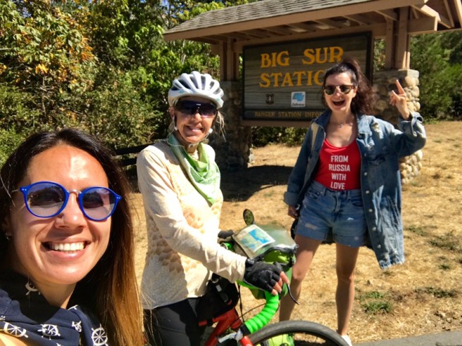 Then a little ways further down the road, I saw another fully loaded touring bike coming northbound, so I crossed over to talk to and shared M&Ms with Christopher, a Scottish fella. He started his tour in Buenos Aires, Argentina and has been on the road for over a year. The northbound riders face an almost continuous headwind, so they are few and far between, and are super tough.
 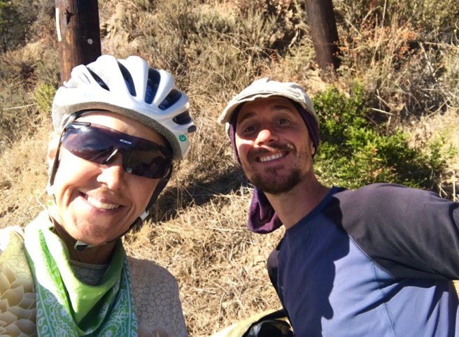 Now I was looking for ANYTHING to stop for–like these horses who have the good life, living in a huge pasture next to the ocean. In honor of my daughter, I stopped to pet them. I hope someone puts sunscreen on the white one.
 And when I saw this sign, I actually considered checking out the ‘Holy Granola’ and ‘Deep Books’, but when I turned in, there was another sign saying that it was 2 scenic miles away, and the road was heading uphill. No way.
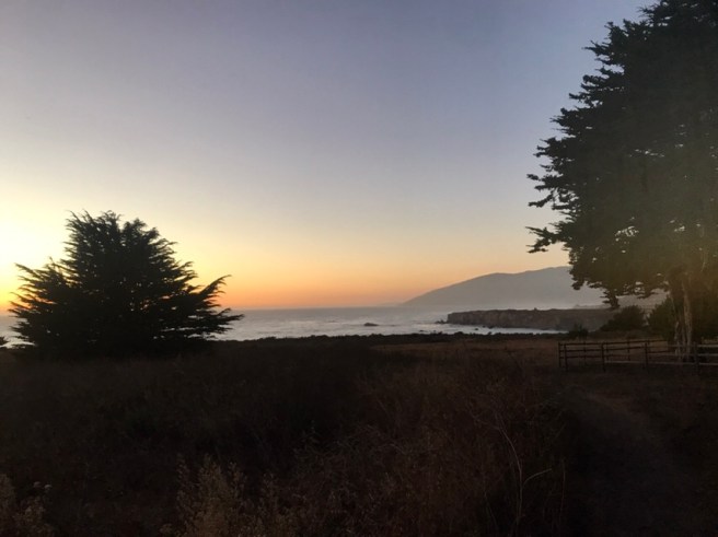
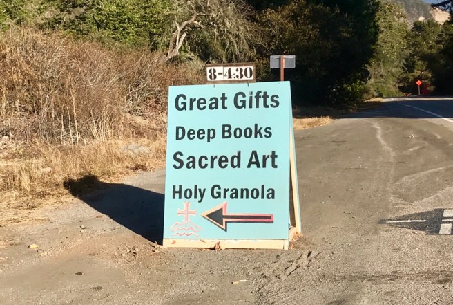 After passing through the massive landslide cleanup project, that closed Highway 1 for over a year, I went through this tunnel and found my way to my campsite in time to catch the tail end of the sunset.

 Check out this view of the ocean from my campsite. Amazing. And my neighbor, Madison, was also amazing. I smelled some kind of culinary creation going on somewhere in the campground, and when I asked her where she thought it was coming from, she fessed up that it was from her site. They had leftovers of sliced onions, zucchini, mushrooms and peppers cooked in truffle oil, butter and another secret ingredient, that they didn’t know what to do with. So she brought them over to me, and those veggies are the best food I have tasted on this trip. I thought I had died and gone to heaven. Thank you Madison. You made my day.


 The Beatle’s song, ‘Strawberry Fields Forever,’ was constantly on my mind, today, as I passed miles and miles and miles of strawberry fields. In one spot, where they were being picked, I wanted to grab some from the pickers and have a berry frenzy right there on the spot.
 If you’re going to be a migrant farm worker, this is the place to do it. There were, once again, miles and miles of farmland butted right up to the ocean. And just seeing that ocean kind of takes the edge off of whatever you’re doing. Well it worked that way for me, anyhow.
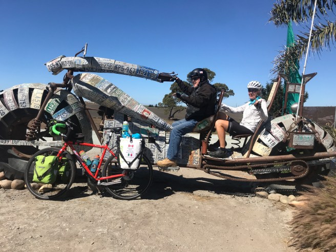
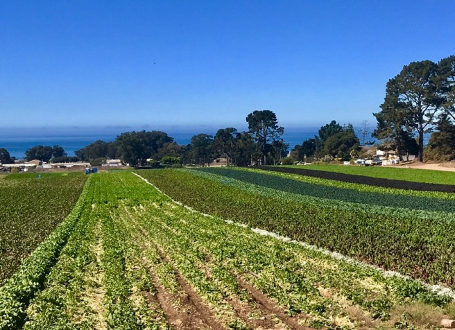 My favorite stop of the day was snapping a photo of both of these found art sculptures. Just as I got my bike set up for the first photo, a group of five guys on Harleys showed up. We posed for photos together and talked for a while.
 It turnes out that one of them rode the “Run for the Wall” ride, this year. Last year, a gentleman named Kelly Anderson carried a photo of my brother Chip on the same ride and posted photos of him putting it on the Vietnam Memorial Wall. I showed them what Kelly wrote at the end of the ride, and the photos he posted, and they were touched.
 And I think I found myself a military man for my future. He’s pretty quiet and laid back, which works for me.
 After passing so many farms, I couldn’t ride by this roadside produce stand. I loaded up on avocados, grapes and strawberries, and sampled way too many varieties of melon and salsa. They are so good!
 I didn’t know that brussel sprouts grow on a stalk, like this.
 It was at this point in the day, that I decided to downsize my day and stop in Carmel, instead of killing myself on the mountains between where I was and Big Sur. All my devices were low on battery, due to not being able to charge them for two nights in a row, and a real shower and warm bed were sounding good to me. And surely that climb will still be there tomorrow. How do you spell rationalize? So I took my time, as I rode in and through Monterey.
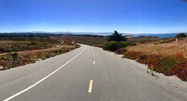
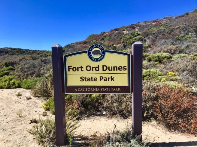
 I cycled on a coastal trail through miles of former artillery ranges, that are now a state park and, in some places, a preserve for endangered species of butterflies and other critters. I guess that’s a good use for land with potential unexplored ordinance, right? I’m pretty sure insects won’t set anything off.

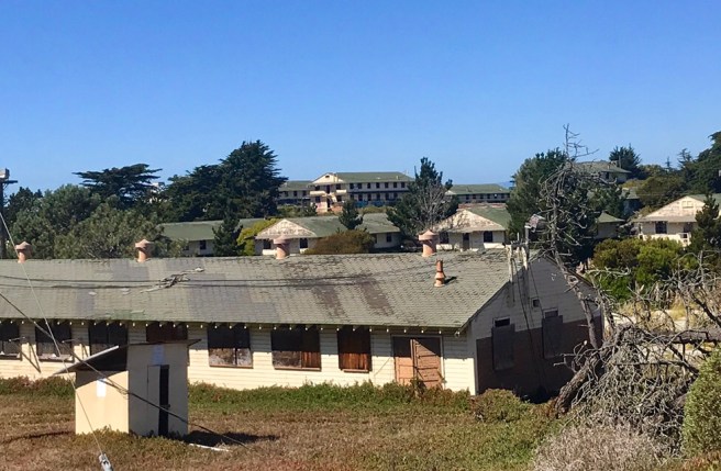
 Before I get off the topic of Fort Ord, let me add that throughout the rest of the day, I learned more of what has happened tto it. When it was closed, many of the viable buildings were immediately turned into a university. And there is a military commisarry and base exchange on the side of the base I wasn’t cycling on, and a portion of the base has been designated a National Historic Site. I missed all of that, by not taking a day off in Monterey to cycle all around the base.
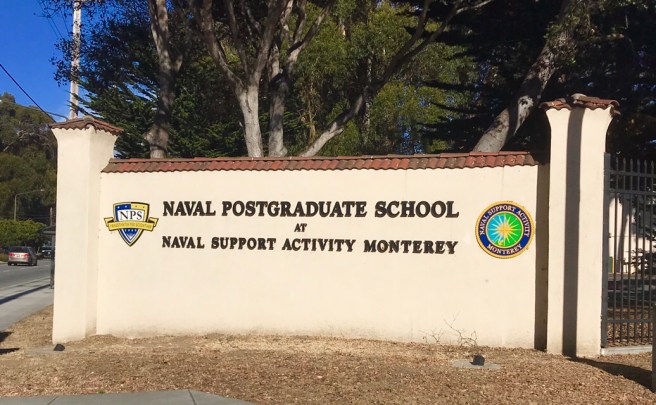
 Then I officially entered Monterey and passed by the Naval Post Graduate School, which is still in business, and beautiful sections of the bay. What a lovely area.
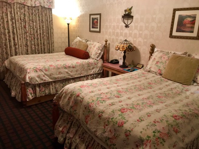
 My digs for the night were a huge room in a quaint little motel, with antique furniture, Tiffany lamps, and brocade wallpaper. I hated bringing my bike inside and covering one of the beds with a bunch of gear, but it had to be done.
 After a very long shower (what drought?), I walked through downtown Carmel, which is lined with dozens of blocks of high end shops–Rodeo Drive-like shops. Didn’t see anything I needed, so I ate dinner and headed back to my room to get a good night of rest. I still have that hill climbing to do tomorrow.


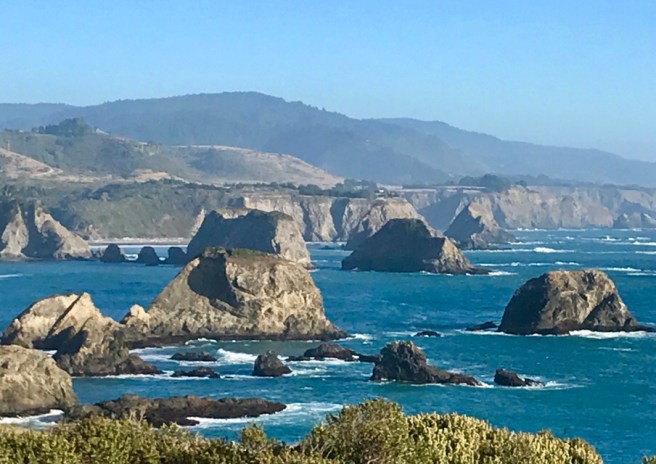
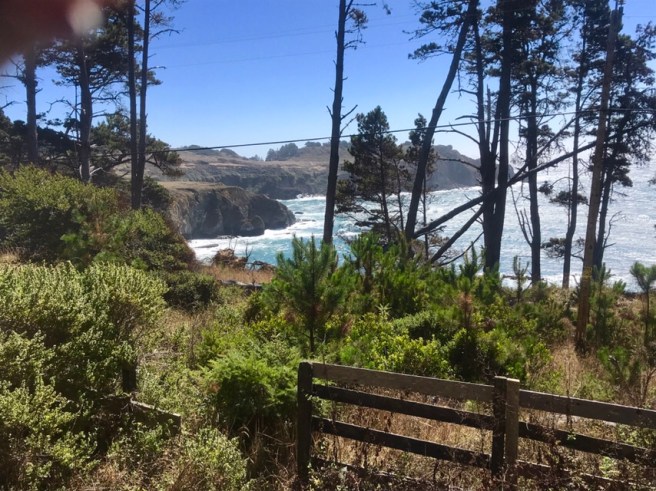
 For the first time, I was seeing limestone in the cliffs and volcanic rock on the shoreline.


 What fascinated me most, about the lighthouse is that it was first lit in 1872, and it is still in operation today. And also, it has survived all the earthquakes in the area, which is amazing.
 These are some of the rocks, just in front of the lighthouse, that used to wreak havoc on boats at night.
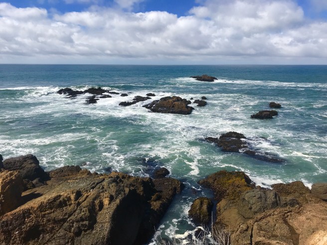 As I approached Big Basin Redwoods State Park, the kite surfers, on the beach side of the road, were putting on a show, reminding me of the kite surfers in training I watched in Bon Aire. Do you think I could learn to kite surf? Or is it too dangerous? Once again, I am thinking of going somewhere to take lessons.
 Then just a little further down the road, I arrived in Santa Cruz, which is on the north end of Monterey Bay.
 This mural welcomed me to town, and within seconds, I was inside ordering a piece of super delicious pizza.
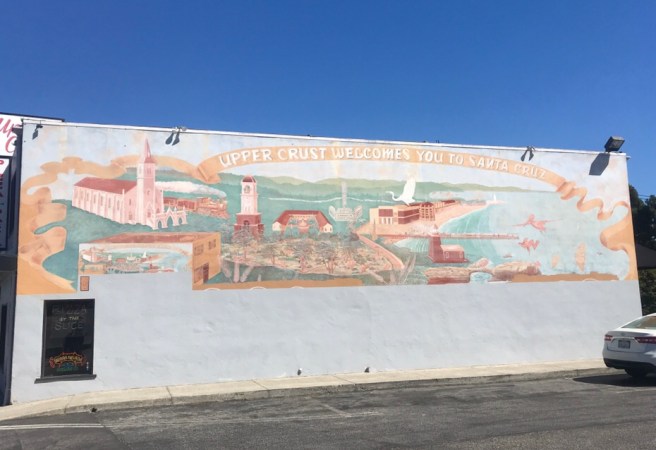 My camping spot for the night was actually in a little town named Capitol–on Monterey Bay, a little south of Santa Cruz.
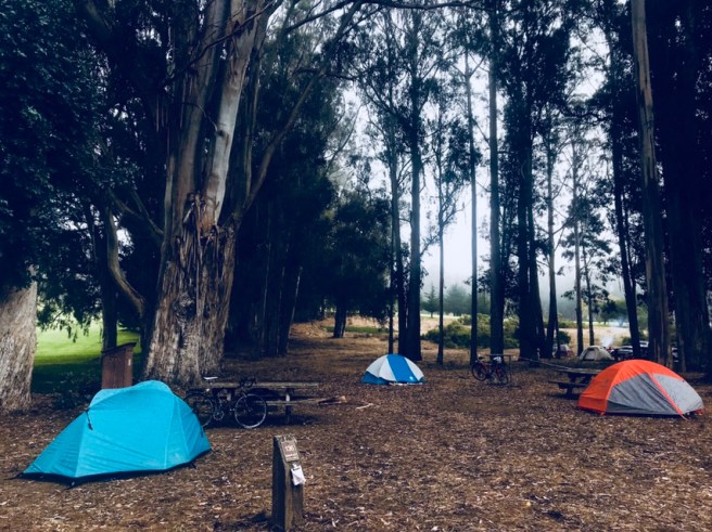
 Here’s my tent. You can’t see it, very well, but that is Monterey Bay behind the trees in the background.
 And this is my tent, in the bigger scheme of things, among the 12 cyclist tents in the campsite, last night. And there was no snoring problem.
 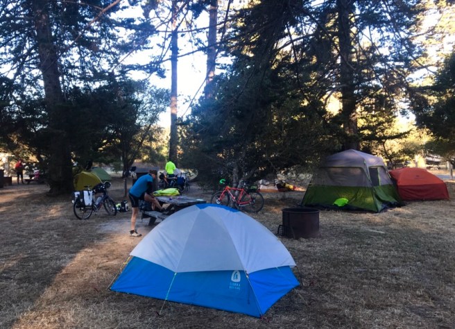 Just wanted to throw up a couple of other photos. I have passed several of these signs that display your speed below the speed limit. Usually, they are somewhere on a hill, where I am struggling to keep my bike upright, going 4.6 MPH, with the speed limit above the sign saying 40 MPH. This is the first time I have been able to take a hand off the handlebar to take a photo of my speed. And isn’t it impressive? There was a tailwind.
 And how about this for my next personalized license plate? What do you think?


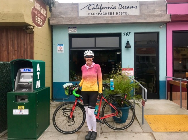
 A night sleeping in a hostel dorm, like the one I was in, can only be restful if you’ve had a complete lobotomy, have amazing earplugs or are exceedingly sleep deprived. There were 20 people sleeping in a dank bunkbed lined room, at least 1/4th of who were hearty snorers. We’re not talking symphonic snoring, here. It was non-stop, full on brass band snoring. I slept like a baby.
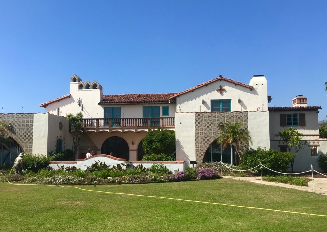
 No trip to San Francisco is complete without a stop at the Palace of Fine Arts, which, in my humble opinion, is the most beautiful European influenced building in the US.
  Apparently,it’s also a popular spot for photo shoots.
 Down the road, crossed through the Presidio, where I once went for my National Guard annual training, staying in one of the two buildings below, which at the time were rickety barracks. The cannons and cannon balls are at the entrance to the fort, and the plaque marks the place where the General’s quarters for the post commander, General John Joseph Pershing, the World War I Commander of the Expeditionary Forces on the Western Front, once stood. It stood there until it burned down, killing his wife and three daughters, which is quite tragic, if you ask me.
 ‘
‘
 A couple of miles and a ridiculous hill climb away, was Golden Gate Park. I’ve been there several times, over the years.
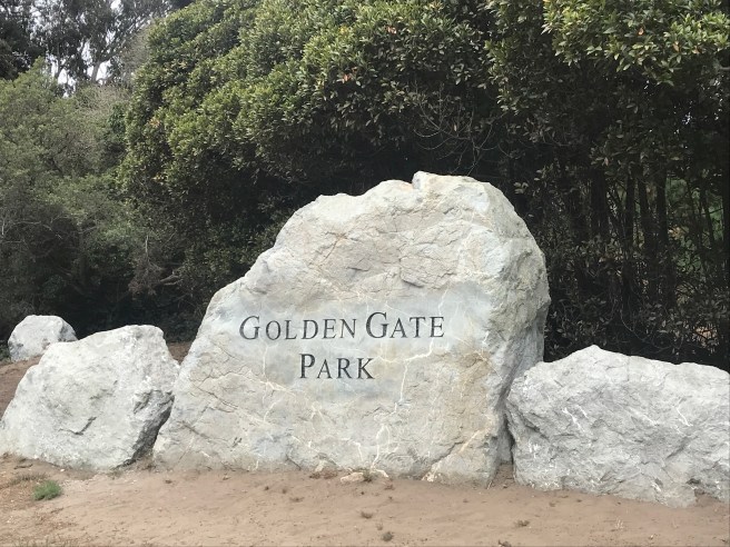
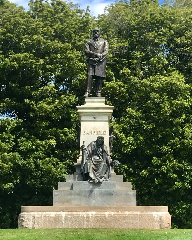 The Conservatory of Flowers is adjacent to the President Garfield statue, and it is just plain pretty, so I had to stop and check out the gardens.
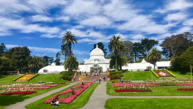 Somehow, I have never before seen the National AIDS Memorial Grove, which was dedicated in 1995. It was a really quiet place, with multiple stops for contemplation. The Circle of Friends is pretty catchy–no doubt a source of donations to fund building the memorial.
 ‘
‘
 The park is so huge, I don’t think I’ve ever made it to the western end, because I’d never before seen the Murphy Windmill, which was built in the early 1900s, to replace the water hauling wagons that used to manually move water through the park to keep things alive. The largest windmill of its type in the world, it used to pump up to 1.5 million gallons of water a day.
 Then across the road, at the west end of the park, are beaches that are also part of the Recreation Area.
 And this was the scene, as I now started cycling toward Half Moon Bay. Ocean on the right, and civilization on the left. And the road was nice and level, and my legs were enjoying a little holiday from grinding hill climbs.
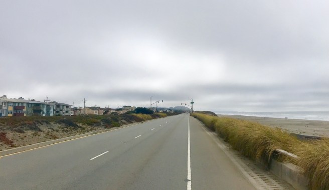
 All the way down the coast, people were stopped at and enjoying the beaches. I paused to watch a bunch of surfers attempting to surf, and it reminded me of the amount of time and effort my dad used to put into trying to catch a fish. He put so much into learning techniques, making lures, getting his tackle together, finding the right spot, etc. Then, after all that, he would go out at just the right time of day and spend hours patiently waiting for a fish to come along, which usually did not happen. Very similar to these surfers waiting for waves and never really catching them.
 A coastal bike bath took me off Highway 1 for a few miles, then before I knew it, I was at my campground.

 After talking to her for just a couple of minutes, I knew she was Noor, a cyclist from the Netherlands, who I’ve heard about from Viktoria, Talan and Mary. Noor is on an 18 month sabbatical from her job as a tissue donor doctor, to do some bicycle traveling. She’s been on the road since May, and is cycling down to Patagonia. Now that’s ambition!


 The route was curved and hilly from the get-go, but it had a good share of funky sight along the way. Passing through Valley Ford, even the US Post Office building was an artsy place, with a mural on its side.
 Where else do you find a Red Legged Frog Crossing?
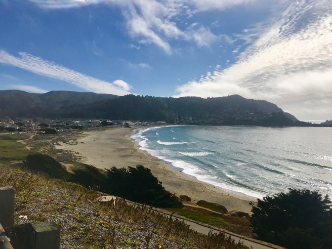
 Here was the scenery, as we rode along Tomales Bay, toward Point Reyes Station,
  In Point Reyes Station, we ordered up delicious deli lunches from the grocery store, and ate on a curb, like a couple of bums. That’s still a word, right?
 A few times, today, Ed and I passed and were passed by a fellow from the UK named Talan, who I had heard about from Viktoria. He started cycling in Alaska on May 26th, and had cycled around Alaska, before riding south through Canada and the US, with his final destination being Bolivia.
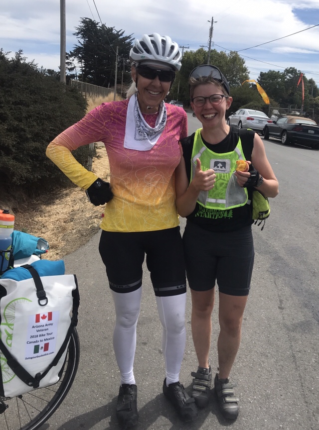 While I was talking to Mary, Ed was busy taking a picture of this mural for me. Thanks, Ed. My granddaughters are going through a unicorn phase, right now, and will love it!
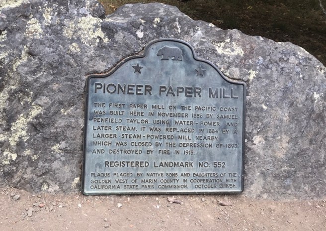
 A few miles outside of Point Reyes Station, we got off the highway to ride several miles on the Marin Trail bike path, as it followed Lagunitas Creek. We passed the site of a historic paper mill, then rode through Camp Taylor, a beautiful campground I would love to return to some day.
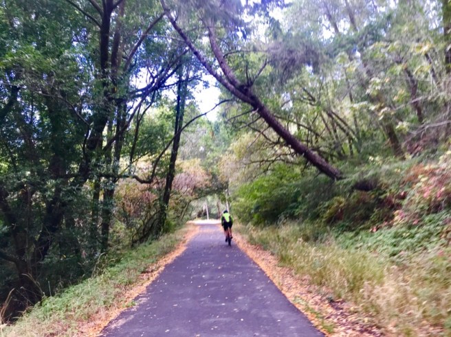

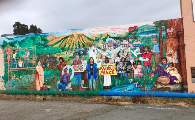
 After descending from the climb into and past Woodacre, we were on a nice bike path that sped us through a series of cute little Marin County towns, starting with Fairfax, my favorite. It had the following mural that was the subject of the book, “Seeds of Peace: A Community Mural–Part Offering, Part Hope”. The people and symbols depicted in the mural are real people and symbols from the community.
 And then there was the Marin Museum of Bicycling, with its giant mountain bike out front. Unfortunately was closed,
 And I loved this modification to what is probably a smaller version of the Statue of Liberty. I think I could live in this town, if real estate was affordable, which I’m sure it’s not.
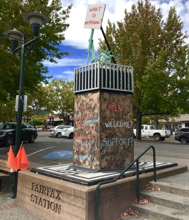 Moving down the road, I once again was trying to catch up to Ed, but that ended when I spotted the Village Pedler–a hip looking bike shop that carried high end bikes. We stopped to get their mechanic extraordinaire, Dustin, to adjust my derailleur cable, and get rid of a ticking sound that had been driving me bonkers for a few days.


 Our first view of San Francisco appeared in Sausalito, then the climbing kicked in again and was relentless, as we approached the Golden Gate Bridge.
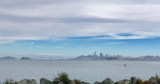
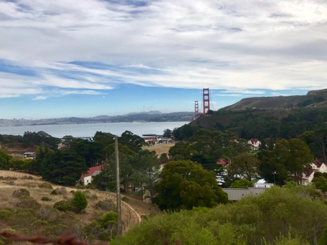 The maps routed us to the east side of the bridge, which is for pedestrians only. To get to the west side, we either had to ride another mile or more, with more uphill (my legs had gone on strike), or push our bikes down ramps that were about 12 inches wide and as steep as a steep flight of stairs. Ed offered to roll my bike down the ramp–fully loaded–while I easily carried his super lite bike down. At the bottom of the stairs, we crossed under the bridge, and were now faced with getting my super heavy bike back up an identical flight of stairs. My hero, Ed, pushed that monster, minus the rear panniers, up the second ramp, then went back for his bike too. Thanks for bailing me out, Ed. I guess I really am a wimpy female after all.
 The view from the center of the bridge.
 After making it to the other side, and one final photo opportunity with Ed, we hightailed it down the Bay Trail toward my hostel at Fort Mason. Ed had a ferry to catch, and the last ferry departure of the day was approaching. We said our goodbyes, and Ed sped off toward the ferry terminal, while I headed into my hostel to get ready for a dinner date with my friend Linda Knutson, who was making a two hour drive to meet up with me.
 Let’s just say that Linda and I had a blast together. She helped me get settled in the hostel, then took me to the Carbon Grill, where we had to cook our own dinner on a grill set into our table. It was a lot of work, keeping those veggies and that meat moving and turning on that grill, and keeping up with consuming them as they came off. At the end of the meal, we were both exhausted, stuffed out of our minds, and smelling like we’d been cooking over a campfire.
  In summary, this was yet another one of my favorite days on the ride. The cycling was tough, but the suffering was lessened by having Ed to ride with. It was so good to see him again and have a chance to catch up, a little, between all that panting and grunting. And I loved seeing Linda, and catching up on our lives and all the big and little things we have in common. I look forward to seeing both of them again, hopefully sooner than later.


 This lodge, with its Byzantine domes and intricate detail, looked like it was transplanted from Turkey, doesn’t it?
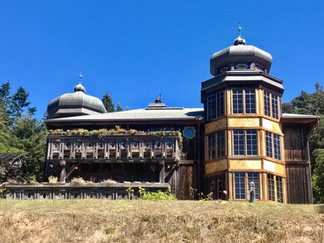 After passing Gualala, I entered Sonoma County, and expected to see some wine country, but the scenery and terrain were more of what yesterday offered up: forests; high desert–kind of; and the ocean, with lots of rock formations and crashing waves. I passed through state, county and regional parks, and, of course, a few corny tourist traps.
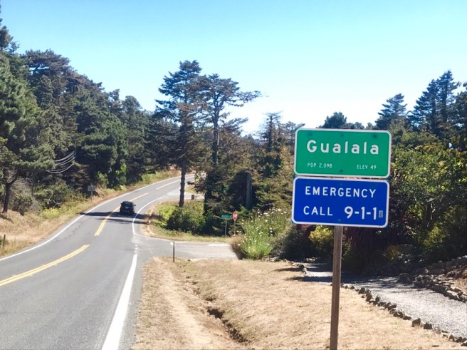


 What stuck with me the most about this day? The roads. They were crazy, winding and curvy roads, often with no shoulder and a steep drop off to the right of the road. Any time there was a thrilling downhill, it was almost immediately followed by a punishing uphill. For a few seconds, I contemplated jumping on a plane in San Francisco, and throwing in the towel on Highway 1. But I’m not a quitter, and I knew about the coast roads when I started this insane ride.
 When I arrived at Bodega Bay, I stopped in town to eat dinner and make a couple of phone calls, before riding to my campground, which was a couple of miles outside of town.
  The wind was gusting nonstop, and it was really cold, as I set up camp in a huge hiker/biker campsite, with me the sole occupant. The site was all sand, and I wasn’t going to try staking my tent out in sand again, so I set up on concrete, in a huge barbecue circle, tying my tent fly to the benches and my bike. Somehow, the tent did not blow away, which amazed me. After watching the sun set over Bodega Bay, I splurged on a $3 coin operated hot shower, and went to bed. I have to get an early start, tomorrow morning, as my Southern Tier riding partner, Ed Craft is making a three-hour journey, with his super sleek new bike, to ride into San Francisco with me, so I need to be up by 7 AM, to be ready to go no later than 9 AM. I am really excited to see and cycle with Ed again!


 And what follows is some of what we may be eating in the future. The first two photos are sea palm. Yummy.

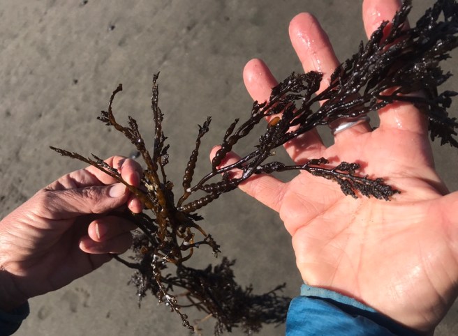 I took notes, and now I feel like I’m failing the test. Don’t flunk me, Karen. I think this is dulse. Yummy.
 And this is ????? I can’t remember. I did fail my test.
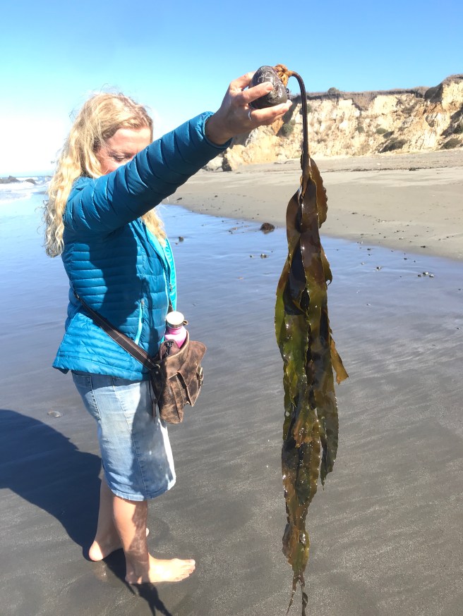
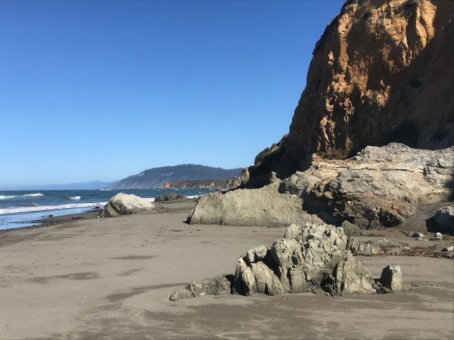 We said goodbye to our private beach, and Karen hauled my panniers to the top of the hill into the park in her car, for which I am eternally grateful, and we said our goodbyes. I wish I was traveling with someone fun like Karen. We would be having a blast all day, every day.
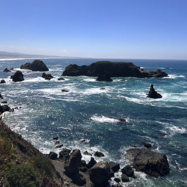
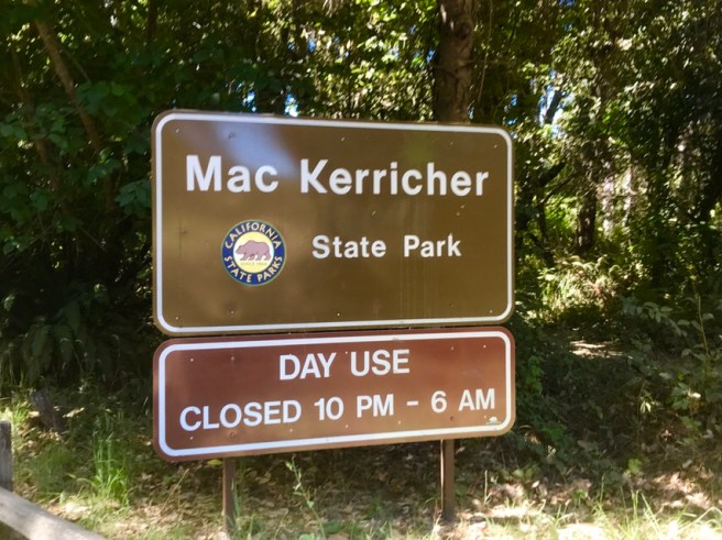

 As soon as I entered Fort Bragg, the town adjacent to the park, one of the first things I came to was…..Denny’s!!! Amazing luck, don’t you think? I had an incredible lunch, there, and left in a state of bliss.
  Fort Bragg was never a military fort, it was just named after a military man. But it was a decent little town. It had a Safeway store, so I was able to resupply my groceries and Gatorade, which is always nice.
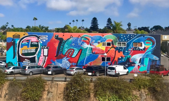
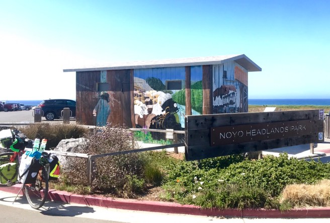
 Above is the Historical Society building that caught my ye. Below, a mural. You know me and murals.
 Down the road was this piece of property for sale. If I bought it, would it really work for me?
 The scenery for the rest of the day was more ocean views, then a few miles down the road from Elk, the route turned inland toward a little town named Manchester–my destination for the night.
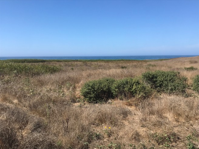