8/28/2021 – We Made It!!! Searsport to Bar Harbor, ME

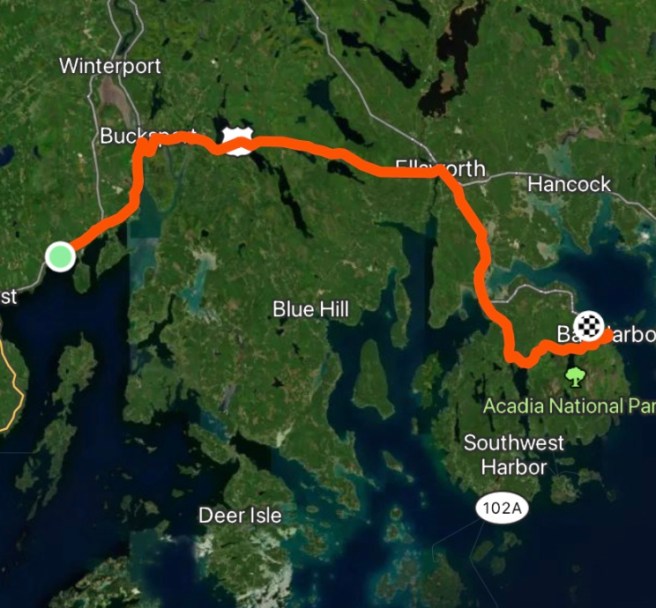
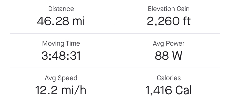
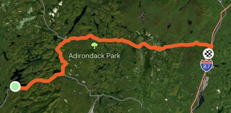
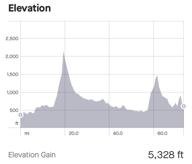
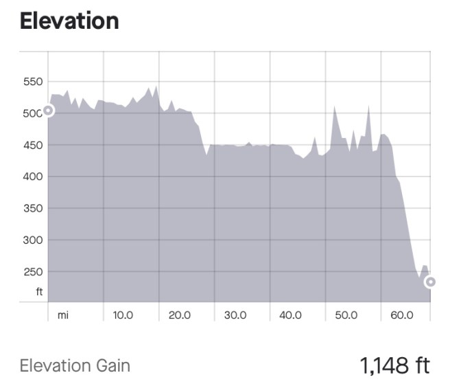
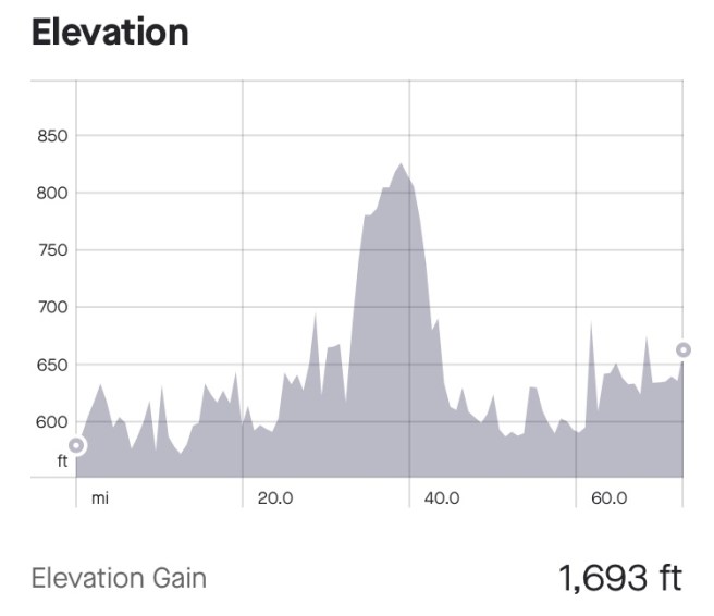
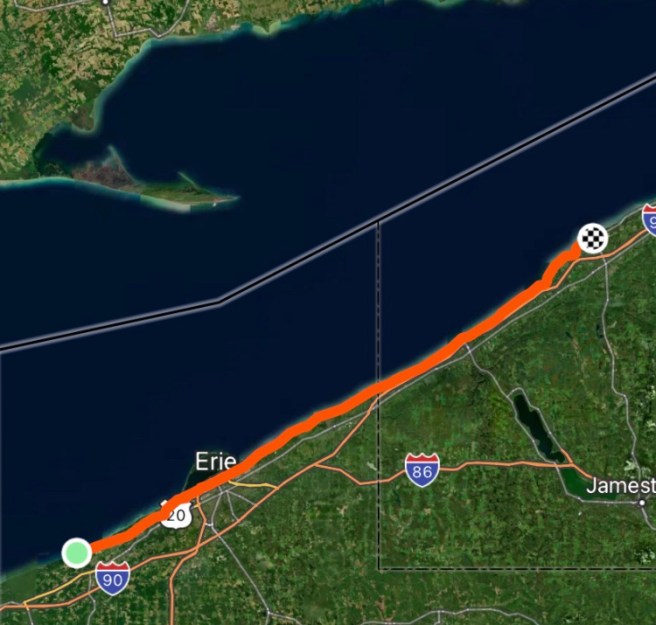
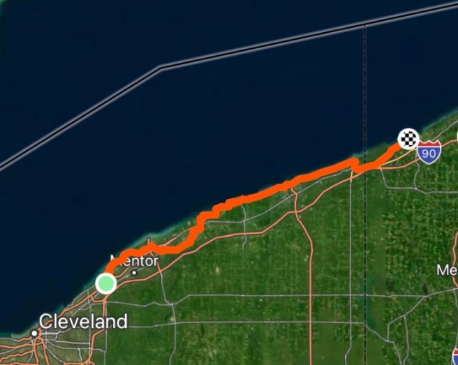
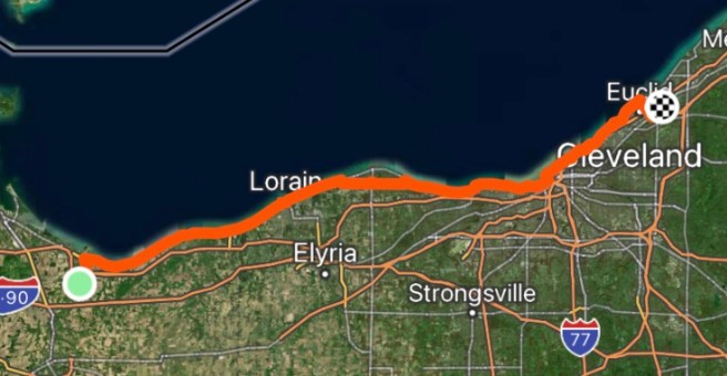
55.79 Miles / 4171.29 Total Miles

3176 Ft. Elevation Gain / 146,397 Ft. Total Elevation Gain

Spoiler!!!!!  The last day of our second insane odyssey is complete!  Tomorrow, Chris and Linda will be picking us up in his van to drive us around Acadia, which will be MUCH more enjoyable than cycling around the National Park, and a wonderful ending to the trip.  They will then drop us off in Bangor to catch our flights home. 

The missing days in this blog?  I will catch them up, when I catch up on sleep, mail, my daughter and grandkids, and a few other things that await me in Arizona.

Here’s what happened today:

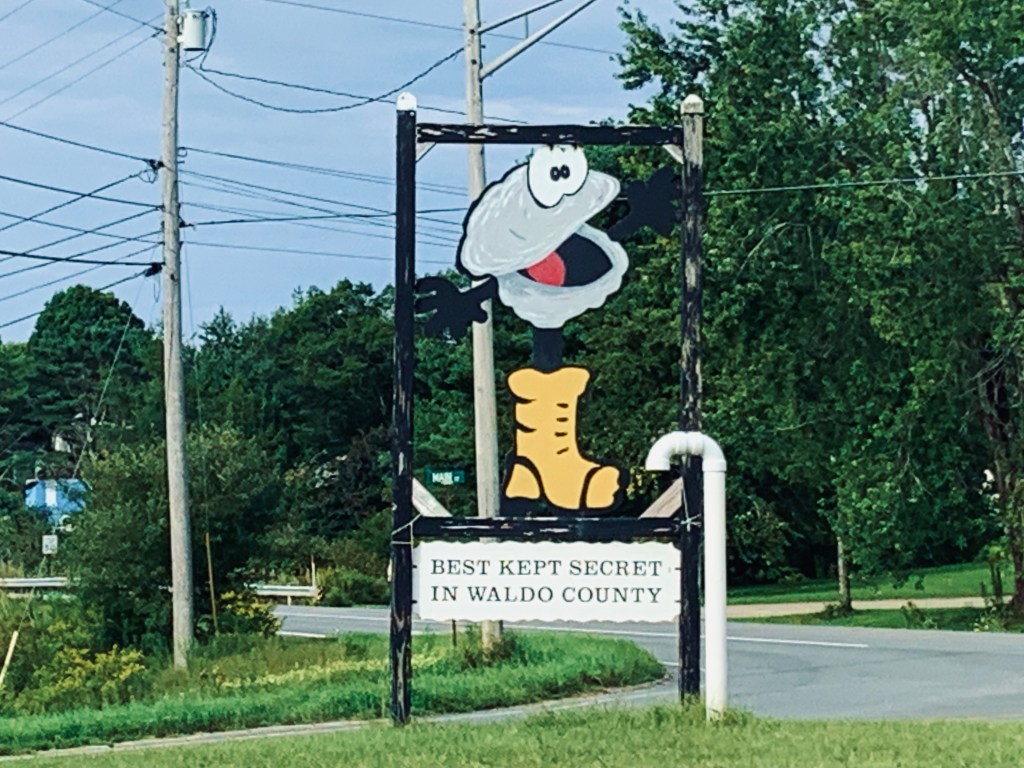
We got off to an early start.  I had already eaten breakfast, back at the motel, but Ed was through with oatmeal and wanted a REAL breakfast.  So before we even got out of Searsport, we stopped at “The Best Kept Secret,”—Just Barb’s. Restaurant.   I ate one super delicious blueberry pancake, that was completely loaded with fresh blueberries, then it was time to get on the road for what we though would be a relatively easy 53 mile day, with 2800 ft of climbing.  

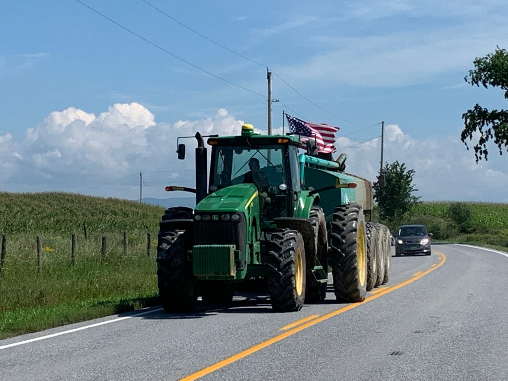
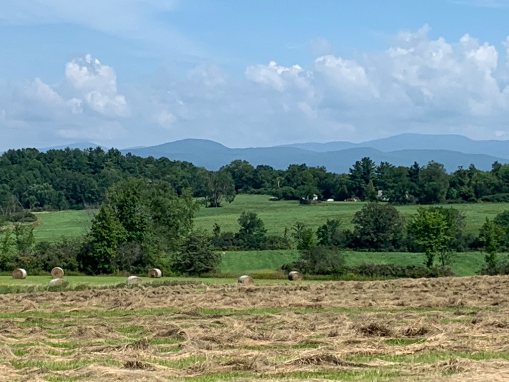
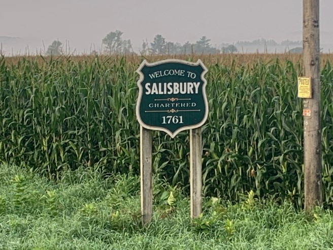
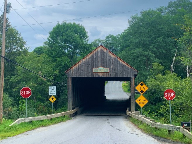
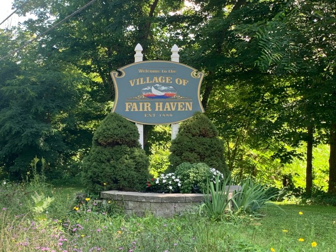
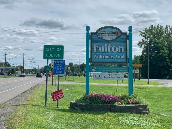
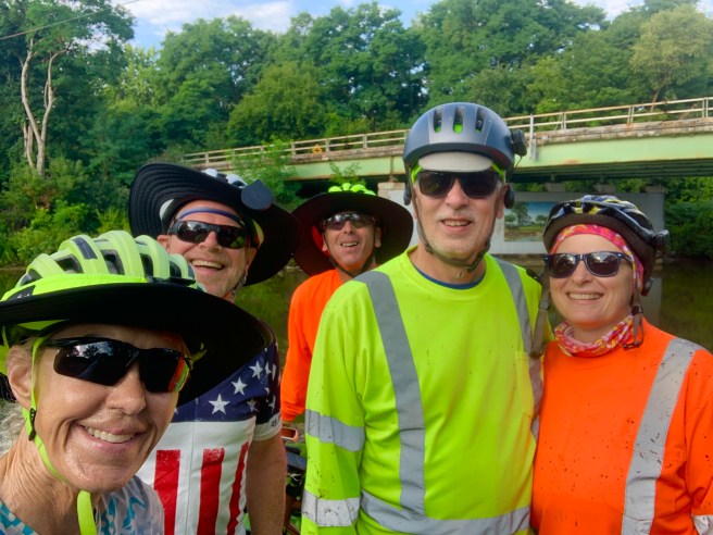
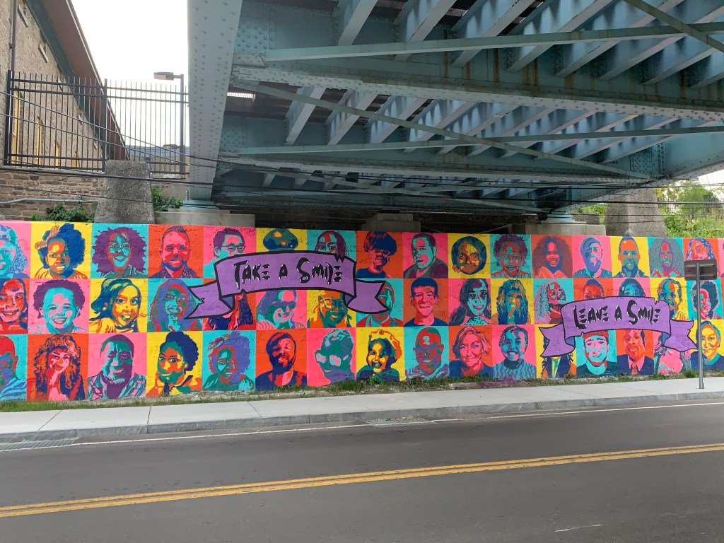
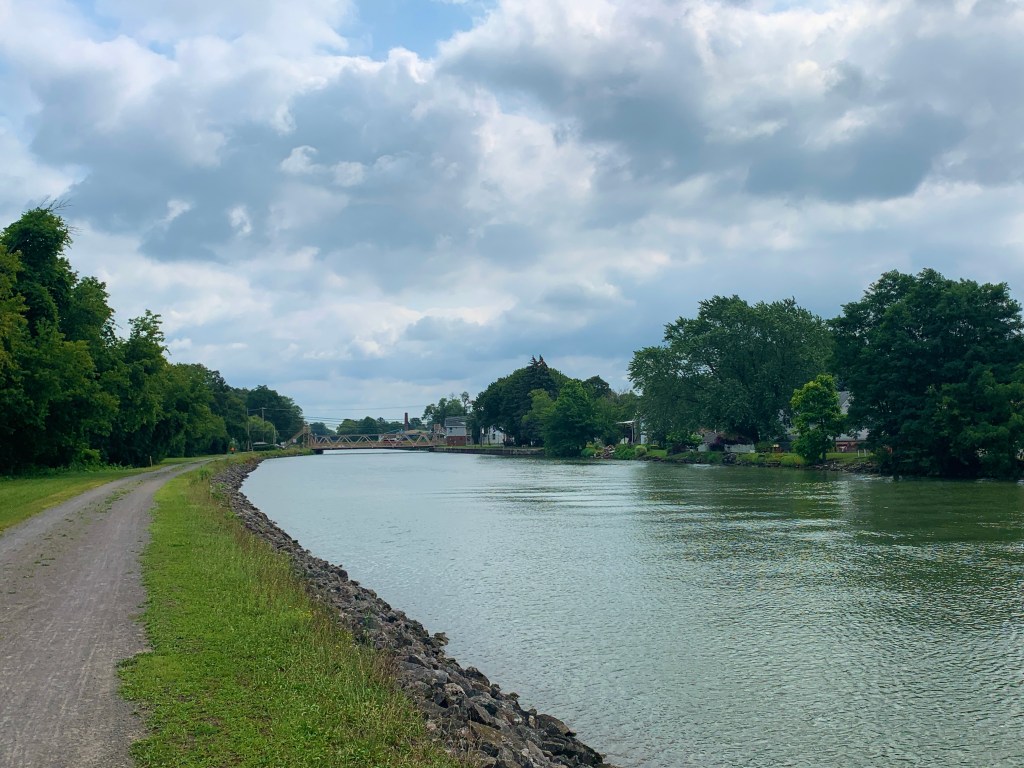
The day was a sampler of all the things I enjoy, while riding–some art, some funk, some history, some architecture, some great food, some nice and helpful people, some memorials, some challenging cycling and a miracle.  It also delivered up some things I would be happy to never see again in my entire life (a girl can dream):  Busy, congested roads, with no shoulder, and super steep hills.  Not complaining.  The good WAY outweighed the bad, making for a very fine day on the bike.

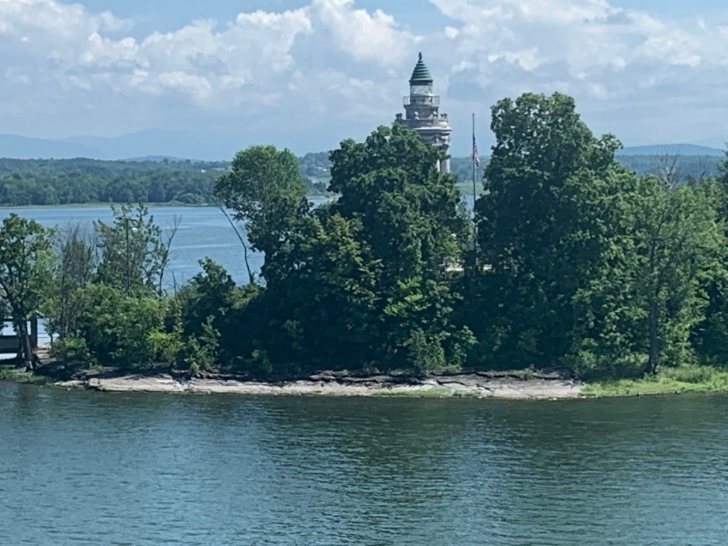
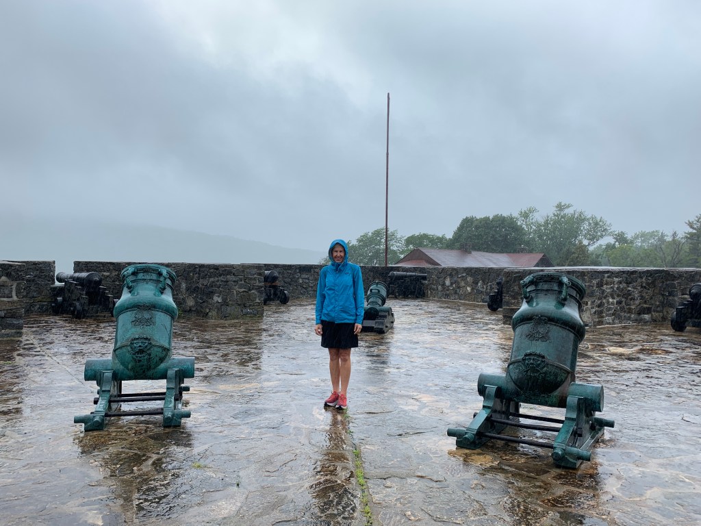
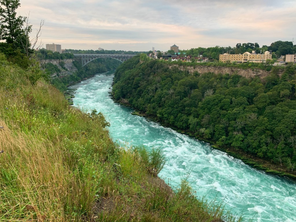
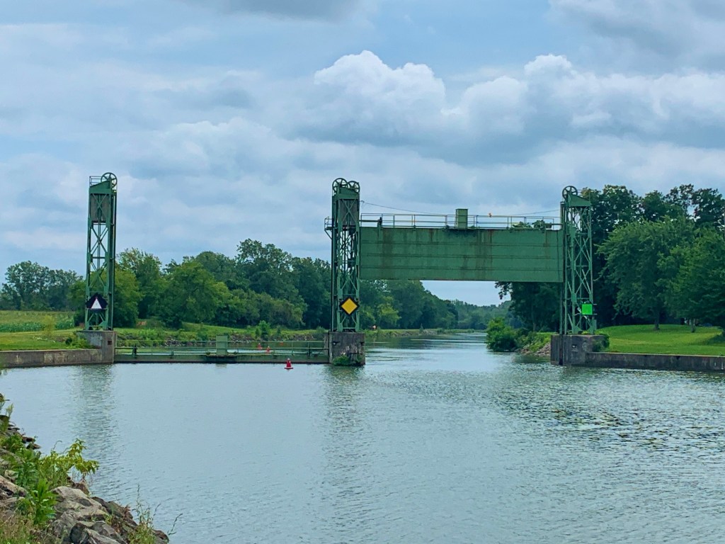
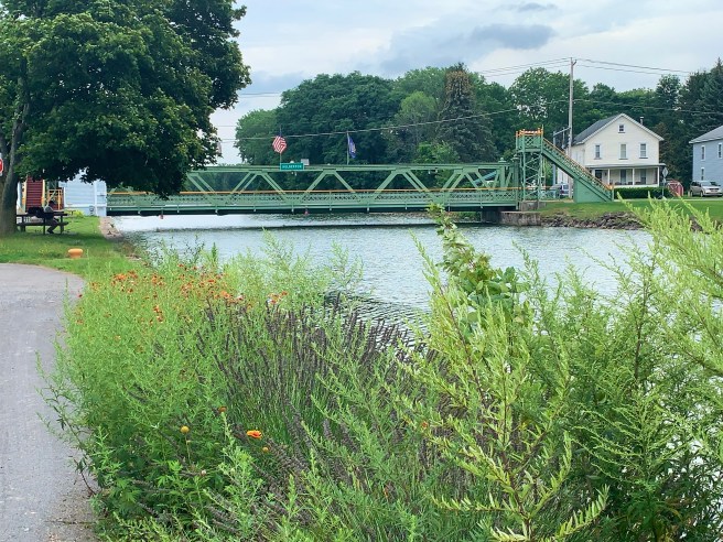
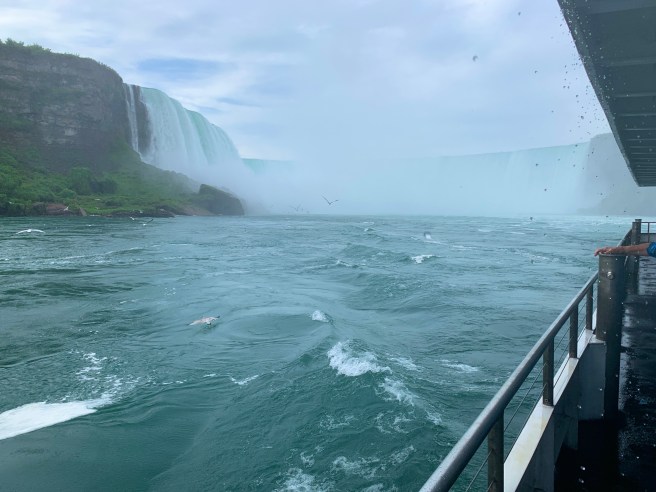
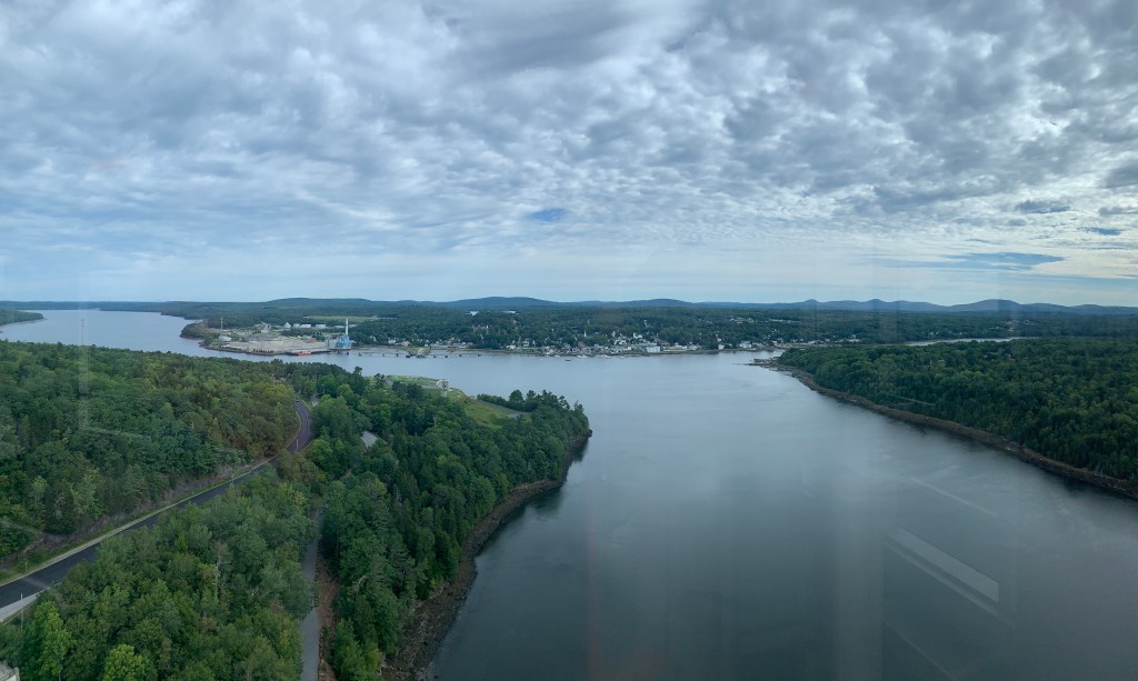
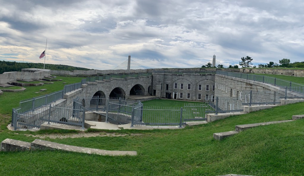
Our first big surprise of the day was stumbling onto the bridge over the Penobscot Narrows and the Fort Knox State Historic Site, which are adjacent to each other. The bridge is an engineering marvel, that was built in just 42 months, after the previous historic bridge was found to be unsound, during one of its maintenance inspections. The design of the new bridge included an elevator in one of the two towers and an observatory at the top, so people could enjoy spectacular views of the river, Bucksport, and Fort Knox.

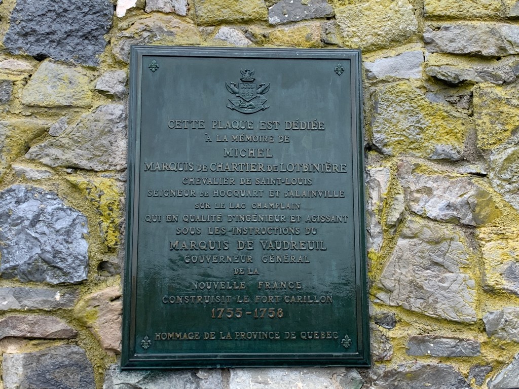
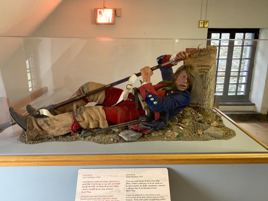
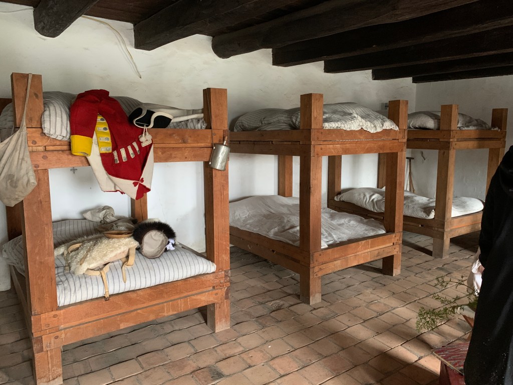
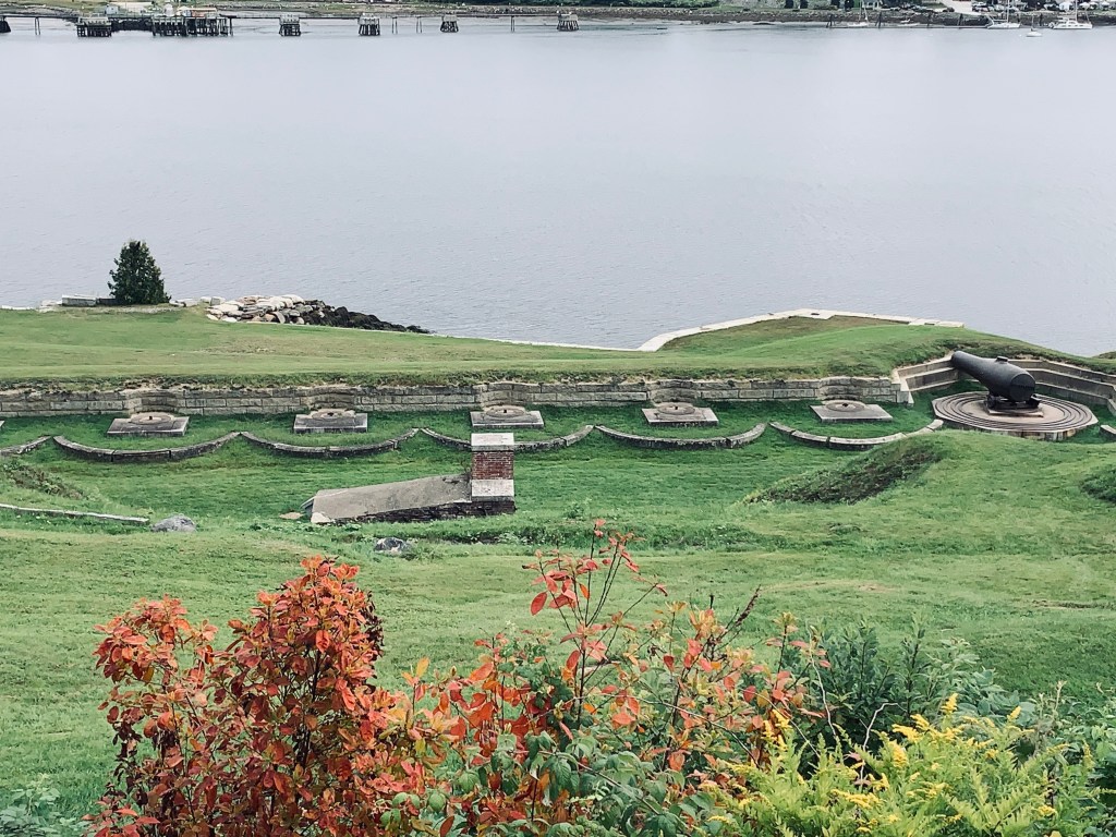
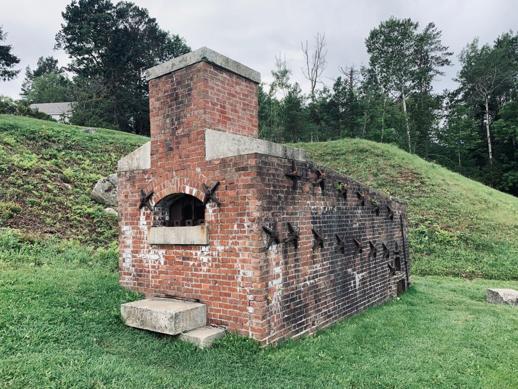
One of the best preserved fortifications on the New England seacoast, Fort Knox was built between 1844 and 1869—the first fort in Maine built entirely of granite.  It is named after Major General Henry Knox, the first U.S. Secretary of War and Commander of Artillery during the American Revolutionary War, who at the end of his life lived nearby.  The fort was manned during the Civil War and the Spanish American War, but was never involved in combat.

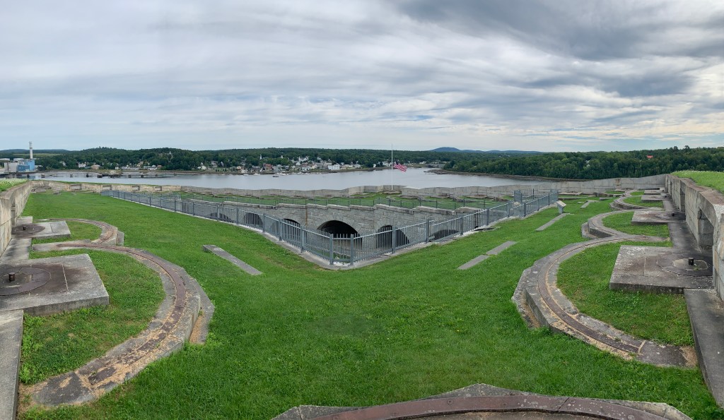
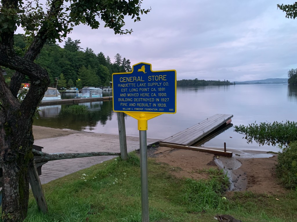
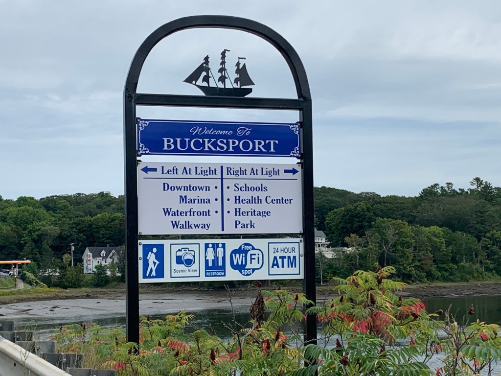
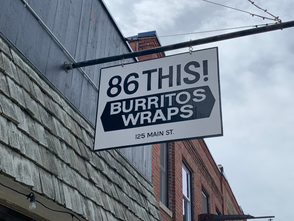
After spending some time in the Observation Tower and exploring the Fort, we rode across the bridge, into Bucksport, and it was time for lunch. So we asked some total strangers, on the street for recommendations, and each ended up ordering a Boss Hog burrito at 86This! I couldn’t eat the whole thing, but I definitely bagged enough carbs to make it through the rest of the day.

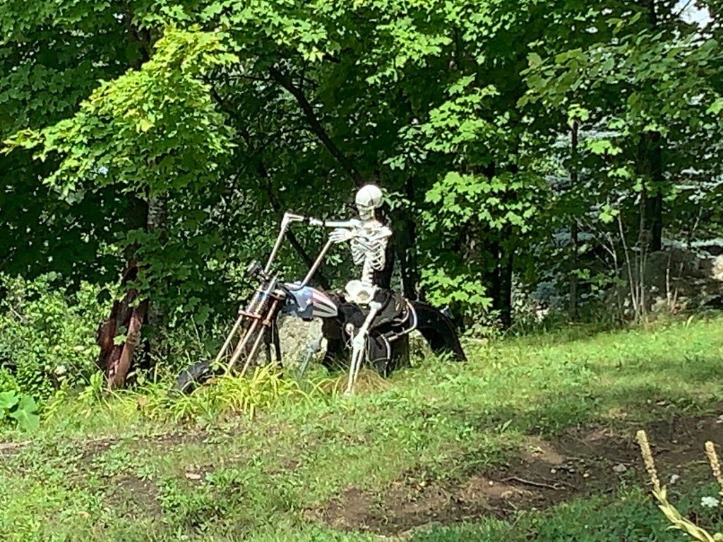
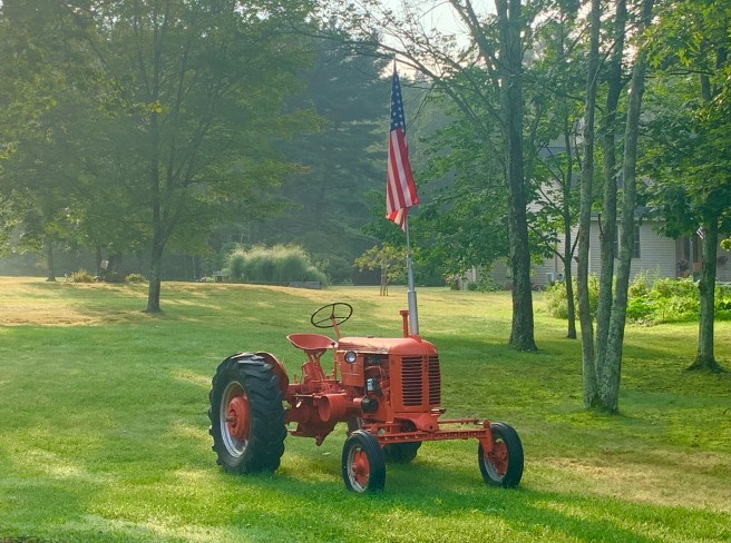
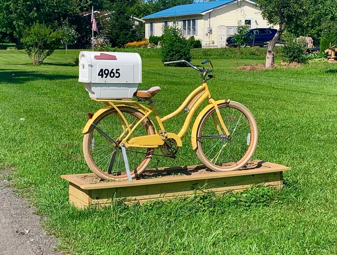
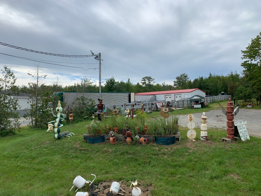
After stopping to take a photos of the yard art, below, we had only ridden short distance, when Ed noticed his music wasn’t playing. When he looked down to figure out why, he noticed his phone had fallen off his bike. He flipped his bike around on a dime, sped back toward the dragons, and quickly spotted his phone laying on the ground, 2-3 feet out in the traffic lane of US Highway 1. Yikes! Did I mention that we were riding in busy, end of season, weekend traffic, on the only road leading to Mount Desert Island, Acadia National Park and Bar Harbor? As Ed rode toward the oncoming traffic, he signaled desperately to the cars, to get them to move over, so they wouldn’t crush his phone. Just as he was catching up to the phone, a car was heading right toward it. And that’s when Ed got the miracle. Somehow, he caught the driver’s attention, and at the last second, the car swerved and missed the phone and Ed, and he was able to snatch that beloved phone from impending doom. Hallelujah, and well executed, Ed!

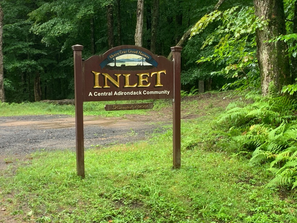
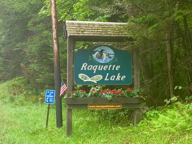
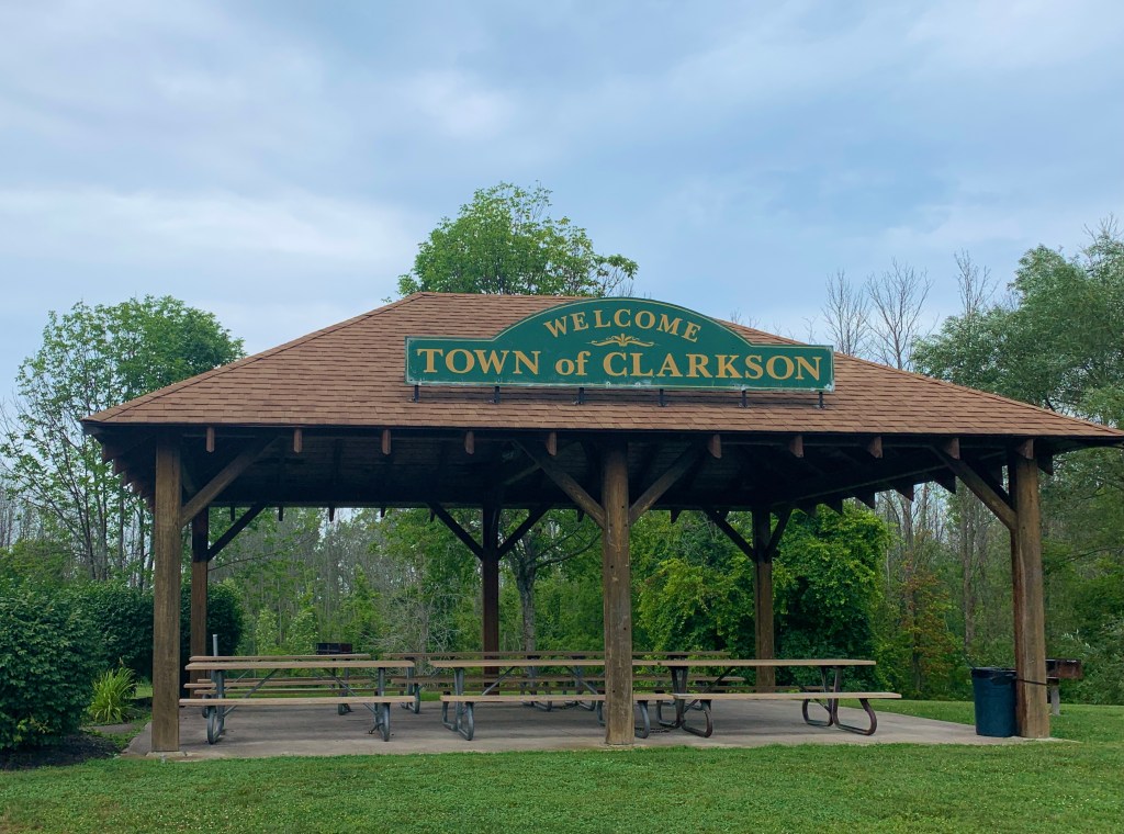
Once on the island, US Highway 1 branched off to the left, and we branched off to the right on Maine Route 3, which, thankfully, had slightly less traffic. We still had a ways to go to get to Bar Harbor, and this is where I discovered that the route I was anticipating on my GPS was not the route we were taking. Our route was a couple of miles longer and had more and steeper hills. Why? Why? Why? My legs were tired of steep hills, but now, both Ed and I had some strange form of adrenalin fueling us. We were muscling our way up hills that we normally would havre shifted into an easier gear for, because we were like horses headed for the barn. We pulled into Bar Harbor, found our way to the rocky beach, at the harbor, and made history–history for us, that is.

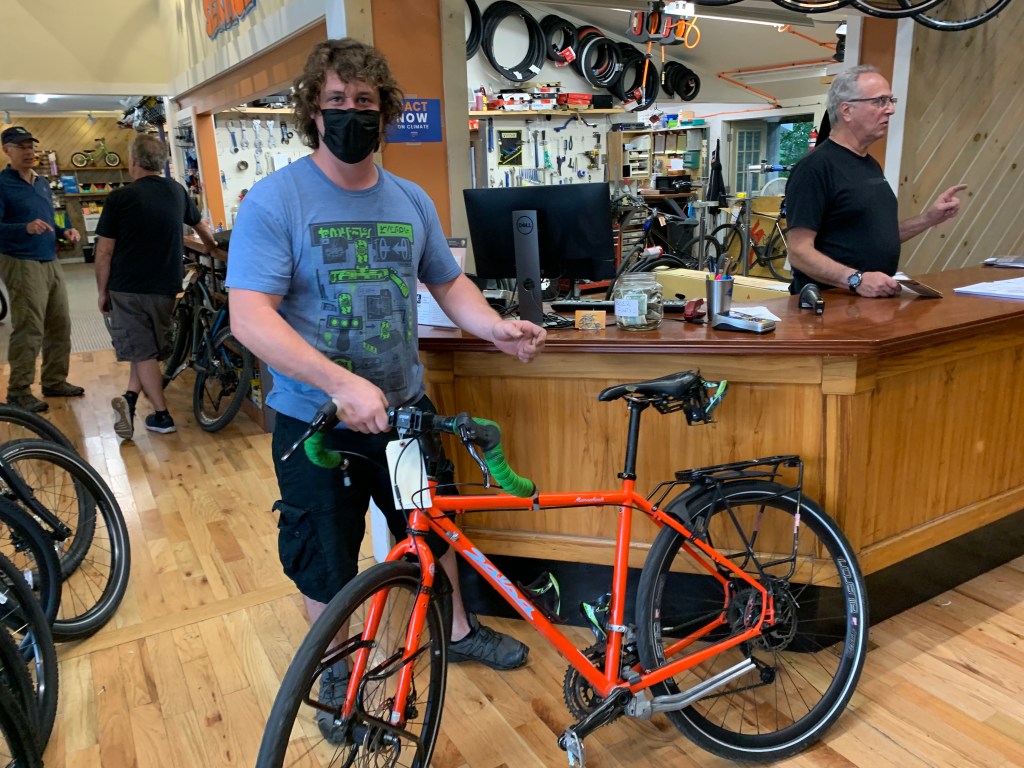
We wished we could take some time to celebrate, but we were under the gun. We had to take our bikes to the local bike shop, before they closed, in a little over an hour, but before we could do that, we had to ride to our motel, check in, drop off all our bags, shower and change into clean clothes, and ride back to said bike shop. We made it! Bar Harbor Bicycle Shop will be packing our bikes in boxes and shipping them for us, and their super speedy process had us out the door in under 5 minutes. Amazing! I’ll miss you, my trusty bike, till we meet again!

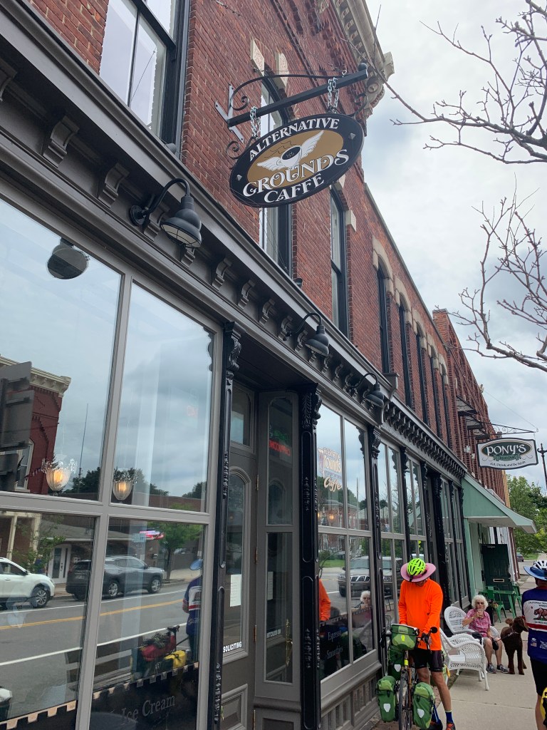
With the bikes set for shipping, we walked a couple of blocks to the downtown area of Bar Harbor. Ed started his celebrating, with a stop at a brewery and several other stops to enjoy the local vibe, and I checked out the park, memorials and shops. I had to buy myself a souvenir t-shirt and one last round of post cards for my loved ones.

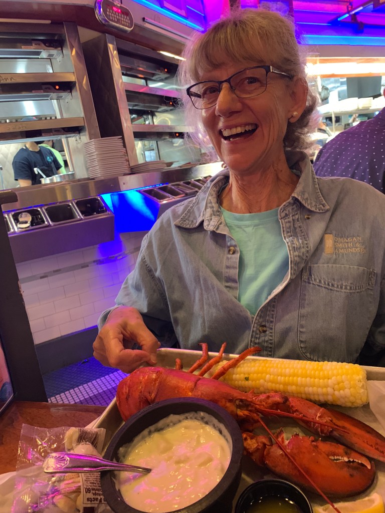
We met up with Chris and Linda at Geddy’s, for our celebratory dinner. Linda is a hoot! She ordered the biggest item on the menu–the Lobster Dinner, and somehow managed to eat the whole thing. Well no, actually, she shared her blueberry pie with all of us, because that’s the kind of gal she is. She and Chris dropped us off at the Days Inn on their way to their lodging, a little further down the road, which was much appreciated! Thanks for the great time, this evening, Chris and Linda!

This has been one heck of a journey! Thanks for riding it with me, Ed! As I said above, I have some catching up to do on this blog, some thank yous to write to amazing Warm Showers hosts, and a daughter and grandkids to hug on a bit. Once I accomplish all that, I’ll be back with my final thoughts on this trip.

8/20/2021 – Schroon Lake, NY to Middlebury, VT

46.28 Miles / 3691.62 Total Miles

2260 Ft. Elevation Gain / 118,943 Ft. Total Elevation Gain

Today was one of my favorite days of the trip. I rode alone, after an awesome day off in Schroon Lake. Started out with a wonderful “continental breakfast,” courtesy of Tammy, the owner of the Blue Ridge Motel. She makes fresh scones every night, for her guests, and puts out the best spread I’ve seen on the trail. On a personal level, Tammy really helped me out–letting me.borrow a hair dryer to dry my wet clothes; picking up an item I really needed from the store; advising me on the route; assisting me on some personal matters; making sure I had a real bowl to cook my dinner in, in the microwave oven–basically, being a friend to a complete stranger. I have a feeling she is a friend to lots of strangers, who pop into her motel. I gave her a big hug, before leaving. I also had to say goodbye to Maggie and Mark, who made yesterday’s adventures possible. They too are awesome people. All of you–remember how nice it is in Arizona during your cold winters. My guest room awaits, and you are welcome to come visit any time.

Yesterday, I scoped out the route Tammy recommended, on the way to Fort Ticonderoga. Then I received a text message from Ed, regarding the route he and Chris took, which was the more hilly route, with less traffic. I decided to go for the hilly route. My legs are pretty strong, these days, and traffic is my enemy. In the end, I actually enjoyed the route. It had a few good hills, but overall, it was easier than most of the hilly days we’ve had lately, and the lack of cars was really nice.

The route went north, then east, then south–to the only bridge for miles that crosses Lake Champlain and the Hudson River that flows out of it, because all the ferries that normally take cars across are closed, for some reason. Once again, I think Covid is being used as an excuse to stop offering ferry service. You can blame a lot of things on Covid, but closing all the ferries across a river, and forcing people to drive dozens of miles out of their way to cross a major river?

The first town I came to was Moriah, which is along the river, a few miles north of the bridge. It’s a nice little town, with lots of historic buildings, several murals, a great ice cream shop (I imbibed), and even a log of all the Champ sightings. Champ is a Lock Ness Monster-like creature that was first sighted by Samuel de Champlain, back in 1602, but then not seen again, till 1924. The most recent sighting was in 1990, so maybe Champ has died of old age. Wait–do monsters die, or do they live forever?

Leaving town, I followed the scenic byway below, as I rode south along Lake Champlain for 4-6 miles, before riding east onto Crown Point, the peninsula leading to the Lake Champlain. Bridge.

View of the bridge, from just north of Moriah
One last look back at the Adirondacks

Just before Lake Champlain lies Crown Point Historic Site, which consists of two forts, a lighthouse, and a few other small buildings.   Prior to the Revolutionary War, between 1734 and 1737, the French built Fort St. Frederic, where Lake Champlain narrows to just 1/4 mile at the Crown Point peninsula.  The narrowed waterway enabled control of the transportation of people and supplies between Quebec and the British Colonies, but the fort was also conveniently located so the French could run raids on British settlements in New York and New England.  The British didn’t like that too much, so they mounted various expeditions to take control of Crown Point, and in 1759 they finally succeeded.  Before the French retreated from the fort, they burned it down, and rather than rebuild, the British immediately began building a new, bigger fort, further up the hill–“His Majesty’s Fort of Crown Point.”  In 1775, the day after taking Fort Ticonderoga, American forces captured the new fort from the British and moved the cannons and heavy ordnance to Boston, where it was needed to defend against attacks there. 

The footings of Fort St. Frederic–the smaller French fort.
His Majesty’s Fort at Crown Point–the larger fort built further up the hill.
Another angle on His Majesty’s Fort
View of Lake Champlain and the Crown Point Bridge, from Crown Point.

The Crown Point Light House.

Lake Champlain and the Hudson River separate New York from Vermont, so when I crossed the Lake Champlain Bridge, I passed over into Vermont, and no kidding, the terrain changed instantly from forested Adirondack hills to farm land on less steep hills.  The buildings changed from often poorly maintained houses, barns, churches and commercial buildings, to nicely maintained everything. 

Another delightful changed in Vermont was that the majority of the houses, barns and buildings sporting flags were sporting US flags, instead of Trump flags.  Nice!  This is the country I know and love!

A few tractors flew US flags.

Remember the mud pull at the street fair a few states back? This farm had a semi rig and trailer to haul its tractor pulling getup to competitions.

As I entered Middlebury, I passed through Middlebury College, a liberal arts university, founded in 1800, and the first operating college in Vermont. It was flush with historic stone buildings.  

My bike was needing a little love, so I stopped in at the local bike shop, downtown, which happened to be owned by a guy who went to college in Arizona.  I asked to have my derailleurs adjusted, but came back to find the mechanics messing with my shifters, which I wasn’t too happy about.  There is some serious climbing, up ahead, and I wasn’t happy with the major irreversible changes they made to how my gears shift.  Grrrrrr–as if I wouldn’t notice?  

I met up with Ed and Chris at the Marriot Courtyard–the only available hotel room in town.   They had saved a nice spot for me–on the floor, just inside the door of our room–to park my bike and to lay out my tent footprint, Thermarest and sleeping bag.  I know it sounds spartan, but it is a really comfortable sleeping setup.  I settled in for a good night of rest.

8/19/2021 – Zero Day in Schroon Lake, NY

Sudden change of plans, this morning. I got up, packed and loaded everything up, then headed to the motel lobby for breakfast and a “map meeting,” to discuss our route for the day. We were facing another entire day of rain and a route not vetted by Adventure Cycling (ACA). Their route would have taken us to Ticonderoga, where we would have taken a ferry across Lake Champlain, but the ferries are all closed down, for some reason, so your have to find your way to a bridge to get across the Hudson River, and there are 3 possible routes. The owner of the motel was familiar with all 3 routes and was of the opinion that the route proposed by ACA was the best route, because it is less hilly, but it is on a busy road with little or no shoulder. We leaned toward the route that had less traffic, 8 less miles, but more hills and climbing. Hills never killed a cyclist, but traffic does all the time.

When I headed back to my motel room to put my rain clothes on, my brain came to a screeching halt. Tomorrow was going to be a zero day in Middlebury, and, per the weather forecast, it most likely was not going to be raining tomorrow. Why ride in the rain, when I could take that zero day today at this little motel, then ride in dry weather tomorrow. I looked out the window, and both Ed and Chris were standing over their bikes, ready to go. I called Ed, on his cell phone, and told him I wanted to stay back at the motel and ride tomorrow, and within seconds, he and Chris were in their saddles, and moving down the road.

It took about a minute to extend my stay one more day, with Tammy, the owner of the motel, and now that I was going to be around for another day, she wanted to know if I needed anything from town, because she was headed there later in the day. I was out of dental floss, so she added that to her list of things to pick up. Once back in my room, I called my sister and girlfriends, took a nap, then went outside to check the weather. A couple, from one of the neighbouring rooms, was having a steak dinner they’d prepared out on the porch in front of their room, so I stopped over to say hello.

Mark and Maggie were about to head over to Fort Ticonderoga, and when I asked if I could tag along, they graciously agreed. I put on my fastest drying clothes and rain jacket, and we hit the road a little after 2 PM, with me sitting on a folding chair in the back of Mark’s Honda Element. On the way there, I checked out that busy road I mentioned up above, and it was a definite no go for riding on tomorrow. Beyond being busy, it was hilly; sometimes did not have a shoulder; and it had foliage growing all the way up to the edge of the road, in a lot of places, that would force a cyclist to have to ride in the lane. This would not be my top route choice, if I had other options.

We had a little over 2 hours to see the fort, so we had to be efficient. Unfortunately, the exhibits and museums didn’t lay out the history of the fort, which is significant, for our country. Its capture from the British, back on May 10, 1775, was the first rebel victory in the Revolutionary War. It kicked off a string of other successful attacks, and the armaments from the fort were relocated to fortify locations that used them successfully against the British. Tomorrow I’ll be going to Crown Point, which US troops captured the following day.

Just before the Fort closed, we drove over to the King’s Garden to see what we could, before they closed the grounds at 5 PM. We ended up being the last men standing, when the buildings closed and all the employees left. We were able to walk around the gardens and take our sweet time looking around, but it was raining nonstop, and we were soaked and getting cold, so we headed back to Mark’s vehicle..

As we headed out of Fort Ticonderoga to head toward our motel, we took a wrong turn and ended up at the ferry landing, where we could see for ourselves that the ferry was indeed closed for the season. .

When Mark was a kid, he spent his summers in Schroon (pronounced “Skroon”) Lake, so he knew everything about everything, there, and wanted to show Maggie. He headed that way, stopping to check out the little lakes along the way. In town, we circled the downtown area and checked out the waterfront, then made a few little stops for treats and groceries, and, of course, to take in the local veterans memorial.

And here we are, back at the Blue Ridge Motel. Thank you, Mark and Maggie for taking me with you today! I enjoyed meeting you and seeing sights I would never have been able to see without you. Mark, I enjoyed your sense of serendipity and never ending interest in seeing everything there is to see, while you can. Maggie, I love your curiosity; your quiet, calm nature; and your courage to speak up when it’s needed. Best of luck to you in your travels together!

8/18/2021 – Racquette Lake to Schroon Lake, NY

65.51 Miles / 3645.34 Total Miles

4118 Ft. Elevation Gain / 116,683 Ft. Total Elevation Gain

Today was like Groundhog Day–another day of being soaked by rain–all day long. And it was a long hard day in the saddle, with a lot of miles and a lot of climbing, in the form of endless hills. When we started out, we rode along Racquette Lake, and I got to see some the other scenery around the lake.

We took a short break at Blue Mountain Lake, ducking under a gazebo, to get out of the rain, for a few minutes. We rode through numerous high-end resort areas, as we ambled down the route. Are there enough of them to support all the people in the northeast US who night want to enjoy a quiet lake vacation? I doubt it.

In Long Lake, we stopped for second breakfast at The Park. We were soaking wet, but the rain had slowed, briefly, so we could sit out in the open, but it was chilly. If we had known this was going to be the last food we would see for 5 hours, we would have bought more than beverages and/or ice cream. Later, I was starving, and towns with food were non existent. Mind you, I always have cookies, Sweet & Salty Bars and M&Ms, in my feed bag, but after a while, I need some REAL food, as in protein, fruits and vegetables.

While waiting for Chris and Ed to finish their break, I started getting cold, and the owner of The Park saw me shivering. So she offered to let me come into the kitchen and stand by the stoves to get warm, and I took her up on her offer. It was a little awkward, but I sure did appreciate her kindness and the warmth of that stove.

Somewhere in the hinterlands that we rode through, there was a little tiny market on the side of the road. Ed and Chris buzzed by it, but I was hungry and thought that maybe, just maybe it would have something simple to eat, like a hot dog or a frozen burrito, so I pulled over. Remember, it was still raining, and I was soaking wet, when I walked in the place. It was maybe 14′ x 14′, inside, and there were only a handful of items for sale–things like a few cans of food, fancy gourmet chocolate bars, and soft drinks–nothing of substance. I spoke to the gal, who was the owner/operator, and she told me that the only food between there and where we were staying, was a gas station convenience store about 25 miles up the road, and Paradox Brewery another .5 miles further.

Ed circled back, to see if I had scored any food at the market, and I told him about the food up ahead. He sped off, and I didn’t see him again, until I pulled into that gas station convenience store. Remember, we were all soaking wet, and it was still raining. Ed and Chris were just as hungry as I was, and they had bought food for now and food for dinner at the motel. I went inside and did the same, then we pulled out of the parking lot together, with just a couple of miles left to go, to get to our motel–so we through.

About a mile down the road, we ran into the Paradox Brewery, and believe me–it was a paradox! Standing, in the middle of nowhere, was a large multi million dollar building, with its own very large outdoor party tent, equipped with big screen TVs. The huge parking lot was packed with cars, and inside, probably 80-100 people were eating pizza, drinking beer and other beverages, playing board games, or just hanging out. Unbelievable! Unless these people were all local, how did they even know about this place? And if they were local, where did they all come from, and why were so many of them hanging out in a brewery in the hinterlands in the middle of the day?

It didn’t matter to us. We took off our wet rain gear and drug our wet bodies into the place, and even though we had just eaten, we ordered the biggest pizza they had–an extra large buffalo wing pizza and beverages. The pizza was tasty, but super greasy. We chowed down on it anyway, and now we were REALLY full. After donning our wet rain gear, we continued down the road another mile to our motel.

Each of us had a separate room, so we could have space to dry all out gear, and with the owner’s permission, we used her hose to wash all the grit and mud off our bikes and gear, before takin them into our rooms. I borrowed a hair dryer, at the front desk, to dry the things that were really REALLY wet, like my cycling shoes and the insides of a couple of my paneers. Once I was clean and warm, I climbed between the sheets and took a nice, long nap, then woke up and worked on my blog for a while.

8/17/2021 – Booneville to Raquette Lake, NY

47.22 Miles / 3579.83Total Miles

2034 Ft. Elevation Gain / 112,565 Ft. Total Elevation Gain

While we were tucked away–dry, warm, safe and sound, last night, the forecasted rain arrived on schedule, at 3 AM. We woke up at 5:30 AM to get ready for the day. With access to a kitchen, fixing breakfast was a breeze. The weather forecast for today was showing a full day of rain. You know, I’m from Arizona, and I would NEVER ride a bike in the rain–normally. But we have a schedule to keep, and who knows how many days of rain there will be. We can’t really stop to wait it out, if you know what I mean. As we pulled out of Stysh’s Brown Barn, we were completely rain suited up, and it was drizzling. And it continued to rain and drizzle through the entire day.

When we got to Thendara, it was time for second breakfast, so we pulled into a convenience market, that turned out to be a convenience market on steroids. It had fresh pastries and baked goods, gourmet sandwiches, breakfast sandwiches, and all kinds of hot and cold beverages, I was completely soaked, cold and shivering, so being indoors helped–a little. I ordered a huge sandwich, but could only eat half of it. And while I was eating that half, the rain turned to a torrential downpour.

We looked at the radar of the storm, and the heavy rain was going to pass us, within the hour, so we decided to hunker down, under the large covered outdoor dining area, and wait it out. And while waiting it out, we booked rooms at Raquette Lake Hotel & Tap Room, so we could dry ourselves, our clothes, bikes and gear out, and be ready for another day of cycling tomorrow.

When the rain throttled back to a drizzle, we started riding again. Everything around us was wet and getting wetter, including us, our phones and our gear, so it was hard to take photos. But there have to be photos, right? We were cycling on a scenic byway through the Adirondacks, and that cannot be forgotten.

Our rooms were above the Tap Room and General Store. We had everything we needed, right there, in that building. I ate the other half of my sandwich, from our morning convenience store stop, for lunch, then went down to the Tap Room for dinner.

After dinner, the rain died down to a very light drizzle, so I was able to walk around a little and check out the lake. Raquette Lake used to be a vacation hot spot for the Carnegies and other ultra rich industrialists, and I can see why. It is a very peaceful, beautiful, friendly place. After my little walk, I stopped by the General Store to get myself a couple of scoops of ice cream, and headed up to bed. With no TV, WIFI, or phone service, I was guaranteed a long restful night.

8/16/2021 – Pulaski to Boonville, NY

52.40 Miles / 3532.61Total Miles

2710 Ft. Elevation Gain / 110,531 Ft. Total Elevation Gain

Kit and Lou–I love you the most! Thank you so much to giving this birthday girl the gift of sleeping in a bed, indoors, last night. I slept so well, and while the guys were taking down wet tent rain flys and footprints, this morning, I was stuffing my silk sleeping bag liner back into its dry little stuff sack with ease.

We got on the road a little later than usual, because we could–we had a shorter day ahead of us. Our first stop was a diner in Pulaski. While waiting for breakfast, we checked the weather forecast, and it was a definite for rain tonight. Before looking for a motel, we put a call in to Can, our campground host at Stysh’s Brown Barn Campground, to see if he had a pavilion we could sleep under, to keep us out fo the rain. He said no to the pavilion, but told us we could sleep in the barn they use for events. We were wondering if there were animals in the barn, or if it was strictly for people.

We spent the majority of the day climbing Tug Hill, which is really a region, not a hill. Located between Lake Ontario and the Adirondack mountains, Tug Hill is 2100 square miles of heavily forested land with the highest amount of snowfall in the Eastern US and the lowest concentration of people. There were a lot of snowmobiles parked outside homes and signs for snowmobile routes.

The scenery of the day was typical–forests and lots off little towns, almost all with a veterans memorial monument of some kind. Nothing in particular stood out, but maybe I’m not paying as close of attention to the scenery, after over 2 months of riding through it. We planned for lunch in Osceola, the mid point of our ride, but when we arrived Osceola, all the businesses in town were closed–yes, all of them. We also needed a restroom, and were lucky to find a nice, clean outhouse behind the one business that was just closed for the day–not permanently. We took a break to eat, drink, rest and talk to a few of the people, nearby, then we pushed ahead to West Leyden, a much bigger town, that we hoped would have at least one restaurant.

When we got there, I stopped to ask a local what our food possibilities were, and he pointed down the street to the Milk Plant Tavern. Two minutes later, we were parking our bikes and heading indoors. Inside were a lot of friendly local folk, who looked like they were regulars, there, and several of them were interested in our ride. All 3 of us ordered the daily special, which was all-you-can eat spaghetti for $4.00. What a deal! But, of course, there were meatballs and beverages, and since it was my birthday, yesterday, I ordered a piece of pie for dessert. The service was great, and the food hit the spot.

We pass way too many caved in, deteriorating houses and barns, in these parts.

After lunch, we only had only 10 miles left to go. When we arrived Boonville, we headed over to the TOPS grocery store, to pick up needed supplies, as well as food for dinner. Then we followed Google Maps to our campground. The app provided a couple of routes for bicycles, so naturally, I picked the shortest one, and we were surprised to again be on the tow path of a 19th century canal.

This canal, the Black River Canal, connected the Black River, which runs through Boonville, to the Erie Canal. In its day, the canal had a world record 109 locks, 70 of which raised boats up a 693 foot gorge, and 39 that lowered them down a 386 foot descent. It was a very complicated engineering feat and construction project, due to the terrain, the types of soil involved, and the water levels of the bodies of water being connected. I found the image below online, so you can see how multiple locks were built in succession to accomplish a big rise or drop in the terrain. Fascinating stuff, eh?

The map then took us off the canal and onto a little country road that took us to Stysh’s, and our barn awaited us. And it was a HUGE barn, where a large wedding party had been held the previous night. We were offered the entire upstairs, to sleep in, then downstairs were the bathrooms, showers, a large fully stocked kitchen and an even larger recreation and game area. It was cool, in the basement, but upstairs, was pretty steamy, till the sun went down, so we only set up our sleeping zones in the area that had large fans. We prepared dinner in the kitchen, sat at the tables to work on our blogs, and had a nice quiet evening–tucked away safely in the barn, with everything we needed to be comfortable for the night.

The torrential downpour hit during the night and lasted for hours.

This is Stysh’s Brown Barn. It is one huge. Barn!! Downstairs is a kitchen, laundry room, arcade/rec room
Chris’ sleeping setup is on the left, Ed put up his tent, and my setup is on the right. Nice, eh? FYI, we did turn out all the lights, when we went to bed.

8/15/2021 – Pultneyville to Pulaski, NY

74.58 Miles / 3480.21 Total Miles

3445 Ft. Elevation Gain / 107,821 Ft. Total Elevation Gain

Today is my 65th birthday and Ed and Dianne’s 40th wedding anniversary. There may be a party, later, but today, there was some cycling to be done. Turning 65 is just a matter of survival, but staying happily married for 40 years, isn’t just about surviving. Both partners really have to work at it. I am really happy for Ed and Dianne and this milestone they have attained. Congratulations, to both of you!

Today was just another ordinary day on the road. Other than the two special events, it was typical of all the days lately, with lots of beautiful scenery, long miles, hilly roads, and a lot of little towns, resort areas and veterans memorials. Two things stood out, though. (1) We passed a lot of apple orchards and tree farms, and (2) We had more amazing Warm Showers hosts.

We were pretty wasted, when we pulled in to Kit and Lou’s place, just south of Pulaski. Kit pretty quickly had a pitcher of ice cold water out for us, as well as fresh pineapple, and cheese and crackers. She showed us where to dry our wet tents, from last night, let us do a load of laundry, brought out the bleach so we could get the grunge out of our bottles, and, special for my birthday, she let me sleep in a bed in the house, which was wonderful. While Kit and Lou worked together to prepare and serve up an amazing, delicious feast, we got to love on their dogs–Blue and Asker. Kit and Lou: Thank you so much for your generosity and amazing hospitality. You are awesome hosts!

We awoke to a beautiful sunrise.
Wood carving is art too.
This former POW Camp, near SODUS, was so nice that some of the prisoners returned, after the war, to live there.
Occasionally, we rest without stopping for food.
Had to take a picture of the sign for the town named after my brother Sterling.
And here is a town that reminded me of Sterling’s wife, :Dolores, who hails from Veracruz, Mexico.

8/14/2021 – Brockport to Pultneyville, NY

69 Miles / 3405.63 Total Miles

1148 Ft. Elevation Gain / 104,376 Ft. Total Elevation Gain

Boy did it rain, last night! A storm snuck up on us just after midnight, while we were sleeping. And again, we had thunder and lightening striking almost simultaneously, which, as you know, is not a good thing. It was hot and humid when I went to bed, so I was stretched out in my skivies with my rain fly openings up to let as much air as possible flow in. When the rain started pouring in, I had to be quick at getting the tent buttoned up tight. By the morning, the rain fly was still wet, but the skies had cleared, and the air was fresh, and it was cool and dry out–as in little to no humidity. What a treat.

Changing the topic, briefly, let’s talk about Gloria and her cooking. This morning, she prepared two different varieties of Dutch Baby pancakes–one with sliced apples, and the other, a chocolate pancake with cherries. They were scrumptious! And that was breakfast–not dessert. Dutch Babies are my favorite menu item at my favourite breakfast spot, Original Pancake House, next to Scottsdale Fashion Square, in Arizona. Note to self: I need to treat myself to breakfast there ASAP, when I get home.

Following breakfast, Gloria and Darrel pulled out their electric assist recumbent trikes and led us out of their neighborhood and through the first 15 miles of our route. We continued along the Erie Canal, but that smooth limestone cinder path, that we flew down, yesterday, was now soaked with water, and we were bogged down for the first few hours of the day, as we dodged deep puddles, and frequently had to ride up on the grass to avoid getting mired in mud. Luckily, no one fell, but I can tell you that I had a few close calls. At one point, the puddles were so bad, that Darrel guided us down sides streets, for a few miles, to avoid them.

One of the side streets we took to avoid puddles on the canal trail.

We met up with a super cool granddad, who had his two grandsons, ages 11 and 13, out on their first bike tour, covering a long section of the Erie Canal. I was impressed with how engaged the boys were in the logistics of their ride and in finding their way. They rode with us for a while, and when we stopped for second breakfast, they joined us at Tom Horton’s. While we were stopped, Gloria and Darrel let them try out their recumbents.

After second breakfast we stopped for photos, then parted ways with Gloria and Darrel, and they headed home. They have absolutely been the best at looking out for us, and we truly appreciate it. When I get home, I’m going to put Gloria’s phone number on speed dial, so I can get recipes from her.

At our lunch stop, Fairport, we encountered our first bridge being raised, to let a tall boat pass beneath. A boat ride down the canal would be fun, if I ever get back this way.

After lunch, I met up with a gal named Heidi, as we left our lunch spot, and we rode together for about 1/2 hour. In 18 months, when she retires, she plans to do some long bike tours, so she had a lot of questions. And I had a lot of ideas and suggestions for her. Heidi told me about a song, about the Erie Canal, that all the kids at her elementary school had to learn, and she sang it to me. It was hilarious. We sped up to catch up to Ed, so he could hear it too. Any woman who is willing to bust out in song with a stranger, is my kind of girl. Heidi, you need to reach out to me, when you get around to doing one of those bike tours. I would love to join you.

And finally, we came up on a lock that we could see up close and personal. Earlier in the day, we encountered a lock that was in service, lowering a boat, but there was such a large fenced barrier, that we couldn’t get close enough to see anything. We could actually ride our bikes over this one, and we did.

In Palmyra, our route exited the canal path and headed north toward Lake Ontario, with 20 steady miles of headwind blowing off the lake, to humble us and zap our energy.

When we reached Lake Ontario, in Pultneyville, we turned east and sailed to our campground, Hughes Campground and Marina. The owner led us out to a remote grassy spot adjacent to both the marina and the lake, where we had plenty of room to spread out and our own gazebo that we strung 3 clotheslines across to dry wet laundry.

Our gazebo is in the background below, and this large anchor was close to our picnic table. If you zoom in on the plaque, in front of the anchor and boulder, you’ll see that it is the headstone of the dad of the owner of the campground. That’s one heck of a grave marker, don’t you think?

8/13/2021 – Niagara Falls to Brockport, NY

78.96 Miles / 3336.63Total Miles

741 Ft. Elevation Gain / 103,228 Ft. Total Elevation Gain

Once again, we got an early start to allow time to work our way through 70+ miles of riding. We picked up the same bike path that led to our hotel and the falls, and continued on it for 6 miles, as it followed the Niagara Gorge on our way out of Niagara Falls. The roar of the falls could be heard for a few miles.

When we got off the bike path, we had a nice tailwind pushing us down roads that led us past rural areas and through a section of Indian reservation to Lockport, where we planned to get second breakfast. As we pulled into the downtown area, we ran into a couple of the many bicycle tourists we would see, today, who were on shorter trips. As I spoke with the wife, I looked down and noticed that my phone was not on its mount. Not this again!

The phone mount is finicky, and I have to fiddle with it every time I attach my phone to my bike, which happens every time I take a photo. The problem is, it can seem attached, but not be, so I usually twist and pull on it, before assuming it is attached, and I apparently did not do that at my last stop, where I had taken a photo of the sign leading into Lockport.

So while Ed and Chris ate their second breakfast and kicked back, I peddled like a maniac to backtrack 4-5 miles to look for it. It could have fallen anywhere I rode. The entire ride, I was thinking through my options. What if I could not find it? Or what if it fell on the road and was crushed by a vehicle? None of them were good. I backtracked all the way to the location of the photo and starting riding back toward Lockport, and then–dah dah DAH–I found it!!! It had fallen off and bounced into some grass, so it thankfully did not get crushed by a vehicle or picked up by a passer by.

I sent a text message to Ed and Chris and told them I had found my phone and to go on without me, as I didn’t want to hold them up further. When I pulled back into Lockport, there they were–waiting for me.

After grabbing a quick bite to eat and using the restroom at a convenience market, I was ready to go again, but not rested in any way. We found a ramp to take us down to a canal, and started following a bike path that ran adjacent to it. And it was at about this point that I realised we were going to be riding on the towpaths of the Erie Canal today and tomorrow. I really had no idea that was happening on this trip. I remember learning about the Erie Canal in all my elementary school history classes, but now I was seeing it first hand. What an amazing engineering feat it was, in its time, and now, in our time, the former tow path is an amazing bike and pedestrian path.

The first order of business was following the guys past a tiny Erie Canal museum and the actual canal lock at Lockport. These are the types of places where I normally would stop, but I had already held the guys up for over an hour, so I didn’t feel like I could stop and hold them up further. But wait. I had messaged them–actually twice–and told them to ride on without me, and they chose not to. For me, there was no reason to fly past things of interest, just to make good time, but I had already missed a museum and the first canal lock to do that. So the ride along the canal got off to a weird start.

If, like me, you can’t remember what you learned about the Erie Canal, back in elementary school, a refresher follows.

The first few miles of the canal tow path were paved, then it turned into a super smooth cinder path, except for the high traffic areas around bridges, that were paved. I normally don’t like riding my bike on surfaces with loose stone, because my tires have very little tread, so they can easily lose traction, which could lead to a fall, and I don’t like falling. But this path was different. It was hard packed, with just a light layer of cinder, and my bike rolled nicely and felt stable, as I rode down it.

Boats can enter the canal from the Hudson River and other canals that connect to this one, so throughout the day, a variety of boats passed by.

In Middleport, I caught up to the guys, and we stopped for a delicious lunch at Alternative Grounds Cafe. The people in this town were so nice! And curious. Several of them asked about our bikes, trip and/or brims. We seriously get more questions about our DaBrims, than anything.

And Ed, who badly misses his standard poodle Clancy, made friends with a golden doodle named Cadberry, who just wanted to love on Ed.

These gates are for flow control, so a section of the canal can be drained.
Much of the canal had farmland like this adjacent to it.
This is actually a piece of commissioned art.
This section of the canal had to be built above ground to span a small valley. That’s a lot of concrete!

The bridges over the canal can all be raised to allow taller boats to pass under them. There are state employees whose job is to respond to calls from boaters for the bridges to be raised.

Ed and Chris were long gone, when I got to Brockport. I used Google Maps to find my way to the home of Gloria and Darrel, our Warm Showers hosts for the evening. Their home backs up to the canal and is just a couple of blocks from the quaint downtown area.

Gloria is a gourmet cook who loves entertaining, so she had cold beverages and fresh watermelon out, when I arrived, and was working on a dinner feast in her kitchen. She had graciously invited our friends Dee and Lee Staley, who we met on the second night of our trip, at Colonial Creek Campground in Washington, to join us for dinner, but only Dee was going to be able to make it..

We set up our tents in the back yard, cooled off on the patio and took showers. And just as I was about to have my turn in the shower, Dee arrived. It was so great to see her! She and I made a connection, back in Washington, and we picked right up where we left off. I had been struggling with some issues, and she was a lifeline for me, with her encouragement and advice, and I really appreciated it! Thank you, Dee, for taking the time to drive down from Rochester to spend time with us. I loved every minute of it, and look forward to meeting up with you again in the future. We will make it happen!

Gloria and Darrel are amazing hosts. She served up a wonderful dinner, and both of them entertained us with their many interests and exploits. After dinner, I walked into town with them to get some ice cream, and we took a nice stroll along the canal path. Thanks Gloria and Darrel for making this such an enjoyable evening and for your kindness and generosity and above all, your most excellent hospitality. Let me know, if you are ever heading my way. I will do my best to reciprocate,

8/12/2021 – Zero Day in Niagara Falls, NY

It was time for a day off–most definitely. I went to bed pretty early, last night, and set an alarm, in case I completely forgot to wake up, but alas, I didn’t need it. I think I slept till 7:30, then fixed myself some oatmeal with the coffee maker, and got ready to take a walking tour of Niagara Falls State Park. The three of us went to the park together, and headed straight for the Maid of the Mist boat excursion.

We were directed to the observation tower, to catch an elevator down 200 feet to the river level, where we were given rain ponchos to wear, before we boarded the boat. I’ve been to Niagara Falls 2 other times, but never taken this boat ride, and for the life of me, I don’t know why I didn’t. It was a blast! The boat took us right up to the American Falls, and let us get thoroughly misted. I thought that might be all we got, out of the tour, but it wasn’t. Our boat captain took us further down to the Canadian Falls, and yes, without a Covid test, we crossed over into Canadian waters, for a few minutes, to ride right up into the horseshoe shaped falls for a few minutes. And we got up close and personal with the falls–really REALLY personal. It seemed like we were just a few feet from where the 600,000 gallons of water per second crash into the river below, and it was deafening, and you could barely see ahead of you, due to the mist. I wasn’t scared, but I’m sure there were people on the boat who were.

The observation deck at the Maid of the Mist.
The view from the observation deck.

Once we survived the boat tour, we walked over the pedestrian bridge to Goat Island, to do the Cave of the Winds ‘tour’. There, you again take an elevator down–this time, 175 feet, don another poncho and some Made-in-China sandals, then walk down several wet, mossy flights of wooden stairs to platforms where you get soaked and blown to smithereens by the gusts of mist generated by the falls. I watched Ed get completely soaked and blown and decided–no way am I doing that! And no one twisted my arm, so I just watched and laughed as other people got blown around like little puppets. I will never forget or not laugh, when I think of the images of the people I watched get soaked and blown. I’ll put that on my list of things I never want to do–right up there with bungee jumping.

After the Cave of the Winds, we had pretty much seen it all, so we caught a ride share up to a corner with grocery and drug stores, and knocked out a little shopping. On the way back, our Uber driver was taking forever to make an 11 minute drive to pick us up. A closer look at the map, Uber provides, showed he was stuck on the Canadian side of the border. We could have waited all day, for him. About the time we figured this out, a taxi pulled up to take some grocery shoppers home. When I asked the driver how much it would cost to get a taxi to our hotel, and he said “About $7.” Whoa. That is way cheaper than our Uber was going to cost. He ordered us up a taxi, and it arrived about 15 seconds later.

This real official sign was posted at one of the stores I stopped at.
The good old fashioned taxi driver beat out Uber hands down

Then we headed back down to the Hard Rock Cafe, for lunch. After lunch, it was time for a little siesta, then a call to one of my sisters. The siesta was amazing! I rested up, with hopes that I would be able to catch up on my blog, this evening, but we know that will probably never happen.

8/11/2021 – Dunkirk to Niagara Falls, NY

72.90 Miles / 3257.67 Total Miles

3257.67 Ft. Elevation Gain / 102,487 Ft. Total Elevation Gain

Today got off to a rocky start nand then had intermittent rockiness all day long. At a couple of different points, I was wishing someone would just shoot me and put me out of my misery. Spoiler: It had a happy ending.

When we woke up, this morning, there was a TORRENTIAL downpour going on, but the rain wasn’t pouring down. It was pouring sideways, along with the trees and other plants. We’re talking gale force winds, that would be impossible to ride a bike in. We had no choice, but to wait it out, till the storm passed, so we hung out in the hotel and tracked the storm with the radar function of our The Weather Channel app. Just after 8:00 AM, when the heavy rain and extreme winds had passed, we got on the road. We were facing down an 85+ mile day, so didn’t have time for goofing off.

The roads were wet, slick, and littered with all kinds or branches, leaves, and other debris, from the storm, so we proceeded carefully, as we passed through Silver Creek, Irving, Farnham and Lake Erie Beach. We rode past everything from rows of humble cottages to streets of ocean front mansions. At the 2-hour point we started hoping for a place to take a break and have second breakfast or even just a little snack, but no joy. None of these towns had even a convenience market open.

At the 40 mile point, we were starving and tired, so it’s a good thing we found ourselves a Subway Sandwich shop. While eating, the natives were restless, over the potential for another creepy hotel in Niagara Falls. We all started looking for options, and Ed called ahead to cancel our current iffy hotel and replace it with a reservation at a Holiday Inn. Thanks for being on top of that, Ed.

In Hamburg, Ed and Chris came up with a plan to shave 5+ miles off our route, by following the Google Maps bike route to our hotel. Seemed like a good idea. We had been moving pretty slowly through the urban areas, and after all, this was a very long day. About this time, the battery on my phone was down to 5% battery, so I plugged it into my trusty power pack, and that’s when I discovered that either my power pack or my iPhone cable had failed. I could not get the pack to charge my phone. So now I’m following these guys, with no capability to see what’s ahead or navigate independently. Oh, and they’re going so fast, I can barely keep up.

In Buffalo, we were routed into an industrial area, where we passed a huge Tessla factory, then into an area with light rail construction, and we were soon to be on a bike path. Well that’s what Google Maps showed. Unfortunately, the bike path was in the light rail construction zone and was fenced off and closed completely. Now what?

I had no navigation capability, so I just had to sit on my hands and hope the guys could come up with a Plan B, which of course they did. This plan led us to the bike path, again, as it ran through a huge municipal park, along the shore of Lake Erie and toward the Buffalo Freedom Bridge. The park looked abandoned, with torn up roads, tall grass and weeds, and very few people. When we were well into it, we ran into a chain link fence that put the brakes on moving forward.

These cool concrete buffalo were in one of the playground areas of the park. I’d love to have one of those in my back yard, for my grandkids to climb on.

Okay. Time for Plan C, which involved some city streets and bike paths, that ultimately led us to the Buffalo Freedom Bridge, thru some waterfront revitalization construction and to the almost 1-mile long I-190 bridge, that connects Buffalo to Grand Island, Did I mention the headwinds yet? There was a major headwind coming off of Lake Erie, and as we rode up the approach to the bridge, I could tell this was going to be difficult. For one thing, the pedestrian/bike lane was very narrow, and there was a sign telling us to walk our bikes. We ignored the sign and started riding across the bridge.

The Buffalo Freedom Bridge

Well the bridge railings were not very high, and I was a little nervous about being blown over and then falling OVER the side of the bridge. But I didn’t have much time to worry about that, because a couple of big semis passed me and almost knocked me over, with their wash. I adjusted, and now had a death grip on my handlebars and my eyes fixed on my rear view mirror, so I could anticipate semis and brace myself. That didn’t really work, because the next semi that flew by knocked me and my bike over completely, and I was wedged between the barriers on each side of the path.

After I pulled myself up off the ground and reattached a pannier, that had fallen off, I looked up ahead, and the guys were probably 1/4 mile ahead of me–still cycling. I started walking and just hoped they would wait for me at the other end of the bridge, because I had no way to navigate, if they went ahead to the hotel without me, which they have done before. At some point, they both got off their bikes and started walking, but I was so far back, I couldn’t catch up to them.

When I got to the other end of the bridge, I was so happy to see the guys there waiting for me. We got back on our bikes and rode ahead, stopping for a break at the first chance we could–a Wendy’s. That bridge, the traffic and the previous dead ends had taken a toll on all three of us. Refreshed–kind of–we peddled across Grand Island and walked our bikes across the I-190 bridge that connected the island to Niagara Falls, without incident.

Buffalo had some great murals
This is the bridge from Grand Island to Niagara Falls

Once off the bridge, our hotel was 6 miles away, but it was late in the day, and have I mentioned that I was meeting a notary at the hotel at 5:30 for a mobile signing on a property I am selling back in Arizona? No pressure, but I was worried about being there to meet him. Luckily, things got a little easier, at this point. We picked up a bike path that ran along the Niagara River, and started making good time. And as we got closer to our hotel, we could see the rapids and hear the roar of the falls. The river path led right to our Holiday Inn, and I had time to clean up, before meeting up with the notary.

After resting a bit, I ventured out to get some groceries and post cards, and to get a peak at the falls. When I had walked about a mile, I was getting into a sketchy neighbourhood, so I settled for a convenience market, then headed for the falls. I arrived just in time to see one of the light shows they put on every half hour, and it was so spectacular, that I FaceTimed my dear friend Jean to show her.

When I was 13, my parents took us kids on a tent trailer camping trip to Washington D.C. that looped up to see Palmyra and Niagara Falls. Dad was 51, at the time, and when he saw Niagara Falls, he exclaimed that it was the most magnificent thing he had ever seen. I’m with Dad. It’s the most magnificent thing I’ve ever seen, too.

Amazing rapids.
Even more amazing rapids.

8/10/2021 – Lake City, PA to Dunkirk, NY

64.34 Miles / 3184.77 Total Miles

1325 Ft. Elevation Gain / 100,794 Ft. Total Elevation Gain

I fell asleep talking to my little sister on the phone, last night. It was only 10:30 PM, which is early for me. There was no wifi, so blogging was out of the question. Add last night to all the other nights I am behind on the blog. Will I ever catch up?

I slept so good, and I was the only one who slept well, last night. It was so hot and muggy, but we had to have our rain flies on to keep dry, when the forecasted rain came at 4 AM, and they pretty much block all air flow into the tent. I put my Thermarest into my silk cocoon sleeping bag liner, stripped down to my skivvies, and slept on top. of the coccoon covered Thermarest. Later in the night, when it cooled off, I covered up with my sleeping bag. The guys all slept on top of their Thermarests inside their cocoons, and were hot till it cooled off hours later.

A trickle down problem, from falling asleep while on the phone, was that I never set my two alarms, so while everyone else was packing up, I was still checking out the insides of my eyelids. Ed finally called me on my phone and woke me up. Thank you Ed. Next time, don’t wait so long, okay?

The updated weather forecast was that the rain would arrive at 7 AM, and it was right on time. Being a little behind the curve on taking down my tent, it and some of my gear got soaked in a matter of seconds, which was a bummer. All that water made it really heavy.

The rain was really pouring down, so we didn’t exactly rush, getting ready to leave. We had 40 minutes of chores to do, before we were ready to leave the campground. Tom offered to haul our bags to the Clarion Inn, in Dunkirk, our destination for the day, so we loaded all the bags we could live without into the trunk of his Lexus. Riding unloaded was going to enable us to make better time through the rain, starting with that steep hill we were going to have to climb, just to get out of our campground. Our Garmins report the grade we are riding, to us, and at one point, that hill had a 14% grade, which is ridiculous.

We rode to and through Erie, PA, which is a really cool town, with lots to see and do. But the rain was coming down so hard, our cameras were useless. They would have fogged up or taken a picture of the rain drops, instead of the subject. So we rode past all the things we usually stop for. I did stop to take a photo of this Veteran’s Memorial, in the downtown area. And while I was taking a selfie, afterwards, I kept hearing a car horn honking. Then I heard a voice say, “Ma’am, could you move your bike out of the road please? I need to back up.” I looked over, and it was a police officer talking to me. Boy am I glad he was a nice guy. I got the heck out of there so fast.

Erie, Pennsylvania Veterans Memorial

After Erie, we came to a road closure and detour. Our normal practice is to ignore those signs and see if we can forge ahead either on the road or sidewalk, and in this case it worked, thankfully. Later, Tom told us that the detour was 10 miles long–10 minutes, when you’re in a car, but possibly an hour, on a bike in the rain.

Once past Erie, we realized that there were no places ahead on the route to refill our water or stop for food. But today we had Tom on the route with us. When he caught up to us, we asked him if he would drive ahead, and pick up some sandwiches for us. He returned with some Subway sandwiches, at about the same time the rain stopped, and we were able to actually take a break and eat them. We were so thankful to have Tom with us on this difficult riding day. Tom: You’re our hero! Having you with us, today, was like having an angel in our pocket–lifting us along and helping us through the rough spots.

After eating, we stowed our rain gear away on our bikes and hit the road. It very quickly became hot and muggy, but now there was a tailwind pushing us along. After a couple more hours, we stopped for a snack and beverage, then went back at it, with just 20 miles left till the hotel.

Lighthouse on the bay in Barcelona, New York
Dunkirk’s lake front Veterans Memorial

When we arrived at the Clarion, Tom was already there–ready to unload our gear from his trunk. He had to get back home, so we bid him farewell, and he began his 6 hour drive back to Fairfax. We are so grateful for you, Tom! You have the experience to know exactly what we were going through and also knew precisely what to do to help us. We hope that the next time we meet, you are riding with us.

After showering, we walked over to Captain Ale’s for linner. It wasn’t our favorite meal, but we were starving, and it was convenient. We then parted ways to take care of personal business, do laundry, shop, go to the barber, clean our bikes and gear, etc. Chris put a new chain and rear brake pad on my bike, which were badly needed. Thank you Chris!

In summary, what could have been a miserable day, turned out great, with a little help from a friend (So says Ringo Starr).

8/9/2021 – Eastlake, OH to Lake City, PA

76.79 Miles / 3129.43 Total Miles

1298 Ft. Elevation Gain / 99,528 Ft. Total Elevation Gain

After a wonderful night of rest in a nice, clean hotel, with ultra soft sheets on the bed, fluffy super white towels and a clean shower, we were ready for whatever was coming our way. Up and at it at early, we were out the door at 6:11 AM, this morning. Amazing, eh? We went downstairs for the breakfast buffet and found out that it cost $14. Really? We have been staying at places where breakfast was free–not going to pay $14 for breakfast–so we jumped on our bikes and started riding back to the route. Shortly, we came up on a McDonalds, where we picked up a quick and tasty breakfast and pounded down some carbs, all at the same time.

Other than the fact that we crossed over into Pennsylvania, and it was hot and muggy, then got hotter and muggier, nothing really stands out about our cycling day, besides the fact that it was way too many miles and way too much climbing for one day. Who came up with this ridiculous plan anyhow? Oh yeah, Ed and I did. What were we thinking?. After riding a few of these 70+ mile days, I was talking to Chris about what the optimum day was, and he said 50. I agree. That would be perfect, if only campgrounds and other forms of lodging would make themselves available, with showers and electricity, every 50 miles..

Back to our day, we passed through farmlands, forested areas, modest homes, little towns, and several resort communities. This is some beautiful territory.

Had to try out the Duck Boat. Obviously, it’s not the same kind as the ones in Boston.
FYI, I don’t think we are the variety of biker these guys love.

When we came up on this Kent State University sign and the flags, I choked up, The image of the young girl kneeling over the body of a slain student, after the National Guard shooting at the Kent State Vietnam War demonstration, came to my mind. I instinctively pulled in to look for a memorial, then Ed reminded me that this was just an extension campus. If there is a memorial, it would be at the campus in Kent, Ohio. Still, as we cycled on down the road, I kept thinking about what I could remember about the shooting and the Vietnam War protests. I was only in the 8th grade, when the shooting took place, but I was in touch with what was happening in the world. My brother had already died in Vietnam, and I read the newspaper every day and Newsweek every week.

Goodbye Ohio. Hello Pennsylvania! Whoo Hoo!
This mural was on the wall of one of the bathroom train cars. Looks snazzy, but does not tell the tale of the dirty and poorly maintained bathrooms–some of the worst we’ve seen.

When we came coasting into our campsite (there was a long, super steep hill that dropped right down into it), the fun began. Tom Calhoun, had driven 5 hours, from his home in Fairfax, Virginia, to meet up with us, and was there waiting for us to roll in. It was so good to see a familiar face! We met Tom when we all rode the Southern Tier together, back in 2017 and have some great shared memories. One of my favorites is the night he and I had to cook dinner, together, and he landed on this menu that included potato salad. But we’re not talking about the kind of potato salad you buy at the deli. No, we boiled the potatoes, cubed them and the other vegetables, and added all the other ingredients ourselves–all without a recipe. What man can do that?

Tom had brought his tent, and he set it up with ours and spent the night. He drove us to the next town for dinner, then we made an ice cream stop on our way back. Once back at camp, we sat and watched the fireflies and reminisced about the Southern Tier, till the mosquitos came out and put an end to our fun. We all readied our bikes for the rain that was forecast to arrive around 4 AM, then dove into our tents for the night.

Thanks for the huge effort you to made to come spend a night with us, Tom! We loved seeing you and enjoyed the memories. Wish you could have ridden at least part of this ride with us.

When we pulled in to Uncle John’s Elk Creek Campground, out popped Tom Calhoun, from our Southern Tier ride, four years ago. He drove down from Fairfax, Virginia to see us, and it was so good to see him again! He pulled out his tent and set it up in our campsite, and now that I mentioned the word campsite, I hope it’s okay with you if I go ahead and rant about the camping, that night. Uncle John’s was a private campground, with half of the restrooms closed, and the remaining open restrooms, which happened to be in old train cars, creepy and dirty. Ironicly, we paid the BIG bucks for the privilege of using them–$45 per tent, and we had 4 tents, so that came to $180.

Once we had our tents up and were showered, Tom drove us to a town several miles away, for dinner

8/8/2021 Huron to Eastlake, OH – 3/4 of the Way!!!

74.57 Miles / 3043.64Total Miles

1056 Ft. Elevation Gain / 98,230 Ft. Total Elevation Gain

While we were getting our gear packed and loaded, this morning, Lance was busy cooking a breakfast fit for kings. He is such a great host! Before we could leave, he took photos, then he hopped on his bike and guided us out of his little resort community on a route that avoided the gravel hill we came in on. Cruising on the Huron River Path, which rides on top of a levee next to the Huron River, we made our way back to River Road, then turned north toward US 6, where we spent most of the day. We were headed toward Cleveland, so the closer we got to the downtown area, the busier the traffic became.

.

We enjoyed riding through some sleepy little towns on the way. When we passed Lorain, we’d been on our bikes almost 2 hours, and I was wanting to stop for a bite to eat, but no one else spoke up, so I grazed on treats in my feed bag. Just a few minutes later, one of the guys mentioned being hungry. Well at this point, we were out of town, and the next town on the route with food was over 25 miles away. I consulted Google Maps, and there was a bakery about a mile south of the route–10 miles away, which is pretty far to go when you’re hungry.

When we approached Avon Lake, we let Google guide us to the bakery. The fella who owns Mimzie’s Bakehouse heated a big cinnamon roll in his oven, for me, and though they don’t sell milk as one of their beverages, they let me buy a glass of milk from the refrigerator back in the kitchen. They were so accommodating! We sat down to enjoy our pastries, then stepped outside. The skies had changed from cloudy to dark, and that’s when the torrential rain shower started. It poured for 45 minutes, and we watched the storm pass on our radar, before getting on our bikes again.

The roads were wet, and there was a lot of water and mist flying, as cars passed us. At one point, it started to drizzle again and seemed to be getting worse, so I decided to put my rain gear on. Me doing that ensured it wouldn’t rain. Once my gear was on, it stopped drizzling, and I started heating up, but I didn’t want to stop and waste more time removing the rain gear, so I suffered through the extra clothes until it was an absolute certainty that it wouldn’t be raining.

From Huron to Cleveland, we rode along the Lake Erie waterfront, so we were passing lakefront homes all day long. The closer we got to Cleveland, the more mansion-like they became, and the more mansion filled the neighbourhoods became

When we reached Cleveland, it was heating up outside. We grabbed a bite to eat, before taking in the Rock & Roll Hall of Fame, which several people had told us not to miss. The bottom level had so much music memorabilia, I couldn’t keep track of where I’d been. I wished I could have stopped and read everything I was interested in and looked more closely at the memorabilia, but that would have taken most of the day. I had to breeze through the place, and it still took over 2 hours. Some ‘artists’ who weren’t anywhere to be seen: the Monkies and Paul Revere and the Raiders. Come on, people–those were my favorite groups, back when I was in the 6th grade. So what, if they were all lip synching.

We had 16 miles left to ride, when we left the museum. As we moved east, we left the mansion zone, and at times were in some very run down areas. And it turns out that our hotel, for the evening, was also in one of those areas. As we checked in, everywhere we looked, things were broken, damaged or dirty–almost like no one was doing cleaning or maintenance any more. The pool was closed, due to Covid, and free breakfast was cancelled, due to Covid. Is it possible that there was also no maintenance and cleaning, due to Covid? I don’t know how a hospitality business justifies that.

When we got to our room, it was beyond sub par. There were little flying insects dive bombing me and hanging out all over the walls, the air filter looked like it had never been cleaned or changed, and the carpets and other surfaces were filthy. Ed was able to get a refund, but Chris, couldn’t get one, because he had already showered–without a shower curtain, because his room didn’t have one. We rode another 4 miles east to the first hotel with decent reviews–a Four Points Sheraton, in Eastlake. After we checked in, we invited Chris to join us, and while he packed up his gear and followed us over, we made room for him to join us for the night. We had wasted a lot of time and energy on the hotel problem, and I had too much to do, to take the time to go to a restaurant for dinner, so I cooked up some oatmeal and loaded it up with my hearty trail mix instead. My Mom would not have approved, but it sure was good.