5/28/23 – Canada!!! East Machias, ME to Campobello Island, Canada

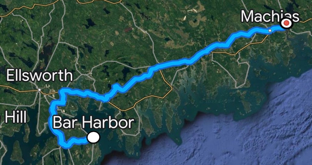
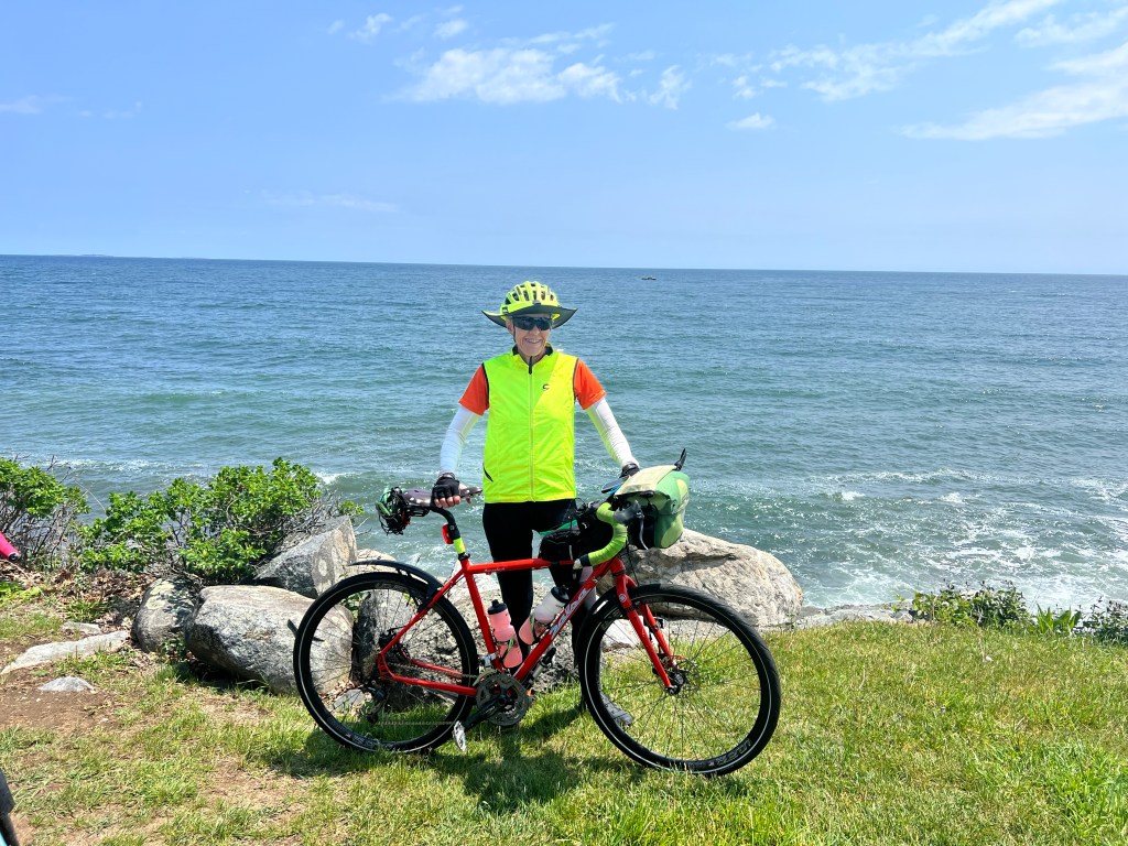
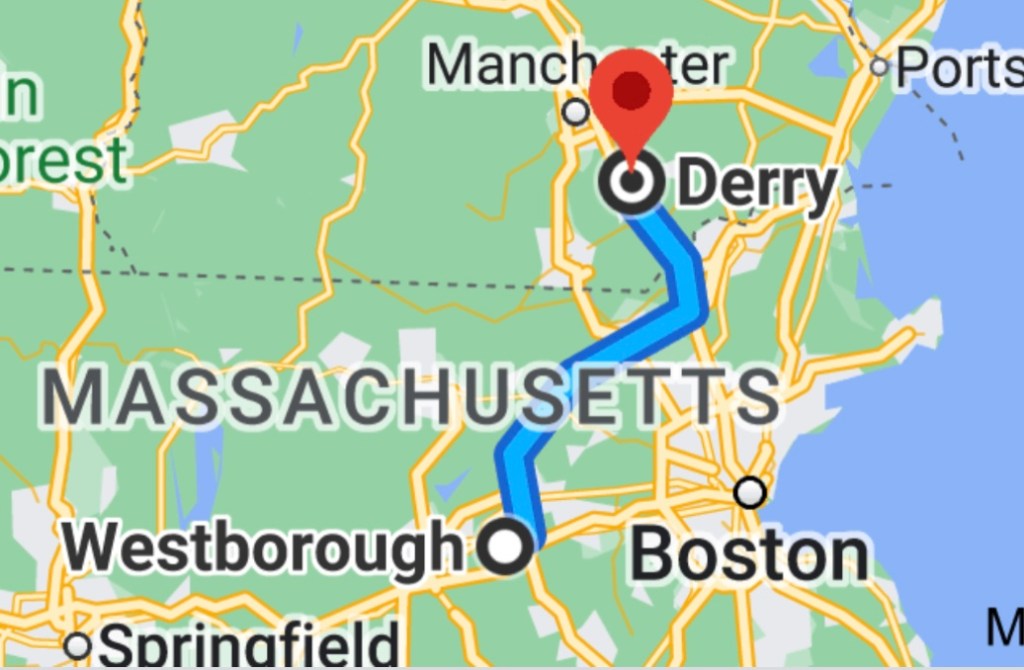
Miles: 32.39 Today / 2924.49 Total 

Elevation Gain:  1595 ft. Today / 92,277 ft. Total

Spoiler: I made it to Canada today!

One of my big goals for this ride was to raise $5000 for the Bike the US for MS non profit organization that allocates donations to MS research and treatment centers. At this point, I am short of my goal, having raised just $4250. If you would like to help me reach my goal, please click this link and enjoy my enduring love forever.

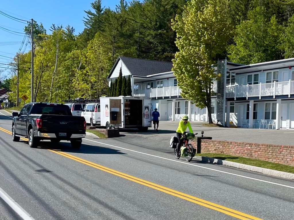
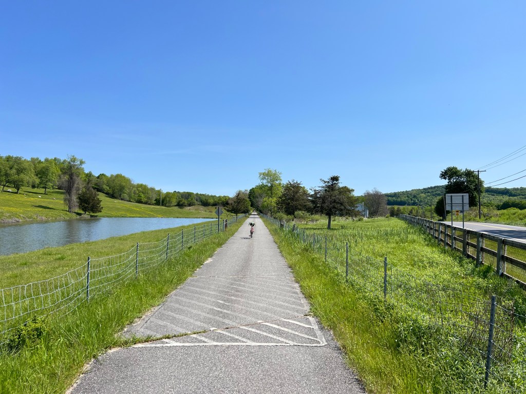
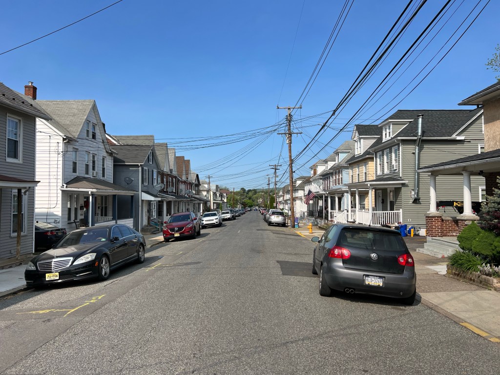
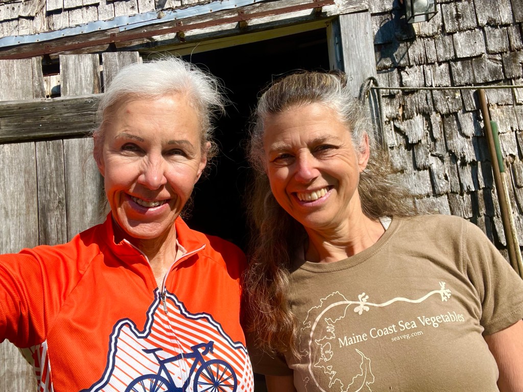
There was no reason to rush out the door this morning, because I only had about 30 miles to ride, so I spent more time chatting with Regina about even more things we have in common, which was great. I really enjoyed talking about some of our common challenges (enduring divorce, dating at our age, etc.) and hearing about her Arizona Trail hike, gear, tips, etc., but at some point, I had to hit the road. So we said our goodbyes, and I started peddling.

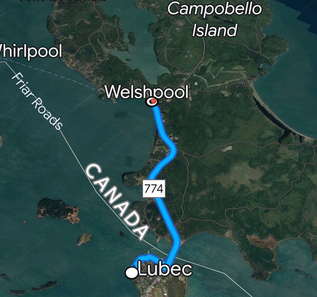
Thirteen miles out, I stopped in Whiting, where I wanted to verify the details of the pickup location for catching the West Bus tomorrow morning. The the girl working the counter of the store that’s listed as a pickup point didn’t know anything about the bus stopping there daily, and neither did her mother, who acted like she was either the store owner or manager. Hmmm. I checked the bus’ website and it listed the Community Center/Whiting Store under pickup location, so I asked her where the community center was, and she didn’t know that either. Seriously? I gave up on that lady, and headed out to find someone with more information.

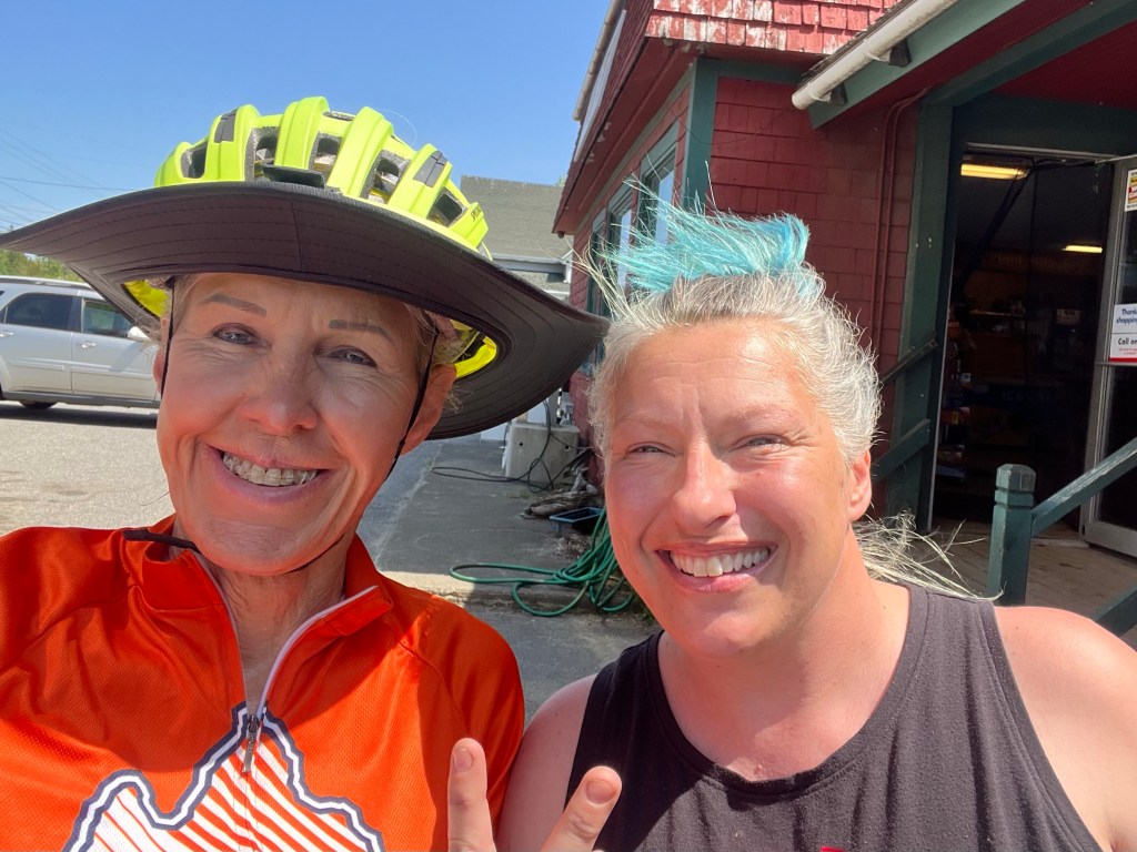
When I got to the parking lot, a young gal named Brianne was heading my way to talk to me. Say what? Her husband had told her that there was a lady in the store who looked like a model, and she needed to check me out. I was flattered, so I didn’t want to insult her by telling her that her husband needs his eyes checked. She knew where the community center was and also knew about what is open on Campobello Island, where I was headed. She recommended a restaurant to me and explained how to get there, which I truly appreciated. Thanks for all your help, Brianne!

Me and Brianne. She helped me A LOT!

After riding by the community center to scope out my morning pickup location (this is important, as I can’t afford to miss that bus), I got back on the road to Lubek, where I’m staying tonight. I was hoping to check in early or at least leave a few gear bags behind to reduce the weight I was carrying into Canada.

The not friendly lady at The Inn on the Wharf, was unwilling to accommodate me in any way, which was a little disappointing. I could see several different places where I could have easily stashed a few small items, but it was a hard No from her, so I rode on.

My original intentions were to cross into Canada, take a few steps, then turn around and come right back, but with Brianna’s help, I now had plans to see Franklin Delano Roosevelt’s summer home and eat linner at a restaurant called The Porch, which is less than a mile up the road from the home site. 

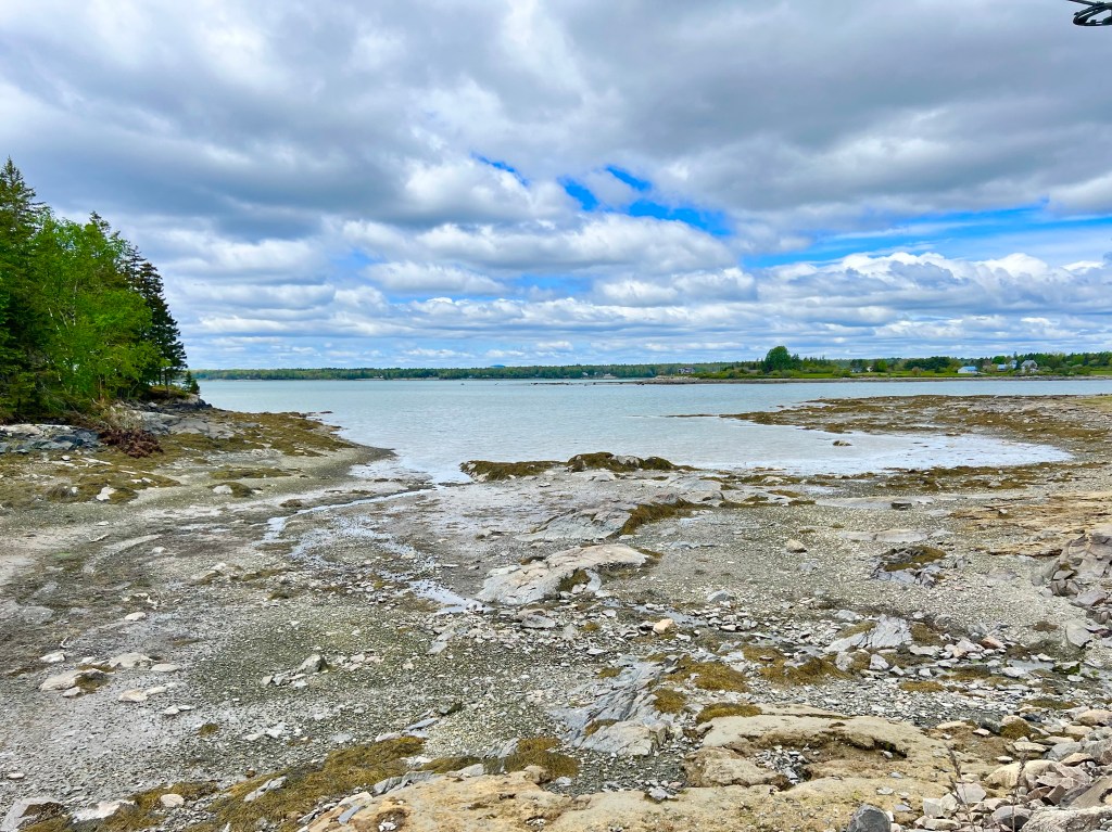
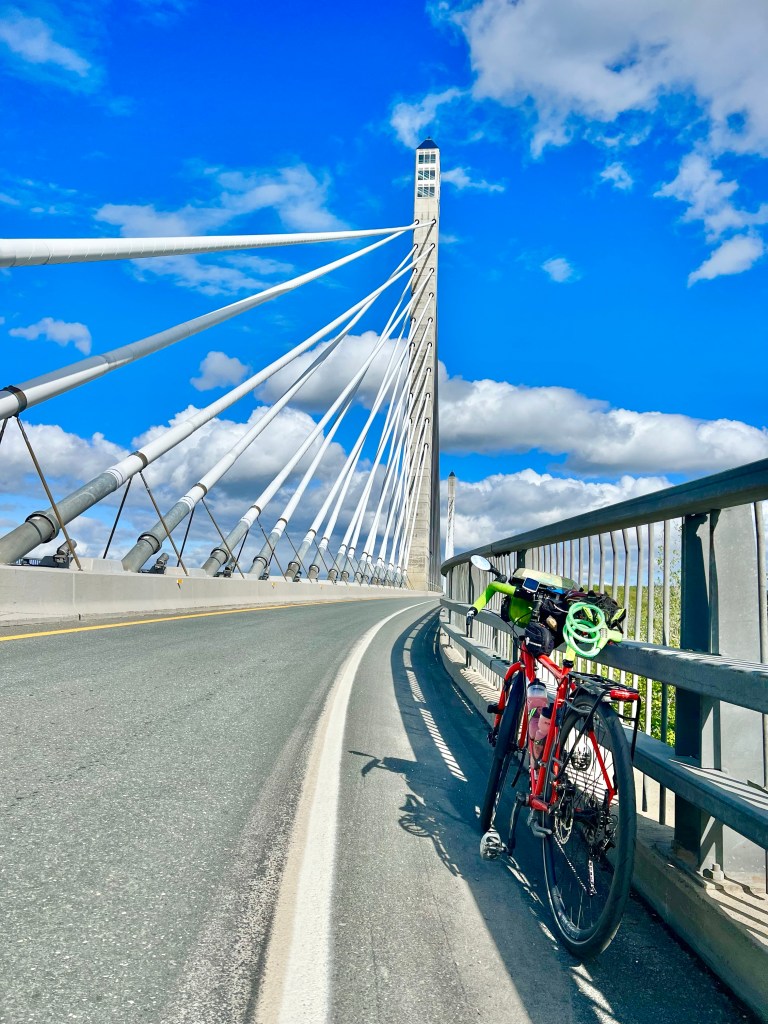
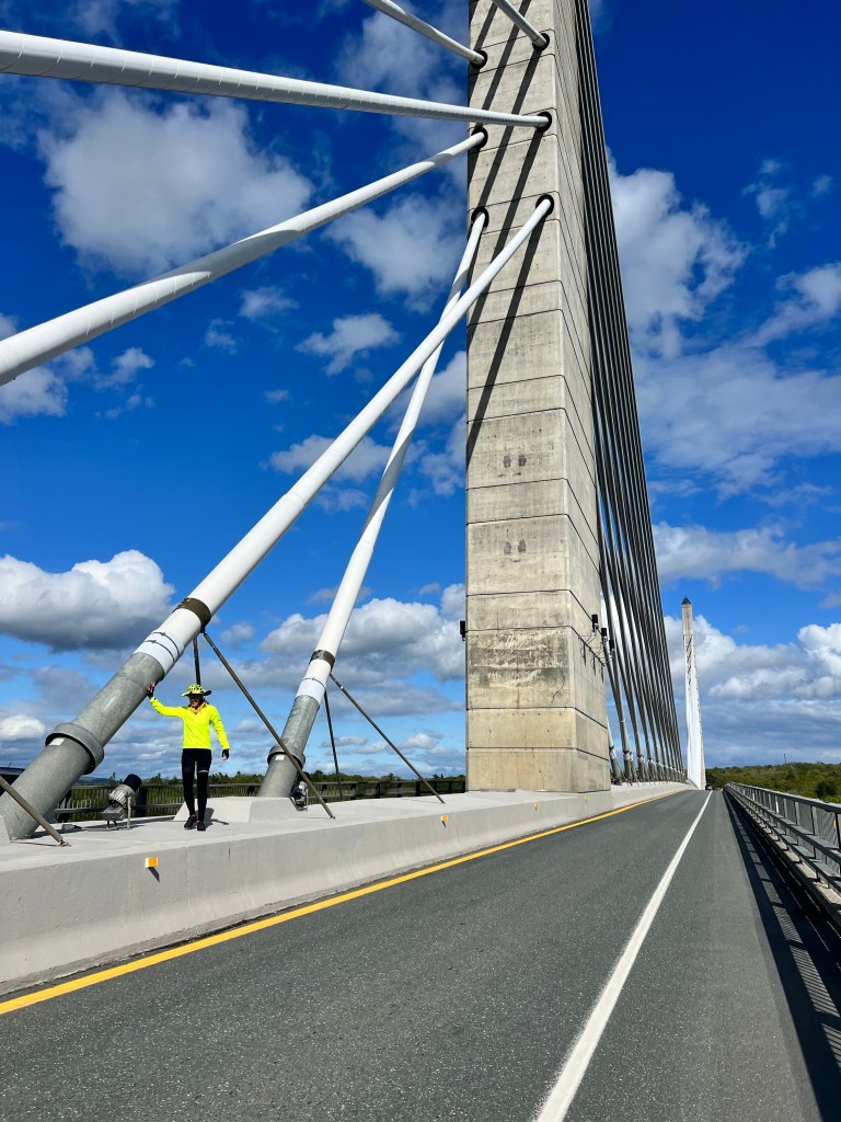
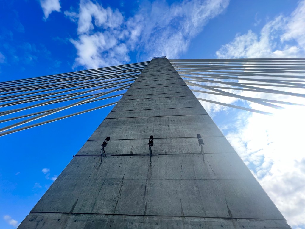
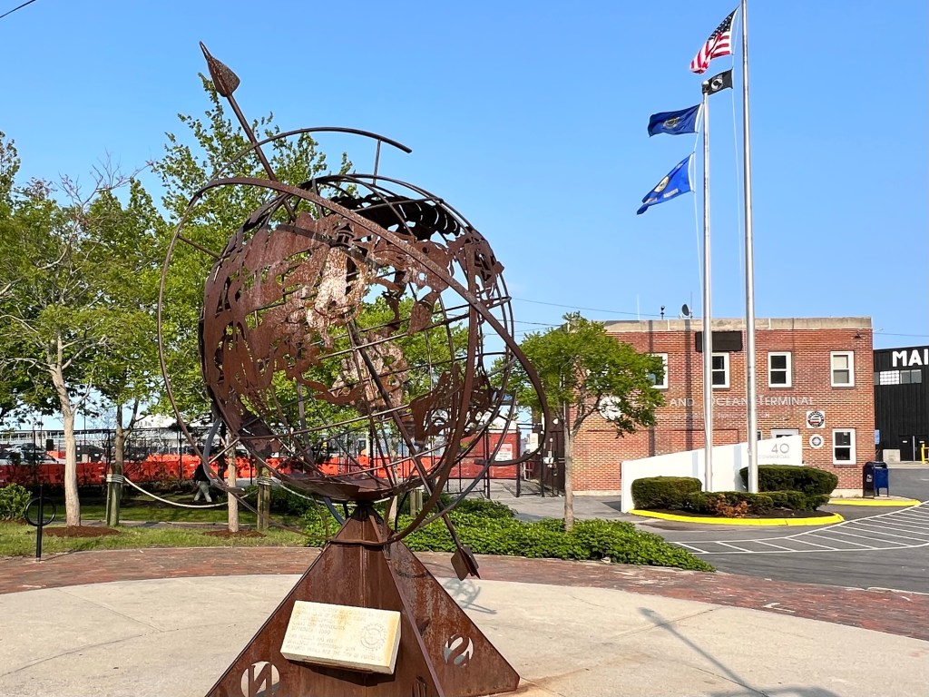
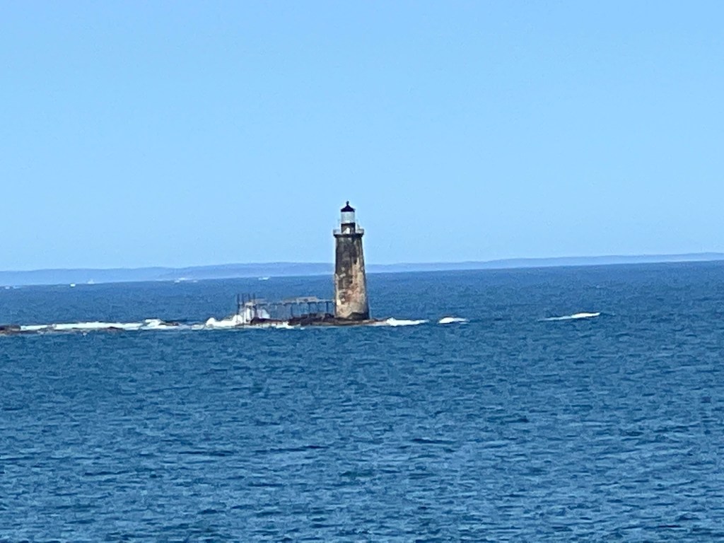
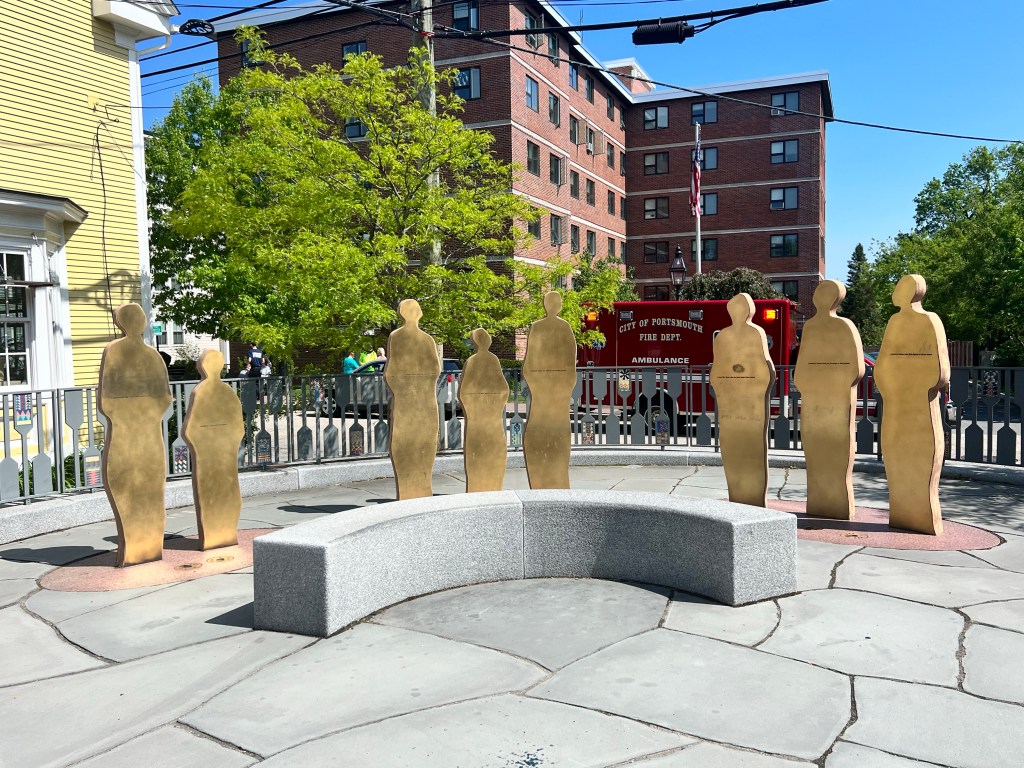
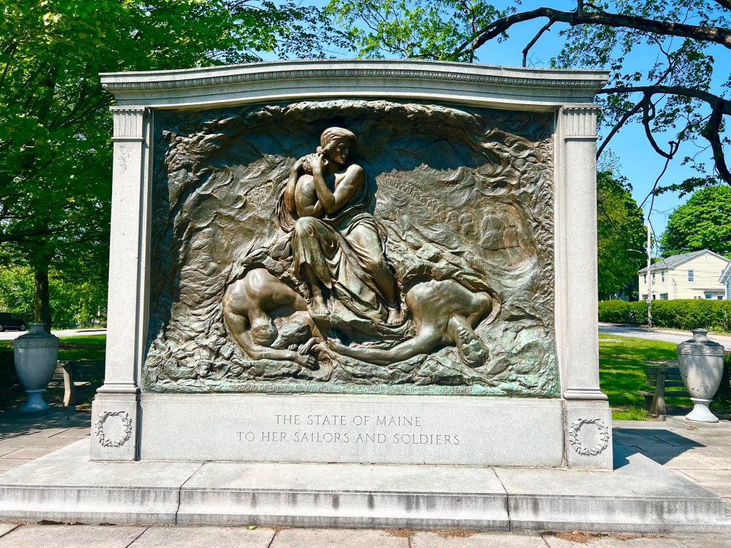
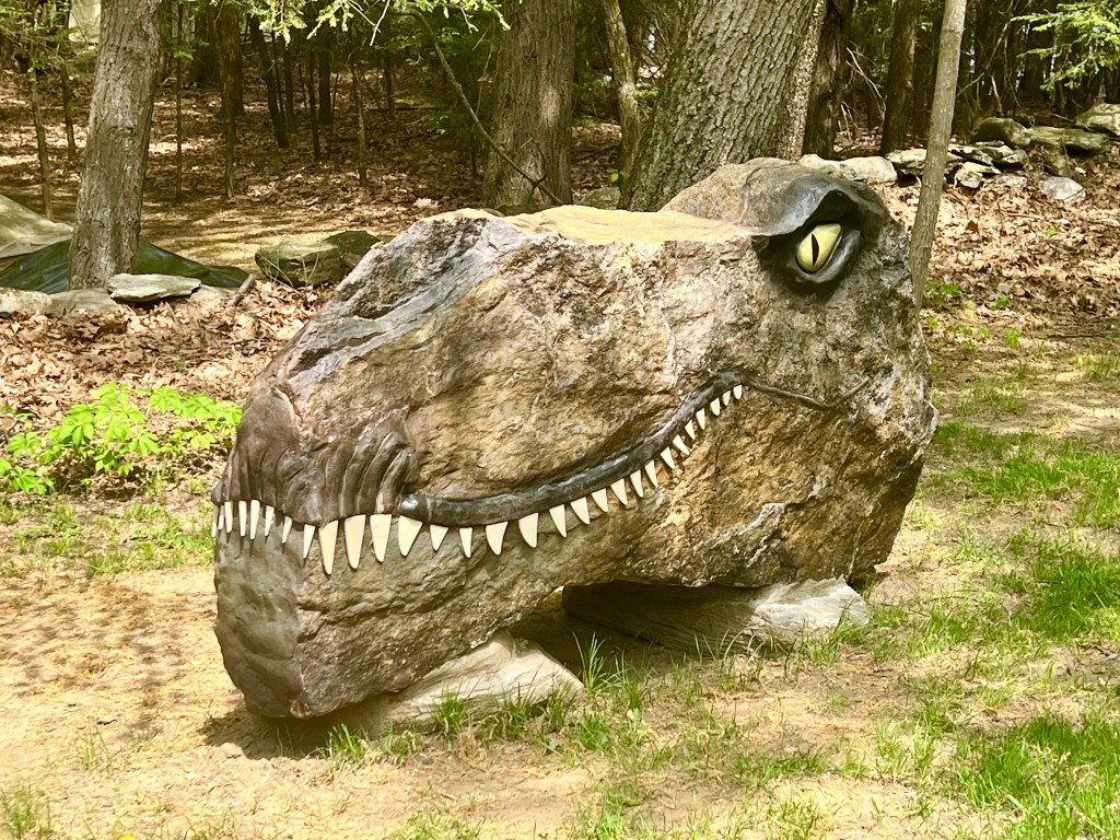
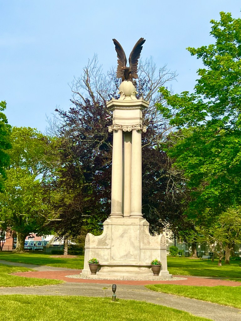
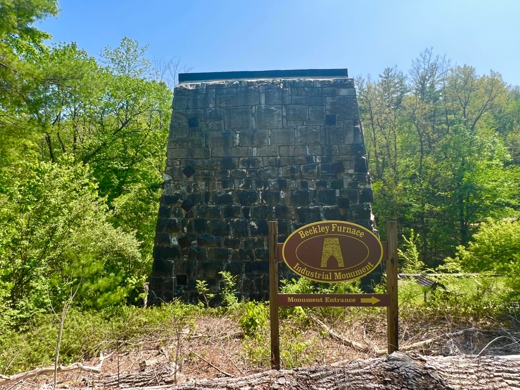
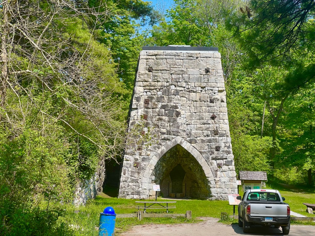
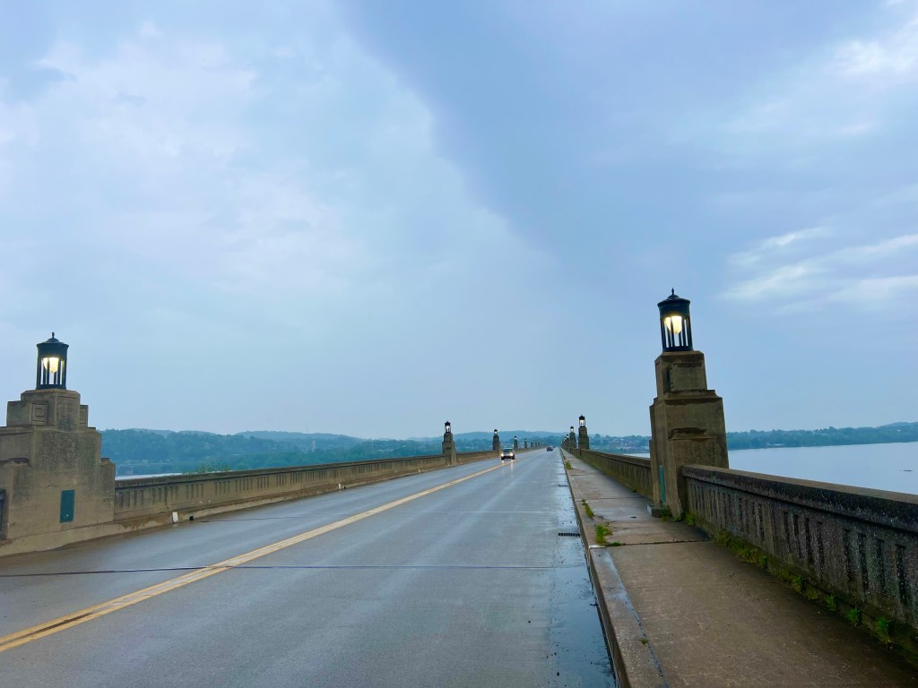
As I headed for the Roosevelt Memorial Bridge, I ran into this Lost Fisherman‘s Memorial, before moving down the road.

After a very thorough screening by he Canadian Border Entry personnel, I was allowed to enter New Brunswick, Canada. I made it!!!!!

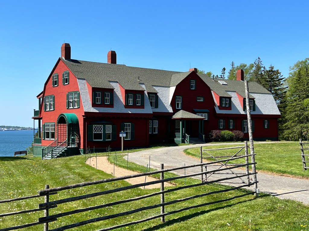
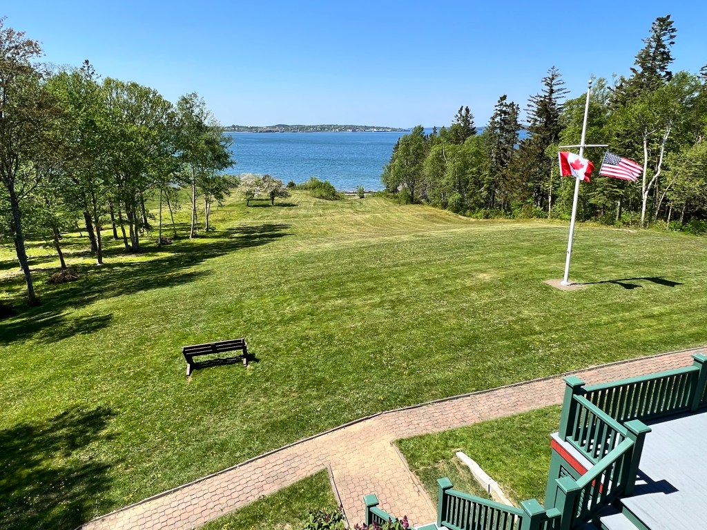
A few photos and steep hills later, I was at the Visitor’s Center of the Roosevelt Compound, watching a film, checking out the exhibits in the visitors center, then taking a guided tour of the grounds and 36 room home the Roosevelts lived in with their 5 kids during the summers. Roosevelt really had a bad hand dealt to him when he caught polio, back before they had a vaccine. But he rose above his paralysis and probably other impacts on his life, to become the longest serving US President through some pretty tough times for our country. Pretty amazing.

My linner was yummy, and it felt so good to take my sweet old time enjoying being on vacation, with nothing hanging over me. No long distance to ride. No clouds threatening a downpour. No other place I had to be or thing I had to be doing.

The Mulholland Point Lighthouse on Campobello Island
The view of Lubek from Campobello

After riding back to and over the bridge, I passed a little ice cream shop I’d been fantasizing about all day long. Sadly, they closed early, but the busy little restaurant connected to my hotel saved the day with their amazing fresh blueberry pie a la mode. I was so busy enjoying it that I again forgot to snap a photo, but let me just say that it would have been VERY photogenic.

I watched the sun set from my balcony, while eating my blueberry pie. More nirvana!

Tomorrow, I ride 11 miles to Whiting, where I’ll be changing into street clothing and catching the West Bus shuttle to Bangor. When I arrive Bangor, I’ll have to ride my bike 6-7 miles from the bus station near the airport to my hotel. 

There are 2 bike shops, a Home Depot and a Walmart nearby, so I should be able to walk over and get the boxes I need for my panniers and bike. Well, the pannier box is a sure thing, but the bike box is iffy. Both of the shops that might have a box will be closed for Memorial Day and claim to not have any boxes, but if there happens to be a good sized bike box in one of their dumpsters, I will do an epic dumpster dive and pull it outlf. The problem is that their trash gets picked up on Mondays by a private company, that most likely will be working on the holiday, and if they have picked up before I arrive, I’ll be out of luck on the box your own bike option and will have to pay one of the bike shops $200 to $250 to pack and ship my bike. Geez! Why is this all so complicated? 

Oh, but that’s just the beginning of what needs to be done. I’ll also need to walk to Home Depot to get a heavy duty box for my panniers and Walmart to get a pedal wrench, bubble wrap, packing tape, something that cuts things and snacks for the plane. And after that, there will be disassembling and packing my bike, sorting out my heaviest gear that can go into a carry on bag into a large pannier, and packing the rest into that box. Super exiting stuff, right?

If you want to hear about my dumpster diving adventures, you’ll have to talk to me in person. No, no. Maybe I’ll summarise how it all turned out in a final post, because I have no idea what to expect, and I surely don’t want to leave any loose ends out there.  

5/27/23 – Bar Harbor to East Machias

Miles: 77.83 Today / 2892.10 Total 

Elevation Gain:  3606 ft. Today / 90,682 ft. Total

Slept in today, but was still on the road by 8:45 AM. `

I carried my panniers downstairs then went to say goodbye to Ed and Joe. Being the gentleman that he is, Ed offered to carry my bike downstairs for me, and knowing how heavy it is, I let him.

Turning my devices on and getting my map loaded up.

After loading my bike up with panniers, I said goodbye to Ed and the rest of the team who were awake, then hit the road alone. My bike suddenly felt so heavy, BECAUSE IT WAS! It was a long hard day, chugging along with all that weight again. Whose idea was it to continue on to Canada anyhow?

I don’t usually ride on the wrong side of the road. Was just waiting for a break in traffic to cross the road.

The weather was great from the get go, but as the day wore on, it warmed up to 78 degrees, which somehow felt hot. Can you believe it? After a few weeks of riding all day long in temperatures ranging from 50-58 degrees, 78 really did feel hot, which begs the question: What am I going to do when I get back to Arizona, where the temps are in the high 90s?

Did I ever mention the quest for a lobster roll as we cycled along the coast of Maine? Eating a lobster roll is a mandatory part of the experience, so the first time I saw a place that advertised them, I stopped to get my first of many, only to be disappointed by the ‘market price’ tag of $24.95 for a 4 oz lobster roll. What the heck? That’s insane! Sadly, the prices kept climbing higher as we moved through the state, peaking at $34.95, which is beyond INSANE!

A week or so before I departed on this adventure, I ate a delicious lobster roll with fries and a drink at Angie’s Lobster in Tempe, Arizona for around $11, and the lobster was from Maine. So now I’m in Maine, and I’m supposed to pay 2-3 times that for just the sandwich? My Mom would have called this highway robbery.

So today, I was a little surprised to start seeing signs like this one.

They also had lobster rolls prices reasonably.

I was finally going to score my lobster roll, but when I stopped, I learned this shop wasn’t going to be open for a while. As I moved down the road, the same deal kept coming up, and I finally got my lobster roll. And you know what? It wasn’t any tastier than the roll I got from Angie’s Lobster, back in Arizona.

I had planned to follow the Google Maps bike route to East Machias, but at some point, it started telling me to take Old Highway 1, which I think I am allergic to. New Highway 1 was pretty busy, but for the most part, it did have a nice wide shoulder, that was rideable about 90% of the time. The less rideable part had potholes and evenly spaced, brain jarring expansion cracks, but for the most part, it was great. So I spoke with a local about how Google kept trying to send me to the old road, and she told me to ignore Google, because the old road is very poorly maintained and is much more hilly. For this girl, poor maintenance and hilly are code words for stay the heck away. So I did.

The view of Acadia across Taunton Bay
The Narraguagas River
The Harrington River

As the day wore on, I was starting to get worn out—REALLY worn out. Face it (I did), this has been a long trek, with some really long and steep days, and I’m tired. Worn out. Ready to be done, as in stick a fork in me. I was just barely able to drag myself up some end-of-the-day hills, including a super steep driveway, to get to the house of my Warm Showers Hostess, Regina.

You never know what to expect when you are meeting someone you found online, but she did not disappoint. She is 4-5 years younger than me; almost single, with 2 grown kids; fiercely independent; and adventurous. She’s a runner, who has done some long bike tours and hikes, including a solo hike of the Arizona Trail in 2022, which is an impressive feat. We have a lot in common and had a lot to talk about, so I’m hopeful I’ll meet up with her again to hike or bike somewhere together in the future. I took her to dinner at one of the 2 non chain restaurants back in Machias, and the food was delicious. It’s a small town, and Regina seemed to know about half of the people who came by our table.

When we got back to her house, I was ready for bed, and that’s when she brought me a vase of fresh lilacs to put by my bedside so I could enjoy the aroma while I slept. Oh my goodness! They were deep purple and pink, and I’m not sure why I didn’t snap a photo of them, but I didn’t. She says she sleeps with a couple of vases nearby when they are in bloom. Note: This is nothing like my sterile life back in AZ, with artificial turf and drought resistant plants I constantly have to coddle to keep from dying. Are we even living on the same planet?

I tried to work on my blog, but again, there was no staying awake. Maybe I’ll get to it tomorrow. And now I have to throw in my shameless request for support of the cause I am cycling for. If you can donate even just a few dollars, it will help.

5/26/23 – Bucksport to Bar Harbor

Miles: 46.53 Today / 2814.27 Total 

Elevation Gain:  2697 ft. Today / 87,076 ft. Total

Today started off with a delectable breakfast prepared by 3 of the congregants of the church who knew this was our last day riding as a team. Arriving a couple of hours early, they made coffee and juice, sliced fruit, prepared breakfast sandwiches and pancakes, and laid out a spread fit for a king. Thank you Bucksport United Methodist Church for being such great hosts!

This last day riding together was a short day to allow time for celebrating, taking bikes to the bike shop to be packed and shipped, mailing boxes from the Post Office, etc. After packing our gear away one last time, we rode out, passing through Ellsworth, Trenton and Mount Desert.

Ellsworth’s Civil War Memorial to the Union Troops.

We met up at a pre planned rally point, then cycled that last mile into town together, and it felt like we were in a parade. Actually, we WERE the parade. The sidewalks were lined with tourists standing or sitting on benches, as if there was nothing else to do but watch us go by as our group rolled into town and down the main drag. At the waterfront park, Duncan had ordered up food, a cake and beverages and set them up in a gazebo for our celebration. Thank you Duncan for making sure everything you do is first class.

As we celebrated, the best friend of one of the riders who left the ride last week to help his wife with her father, on hospice and deteriorating more quickly than expected, sent word that his father-in-law had just passed. Very sad, but the timing was confirmation that the tough decision he made to return home when he did was the right one. 

It was chilly and windy, so when the celebrating was over, I headed to the post office to grab a box, then to the hotel to stuff it with the heavier items I wouldn’t be using in the next 2 days of riding. After dropping my box at the post office, I checked out the gift shops long enough to get T-shirts and post cards for my grandkids, then bought myself a pint of Ben & Jerry’s New York Super Fudge Chunk for my own private celebration.

There was still work to be done—installing my other front rack, putting the proper bolts and washers at all the rack attachment points, organizing my gear into and balancing the weight of the panniers and culling out the food and gear I could leave behind. Once everything was squared away, I passed out and got myself a solid night of heavenly sleep in a real bed with a real pillow. Nirvana.

I’m not going to stop asking for donations. Here’s the link again. Two more days of this, and you won’t have to hear my begging any more.

5/25/23 – Thomaston to Bucksport, ME

Miles: 57.4 Today / 2767.74 Total 

Elevation Gain:  3196 ft. Today / 84,379 ft. Total

When we left Thomaston Baptist Church the chance of rain was 1-2% for the entire day, so all but one of us left our rain gear behind. 

Riding with Butch through our lunch stop, we both had different plans for the day.  We had, independent of each other, decided to take a couple of shortcuts to shave about 20 miles and over 1000 feet of climbing off our day. Sounds like we’re getting lazy, but it’s really just exhaustion.

The roads were hilly and smooth, as they wound through more New England countryside, passing farmland, lots of forested areas and the quaint historic towns of Rockland, Rockport, Camden, Lincolnville, Bellfast, Searsport and Stockton Springs. Each one of these towns consisted of lovely Colonial era homes and historic downtowns. We came upon some vistas that we had to stop for.

Crossing the Penobscot Narrows Bridge was another big deja by moment. Such a a amazing structure!

Once off the bridge, we passed through a corner of Verona Island before crossing yet another bridge to Bucksport. After finding our way to the local United Methodist Church, we settled into our accommodations, which were private rooms (classrooms, halls, offices, etc.).

I’d better they busy. I haven’t been to almost half of the places on this sign.

Tomorrow, the Bike the US for MS team reaches their destination in Bar Harbor. As you know, I will continue on for a couple of days to Canada. I have contemplated ending my ride with the team and just heading home, but this is a goal. I have to accomplish it.

P.S. Remember that weather report? Those predictions ended up being wrong, and at our lunch stop, it started raining. I ducked into a restaurant and ordered a drink, so I could stay warm and dry. Checking the weather radar, we could see that the rain wasn’t going to let up for 2 hours. It was around 54 degrees out, so getting wet could turn into hypothermia, but waiting for the clouds to pass, based on the weather radar forecast, didn’t make much sense. So the 4 of us who were contemplating this together jumped on our bikes and started riding, and as we rode, its started sprinkling. When the full on rain started coming down, I pulled off the road and ducked under the overhang of a vacant building till it stopped. The clouds looked threatening for the rest of the day, but thankfully, the rain was over.


5/24/23 – Yarmouth to Thomaston, ME

Miles: 77.2 Today / 2710.34 Total

Elevation Gain: 4711 ft. Today / 81,183 Total

A few days ago, I met up with 3 American Legion members outside a grocery store and made a donation to their fundraiser. They dug into their pockets and, between the 3 of them, donated $12 to mine. Big and small, donations all help find a cure and treatments for Multiple Sclerosis. Please donate if you can.

Today was one of those days where you know up front that it’s going to rain. The forecast was for 4:30 or 5:00 PM, so we knew we needed to hustle and knock out the 77 miles on our schedule. 

After passing through Freeport, we hit Brunswick, and that’s when things started looking familiar, like this bridge, which was at the beginning of a really nice 3 mile long bike path along the Androscoggin River.

From Brunswick to Bar Harbor, the route is the same as what I rode on the Northern Tier in 2021. There were a lot of deja vu moments and cool things I didn’t take a photo of, because I already caught them back then, as we again rode through quaint little towns of Bath, Woolwich, Wiscasset, Damariscotts, Newcastle and Waldoboro on our way to the Thomaston Baptist Church, our digs for the night.

I sure as heck don’t remember all the hills I climbed today. And maybe that’s because we didn’t ride 77 miles a day on that tour. Shorter distances mean less hills climbed in a day.

5/23/23 – Olgunquit to Yarmouth, ME

Miles: 73.1 Today / 2633.14 Total

Elevation Gain:  2375 ft. Today / 76,472 ft. Total

Well that hotel night was a mixed bag. I loved the view of the inlet and ocean, and my room was excellente, but it as cold, last night, and neither of the heaters in my room worked. I still slept like a baby, but it was an annoyance. I was able to wash my kit (cycling clothes), which was a plus.

One other problem arose when I went to add some air to my tires. When I went to unscrew the plastic cap you screw on the valve, the valve core of the rear tire unscrewed with it, letting all the air out of the tire in about 5 seconds. This has never happened to me before in my entire life!  Why now?  

I panicked. What if that blasted tire loses its seal again? What if I can’t re inflate it with my itty bitty bike pump? Well I lucked out, and it didn’t lose it’s seal. I probably had to give the tire 1000 pumps of air, with my tiny little Topeak Road Morph Mini pump to air the tire up, but thankfully, I did get it aired back up. And I was happy that athis happened last night, instead of in the morning, so I had time to deal with it.

Starting 6.5 miles up the route from the rest of the team, I got out the door early, so when I ran into a hardware store at about mile 2, I stopped to solve my rack hardware problem. I rolled my bike into that section of the store where they have trays of all types and sizes of nuts, bolts, washers, etc. and asked James, the guy working that area, if he would help me solve the problems with bolting my racks on. He gave that a yes, but I’m not sure he understood how much help he was going to have to give me.  

We removed the rear wheel, so he could see where it looked like I was missing a nut to screw the bolt that holds the rack into, and he was mechanical enough to see that the bike part that my rear brakes are attached to has a hole I should have been bolting into, but it was pivoted a bit and out of alignment. We broke out my Allen wrenches and busted a gut trying to free up that part to move it back in place. After a lot of grunting and groaning, we were able to loosen loosen the bolt and get it into proper alignment, then with Jame’s help, I was able to get the bolt to screw in and hold the rack in place. This might not sound like a big deal to you, but I was looking at having to ship my rack and rear panniers home if I couldn’t solve this problem, and finding and transporting a big box to pack a bunch of stuff in is easier when you are driving a car than it is when you’re riding a bike. This was a major problem averted, trust me. 

I forgot to mention that when we rotated the part that the brake mechanism is mounted to, it tightened up the brake cable, so now we couldn’t get the wheel back on, due to the brake pads being adjusted inward where the brake rotor needed to be. James was clueless on disc brakes, so this was my problem to solve. I’ve watched mechanics adjust my brakes, but they are complicated creatures, so I try not to deal with them, but today I had to give them my best shot. After a little fiddling with the two adjusters on the inside and outside of the disc and the barrel adjuster, I somehow lucked out and backed off the brake pads enough to get the tire on and then into position to allow it to spin freely, while also stopping the bike. Trust me, succeeding at that was a complete miracle.

An hour had passed, dealing with the bolt and brake problem, so now I was behind the team and had to pedal like a son of a gun to catch up, which I did by the first rest stop. 

Within a mile of the hardware store, the route took a turn and had me riding along the ocean again, with very few cars and people and spectacular views. And that continued for most of the day. If the view wasn’t the ocean, beach or tide pools, it was picturesque farms, homes and forests.

Back on the route, I passed miles of farms and historic Colonial homes, rode through several small towns, including Kennebunkport, before jumping on a gravel rail trail for a few easy miles of scenic farmland and forests.

This was a 70+ mile day, but when I saw signs for lighthouses, which Maine is known for, I decided to go the extra miles to see them, and it was worth the effort! From Port Williams Park, I could see 2 lighthouses.

The Portland Head Light.
The Ram Island Ledge Light.

Portland was one of my favorite cities thus far. My sister and I had a stop there, a few years ago, when we took a Fall colors cruise of New England, but it seemed a lot different on this visit. I loved the vibe of the downtown area, the public art, and how active people are there. In the downtown area, I rode on the paved Eastern Promenade Trail for a couple of miles and passed people of all ages and backgrounds out walking, running, cycling, and just hanging out with their dogs, family and coworkers. I love that kind of culture.

I think these used to support buildings or docks. Tried to ask several people, but they all had headphones on and didn’t hear me or krespond.

In Yarmouth, we were hosted by the local Universal Church, where a couple, Marge and Pete, who are a little older than me, served up a delicious meal and desserts that were mostly catered. What a feast that was!

This is a typical room where we carve out places to bed down on the floor. Tonight, I had a private room to myself!

Before they left, he helped me find a private room to sleep in, and I was hopeful the privacy would give me some space to work on my blog, but I couldn’t keep my eyes open long enough to accomplish anything. It’s a daily problem, at this point!

5/22/23 – We’re in Maine! Derry, NH to Olgunquit, ME

Miles: 65.5 Today / 2560.04 Total

Elevation Gain: 2192 ft. Today / 74,097 ft. Total

Today was an excellent day of riding. The weather was cool and breezy—between 50 and 59 degrees, and the scenery of the day was countryside with rolling hills, vibrant forests, tranquil lakes, rivers and ponds, and centuries old colonial settlements and historic landmarks.

As we left Derry, we passed some of the things I enjoy on the road—a magnificent Civil War Memorial and some cute funk. Derry is the only working class town we’ve been to—a place where at least part of the town is populated by normal people living in normal houses, versus rich people living in restored Colonial houses and mansions.

Throughout the day, we passed through several typical New England towns, but 3 of them stood out as places I would love to live, if I didn’t have family keeping me in Arizona. All of them had amazing colonial homes of all shapes and sizes, beautifully landscaped homes and parks, a quaint downtown area with unique local shops and restaurants, and people out enjoying the weather—walking, with or without dogs, and riding bikes.

In Exeter, a park with the bronze statue below caught my eye. It was sculpted by Daniel Chester French, who hailed from Exeter and is famous for sculpting the statue of President Lincoln at the Lincoln Memorial.

As we pulled out of Exeter, I spotted a bike shop that was a lucky find. It had a sign on the front door telling people who needed repairs to go to the side door, where 2 mechanics were working on bikes of people who walked in off the street, like me. The problems causing my squeaky brakes and derailleurs were diagnosed and corrected, so my bike now rides and sounds as it should. Hallelujah!

About 9 miles past Exeter, we rode up on the shore of the Atlantic Ocean for the first time since the Outer Banks. Is this not what we did this ride for? Seeing white sandy beaches, tide pools and simpler homes along the waterfront was so nice. For a good part of the rest of the day, our route meandered along the waterfront as we passed through Rye, Portsmouth, Kittery, York Harbor and York Beach.

Being on the coast, we were now ready for that lobster roll we’ve been craving. We stopped at this seafood restaurant, and the market price for a 4 oz lobster roll was $25. That’s not going to happen!

In Portsmouth, I spent some time at the African Burying Ground Memorial, which you can read about it Here. When contractors on a city improvement project found 13 wooden coffins during an infrastructure upgrade, a large area and major street were blocked off, while archaeologists, geneticists and forensic scientists studied the site. They found over 200 people of African s descent buried there.

A few miles past Portsmouth, we crossed the Piscataqua River, which is the border between New Hampshire and Maine, where the states meet the Atlantic Ocean. There was I no official welcome sign, but I did find this.

Had to stop and check out Fort McNary, built to protect approaches to the Piscataqua River, south of Kittery, from 1715 to 1918 when it was deactivated.

You could see the Portsmouth Harbor Lighthouse from Fort McClary.

The church that was hosting us for the evening had something going on that was going to keep us from using the church building until 9 PM, so I had lined up a hotel 6.5 miles up the road. When I arrived the church, my plan was to put my rear rack on my bike, load what I needed for the night into a pannier, then ride up the route to the hotel. There was just this minor problem. I couldn’t figure out how to get the bolts in my toolkit to work with the racks I’ve been using since 2017. I felt like I was losing my mind. The rear bolt on one side would not screw into anything that held the bolt, as if a nut was missing on the inside of the frame. So I mounted one of the front racks, but even mounting that was very difficult. I couldn’t believe how this task I’ve done numerous times was now so difficult. Has my exhaustion affected my mental state?

Fiddling around with the racks delayed me for over an hour, so I didn’t get to my hotel till almost 7 PM. I brought a dehydrated camping meal with me, so didn’t have to take time out to get a restaurant meal, which give me time to hand wash my cycling clothes to wear again tomorrow.

After taking a walk down to the beach to see low tide at the inlet behind the hotel, I worked on my blog till I couldn’t keep my eyes open any longer—about 10 minutes. Sleeping in a real bed was a treat I will really appreciate when I get home.

5/21/23 – Westborough, Massachusetts to Derry, New Hampshire!!!

Miles: 59.8 Today / 2494.54 Total

Elevation Gain: 2759 ft. Today / 71,905 ft. Total

First things first. Today is my granddaughter’s 10th birthday. Happy Birthday, Ella! Remember that we will be having our own private birthday party together when I get home! Grandma Loves You!

Another day, another state! Today, we entered New Hampshire—the most welcoming state yet, with 3 different signs at the border.

Confession: All of this riding is wearing me down. Have you noticed the pace of my blog posts? Todays hills were a little more tame than those of the last few days (huge relief), but interns of scenery, it felt like an extension of the last few days of riding—more of the same things I’ve been seeing for days. More rail trails, more charming small towns, more towering forests, more historic homes, more hills and winding roads, more river crossings, and more historic landmarks. I could never tire of seeing all these things, but I’m having a hard time coming up with new material to write about.

How about this? My bike has been acting up since the rain day and heavy duty hill climbing we had last week. Every time I shift the gears on my rear wheel cassette, the rear derailleur makes a loud screeching sound. Then there are my rear brakes. One of our “mechanics” adjusted my rear brake, and he says the rotor is warped, so the brake will just have to drag till the pad wears down. Well that dragging is very annoying. Then there is this other non bike problem, where my cycling shoes make their own creaking sound when they are not tightened up just right. All these squeaks and sounds are driving me nuts!

So today, while I was cycling down the Nassau River Rail Trail, I met a talkative gal named Amy Seligman, who not only is a turtle whisperer, but she is also the friend of a former Coast Guard Engineer who claims to have bicycle repair skills. She offered up his services to diagnose what is causing all the annoying noises, and he had some ideas. When I got to the next rest stop, I had our “mechanic” check my chain to make sure it doesn’t need to be replaced. Good news—it doesn’t. The annoying sounds continued, like a Chinese torture chamber. Still no relief!

We were surprised by a short rail trail that brought us into Derry, then we ended up at another Methodist Church for the night. This one had no shower or private rooms for sleeping, but instead had a very nice young pastor with a gigantic, docile, black and white spotted Great Dane who is a people lover. I think everyone on the team, but me, has a dog waiting for them at home. I feel the pressure, but not right now, thank you. Maybe l’ll cave in and get one later in life, when I travel less.

The mural on the side of Hare of the Dawg.

Most of us walked down to Hare of the Dawg for dinner and bellied up to the bar to order some food. I treated myself a delicious Cobb Salad, which reminded me of how I eat when I’m not riding a bike like this. When we returned to the church, the lights were pretty quickly turned off for bedtime, so I followed suit and went to bed early.

5/19/23 – Windsor Locks, CT through Rhode Island to Westborough, Massachusetts

Miles: 84.7 Today / 2434.74 Total

Elevation Gain: 5994 ft. Today / 69,146 ft. Total

Question: When are these long days going to stop?

Answer: Today. According to our itinerary, this is the last long ride of the trip. Kind of.

Tomorrow we have our last rest day, then there will be just 8 more days of cyclingto get to Canada, 6 of those to Bar Harbor with the BTUSFMS team. One of the 2 days on my own will be a long day, just because there are no lodging options for 86 miles. I look forward to being on my own, the last 2 days and managing my time and rest stops the way I usually do when I am bicycle touring. It’s been fun riding with a group of people and bumping into team members here and there throughout the day, but I’m ready for some alone time. Really ready. In fact, when I get home, I may need a week as a complete hermit to recover. No, make that a month.

In Westborough, we are being joined by the guy from BTUSFMS who runs the US rides and trains the route leaders as well as 2 new route leaders who will be in training for the rest of our tour. They will take over as route leaders on the Northern Tier ride that leaves out of Bar Harbor 2 days after we arrive there. 

But let’s get back to my day. On a bike, 86 hilly miles is really far, and climbing almost 6000 vertical feet is SUPER challenging. Together, the distance and non stop hill climbing made for a long day in the saddle.

The route wound through more of rural Connecticut, then the northwest corner of Rhode Island, then into Massachusetts—all in one day. The only way I knew I was in another state was looking at my map, because “Welcome” signs were non existent, due to being on rural roads. At one point, I stopped to ask a woman who was walking her dog if I was in Massachusetts yet. She set me straight—I wasn’t.

Throughout the day, we rode up and down hills and through quaint little towns, scenic state forests, large family farms, and private homes, many of them historic, on large forested parcels. I wondered where middle class people live in these states, because there wasn’t a single home for the average Joe to be seen, at least from the roads we were on.

The First United Methodist Church in Westborough had enough rooms for each of us to have a private room, which was a huge plus. What they didn’t have was a shower, so we had to take a tent shower on the side of the building next to the parking lot, which was a little awkward.

While I showered, about 65 people were arriving for a concert that was being held in a really cool central hall of the church. The female vocalist had amazing pipes, and there was a bit of a sing-along component to the show, so once I was dry and dressed, I found my own seat to watch and participate.

5/18/23 – BAM! Connecticut! – Clinton Corners, NY to Windsor Locks, CT

Miles: 93.7 Today / Total 2350.04

Elevation Gain: 5518 ft. Today / 63,152 ft. Total

On days when we are riding over 90 miles, we awaken and leave an hour early to give us more daylight to ride. That was the case today. We had a 94+ mile route with over 5500 ft of climbing ahead of us, but when we awoke at 5:30 AM, it was 31 degrees outside. Holy Cow!  No way can I ride in those kinds of temperatures! I’m from Arizona. An hour and a half later, it was 34 degrees, which is warmer, but still FREEZING Cold!  The problem was that we didn’t have time to wait out the temperature, due to the distance ahead. I put on about 4 layers of clothes and hit the road.

I ran into Jade and John pretty early on and kept leap frogging them throughout the day. A mile before our first rest stop, John, Ed and I met up at a Mobile gas station for a breakfast sandwich and some hot cocoa for me—coffee for them.

Breakfast stop in Wassaic.
The REAL rest stop.

Just after the real rest stop, the route turned onto the Harlem Valley rail trail. Then after 8 spectacularly smooth and level rail trail miles, it started looping around insane hilly, winding roads. 

The trail ran through miles of farmland.

At the border of Connecticut, Ed, Jade and John all showed up within a minute or two of each other for photos.

Our lunch stop was by a pizza joint and an accordion shop. I wasn’t in the mood for pizza again and don’t have room to carry an accordion around, so I had to pass on those options and move down the road 0.3 miles to get a McDonalds fix and make some phone calls. A few minutes later, Jade and John showed up for burgers too. After lunch, we leapfrogged each other for a while, then met up at the last rest stop of the day. 

This furnace was operated from 1847 to 1919, making pig iron for railroad car wheels.

After downing a scrumptious brownie from the bakery across the street, from the rest stop, it was time to make the final 28-mile push of the day. At the rate we had gone to this point, it was likely all of us would be pulled off the route before making it to our final destination, due to darkness rules, but I wasn’t going down without a fight. It was a race against time to get to the finish line before the van picked me up, so I rode like a banshee up about 6 miles of long steep hills, raced as hard as I could down the downhills and stopped for a few photos. The steep hills didn’t let up till the 20 mile point, when they turned to predominantly steep downhills, and I excel at going downhill. I easily made it to the church with enough time to stop at Popeyes for some chicken tenders, blackened ranch dressing and side dishes. After dogging myself out today, with both the miles and the climbing, I deserved them, right?

Had to message some town names to my brother Sterling and his family who moved back to Arizona from Connecticut a few years ago.

When I arrived the church, everyone else was already eating dinner. A couple of the parishioners, Jim and Vicki, had prepared a pasta dinner and salad, with beverages and cookies for dessert. I ate a little of each dish they brought, then pulled out the chicken tenders. After downing 4 of them, I had to tap out and save the side dishes for breakfast. Once again, it was too cold for a shower, so it was a second night of a sponge and baby wipe bath, then chores and bedtime. The End.

5/17/23 – Port Jervis, NY to Clinton Corners, NY

Miles: 79.8 Today /  Total 2256.34

Elevation Gain: 3406 ft. Today / 57,634 ft. Total

When we rode out, this morning, it was chilly, with temps around 48 that never got higher than 58 as the day wore on. The entire day, the winds blew 13-15 mph, which meant that this Arizona girl never got warm enough to take off her light jacket. Didn’t even consider it.

If, like me, you think New York State is all like New York City, you need to spend some time in the countryside, like I did today. Everything is green, lush and beautiful, with lots of quaint little towns, miles and miles of farmland, and friendly people. We rode along the Neversink River till we got to Otisville, then along the Shawankunk Kill, a tributary of the Wall Kill River we crossed later in the day. Who dreams up the names of the rivers and streams up here? They’re so dark.

Neversink River.

As I pulled into Bloomingburg for first rest stop, I passed a man walking down the road who looked like he was a Hasidic Jew, then women dressed very traditionally with their hair covered, also looking like Hasidic Jews. Was I in some kind of time warp? The van was set up across from a bakery (score!), and inside the bakery, the owner and his wife and daughters were all dressed like Hasidic Jews. They were super friendly, so I struck up a conversation with the wife. We talked about Israel and Arizona—how I went to Israel in January, and how her mother spends her winters in Tucson. We also talked about MS and how her 16 year old daughter has a school friend who has ALS, which is very sad. The bakery and the town made a huge impression on me, so I went back to see if the wife would let me take a photo of the two of us, but she wasn’t dressed up enough for a photo and said no, but she did let me photograph some of her goodies.

The story behind how all those Hasidic Jews ended up in that town is REALLY interesting. Basically, there were and are hundreds of Orthodox Jewish families living in New York City and its suburbs, who will never be able to afford a home. So the son of a Rabbi found a failing community of 400 people, in a town of abandoned homes, buildings and businesses, and bought them up, along with a bunch of farmland, with the intent of building a community where Orthodox Jewish families could live affordably and have the wholesome things they want in their lives. Well the 400 townsfolk didn’t like the invasion, similar to how communities didn’t want a bunch of Branch Divisions or Warren Jeff followers taking over the townS. It’s a great story where the good guys win, and you can read it Here.

After that rest stop, we jammed for 17+ windy, hilly miles of country roads, one with a long stretch of road construction.

Blasted Chip sealing!
The Wallkill River.

Then we took a turn onto the Wallkill Valley River Rail Trail. After almost 10 miles of a super flat and smooth path through beautiful countryside, it delivered us up to a lunch stop in Paltzburg with fabulous pizza by the slice.

A few miles later, we were on another Rail Trail Hall of Fame route down the Hudson Valley Rail Trail, taking us over the Hudson River, with spectacular scenery from start to finish.

Hudson River.

After taking a short break, we set out to ride the 15 miles to Clinton Corners, which sounds simple enough, but it was rush hour and the roads were really rough and super hilly, and I’m not talking standard hills. I’m talking steep hills. I had Butch in tow, because the battery on his phone had died, and he had no way to navigate to the church without it.

It took forever (in my head) to arrive at the Clinton Corners Evangelical Free Church, and it was so cold out at that point that I couldn’t even consider a hose shower. I had to give myself a sponge and baby wipe bath and call it a day. With no time or energy for anything but dinner, chores and sleep, I found a corner in a hallway to lay out my bed, and I was out cold in seconds.

5/16/23 – I’m in The Empire State! Phillipsburg, NJ to Port Jervis, NY

Miles: 73.2 Today / Total 2176.54

Elevation Gain: 4324 ft. Today / 54,228 ft. Total

One word for the day: Hilly and Steep. Oh wait, that was two words.  

I was unable to even turn my Garmin off yesterday, when I was working with the technical support guy over the phone. We had been trying to reset it to the factory settings, but were unable to get it to reset. Well last night, when I was going to bed, I noticed that it had completely died, so I plugged it into my charger overnight. Well this morning, I turned it on, and all data fields were working again, just no ability to connect to my phone or the Garmin app, where you download data from the device. The bottom line is that I can navigate again (YAY!!!), but I can’t get any of the data out of the Garmin and into my blog (Boo! Hiss!) So I’m still low tech, with no map and very few metrics that stick around at the end of the day. 

Today’s cycling was pretty challenging. As we continued riding alongside the Delaware River, there was more character building winding, hilly road travel.

In Belvedere, we crossed back over into Pennsylvania.

Had to throw in this mid bridge warning.

And shortly thereafter, we started riding through the Delaware Water Gap, which cuts through a large ridge of the Appalachian Mountains and was formerly one of the Wonders of the World. Well somewhere along the way, it fell from Wonders of the World status to roads are closed status, and they don’t seem to be doing anything about it. Most of the roadway through the section on the Pennsylvania side was closed, due to rock wall barriers failing along the steep drop-off down to the river. We hefted our bikes over the barriers and had the place to ourselves with no cars, people, or road maintenance to bother us for who knows how long. Instead, plant litter and some fallen rocks adorned the road, and we enjoyed amazing views, lush trees and wild flowers, and some really cool faults in the rock faces along the roadway.

At the end of the road, we crossed the Appalachian Trail, and a few complicated turns caused most of us to get off course briefly before we got to the I-80 bridge to the New Jersey side of the Water Gap.

Don’t know what happened to this photo, but you can see where we’re going, right?

Continuing our journey through more lush scenery along more winding, hilly roads, after a few miles of very few people and cars, we again ran into even bigger road closed barriers. More hefting of bikes took place, then just 150 yards later, we hefted over another set of barriers and were back on open roads with, again, very few people and cars as we made our way out of the Gap.

I was all alone, at this point, and it looked like no one had been here in a while.

Now we were on rolling hills through remote countryside with miles and miles of no commerce and very few homes. At Millbrook, we were surprised by the steepest hill of the ride thus far, with insane 14-15% grades.

There were a lot of abandoned homes and buildings on this section of road.

The last section of road for the day was Old Mine Road—a heavily treed, climby gravel road with massive potholes everywhere. We’re pretty sure it got it’s name from the potholes that looked like they were formed by land mines, not because it goes to an old mine somewhere. The lush trees laid down a filter of shadows over the potholes, so you couldn’t tell if you were seeing a shadow or a hole, with the end result being you were usually wrong and smacked your brain and bike with a pothole, of which their were a gazillion. And when I said the road was hilly, that means that after painfully slow climbs up, your downhill reward was not rewarding, because you didn’t want to thrash yourself with added force. Later, when one of the guys took his bent wheel to a bike shop in Port Jervis, they told him that Old Mine Road is for gravel and mountain bikes, not road bikes. Good to know.

We were happy to arrive Port Jervis and stay in a wintertime homeless facility called the Warming House. It had really nice facilities for us currently homeless cyclists, with a really nice kitchen, shower, laundry setup and cots to sleep on.

A sad note: Nick decided to quit the ride by the time we reached today’s first rest stop. His legs were wasted from the morning climbing on top of yesterday’s climbing, and we’re on the first of 4 even longed days in the saddle, with even more climbing. His wife picked him up this evening, which leaves me and Ed as the resident old folks on the ride. We pinky swore an oath to each other that neither of us would quit for any reason.

5/15/23 – New Jersey! Conshohocken, PA to Phillipsburg, NJ

Miles: 73.24 Today / Total 2103.34

Elevation Gain: 1600 ft. Today / 48,304 ft. Total

Today got off to a rough start. After I rode down to the post office to drop off a birthday card for my granddaughter, I fired up my Garmin, and the only numbers coming up on the screen were heart rate, calories and time. Cycling information? Nada. I tried all kinds of things to bring it back to life, but nothing would work, including calling Garmin’s technical support line—later when it was open for business. They’ll send me a new Garmin for $150, but they don’t have the address for the one and only church that would be able to accept it up ahead.

This may not sound like a problem to you, but being able to navigate is way up my list of things that are important on a trip like this. My options were: 

  1. Follow the paper maps I bought from Adventure Cycling, which is how I navigated on the Souther Tier.  Sadly, these maps haven’t been updated since 2017, and road names and routings have changed a lot since then. I would be pulling my hair our all day every day, if I had to rely on them.
  2. Use Google Maps. The problem with that is that I am traveling with a group of people on an established route with set rest stops and destinations that might not be on the Google Maps route.
  3. Follow one of the other riders every where they went, which would mean no stopping to check out sights or take photos, because all the guys are just focused on getting to the destination at hand as quickly as possible. 
  4. Download the Adventure Cycling Bike Route Navigator App and buy the maps for where I will be riding for the rest of the trip.

Option 4 was really the only choice for me, so while the guys were all riding down the route, I was downloading an app I am completely unfamiliar with, buying maps and trying to figure out how to use them. To call this app navigation is a stretch. It puts a pink line that is the route in front of you, and you are a little blue dot that moves along the pink line, if you are on the route.  If you go off route, your little blue dot is no longer on the pink line, and if you don’t keep your eye on the little pink line, you will definitely go off route. There are no prompts for turns, of which there are many, and there are no distances—just a pink line and your personal blue dot.  I was able to muddle my way through the app well enough to the first rest stop, where Jade gave me a few pointer. Now I could at least survive navigation-wise, so I pushed on down the route.  

I caught up with John and Butch and rode with them for a good part of the day, starting with when we crossed the Delaware River on a big long bridge that you have to walk your bike across. The center of the river is the border between Pennsylvania and New Jersey, so we entered New Jersey on the bridge without an official welcome sign. Well the paint on the pedestrian path is official, so I take that back.

Once past the bridge, we found the D&R Canal Path, a rail trail along the canal that connects the Delaware and Raritan Rivers. Cycling that path was pure heaven, with nice gentle grades and beautiful smooth cycling surfaces that lasted about 20 miles.

The Delaware River was to our left and the canal to our right.
Yeti‘s live on! My first Yeti since the Northern Tier.

Sadly, that all ended when we hit Milford, and the rail trail moved to the Pennsylvania side of the river, but our route didn’t. Now I was riding on hilly terrain next to the river, so the roads had to meander up and down and around and over the hills, to make having a road even possible. I was huffing and puffing and wishing I had crossed over to the rail trail on the other side of the river, but I had no idea if it would get me back to New Jersey when my route changed directions.

When we arrived Phillipsburg, I was exhausted, but the climbing wasn’t over. Alliance Church, which hosted us, was at the top of a very steep hill. Grrrr. Way to end the day.

Definitely a working class neighborhood.

Note: Now that I don’t have a working cyclometer, I don’t have a way to track my ride or capture the numbers I love to see as I ride along and at the end of the day. This is what life was like back in the old days, before we had all the data and technology I love. I will not assimilate, trust me.

Here is some technology I do have. Feel free to use it.

Thanks for sticking with me and following my ride.

5/14/23 – Day off in Conshohocken, PA

There were limited places for us to sleep at the fire station, so Connor found a big closet with a couple of big boxes on wheels in it, where rolling just one of them out of the closet cleared enough space for him to bed down and have some privacy. Sunday morning, when there was more light, we could read the words in the side of the big box he’d moved.

It’s a Dominion Voting Machine! Very historic!

We had a day off the bikes again in Sunday, and I was again unable to get a ride to church. This time Uber and Lyft were going to charge me $48-$50 for round trip transportation, so I didn’t go. Instead, I joined the team on a visit to and tour of a Philadelphia long term care center that houses 280 wheel chair bound Medicare patients, some of whom have MS.

One of the recreation therapists spoke to us, about the capabilities and limitations of the patients we would be interacting with, then got us involved in rounding up patients for a stretch class. (We were the lure to get people out of their rooms.) It was really sad to see the physical and mental condition of the residents, in spite of the really great care they get.

Before heading back to the fire station, we stopped for lunch and ice cream in the trendy neighborhood of Manayunk. Very cool place!

Back at the station, the rest of the day was spent blogging, cleaning and maintaining bikes and gear, sending out Mother’s Day messages and talking to my sister Janette on the phone

Happy Mother’s Day to all you Mothers and women who nurture other people’s children!

5/13/23 – Passed 2000 Miles en route to Conshohocken, PA!

Miles: 85.71 Today / Total 2030.21

Elevation Gain: 3970 ft. Today / 42,734 ft. Total

Remember when I mentioned that I have decided to not let rain get to me? It’s a good thing, because it rained most of the day today, but this rain affected us differently than we expected, which I’ll explain later. We were expecting a long 83 mile day of riding, so having a couple of famous places on the schedule gave me something to look forward to.

Passed this mural in Columbia.

As we headed to Lancaster, I dug in and peddled, then when I arrived there, it was such a cool, laid back town that I almost forgot about the rain. Most of the houses and businesses lining the streets are in historic buildings, some just a few feet from the road, and the town has a hip vibe, with a lot of small businesses. Wish I could have spent more time there, but I had to keep moving.

This is the Lancaster County Prison. Looks old world, except for all the concertina wire.

Once out of town, we were in Mennonite country, and everything was different—neat, tidy, ordered and beautiful. There were miles and miles of gently rolling hills covered with farms and farm houses.

Instead of the lineup of large pickup trucks a typical US farm would have, homes and farms had bicycles and horse drawn carts and wagons. Even the farm machinery was horse drawn. The homes and yards were big, tidy and well maintained, with large vegetable gardens and flower gardens. Women wore dresses and bonnets, and men wore pressed pants, long sleeved shirts and hats. It felt like life in the 1800s.

The farmer yelled and yanked the bridle of the horses, when they turned their heads to look at me. He was a gruff old guy.

Horse drawn carts passed us on the road as we peddled along, but prior to us arriving, a lot of other horse drawn carts had already been on the road. And how do I know this? Because there was a lot of horse poop on the road being dissolved by the rain. The resulting foaming puddles of watered down poop mush were splashing and spraying on us as we rode along and as cars and trucks raced through the puddles. We, our bikes and our gear were completely covered in stinky poop water and globs of muck, but it was a small price to pay to see the beautiful setting we were riding through.

We followed PA Bike Route S most of the day.
Our one and only covered bridge, the Weavers Mill covered bridge, dates back to 1878.

Just before leaving Mennonite country, I bumped into Craig and John, and we came across a bakery, stopping for some delicious baked goods. Believe it or not, this was my first bakery stop of the tour, which, as you know, has not been my way in the past. What is happening to me? I normally eat like a 17-year-old by on these rides. Am I broken?

Now we were on busier roads, sometimes with no shoulder, so it was eyes on the mirror and peddle to the metal for 35 miles of rain that acted like it was going to quit, before it started up again. When we arrived Valley Forge, most of the guys pushed on to our destination, but I had to stop and look around. The last time I was there was the summer of 1970, when my family and cousin Rebecca camped our way across the country and into Canada in a tent trailer for 3-4 weeks.

I met the Schneiders, an LDS family from Cedar City, Utah, on my way into the Valley Forge sights. They are on an impressive, epic, 28 day church and US history vacation with their 6 kids. Oh, I forgot to mention—they’re traveling in a Cruise America RV! They reminded me if my parents and some of the epic trips they took our family on when I was growing up. Great memories!

Things turned hilly and trafficy as I left Valley Forge, and I was racing against the clock to get to Chonshohocken Firestation 2 before it got dark. Two of my lights ran out of battery, and it was almost 7:30 PM when I finally arrived.

All the guys had already showered, so I could take all the time I needed to scrub the horse poop off my clothes and gear, before scrubbing it off myself. My bike was a disaster that could wait till tomorrow.

So what do you think? Does this sound like fun to you?