7/28/2021 – Tilleda to De Pere, WI

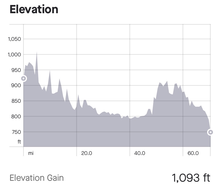
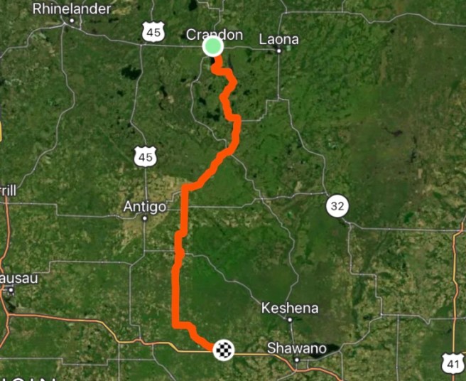
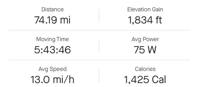
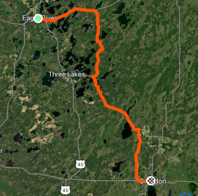
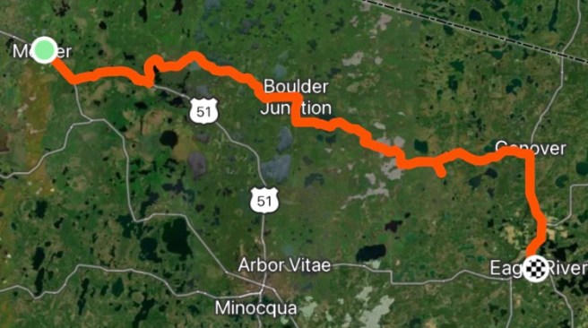
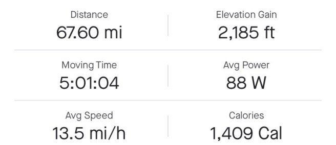
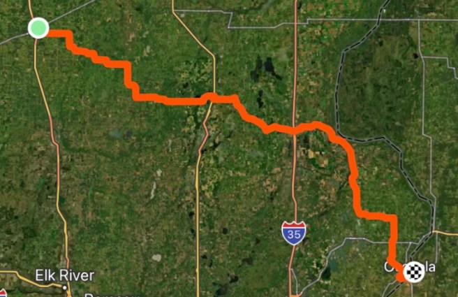
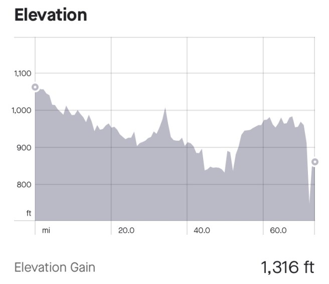
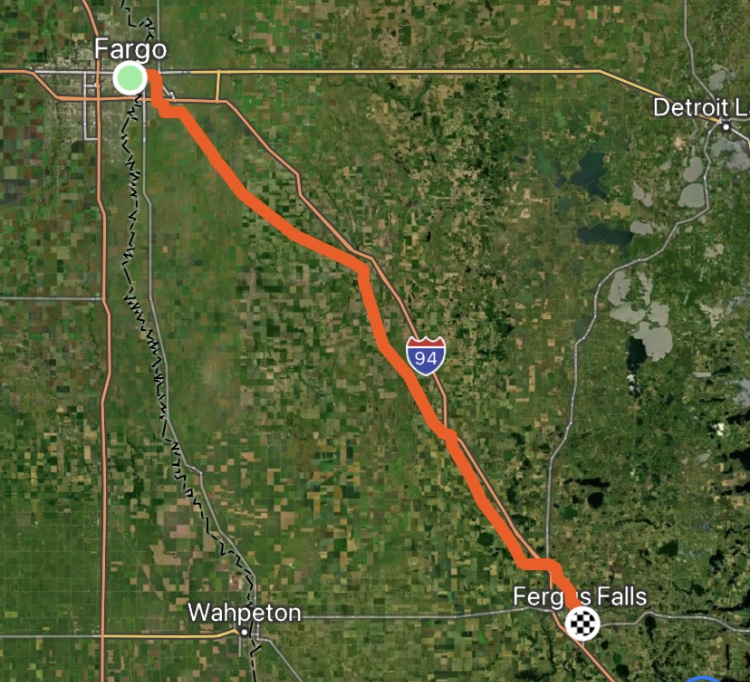
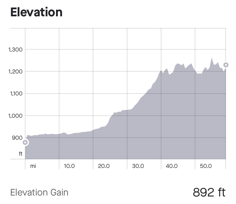
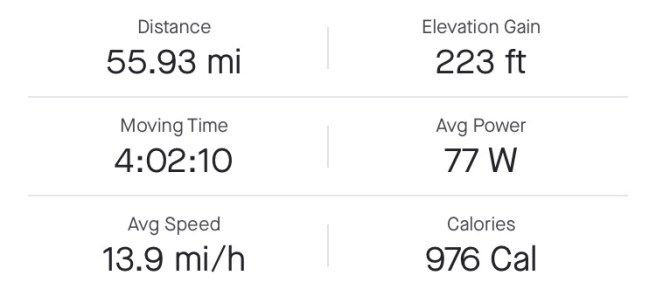
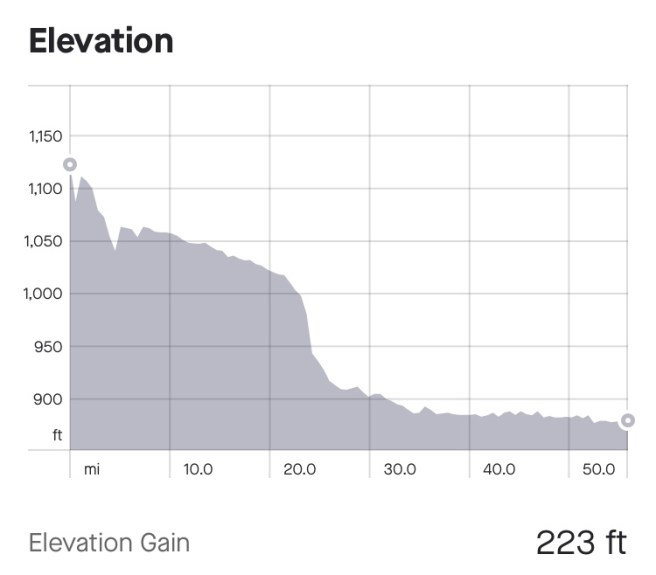
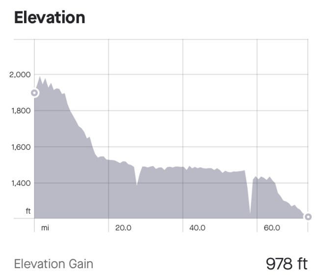
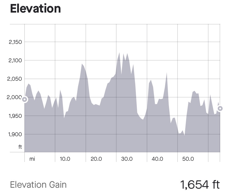
70.49 Miles / 2484.62 Total Miles

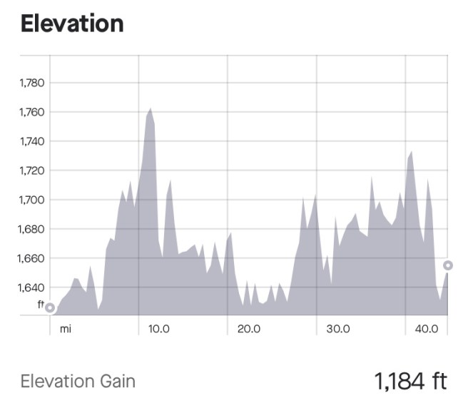
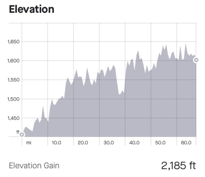
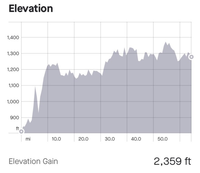
1093 Ft. Elevation Gain / 87,259 Ft. Total Elevation Gain

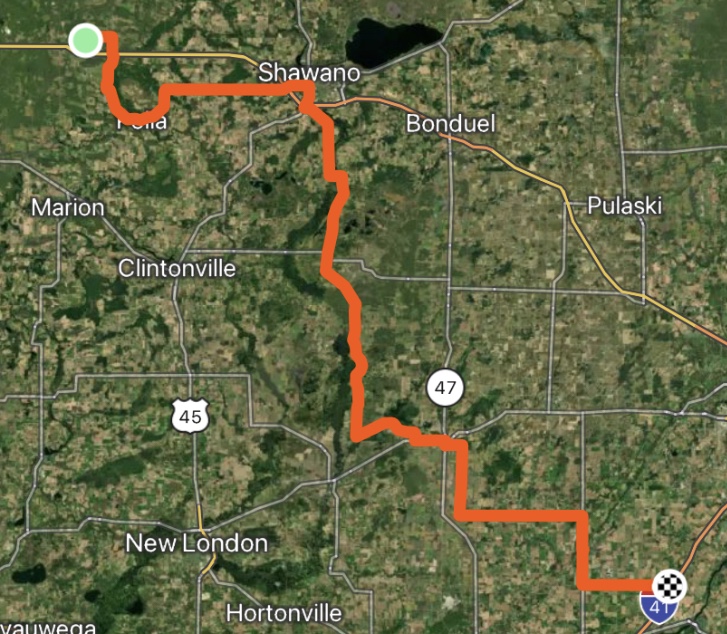
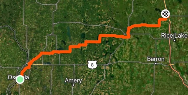
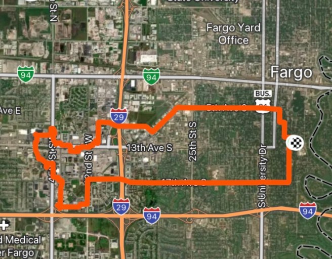
When we pulled out of the campground, there was confusion over which way to go. Our paper maps seemed to be telling us to go right, but our GPSs were telling us to go left. So I consulted my good friend Google Maps, and it too said to go left. For some stupid reason, we ignored the GPS and Google Maps and went right, but within a minute, Google Maps had rerouted us, and the right turn was going to take us to our next town, with just an additional 0.3 miles added on to our day. Good enough for me. No need to turn around, when you are already headed for your destination When we arrived Leopolis, we were one block off route. From there on, it was smooth sailing for rest of the day.

This is NOT the town where Pella windows are made.
Pine Grove Campground is where we stayed last night.
Hey! I thought we had more than a month left to go, before we get to Maine!

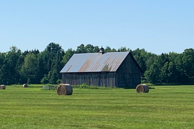
Starting in Washington and continuing probably through the end of our route, we keep passing abandoned farm houses that look like they would be pretty cool, if they could be fixed up. Or is it a matter of they can’t be fixed up, because the owners didn’t maintain the roof, the siding, the paint, etc., until the entire building is ready to fall apart, and then it is so expensive to catch up on all that maintenance, you give up and build a new one? If anyone reading this knows how these houses end up being abandoned, like this, shoot me a message.

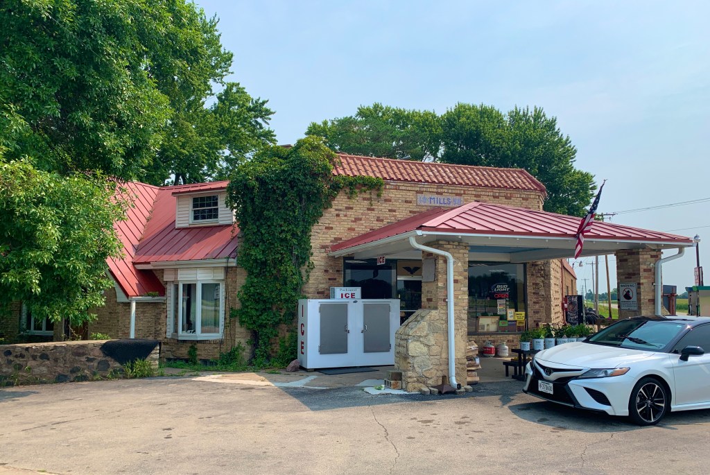
In Leeman, which, as far as I could see, wasn’t really a town, there was just this corner store, run by a single Mom and her kids.  They are out in the middle of nowhere, and they sell groceries, pet feed, gas, and all kinds of stuff.  I was impressed.  I was especially appreciative of the fact that they sell chocolate mile, because I was needing a fix.  

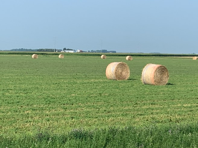
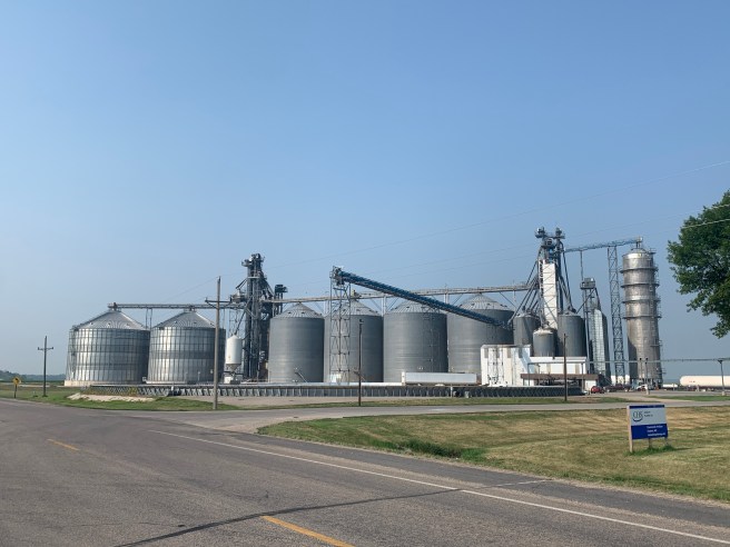
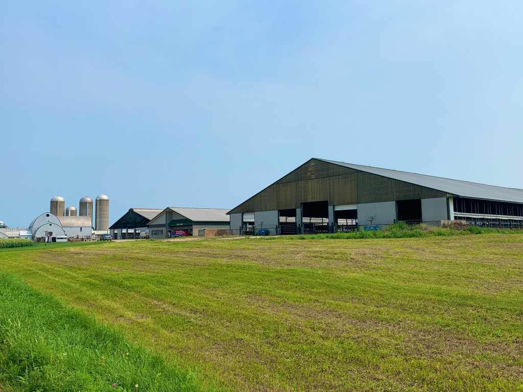
Today, we started passing dairy farms. Lots and lots of dairy farms. BIG dairy farms, and a few little ones too. I need a tour of a big dairy farm, if you know anyone who could give me one. What do they do with all those silos? Where does all the manure go? What do they do with the baby boy cows? The nicest dairy farms seemed to be branded with the big companies like Land O’ Lakes.

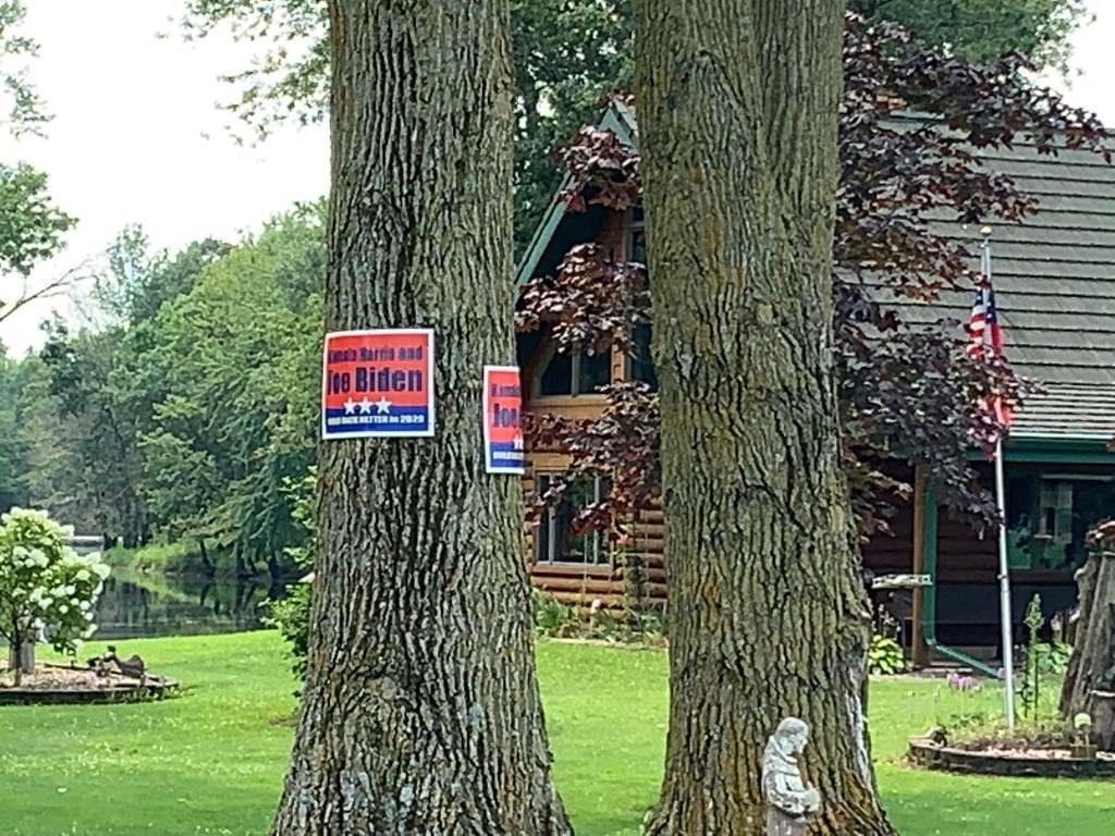
Out in the country, there are very few Biden signs, and a lot of Trump signs. I stopped to talk to the people at this house, and they told me that most of the Biden signs mysteriously disappeared.

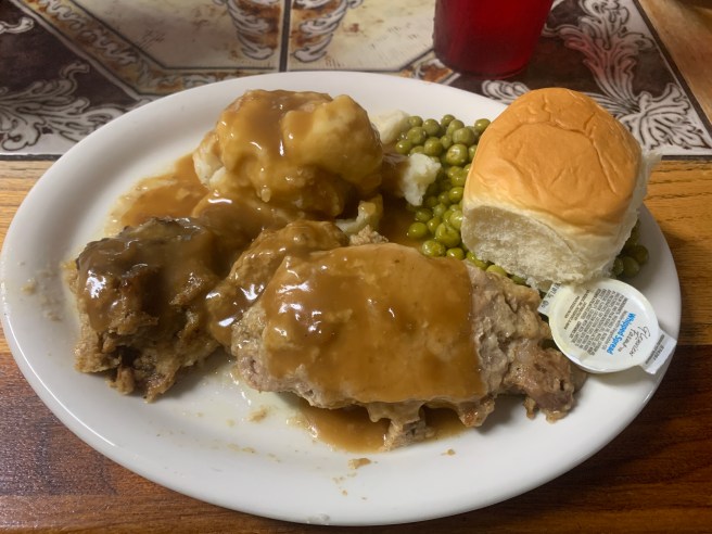
When we stopped for lunch in Black Creek, the waitress and customers in the little diner where we ate were interested in our adventure, and they were surprised we were camping tonight. Why so surprised? Because, they informed us, there was a severe weather warning for the area. What? This was the first we’d heard of it. One guy brought his phone over, to show us his radar app, and it looked pretty bad. My National Weather Service feed had a prediction of golfball sized hail, 80 mph winds, tornados, and possibly a Derecho. If you’re in a car or building, you have some protection from the elements, but in a tent? Not so much. I was wondering how this was going to impact us.

I had planned to stop at the local library to work on the blog for an hour or so, but the weather had me worried, so I headed for the campground to get ready for whatever might be coming our way.

Our campground for the evening.

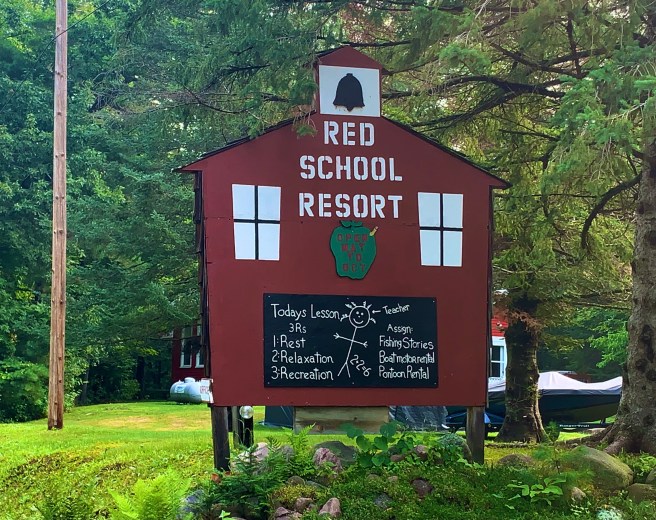
By the time I arrived at the campground, Ed had arranged with the folks at the campground to let us sleep under the pavilion by the pool, to be safe from the storm, lightening strikes and a tree possibly falling on us.  The catch was that we had to wait till camper activity in that area died down, before we could set up.  Easy enough.  We’re good at hanging out, and can easily find ways to entertain ourselves.  

During my first hour there, a 9-year old girl, was having a big birthday swim party with about 8 other little girls her age. I put my swimsuit on, while I washed all my clothes, and swam and showered, while my laundry was washing and drying.

At one point, while I was in the bathroom getting chain grease stains out of my sun legs, a little girl called out for help from one of the bathroom stalls. Her voice was so soft, I wasn’t sure of what I was hearing. She called out again, “Can somebody help me?” I went over next to the stall where the voice was coming from and asked her if she needed me to hand her some toilet paper. “I have toilet paper, “ was her response. “I need someone to help me wipe.”

Ummm. Let’s see, now. That’s something I would have helped my daughter with and have helped my grandkids with, but not someone I don’t know—especially a child. I asked her if her Mom was here, and she told me her Mom’s name. So I headed outside to find her Mom, asking the nearest parent to the door who Tashonda was. Mom was a ways down the sidewalk, talking on her cell phone, so I hurried down and told her that her daughter needed her in the bathroom, and she almost ran for the bathroom. When I pointed the stall out to her, I noticed all the mud, grime and water tracked in from the pool or from the adjacent showers overflowing. There was no hesitation. This mom dropped to the floor of the RV park bathroom and low crawled on her belly into that toilet stall, and she proceeded to gently talk to and help her daughter and tell her what a good job she’d done.

Super Mom Tashonda.

Did I really just see this? Was I really hearing this? Who dives down and gets prone on a filthy public restroom floor, then drags herself into a bathroom stall, to help their child wipe their fanny? Tashonda you are the bestest, kindest Mom EVER!

Over the next couple of hours, people from the RV park who had TV service came by to update us on the increasing severity of the storm warnings and to inform us on what to do if we heard the tornado sirens (run for the laundry room). We had done everything we could to prepare. Our tents were tied down to picnic tables under the pavilion and my bike, panniers and all but my sleeping gear were in the laundry room.

It was pouring rain, as I climbed into my sleeping bag, then a flash of lightening lit up everything, followed by a thunder clap, just a second later. Things weren’t sounding too good, but it was all out of our control. I fell asleep quickly, in spite of the loud rumbling thunder. Story to be continued—tomorrow.

7/27/2021 – Crandon to Tilleda, WI

74.19 Miles / 2414.13 Total Miles

1834 Ft. Elevation Gain / 86,018 Ft. Total Elevation Gain

We were so fortunate to have a change in lodging plans, yesterday, that put us indoors for last night’s storm. The thunderstorm and high winds lasted most of the night, while we were safely tucked away between the covers, in the Four Seasons motel. As we rode out, this morning, the roads were littered with tree branches, and there were fallen trees along our entire route, or evidence of fallen trees that had been removed by highway crews. Our tents would have kept us dry, no matter what, but if a tree had fallen on us, or if lightening had struck a tree near us, we would have been toast. We weren’t going to have access to food or hydration for 51.5 miles, so we left our motel room, fully stocked for the day.

Crandon was a pretty spiffy little town, and as we rode out of town, it moved up a few more notches, in my mind. Part of the town backs up to this really nice lake, and the houses that back to it are not mansions. They are just humble homes that normal people live in. And the city has a nice little park with a public beach, so everyone can enjoy the lake.

We had no idea we were going to pass through Nashville. It wasn’t even on our map.

This is the Red River, outside of Mattoon, but we also crossed over the Wolf, Lily and Embarrass Rivers. The Embarrass and Wolf Rivers had tubing and kayaking operations, and it would have been nice to have had a few extra hours to stop and go on a float. I thought to myself that when I get home from this trip, I need to get out to the Salt River Recreation area ASAP and float down the Salt River, before they shut down for the winter. The water is much clearer than this water, and there are rapids. Send me an email or text message, if you would like to join me.

We’ve been passing Christmas tree farms, over the past few days, and I keep forgetting to take a picture. So here it is.

Mattoon was our lunch stop, but the only available food was in the Deli of the little grocery store. While we were patiently waiting to order, a heavy set women walked up and put her order in ahead of us. We held our tongues and didn’t let it get to us. When our order was ready, the deli gal brought it to us, as if we were in a restaurant. Very nice touch. Lunch was delicious!

I noticed that the town had a library, so I decided to stop in and work on my blog for an hour or so, while Ed move on to the campground. When I got to the library, I discovered that it is only open 2 hours a week, and this didn’t happen to be those 2 hours. I needed to use the restroom, so crossed the street to ask the people at the city hall building if I could use their restroom. The doors were all on electronic keypads, so I couldn’t even go inside to ask, but someone heard me trying to open the door and came out to see if I needed help. And that someone was the heavy set woman from the grocery store deli. Turned out that she was really nice. She let me in to use the restroom and told me that even though the library was closed, I could sit out front and use their wifi.

The front of the library building had full sun, there was no place to sit, and it was really hot outside. So I sat on the asphalt in the only available shade–the shadow from the bed of a pickup truck. Apparently the gals from the city hall building looked out to check on me, because the heavy set gal came over and invited me over to sit indoors and use their wifi. I cranked out a post and hit the road. There were still 20 miles of riding left to get to the campground.

Mattoon gave me my mural fix for the day. They didn’t have buildings to put a mural on, so they took advantage of a long retaining wall. Very resourceful.

For only $2500, you could own the antique bucket of bolts truck on the left.

I finally made it to Tilleda, where we had decided to camp. The Pine Grove Campground & RV Park was a high end place with a high end price, with 2 beaches along a lake, a pool, goofy golf course, petting zoo, playground, fountain, store, golf cart rentals that looked really fun, showers, wifi, and a nice patio/deck for us to sit on. Oh, and lots of mosquitos. We burned through a bunch of my mosquito repellent, and they were still biting us.

One of my favourite features of the campground was the goats, Stan and Ollie. Ollie was the man of my dreams–attentive, patient, full of energy, easy to please, likes to pose, eats healthy, is fit, and will fight for what he wants. He and Stan entertained us, by head butting each other, locking their horns and chasing each other around. Very manly–my kind of guys. Forget all those boring human men. Maybe those Middle Eastern men truly do know the secret to happiness.

7/26/2021 – Eagle River to Crandon, WI

44.88 Miles / 2339.94 Total Miles

1184 Ft. Elevation Gain / 84,184 Ft. Total Elevation Gain

With a short day ahead of us, we decided to sleep in and get a real breakfast, before embarking on our ride. For us, this was a rest day–kind of. There weren’t going to be any towns with food or hydration until Crandon, so we made sure we had plenty to eat and drink, before getting on our bikes.

We passed along some lakes, just after we left town, and people were actually headed out on them, with their boats. I’ve seen a lot of lakes and a lot of boats tied to docks, on this trip, but boats being used on lakes? Probably less than 10. It was good to see people heading out to enjoy the lake.

As we moved down the road, we entered the Chequamegon-Nicolet National Forest, which is a forest with trails and lots of campgrounds, but no historical destination, site or building.

Our route followed a couple of scenic byways, but to me, it just all looked like a bunch of tall trees, with a lot of fern undergrowth. Sometimes I was so busy trying to dodge potholes and torn up pavement, that I couldn’t even see the trees.

,Eleven miles of our ride, through the National Forest, was on Old Military Road, which actually does have historical significance. It was built between 1864 and 1870, as a wagon road, to provide a route for reinforcement of two military forts during the Civil War Period. Mind you, the road had no role in the Civil War. That is just the timeframe in which it was built.

We passed through Hiles, and even though it claims to be the “Mushroom Capital of Wisconsin,” we never saw a mushroom. Not even one.

As we approached Crandon, we passed an interesting entrance to some kind of auto racing facility. I didn’t recognise the vehicle on top of the sign, but I love the idea of a vehicle on a sign, so I took a picture. As we continued down the road, we figured out what the facility is–the Crandon International Raceway, Home of the World Championship Off Road Races. Too bad we aren’t here September 1-5, because that’s when the championship races will be held. I’ll bet big money that they beat the excitement and crowd of that Mud Bog we saw in Butternut.

I wanted to use the wifi in the public library to work on my blog, so Ed headed out to get lunch, then rode ahead to our campground. While at the library, I met a brother and sister, in their 20s, who are riding the North Lakes Route–the same maps we are currently following. They headed out for the same campground we were planning to stay in, so I expected to see them later. Well, I missed seeing them, because after riding almost 5 miles, Ed arrived the campground to find that it has been closed for construction for at least a year. With no other campground up ahead for over 50 miles, he had no choice, but to turn around and come back to Crandon. Once again, this kind of news would be easier to deal with, if you were driving a car. We found ourselves a cheap motel for the night, so we weren’t exactly homeless.

The brother/sister duo had stopped at the grocery store, so never bumped into Ed to get the news about the campground closure. They too rode all the way out there, then rode all the way back to stay in the same cheap motel. Great minds think alike.

Every time one of these malfunctions happens to us, the end result turns out better than the original plan, and that’s when Ed says, “Everything happens for a reason.” Last night, there was another thunderstorm, with heavy winds, that lasted most of the night. This morning, we passed a lot of downed trees laying across the road. As much as I love camping to in my cozy little tent and cocoon, I’m glad we were indoors for the storm.

7/25/2021 – Mercer to Eagle River, WI

63.84 Miles / 2295.06 Total Miles

1332 Ft. Elevation Gain / 83,000 Ft. Total Elevation Gain

After an uneventful night, last night (no thunderstorms), we got on the road early, today. Our first stop of the day was going to be breakfast with John Nelson, in Manitowish Waters. I messaged ahead to let him know what Google Maps was saying our ETA was, then called when we got closer. We were meeting up at a place called Dixie’s, across the street from Dietz’s gas station. We jumped on a rail trail in Mercer, and were teleported forward on luxury asphalt. I felt the pressure to be focused and make good time, but there were all these cool things to snap photos of catching my eye.

We’ve seen several of these Soo Line rail cars, starting in Minnesota. Mercer had one next to their former train depot.

Had to stop at Mercer’s Veterans Memorial. Loved the Eagle sculpture.

Then there was the gigantic Loon, Claire d’Loon, with a display that played all of her various calls and sounds.

The rail trail is very high end. This is one of the many bridges we crossed.

And here’s Ed, showing his rail trail etiquette.

Pretty quickly, we were in Manitowish Waters. We passed our original meeting place, the Pea Patch Motel, and were wondering if we followed the Aurora Borealis sign, could we actually see the Aurora Borealis.

The Memorial Park, in Manitowish Waters, had a huge fish sculpture, that was really cool. This place was so well groomed, with gorgeous flowers planted everywhere, and lots of meticulously mowed grass, even along the bike path.

Starvation was setting in, when John arrived. I ordered the breakfast casserole and a peach smoothie, and they hit the spot. John entertained us with the things that go on in town. The place is so meticulous, because the owner of ULine, a large commercial supply vendor, lives there and donates heavily to her town.

We struck a pose, on the dock, with John, but had no photographer to take a photo. And at that very moment–like a scene from a movie–a beautiful, blonde bombshell came traipsing down the stairway to the dock. It was Johns wife, Jill, coming to save the day. Ed and I had been preparing to leave, but now we were sitting back down to hear about Jill’s water skiing show, last night, and get caught up on other important things. I’m kind of old to think about learning the kinds of things she does on skis, like being on the top row of a large pyramid formation, but she says that if I were to come back next summer, they would teach me how to do some tricks. Hmmm. Great idea! I’ll put that on my list of things to consider.

When we left Dixie’s, our bike path travel continued, till we got to our next town, Boulder Junction.

Once there, we toured the downtown area, checked out the Veterans Memorial and the town mural, then looked for and found unique sights.

My bike had been making some strange rhythmic sounds for several days, so while Ed sat down for lunch, I headed down to see the bike mechanic at Coontail Bike Rentals–the first bike repair opportunity I’d had, since Fargo. Thankfully, they had a super knowledgeable Specialized certified mechanic on duty. He trued my real wheel, adjusted my brakes, checked my gearing and re installed my beast of a kickstand (I had removed it, because my wheel was so out of true, that I though it was rubbing against it.) Thank you Coontail for having such a sharp guy working for you!

Ed finished up with his lunch at about the same time the mechanic finished up with my bike, so we got back on the road. During our little break, both of us had been getting an earful about how the bridge was out just before Conover, and the detour was REALLY long. Ed had found a shorter alternate route on Google Maps, that bypassed the bridge ; one gal had suggested another alternate to avoid the bridge and the traffic we would encounter on the road from Conover to Eagle River; and one gentleman mentioned a snowmobile/ATV bridge we could take, that runs parallel to the bridge, but just a little south of it. What would you do with those 3 choices? I went for Ed’s Google Maps option.

We pushed ahead, and that Google Maps option was looking good for the first mile. It was a nice road, and all downhill, till we ran out of pavement and were looking at who knows how many miles of a dirt/gravel road. We turned back around and peddled back up that hill, deciding to just follow the ACA route, but take the snowmobile bridge, if we couldn’t find a way to cross the bridge.

As we rode up on the bridge, I told Ed that maybe we could just find a way to cross the bridge, but when we got closer, there was no bridge to cross. The entire span had been torn down. It took quite a bit of grunting and groaning to get our bikes up a steep embankment, then through the dirt and gravel on the road and ramp to the snowmobile bridge. Once we were over it, we were home free, with no detour required.

I didn’t see a Veterans Memorial in Eagle River, but there was quite a bit of Yeti action. Wait. A couple of those Yetis look like the ape from the Tarzan Disney movie

7/24/2021 – Ghost Lake to Mercer, WI

67.6 Miles / 2287.4 Total Miles

2185 Ft. Elevation Gain / 81,668 Ft. Total Elevation Gain

A few days ago, I received a message from my ex-husband, Jerry, suggesting I look up John Nelson in Manitowoc Waters, Wisconsin.  He and his family head out there to stay in a lake house for one or more months, each summer, and he is there right now.  I looked at a Google Maps, saw how far north that location was from where we were, and told him it was too far out of our way.  Then a few days later, I pulled out our next map, and Manitowish Waters is actually on our route. So I reached out to John and did a little coordination.  John doesn’t actually stay in Manitowish Waters, but is about 5 miles north of there on South Turtle Lake, so he was going to drive down to the Pea Patch Motel & Saloon, pick us up, and take us up to the lake house for the night, then bring us back down in the morning.  We had to make a few changes on our end.  Ed cancelled our campground in Mercer, and instead of riding the 64 miles to Mercer, we were now going to be riding 76 miles, which was doable.  We had a plan to go with John to see his wife, Jill, and son, Connor, perform in a water ski show, something I’ve never seen before.  All this was going to happen today, until last night and this morning happened.   

If you remember, it was going to rain, last night, and at 12:22, the heavens opened and it didn’t stop raining until 9 AM this morning.  And then we had to tear down camp with wet rain flies and tent footprints.  To save time, we agreed to skip breakfast and pick up something to eat at our first food stop on the route, which helped us clear out of our campsite in record time.

Ten miles down the road, we came to Clam Lake. No food available.

Seventeen miles further down the road, we came to Glidden, “The Black Bear Capital of the World.” We pulled into the first convenience store we came to, and thankfully, there were a lot of choices for breakfast. They sold the most delicious strawberry milk I’ve ever tasted, and somehow, I had the self control to not buy a second bottle.

Out front,, we met a gal wearing a “Get Nutty in Butternut” shirt. (Butternut is the town 9 miles further down the road.) This gal told us about some really nice murals painted by a resident artist of Buttercup, and you know how I love murals. Also, there was a big street fair going on in Buttercup, and we were not going to blow past a street fair, without stopping to check things out and try some of the local food.

So Ed and I had a conversation about how difficult it was going to be to meet up with John. We would have to ride over 75 miles to get to the Pea Patch, and with our 3 hour rain delay, and now this street fair, there was no possible way to make that distance before 6 PM, when we would have to be cleaned up and ready for the 45 mile drive to the ski show. We agreed to try to make good time, but we would reassess our progress as we moved along.

And that’s when we saw the little ice cream shop next door. I hadn’t had ice cream in a few days, and they had Elephant Tracks, and I’ve never tasted it before. There was going to have to be some savouring of ice cream, before we could get on the road. Mmm Mmm Mmm. That Elephant Tracks was super delicious! 

Even though we were trying to make good time, some things cannot be compromised, such as stopping at Veterans Memorials and murals.  So I stopped at the Glidden memorial, and lo and behold, the first mural of the day was facing it. The people on the mural are actual citizens of Glidden, and their names and service dates are written in gold next to each of their paintings.  Additional service members names and service dates were in the gold stars on the mural.  I loved the mural, and couldn’t wait to find the others, so we headed toward Butternut, where the artist lives and where there are supposed to be several other murals.  

After going only a couple of miles, Ed’s rear tire went flat.  And that’s when we knew that we wouldn’t be making it to see John Nelson, today.  The tire had a big staple in it, and it was not an easy fix.  He installed a new tube, then neither one of our pumps would pump it up, because his spare tube was bad. He had to patch the old tube, which thankfully worked.  

Then we got back on the road and got ourselves to Butternut. 

Their Veterans Memorial also had a mural adjacent to it, and I loved that mural too.  The painter has such great ideas on how to depict people, inspire thought, and lift up the viewer of her work.  That’s how I felt–lifted up.

The mural on the wall of the school faced the playground, and pictured are actual kids from the town.

The next few murals are folks from Butternut.  If you zoom in, you can read a narrative about each of them, written on the background.  I’m assuming the narratives were written by a family member or close friend.  Many of these people are still alive, and they are remembered on these murals.  I love the whole concept of it!  Before heading up to the street fair, I stopped in the artist’s studio to meet her.  Told her how much I love her work.  I need to get her to paint a mural of my adorable grandkids and their parents to put on my wall.  I’d have to find a blank wall, for the mural, but I could do that.  Who needs a piano?  Or a television?  

After touring the downtown and talking to some of the locals, we headed over to the town fair, which involved climbing a hill with an 11 or 12% grade.  Way to hurt us, but that wasn’t going to stop us.  At this point, we were determined to find ourselves some lunch.  My first stop was the baked goods booth, manned by a couple of ladies from Sweet Brew, the local bakery.  I bought some snickerdoodles and some unnamed super healthy cookies for athletes.  I’m not an athlete, but I need munchies on my bike that are healthy, so they will be perfect for my feed bag

And then there was the dunk tank, where a guy dressed in a pink tutu and wearing white rabbit ears was being dunked by adults and kids over and over again.  It was hilarious to watch. 

The horseshoes tournament was much more serious.  I overheard a conversation, there, about how if these guys entered the senior games, no one could beat them.  That’s how good the Butternut horseshoes players are.  If I had been carrying something that could be written on and a pen, I might have asked for some autographs.

The big crowd draw was the mud bog.  Two trucks would line up in two separate lanes of deep mud, and race to see which one could get through the mud first.  It’s not like they could just drive through it.  They all got stuck, and had to ramp up their engines to get their wheels spinning, and then the truck would start spinning and turning, till their tractor tread tires pulled them through. It was insanely loud, but the crowd loved it.

There was a lot going on at that street fair, and we didn’t have time to take it all in, but we did stop and have the biggest bacon cheeseburger I’ve ever eaten, cooked by the crew from a local resort.  It was super delicious.  And then it was time to head out.  

Our new plan was Plan A–stay in Mercer for the night.  Ed lined up yet another Campground/RV Park, as the one he cancelled was now full, and we hit the road.  

Before we got out of town, though, we had ourselves another Yeti sighting–on the back window of an SUV. And before I lost my cell phone service, I called John to let him know that we weren’t going to make it for the night, but that we could meet up with him for breakfast in the morning.  

When we arrived in Mercer, the RV park we stayed in was much nicer and more convenient than the one we cancelled would have been, and it had laundry facilities.  After showering, Ed walked into town to get a drink and see what was going on (he found live music), while I did laundry and worked on the blog.  

And that was another day on our bike tour!

test

7/23/2021 – Haugen to Ghost Lake, WI

75.84 Miles / 2295.64 Total Miles

2730 Ft. Elevation Gain / 79,483 Ft. Total Elevation Gain

In 2015, I spent 5 weeks in Italy, and within a couple of weeks, I had seen so many statues and cathedrals, that I couldn’t be impressed by yet another of them. I had become numb to them. Has that ever happened to you? I mention this, because it’s happening to me on this ride. I have become numb to crops and lakes and forests. There might not be more photos of them going forward, even though I see them all day, every day. They may just be in the background of other things I take a picture of, so it will be up to you to notice. Is laziness setting in? I hope not.

After enjoying a restful night, on a real bed, in that little KOA cabin, and a real sink to brush our teeth at, in the morning, we hopped on our steeds at 7:20 AM and bid Shady Rest Campground adieu. We decided that the guy who owns the place does a lot of what he does just to be good to people, and we really appreciated his goodness to us.

Just a few miles down the road, we ran into this herd of Bison. If only they had been this easy to find and see at Theodore Roosevelt National Park. The fence keeping them contained looked pretty flimsy, so I am hoping it was an electric fence, and that electric fences work on gigantic ultra furry creatures, like bison.

Once we ran into this sign, we were on the lookout for Amish horse drawn buggies, but we never saw one. I didn’t mention it, but we saw one going down the road, yesterday, and cars were blasting past it a high speed, which I thought was pretty thoughtless. Horses can really get spooked by things racing up behind them. I know what it feels like. I get spooked too. Frequently.

We cycled past miles and miles of resort cabins and lodges along the shores of Lake Chetac, Sand Lake, Lac Courte Oreilles and Grindstone Lake This would be a great place for an extended family vacation, if these places aren’t booked up years in advance. I especially liked the sign for the Red School Resort.

It looks like Wisconsin folk believe in Yetis, because look what is starting to crop up again. We didn’t see them in North Dakota or Minnesota. I haven’t met any experts yet, but if I do, I’ll keep you posted.

We had very few places on our route, today, where food or beverages were available, so when we came up on this one, my heart lept a little. The guy who owns this store lives here and keeps it open year round. Apparently, enough snowmobilers come to town, in the winter, to keep him in business.

The mailbox of the day.

We learned a bit about the Lac Courte Oreilles Ojibwe Indian Tribe, as we passed through their reservation. Many of them were converted to Catholicism, back in the 1860s, by Catholic Priests who offered them mass. They built a log church that burned down and was replaced by the pipestone church below.

They serve in the military and honour their veterans. Their memorial is really REALLY nice.

While on the Ojibwe reservation, we stopped at a grocery store, to pick up some food for lunch and restock a few items. Parked out front were a couple of loaded touring bikes, so an encounter with other cyclists was inevitable. In the store, we met two college aged fellas who are cycling from Washington D.C. to Minneapolis. They rode out of D.C. on the C&O Canal and Greater Allegany Passage trails, then used RideWithGPS to route them up to what is known as the Northern Peninsula (of Michigan), where they toured Makinac Island, then crossed over into Wisconsin. They’re definitely having an adventure.

We passed into, through and back out of the Chequamegon National Forest. It was very similar to forests on the Olympic Peninsula, with their lush foliage, tall trees and fern.

The 4.5 mile “Rustic Road” we rode on at the very end of our day, reminded me of the difficulties of the day. It was hot and humid from the moment we got on our bikes, and both the heat and humidity increased as the day wore on. And now we were being beat up by torn up pavement. This particular Rustic Road informed me of what a Rustic Road is. It is a paved road that no one has the funds or time to repair, so they put a cool sign on it, to make it look like they intend it to be rustic. Occasionally, there was a fresh patch of asphalt, on a section of pavement that looked like someone dropped a bomb on. I couldn’t figure out what they were trying to accomplish, with their little bitty patches, when the entire section of pavement was completely deteriorated and impassible, but maybe they have to use that asphalt or lose it;

A couple of miles after surviving the beating from the rustic road, we arrived at our campground. Surrounded by large camp trailers and RVs, we had a nice quiet spot with every thing we needed, except wifi, of course. After showering, we headed over to the lodge to get dinner and to hopefully find a place to set up blog central.

This was Friday night, so the place was packed with people who had come from miles away to enjoy a night out with food, drinks, music and friends. I ordered up some fish tacos, and they were scrumtious. Sadly, blog central was not going to happen, because the wifi didn’t work in the lodge. The owner told me that there are 3 large boulders, near the office, where you can get wifi, and I meant to head over there after dinner, but that’s when the live music started.

The female guitar player/vocalist sounded like a cross between Joni Mitchel, Melanie and Janice Joplin. She was really good. The lead singer, harmonica player and congo drummer was the owner of the resort, who had been wearing the bartender apron, up until he got his cue to take his place with the band. He was a talented performer too. I don’t get out to hear live music, very often, so I stuck around and enjoyed the moment.

When I finally headed over to the 3 boulders, I was able to access the wifi long enough to check my text messages and respond to one of them. End of wifi for the evening. Time to go to bed. Not being a quitter, I stuck around and hit my head against the wall for another 15 minutes, before completely throwing in the towel on the wifi.

The weather forecast had predicted rain during the night, so I closed everything up tight, before going to bed. Unfortunately, with every thing buttoned up, my tent was a sweat box. I was laying on top of my silk cocoon in my skivvies, sweating my brains out, so I opened the rain fly on both sides of my tent to let some air in. At 12:22 AM, a torrential downpour, thunder and lightening all hit at one time. Water was pouring in both sides of my rain fly, until I closed up those openings. The thunder and lightening kept me awake for about an hour, before I fell asleep again.

7/22/2021 – Osceola to Haugen, WI

64.42 Miles / 2219.80 Total Miles

2359 Ft. Elevation Gain / 76,753 Ft. Total Elevation Gain

I don’t know what the deal is, but every day, when we are in our last 10 miles, I think to myself, “I don’t think I can make it.” The miles drag on and take forever, and there always seem to be a few last minute hills to make things harder. Then, when I arrive our destination, I feel completely wasted. Maybe I have iron poor blood. Naw, I’ve been taking my vitamins. I think I need an attitude adjustment.

Today, we started out on a “Rustic Road,” whatever that means. It just seemed like any other road to me. When we reached St. Croix Falls, we hopped on the first Rails-to-Trails path that required payment, the Gandy Dancer Trail. We didn’t know how good we had it, when riding the 200+ previous miles of free rail trails. This trail started out paved, then switched to double track gravel (I want my money back), which is not my favorite cycling surface, though it beats the heck out of torn up pavement.

It was hot and humid within a few minutes of hitting the road, and got worse as the day progressed. Add to that the fact that, other than the rail trail, which was relatively flat, the rest of the day was rollers. Endless rollers. And the wind was out of the south, while our route zigzagged northeast, so part of the time we had a cross wind, and part of the time we had a gentle tailwind.

Different organizations sponsor sections of the trail, and get a sign named for them. I liked this one.

At one point, there were fields of corn, green beans or soy beans on both sides of the trail, with a wide swath of trees on both sides of the trail. So the spots where farm vehicles come through, to maintain the farm, were all marked with little tractor crossing signs.

In Balsam Lake, we stopped at a convenience store for second breakfast. Could all these extra meals be putting extra pounds on me? My clothes are not feeling looser, after all this exercise. I worry! What if I’m gaining weight?

Who needs a sign, when you have a historic pickup truck and a plant lady outside of your landscaping business?

This sign marked a collection of metal sculptures, on a large family farm we passed.
The little sign reads, “Average Size Mosquito in Wisconsin.” It sure feels like they are that big.
This poster was next to a county fair sign. Great advertising!
Thankfully, my Garmin routed me in the direction of Hunky Dory. I must have blinked and missed it, because I never saw or felt Hunky Dory.
Yesterday, the mailbox that looked like a huge ear of corn caught my eye, and now I’m starting to notice mail boxes. My little Sister, Janette, would love this one. I wonder if her HOA would allow it.

I received a resupply box, yesterday, mailed by my wonderful neighbors, Mat and Lucy. When we got to Cumberland, I found the post office and mailed all my empty bottles, unused clothing, etc., home. Unfortunately, it had zero effect on the weight of my bike and gear. Also, while in Cumberland, we ate a delicious lunch at Louie’s on the Lake, a spot recommended by a lady I bumped into, that happened to be right on our route.

When we arrived in Haugen, we were hot and sweaty, and gritty, from the gravel rail trail. We stopped at the little grocery store in town, bought a cold drink, and sat under a shade tree for a few minutes, before proceeding the final 2 miles to our campground.

As we neared the campground, some unusual yard caught our eye. When we stopped to snap some photos, the owner of the house came out to inquire if we were camping in the RV park. Turns out that he is the owner. He followed us to the park to show us our camping spot, but before we got to it, he asked us how long it had been since we slept indoors. “Last night.” He still offered us a deal on one of his KOA cabins, but didn’t tell us what the deal was. We went along with it, because it’s nice to be indoors and have electricity and a refrigerator, and it saves us time setting up and breaking camp. Also, there was room on the covered patio for our bikes, which means no dew to deal with in the morning. Ed headed over to the shower, and just a few minutes later, the skies opened up, and it rained like crazy. He was stuck in the shower, and I was stuck in the cabin, for probably an hour. And we were both thinking how lucky we were to be in that cabin instead of our tents.

The campground had a little restaurant/bar, with tasty pizza and fast wifi, so we set up blog central and worked on our blogs for a few hours. When the owner came by our table to collect payment for our accommodations, we were shocked, when he only charged us $20 for a night in a cabin. Which brings me back to that age old question that keeps coming up. Are we blessed, or are we lucky? We have been amazed by and thankful for the goodness, generosity and kindness of people along our route.

7/21/2021 – Milaca, MN to Osceola, WISCONSIN!!!

73.63 Miles / 2155.38 Total Miles

1316 Ft. Elevation Gain / 74,394 Ft. Total Elevation Gain

News Flash: We passed the half-way point of our tour, today. Whoo Hoo!!!

When we started riding, this morning, it was 59 degrees outside. I thought I was going to freeze, but I toughed it out and put my mind to peddling, and I warmed up pretty quickly. There was very little wind at the beginning of the day, so this was the time to knock out some miles, before the wind picked up, and that’s what we did. A few hours later, that all changed, and we had a southeasterly wind, which was a headwind, because that was the basic direction of our route for the day. As the day wore on, the wind picked up speed, and we slowed down. And on top of the wind, we were dealing with rolling hills, again, and they too wear you down. I’m not trying to be a complainer, but these are not my favourite riding conditions.

Before I get going on my next topic, which also could. be construed to be complaining, I need to explain our routine, in case you haven’t figured it out. We try to be on the bikes by 7:00 or 7:30; ride for two hours; stop for second breakfast or at least a cold beverage (chocolate milk for me); ride for another two hours; stop for lunch–either at a diner or convenience store, or flatbread sandwiches we prepare; then ride till we get to our final destination. I have a feedbag on my top tube, with trail mix, cookies, crackers and/or Skittles that I graze from every 10-15 minutes–all day long, and four 23 oz bottles of Crystal Lite Lemonade that I suckle from every 10-15 minutes.

When I said I was going to explain our routine, I’ll bet you thought it had something to do with riding the bike, but it’s really all about eating and hydrating.

And I explained it, because today, our route was devoid of any place to stop at the 2 hour point. Our maps showed food and beverage establishments in most of the little towns, but town after town, we were disappointed. We kept moving on to the next town, and then the next, and then the next. The towns were all so small that they either don’t have a diner or shop with food or their little diners went out of business during Covid. At the 38 mile point, we were over 3.5 hours into our ride and needing something–anything–to eat or drink.

We pulled in to Stark, and there were two bars across the street from each other. One was closed permanently and, according to GoogleMaps, the Full Moon didn’t open till 2 PM. There were two cars in the parking lot, so I had a glimmer of hope, as I tried all the doors. The back door opened, so I popped my head in the door and hollered out, “Anyone here?” And luckily, someone responded. I stepped inside and asked if they would be willing to sell us a couple of soft drinks, even though they were closed, the guy behind the bar said yes. I went out and got Ed, and we bought a couple of cold cans of soda pop and sat out on the covered patio to finally take our much needed break.

Apparently, we are mooners, because this is the place we were finally able to get our morning snack and take a break.

When we were ready for lunch, we had the same problem. At the cafe below, in the historic village of Sunrise, we learned that all the businesses that deal with the public were closed. The drought has brought the water level down on rivers and lakes, so the tubing and kayak operation was closed for the rest of the season, and this eatery had to follow suit. We sat down at the empty picnic tables to prepare our flatbread sandwiches and eat our lunch.

This chair was the highlight of my day

Changed my mind. This sign was the highlight of my day. After spending the entire day not finding food or beverages, and a good part of it riding into a headwind, it was so nice to see progress. Goodbye Minnesota. Hello Wisconsin!

Oseola”s a tourist town, with a good vibe and interesting shops. I was thinking that after my shower, I’d like to come back and walk through the shops, then get a bite to eat, but our hotel was down a long hill (strike 1) and at the far end of town (strike 2). And it was situated right next door to a popular restaurant, with a fetching menu (strike 3), so we never went back into town. Instead, I took an amazing, long, much needed nap.

7/20/2021 – Sauk Centre to Milaca, MN

87.16 Miles / 2081.75 Total Miles

1001 Ft. Elevation Gain / 73,078 Ft. Total Elevation Gain

We knew up front that this was going to be a really long day. And it didn’t help to have some headwinds to deal with, now and again. We picked up where we left off on Lake Wobegon Regional Trail, today, and Memoryville was one of our first cool sights. Unfortunately, the place was locked up, with No Trespassing signs, so we couldn’t go in to check it out, but it was like a movie set, complete with a fake cow in the pasture.

And then, nearby, was another collection of Dinosaurs of the Prairie in the making–threshing machines all lined up, ready for another threshing machine to join them. We pushed on

Partway between Freeport and Albany, a group of 9 loaded cyclists of various ages pulled up, including 2 moms bringing up the rear. The Caniglia and Gilday families, from Camano Island, Washington, are cycling the Northern Tier westbound. They began their trip on June 1st, and are about to take a train to skip North Dakota through Whitefish, Montana, due to the kid’s school and their jobs. They are camping in 4 tents and preparing meals over a camp stove,, the majority of the time. The kids, aged 11-17, were so polite and patient! Ed and I were super impressed. We wish them well on the rest of their trip.

I rarely see people out riding bikes, but most of the small towns have art or sculptures somewhere with bikes in them.

We crossed the longest covered bridge (186 feet) in the State, to get to Holdingford. As we were cruising around and exploring the downtown, two different guys stopped to tell me and Ed about a new cafe up the trail for bicyclists. It was only 10:30 AM, so weren’t really ready for lunch, but we are all about supporting cycling, so when we finished up in town, we got back on the bike path, and it led us to BOHO. From the outside, BOHO looks like a very large house, but on the inside, it is a cafe, with a museum and art gallery all together under one roof. There were probably 8 groups of women there, for what looked like standing lunch dates.

Once we looked around and smelled the aroma of the soup du jour, we decided it was time for an early lunch. We sat down and had some soup and ice cream, and it was super delicious.

I’m not sure if Einstein really rode a bike, but he did have that famous quote, “Life is like riding a bicycle. To keep your balance you must keep moving.” That is so true!

Greg, the owner of BOHO, videotaped an interview with us and took some photos for his wall. He is a recent retiree, who moved back to his home town, and he’s giving back to his community with the space he built. And the community really seems to like it. Good luck with BOHO, Greg!

Just a few miles further down the road, we came to Bowlus. It had its own little cycling pub, BOHO’s sole competitor, a nice Veterans Memorial and a modern park, for kids, and there were a bunch of them there. The wind was picking up, as we left Bowlus, and it was really going to test us for the rest of our ride.

One of the last turns on our route led to a construction zone with detours that would have been fine for a car, but not a bike. I had already ridden almost 80 miles, and I still had a few miles left to go, and now I was being asked to add on 5 additional miles. So I opted for a shorter detour on a gravel/dirt road, and that was a big mistake. Thankfully, there wasn’t a lot of traffic, but over the course of about 3 miles, I was passed about 14 times, and none of the vehicles slowed down. So they created a huge trail of dust that I had to ride through. I covered my mouth with my bandana, but my sweaty body was like a magnet for all that dust. Grrrr. After the dirt road were several miles of terribly deteriorated pavement and heavy high speed traffic. What did I do to deserve all this?

After much suffering, I arrived in Milaca and the Rodeway Inn, where we were bedding down for the evening. I was completely wasted and filthy. I parked my steed in the Veterans Parking space, because I could, and wheeled my bike and gear into my room for the night. My brain was fried. It took me about 1/2 hour to get it together enough to take a shower.

Once my bike and I were cleaned up, and my gear was somewhat organised, I walked over to a nearby Subway Sandwich shop for dinner, and the fella behind me in line, a guy named Jesse, insisted on buying my dinner. Aaaah. Things were looking up. He told me he has noticed cyclists coming through his town for years and has always wanted to do something to help them. He sat down, and we talked for a few minutes, before he had to head home to his other half. I told him he’d be a great Warm Shower’s host, and hopefully he’ll look into it. Thanks for your generosity, Jesse! My salad was amazing, and your kindness and generosity lifted my spirits after a miserable end to my ride. Good luck with your new business venture, and be sure to look me up, if you ever get out to Phoenix.

7/19/2021 – Fergus Falls to Sauk Centre, MN

72.17 Miles / 1994.59 Total Miles

886 Ft. Elevation Gain / 72,077 Ft. Total Elevation Gain

,After a restful night in a comfortable bed, and breakfast cooked in a kitchen, instead of over a camp stove, Jake jumped on his bike and led us to the start of our route, this morning. He was also heading out to swim in his favourite lake, which happens to be along our route, but I’m pretty certain he guides all his guests to the trail. We bid him farewell and will never forget his amazing hospitality.

Once on the Central Lakes State Trail, our route kept us on a bike path the entire day. It was nice not having to deal with cars, except at trail crossings, but we missed riding through the downtown areas of all the little towns. The trails are former railroads, so the run alongside towns, but not down the main streets, so we had to venture off the path at each little town, of which there were many.

When they say Minnesota is the Land of 10,000 Lakes, they’re not kidding. I lost count, but am guessing we passed at least 60 lakes of various sized, today. And if we weren’t passing a lake or small town, we were passing farm land.

In Alexandria, we it the motherlode of the day, for statues. The Viking was built for the 1965 Worlds Fair, in New York, and is 28 feet tall.

In Osakis, the first trail ended and Lake Wobegon Trail took over. And that reminded us of Garrison Keillor and the Prairie Home Companion. Whatever happened too Garrison Keillor, anyhow? I googled it, and it’s not a pretty story. I’ll just leave it at that.

In West Union, we were presented with a choice of outhouses. The modern porta potty was our top choice by about 1000 points. The old fashioned 2 holer was dirty and creepy.

When we arrived Sauk Centre, there were signs of Sinclair Lewis everywhere. We stayed in his campground, rode down his Avenue, and checked out the murals and statues by his library. His book, “Main Street,” made Sauk Centre famous.

The town Veterans Memorial

The town has several really nice murals. Being a fan off public art, I really enjoyed all of them. Wish I could take that artist home with me and have her muralize the walls in my new back yard.

My favourite mural. Reminded me of my granddaughter, Ella, who is becoming a reader.

,We camped out by a lake and enjoyed the cool air, but once it got dark the mosquitos turned evil and came after us. That’s when we got in our tents, which are tightly sealed, so mosquitos and other bugs can’t get in to bother us.

7/18/2021 – Fargo, ND to Fergus Falls, MINNESOTA!!!

11.07 Miles / 1863.31 Total Miles

141 Ft. Elevation Gain / 70,299Ft. Total Elevation Gain

We got a pretty early start, today. We hated to leave the comfort of Shawn’s home, his hospitality, Major Taylor, and the lovely town of Fargo, but first, there were a few sights left to see on our way out of town. The train cars with murals, near the university, and the Veterans Memorial Bridge. We had to go off route to take them in, so Ed found us a shortcut that knocked 4 miles of our day, and we needed to be saving miles. We had a persistent, painful 8-9 mph headwind the entire day. You know, Sunday is a day of rest, but for us, not only did we miss church, but we also didn’t get rest. I think God is punishing us.

Do you can remember the Statue of Liberty in the Veterans Memorial Park of Lewistown, Montana? The one that was donated to the town by the Boy Scouts of America, back in 1950? Well, Fargo also received one of those statues, and the builder of the Fargo-Moorehead Veterans Memorial Bridge had a larger replica of that statue made for the bridge.

Half way across the bridge, we arrived MINNESOTA!!!!! We were ready for a change in scenery, and we found it. Still riding through endless farm land, with tiny towns intermingled pretty frequently, and new crops being farmed: soybeans, sunflowers and sugar beets, we still passed loads of hay and livestock.

Early in the day, we ran into Ryland, a college student on summer break, who decided on a whim to cycle from Boston to Seattle. He has no plan and no route. He figures that as long as he is heading west, he can’t go wrong. Sorry, but I think he’s out of his mind! I didn’t tell him that, but there are so many ways things could go wrong. Some roads have water and food along them, and others don’t. Some roads have a lot of traffic; others don’t. Some roads have good pavement and shoulders; others don’t, etc. I wouldn’t roll the dice and hope to get lucky

We passed through a bunch of little towns, today. It’s going to be like that for the next few days, actually. That’s how Minnesota is. Lots of little towns with farms, granaries, silos, banks, and a few other businesses.

In Rothsey, there is a large monument to the Greater Prairie Chicken. When the land in the area was first plowed, the population of prairie chickens increased, but as more and more land was plowed, the population started to decrease. Now, the only places Greater Prairie Chickens can survive, are areas where grassland and prairies have been preserved and maintained.

The never ending headwind wore me down, and I was exhausted the last 20 miles of the ride. In contrast, Ed was a cycling powerhouse, and I couldn’t keep up. I monitored my heart rate, and it was a steady 125, just trying to catch up to him, so I gave up on that and slowed down to a pace that kept my heart rate at 110-115, which is actually sustainable. Then I turned on Pandora, to drown out the heavy breathing with music. Actually, singing along drowns out the heaving breathing and takes my mind off the grind.

It was so good to finally make it to Fergus Falls. Right off the bat, I was impressed with how well maintained the houses and buildings were. It is a cute little town., with an abundance of interesting public art and loads of historic sights.

This piano is outside the children’s museum.

There is a dam close to our Warm Showers host’s house, with water falls that would have cascaded down, like a mini Niagara Falls, if there weren’t a drought and the water level of the river hadn’t been so low. The power company owns 5 dams along the river and provides electricity to 422 communities and 70,000 square miles of land, and I’ve never even heard of it before. Otter Tail Power Company. Sounds like a business from a Disney movie.

,Jake, our host, has a beautiful house and the garage of my dreams. We were able to park our bikes in the garage, unload our gear, and take what we needed inside. Our sleeping accommodations were in a cool, refreshing basement. After showering and getting settled, we rode our bikes downtown to get some amazing Mexican food. Then Jake took us on a walking tour of the flower garden across from his house.. We sat out in his yard, snacked on blueberries, brie and lavash, and talked for several hours, before turning in for the night.

7/17/2021 – Zero Day in Fargo, ND

11,07 Miles / 1863.31 Total Miles

141 Ft. Elevation Gain / 70,229 Ft. Total Elevation Gain

Ran several errands and checked out some important art and movie memorabilia on the way. Here’s how it went down:

After sleeping in, I first needed to pick up a couple of things from Scheels and Wal-mart, so I ventured out on my bike. In the course of my day, I bumped into 3 Trail of the Painted Bison installations around town.

If you remember, the Bismark Scheels has life sized George Washington, Alexander Hamilton and Ronald Reagan bronzes out front. Fargo’s Scheels also has Abraham Lincoln. Nice. I wonder if I could get a couple of these guys to come sit in my new back yard?

I don’t know where I was when the movie Fargo was popular. For the most part, I don’t watch R rated movies, so maybe I just looked past it. Well up here, that movie is a big thing. It was filmed here, and the wood chipper scenes are legendary. Ed and I stopped by the Fargo Visitor’s Center to try our hand at the wood chipper.

Then I putzed around, for the rest of the day and relaxed. Tomorrow, we head into Minnesota and predicted headwinds of up to 12 mph. I’m dreading it.

7/16/2021 – Enderlin to Fargo, ND

55.93 Miles / 1852.24 Total Miles

223 Ft. Elevation Gain / 70,158 Ft. Total Elevation Gain

What is my problem? Am I obsessed with rumble strips? Today, it was a mishmash of all the different types North Dakota has thrown at us, plus a new one. A rumble strip down a narrow shoulder with 6-8 inches of space to ride on either side of it (the right side drops off, and is not rideable). These strips are ONLY to wake or alert sleepy or inattentive drivers. And I get it–there are so few cyclists up here, they don’t need to plan around the 200 or so Northern Tier cyclists who share the roads with local cars a few months out of the year. Still, these strips create a huge safety problem for us cyclists. Today, there was a lot of traffic, from the moment we departed Enderlin, till when we arrived Fargo, and most of it was large trucks. There we were, riding out in the lane, because we couldn’t ride on the shoulder. We survived, so I guess shouldn’t complain.

We got an early start, leaving the hotel at 7:15, just 15 minutes after Sue departed. We passed her pretty quickly, but figured she’d catch up to us when we stopped in Kindred for second breakfast. After 29 miles of a very slight downhill and a very slight quartering headwind, we arrived in Kindred and were greeted by the most massive grain facility I’ve seen yet. It had dozens of conveyers, chutes, tunnels, etc. What are all those things for? While we ate our second breakfast, at Express Lane convenience store, I made a phone call to the facility, to see if they ever do tours. Unfortunately, I never heard back from the General Manager, so no tour.

Sue caught up with us at Express Lane. We were all headed for Fargo, and that was going to be the end of the road for her, as she’s heading back to Ohio on Amtrak, late this evening. We said our final goodbyes and headed down the road. Once we turned north, our headwind turned into a bit of a tailwind, and we were sailing along. Beautiful! When we turned east again, the headwind had picked up, and it was slow going.

Hmmm. I’ve never seen a pollinator park before. There were a few stacks of bee boxes, in one area, and signs telling people not to drive up on the grass.
I liked the exterior decor of this out building.

We arrived in Fargo, just after noon, and headed to our Warm Shower’s host, Shawn Vasichek’s, house. He helped us get settled and introduced us to his 1-year old Golden Retriever,, Major Taylor, who is one gigantic puppy. He was super sweet, playful and cuddly. We showered and headed out to explore Fargo.

On our way to Shawn’s, we passed parts of River Front Park, and this Veteran’s Memorial caught my eye. The stories carved in stone were really interesting.

Fargo’s old historic train station is occupied by Great Northwest Bicycle shop, the biggest bike shop I’ve ever been in. One of their mechanics went over my bike and made sure the brakes and derailleurs were properly adjusted. I also stocked up on the nuts and bolts that hold my racks on, as I lost a couple of them yesterday and had to borrow from Sue and Ed to keep my right front rack from falling off the bike. I can’t even imagine how badly that would have gone down, had it gotten any looser. The rack would have jammed into the spokes, messed up the wheel and possibly the tire, caused an immediate stop and crash, and who knows what else. No thank you.

There happened to be a very large street fair going on, downtown, and while Ed was waiting for me to get my bike fixed, he bumped into Sue–AGAIN! She was pushing her bike and gear through the crowd. Once my bike was ready, we all locked our bikes together and spent a few hours checking out all the booths, sampling as much food as possible and eating dinner. Then we consulted our GPSs and headed to Moorhead, Minnesota, across the Red River, to check out a historic Dairy Queen.

Fargo has a lot of public art scattered all around town.
The rail bridge over the Red River.
We had to pose with the biggest Dilly Bar in the World.

The legendary Moorehead Dairy Queen first opened in 1949, and, to this day, usually has a long line waiting to order After eating the first Blizzard I’ve had in probably over a year, I said my final goodbye to Sue–for the fourth time–and headed back to Shawn’s house. He had delayed his departure on a weekend trip, to hang out with us, so we sat out in his back yard, watched his chickens run around, listened to music, played with Major, and talked till almost midnight. Shawn is a great guy–another person who would give you the shirt off his back, Thanks for the amazing hospitality, Shawn! We truly enjoyed our stay with you and Major!!

But wait–there’s more. When we went inside to go to bed, Major decided he was going to sleep with Ed on the twin bed, but it was a wee bit too small for both of them, so he snuggled up next to me, then on me, then next to me, then on me….till I fell asleep. You gotta love puppies.

7/15/2021 – Gackle to Enderlin, ND

73.87 Miles / 1722.44 Total Miles

978 Ft. Elevation Gain / 68,957 Ft. Total Elevation Gain

The sleep was great, last night, in The Honey Hub. Sue awoke early and got out the door just after I crawled out of bed. She had a longer 74 mile day than me and Ed, because she was able to book a room in Enderlin. Ed and I called to book a room, and both hotels were sold out, so we made a reservation for the Little Yellowstone Campground, next to the Sheyenne River, which was just a 58 mile ride. We said our goodbyes to Sue, because this was the last time we would see her. From Enderlin, she was heading to Fargo, the terminus of her tour.

We left the hostel with enough food and hydration to get us through 50 miles of riding, because today, we wouldn’t see civilization again, until we took a 6 mile detour from the route to stop in Litchville. The entire day was spent riding on a long straight 2-lane road, with quite a bit of farm traffic. Did you catch the work “straight” in the previous sentence? We’re talking no turns, no curves–just rolling hills, corn fields, cattle, hay bails, wind breaks, silos, farm machinery, ponds and lakes, and a few farm houses.

Just because I keep posting photos of cows, doesn’t mean I’m obsessed with them. Today was the first time I saw a herd of cream colored cows. They were very well mannered, standing at attention and keeping their head and eyes on us as we passed by.

We were a little shocked to see that we were crossing the Continental Divide again, per the photo below. The last time we crossed it was at the top of Going to the Sun Road, in Montana. Ed did a little research, and it turns out that there are 6 different Continental Divides. This one runs east/west, dividing the Hudson Bay from the Gulf of Mexico.

When we were 2 miles from the turn off for Litchville, the last town with known food, before our campground, I received a message from Sue. She was 6 miles up the road at a convenience store on the route, that was not on our radar. She reported that she had found, “A Jackpot”: Hot food, chocolate milk and ice cream treats (after just a few days with us, she knows us so well!) I caught up to Ed to let him know, before he made the turn to go off route 6 miles for food. Avoiding the extra miles was a plus, and we actually knew that this place served the kinds of food we would like for our last hot meal, before dinner and breakfast cooked over the camp stove. Thanks for running recon for us, Sue! Lunch was great!

After lunch, we had another 7 miles to go to get to our campground. When we pulled in, the place looked really nice. It was clean; had electric hookups and a couple of water spigots; there was only one other camper; and there was an abundance of shade to keep us cool for the rest of the day. When we checked out the water spigots, though, the were missing the handles, so there really wasn’t water after all. This was going to be a big problem. You can’t cook or clean, without water, and we need water to stay hydrated, when we ride, and I was already down to just one water bottle on my bike.

The decision to ride 17 miles down the road, to Enderlin, was an easy one. I sent a message to Sue to let her know we were coming her way with no plan, and asked if we could share her room. She had just checked into a room with 2 beds, so things worked out perfectly, which goes back to that question I keep asking: Are we blessed or are we lucky? We had to battle a bit of a headwind, on the way to Enderlin, so it took us 1.5 hours to get there, but when we arrived, it was good to see Sue again and even better to have a place to sleep for the night.

After stashing our bikes and gear, showering, and taking care of some personal business, we hopped back on the bikes to ride into town, for dinner at the Traxside Cafe. When I started riding my bike, the right front rack was rattling like crazy, so I had to stop and check it out. Turns out that 2 of the 3 bolts that hold it on the bike were missing. When did that happen? That rack has been carrying a heavy pannier full of food and cooking/eating gear. I knew that I did’t have any of the kinds of bolts required to properly attach the rack to the bike, but Ed and Sue were pretty sure they had some options. We would work on that when we got back to the hotel, but first we needed to eat dinner.

I was dying for some vegetables, and the meal below, stuffed pork chops, had 2 vegetables, so I ordered it. I almost died when the waitress brought my plate out. The canned peas looked and tasted worse than anything I ever ate in almost 32 years of Army food. The sad thing is that I ordered this plate, because I wanted a healthy meal, and this is what I got. I ate all of the mashed potatoes (made from potato flakes) and gravy (probably came out of a can), and 2 bites of everything else. What a complete waste of money. Finding healthy food is a challenge, on cycling trips. I really need to find a way to eat better.

,Tomorrow, we’re riding to Fargo, where we’ll be taking another day off, to see the town.

7/14/2021 – Hazelton to Gackle, MT

63.91 Miles / 1602.82 Total Miles

1654 Ft. Elevation Gain / 67,979 Ft. Total Elevation Gain

We were expecting rain, last night, so I moved my tent under one of the park ramadas and slept in my tent on the concrete pad. In the course of all the shuffling of gear, I lost my toothpaste and lip balm. There won’t be toothpaste available anywhere for two more days, when we get to Fargo. Don’t tell my dentist.

We had to clear out of the park by 7 AM, so a group of people could set up for an event, so the pressure was on to button up the gear and get going early. Sue rode out at 6:20, and Ed and I departed at 6:50. Maybe I can blame all the rushing involved in pulling that off for my toothpaste and bag balm disappearing.

It was a chilly 65 degrees with overcast skies, and a light breeze, when we started riding, and I was cold. The clouds and breeze hung around most of the morning, which kept the temperatures down, which made the cycling much more enjoyable. Todays landscape was endless rolling hills, covered with crops and cattle, with hundreds of lakes and ponds interspersed all over the place.

Where is Temple Grandin when. you need her? We passed two herds of cows, with one lone cow standing off by itself at the fence line, today. The first was a female and the second a male. Cows are herd animals, so what would make one want to be off by itself like that? These are the kinds of thoughts that occupy an idle mind on a long bike ride. I talked to Ed and Sue about it later, and both had noticed and wondered about both cows, just as I had. Are we all losing it? Or are we just becoming more sensitive to the feelings of other creatures?

Here’s another thing that got us talking. Many of the farmers have piles of surface select boulders, here and there, in their fields. Why don’t they just consolidate them somewhere out of the way, so they can do their farming, without having to work around boulder piles? This afternoon, I came across a field where the boulders have not been piled up, and it was not useful for anything but grazing cattle. And that’s where I hatched my theory on the piles. They probably result from the rounding up of boulders so a field can be farmed, and it’s such a big project, that once they have a pile, that’s good enough for them, and they call the job done. Again, another topic to mull over, as we ride along. I may have a different theory tomorrow.

As we travelled further down Highway 34, something odd was taking shape on the horizon. As we drew closer, we could see a sign and flag, and pulled in to get a closer look. A procession of retired threshing machines, belonging to the late John “Custer” Grenz, wound its way along Custer Ridge on the north side of the road–34 of them, to be exact. What a sight. Back in the day, threshers were a major agricultural breakthrough, mechanising removing grain from its stalk and husk, which previously had been a tedious manual process. When combines came on the scene, threshers became obsolete, and that’s when John Grenz started collecting them.

A few more miles down the road, we came across three westbound Northern Tier cyclists, who started their ride in Bar Harbor, ME. Nadia, Mia and Erica are three super sharp and enthusiastic young ladies in their 20s, with promising futures. One is about to begin a Phd program, another works for a non profit, and the third just finished college and is getting ready for the next step in her life. They found each other on the Companions Wanted section of the Adventure Cycling website, met in Virginia, and are still hanging together, after riding about 2500 miles together. Super impressive! We exchanged stories and tips, then they had to get moving, because they still had 39 miles left to ride.

I don’t want to sound like I obsess over silly things like rumble strips, but North Dakota really takes them to another level, which puts them on my radar–daily. On rural roads, they have a full lane width set of rumble strips that runs perpendicular to and between the center line rumble strip and the fog line rumble strip, which means there is no way to avoid having your brain rattled by these pain givers. These strips are placed at intervals on the approaches to stop signs, to get the attention of sleepy or inattentive drivers and prevent accidents, which is a noble cause. But bicyclists also use the road, and these things are pure torture for us. And there is no way to get around them. My brain was severely rattled by several sets of these, today and yesterday, and I’m worried that I might be getting shaken baby syndrome.

I mentioned earlier that the winds were mild, this morning, but that all changed after our last turn of the day. We had 10 solid miles of steep rollers, while facing a 10 mph headwind. When we finally arrived in Gackle we were wiped out.

We headed straight for The Honey Hub bike hostel, got settled, showered, did laundry and other chores, then headed out to the one and only food establishment in town–tastee freeze. The place was packed with diners. It was only 4:45 PM, and even though we were there for a treat, we decided to also get dinner, so we wouldn’t have to venture out and wait in line again.

The Honey Hub hostel is operated by a young family with a huge beekeeping operation. They furnished a room in their house that has a separate entrance and added a bathroom and laundry center to it, so they could host cyclists who are riding through Gackle on routes like the Northern Tier. They sometimes have 20 cyclists here at one time, which means there are tents set up in the yard, because there’s only room for 3 people to sleep inside. Fortunately, we were the only guests tonight, so we didn’t have to deal with our tents.

Ed, me and Sue.
We laid out our tent footprints on top of the bed, before putting our sleeping bags out.
Blog central is going on our back.