8/30/18 – Day off in Astoria

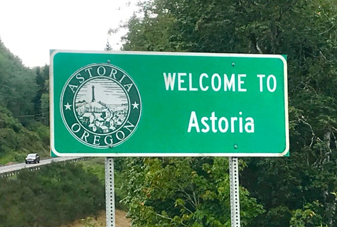
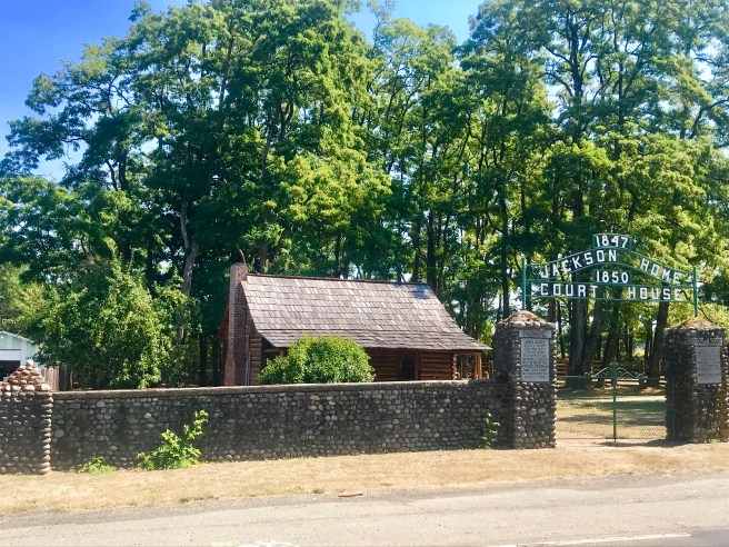
Not knowing anything about Astoria, I left it to Dale, who lived here 40+ years ago when he was in the Coast Guard, to show me around. We started out at the Lewis and Clark National Historic Park–a very cool place. After checking out the museum, we headed out to explore a reconstruction of Fort Clatsop, where the expedition party waited out the winter of 1805-1806 at the mouth of the Columbia River. Learning about the individual members of the company, including, of course, Sacajawea and William Clark’s unnamed black man servant, was fascinating.

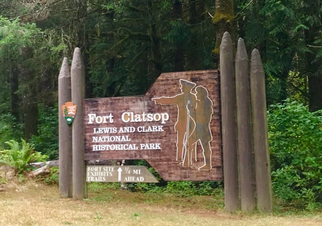
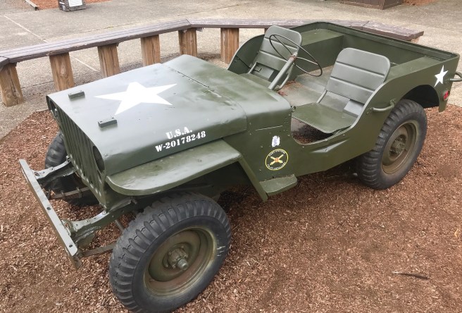
Then we were off to Fort Stevens, built during the Civil War to defend the mouth of the Columbia River. The museum was pretty much non existent, but there was a neat little World War II era Jeep, that brought back memories of Hawkeye Pierce. We were able to wander around two large bunkers with emplacements for artillery, and a third (Battery Russell) with a huge gun in place.

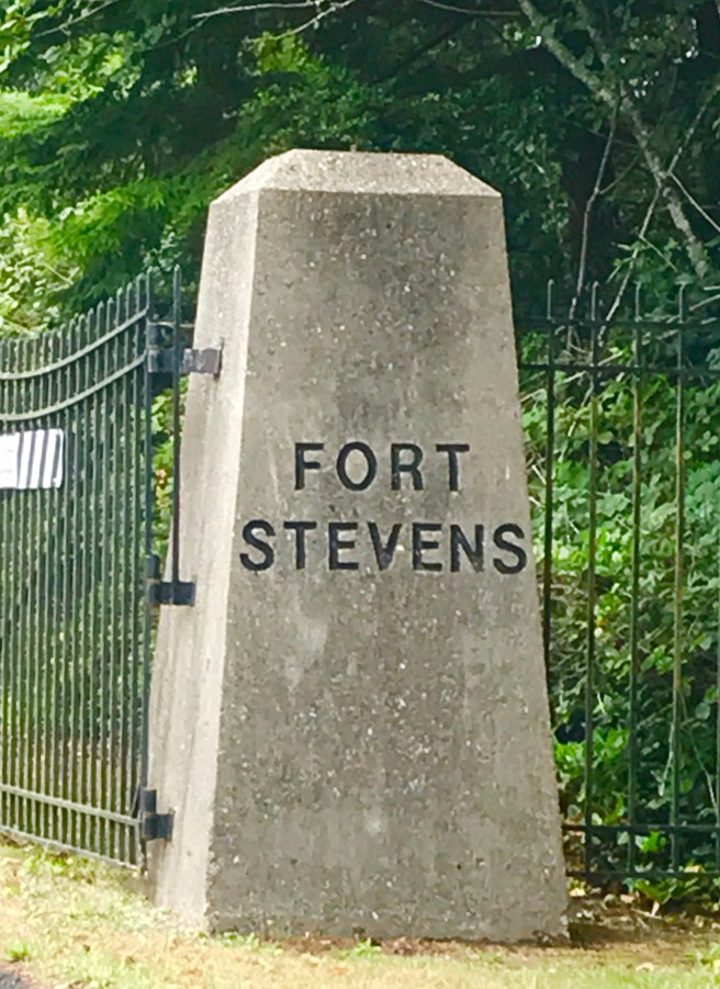
In 1942, the fort was fired upon by a Japanese submarine, making it the only military installation in the continental US to come under enemy attack. It wasn’t a very successful mission for the Japanese, as only one of the 17 fired shells hit land, and that one didn’t actually hit a target. How did the commander of the fort react to the attack? As much as the men on duty in the bunkers wanted to take out that submarine, he ordered them to stand down and hold their fire, as firing their guns would have given their position away to the Japanese. Smart fella, eh?

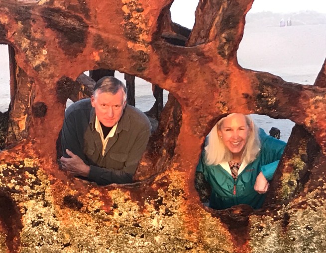
Here’s a photo of me with a replica of the artillery shell used by the Japanese.

We were not quite through with things military when we headed to our next stop, which was at the top of Coxcomb Hill, the high point overlooking the mount of the Columbia River. I’d been hearing about this thing called the Astoria Column all day, and now I was finally going to see what people had been talking about. Patterned after the Trajan Column in Rome, the 125 foot column is the world’s only large piece of memorial architecture made of reinforced concrete with a pictorial frieze that spirals upward, depicting the discovery of the Columbia River by Captain Robert Gray in 1792, the winning of the West and the arrival of the Great Northern Railway. Inside is a 164 step spiral staircase that leads to a viewing platform on the top. It is from there that we each launched a couple of cheap balsam airplanes to see how far they would fly. My first flight immediately spiraled toward the ground, then caught a draft and drifted upwards, above, through and beyond the trees for probably 7 minutes. After seeing my plane fly around, one little boy, who I’m thinking was 9 years, and who complained loudly as he followed us up the stairs to the top, exclaimed to his Mom that if she gave he a couple of dollars, he would go down to gift shop and buy a plane to send flying from the top. She gave him $10, and he was back shortly with enough planes for every member of his family to have two flights. Most of them lasted less than a minute, but his probably lasted 10 minutes. Amazing.

View from the Astoria Column

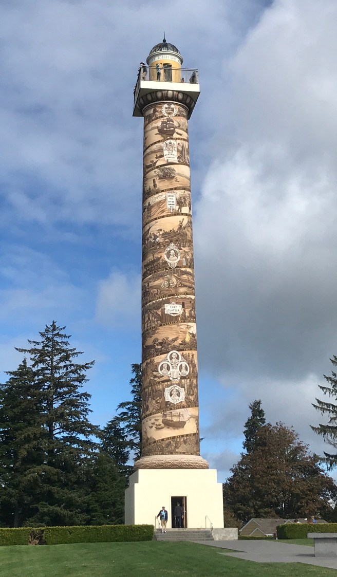
The next stop on my tour was the Astoria Riverwalk, where we made a quick stop at the Columbia River Maritime Museum–quick only because it was 40 minutes from closing. We watched a 3-D movie about hurricanes, then hightailed it over to the Dauntless, a Coast Guard Cutter that was docked nearby. The ship had numerous decals on the side of the bulkhead, each marking a millions pounds of either marijuana or cocaine captured by the crew. We didn’t count them all, but they have capture a lot!

Further down the Riverwalk are the city docks, a good part of which have been taken over by harbor seals, who lay around, bask in the sun, bark, fight, sleep, and otherwise prevent boats from docking there. They were pretty darned entertaining.

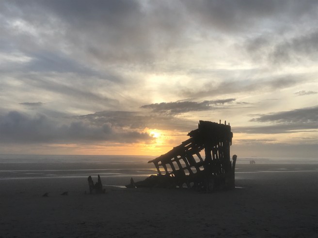
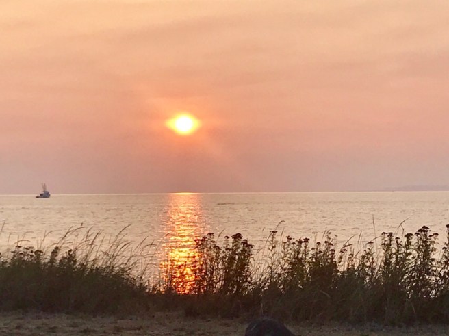
Our final stop of the day was Seaside, where we found a spot to watch another beautiful sunset.

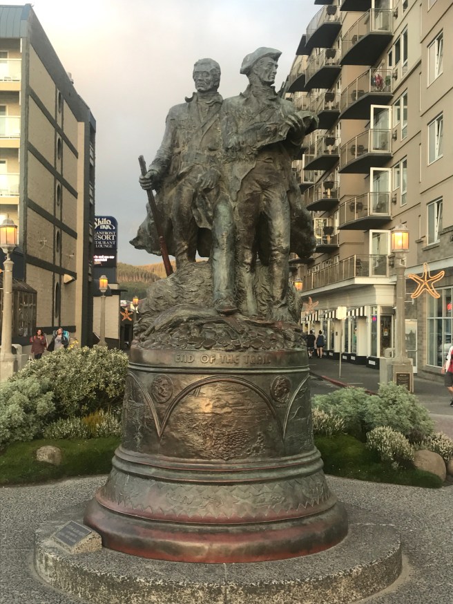
Thanks, Dale, for making the time to take me on a whirlwind tour of the best sights in and near Astoria! Had a great day!

8/29/18 – Kelso to Astoria, Oregon

52 Miles

2707 ft Climbed

Finally, today, I got out the door early. After a stop at Safeway to pick up some Gatorade and a couple of huge cookies. Cruising through downtown Longview, I road alongside the Cowlitz River and past Sacajawea Lake.
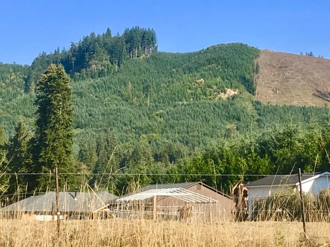
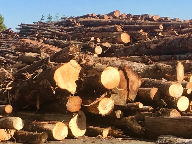
It is at this point that I missed a turn and didn’t notice it, because I was so distracted by the immense quantity of logs laid out before me. Never seen anything like it in my life!

Then, unexpectedly, I found myself at the Lewis and Clark Bridge crossing of the Columbia River. Thinking it should have taken longer than that to get to the river, I consulted Google Maps and was informed that I was on its version of the bike route to Astoria, Oregon. So I completely ignored the ACA maps and kept moving forward. Within five minutes, I knew that was a huge mistake, but for some stupid reason, I felt committed to my decision and stuck with it. I was now stuck on a 1.5 mile long 7% grade–the first of many I would encounter as the day wore on.

If there was a silver lining in this, it was the people I met at the first viewpoint I came to, which was at the top of that first grade. A gentleman named Mike Johnson, from Maryland, was stopped with his cousin and her husband, who are Swedish and whose last name is Johansson. They are on a long trip together in a van, and we had a great conversation about our travels, and cycling, and the joys of being retired and single, and other topics. It was a pleasure to be reminded of how nice people are throughout the world and how much we have in common.

Once back on my bike, the long steep climbs did not let up most of the day, ascending up to two miles at a time at grades of 6-7%. As I passed through Clatskanie, I was hoping for a place to stop for a snack, but no joy. This town had nothing to offer.

So I pushed on to Westport. En route, there was a billboard touting a place called the Berry Patch, where thousands of pies are baked every year. Now we’re talking–something to look forward to. And I was not disappointed. A bowl of homemade soup and a piece of warm marionberry pie with a scoop of vanilla ice cream were amazing.

When I went to mount my bike, again, an older gentleman inquired about my ride. As I talked to him, I realized that he is the owner of the restaurant and accepted his invitation for a private tour of his commercial kitchen, where he makes and bottles several varieties of delicious soups and jams that he distributes throughout the area. Fascinating and delicious stuff!

Back on the road, the route eventually met up with a pair of railroad tracks that it stayed relatively close to for a part of the rest of the ride, which, as you know, makes for leveler riding. And as I approached Astoria, I kept stumbling onto spectacular vistas.

How does a person who lives in such a rainy, wet place get the courage to build a house and live on a river?

The plan was to take a day off in Astoria, so my Portland friend Dale drove out to meet me and show me around, which is going to be REALLY nice. We got rooms in a really cool hotel/hostel called The Norblad, and headed off to see the sunset from the beach at Fort Stevens. In 1906, the Peter Iredale, a cargo ship, ran aground here in bad weather, and some of the masts snapped. This many years later, it is a really cool shipwreck. And the sunset was breathtaking.

8/28/18 – Centralia to Kelso

52.5 Miles

1427 ft Climbing

I got an early start today! Are you proud of me? I try to clean my chain and check the air in my tires every three days, but this morning, my pump would not push air into my tires. I needed to find a place to use a real bike pump to top off my tires. So I checked for bike shops near my cheap motel. The sporting goods store I reached on the phone told me that only one shop in town works on bikes, it is only open from 10 AM – 2 PM, and it is located at the community pool. Sounded a little weird, but I was desperate. The pool was not far off my route, so I went for it. Sure enough, the place was open, and the three people working there were all over helping me.

Turns out that they are a non profit that the city has donated the use of their old pool building to. They take donations of bikes and parts and use them to build working bikes that are given to homeless and needy people. In the 15 minutes I was there, six people stopped in to drop off or pick up bikes.

Dave, the guy who runs the place, advised me to not take the ACA route, for reasons I could have guessed, like unnecessary climbing due to use of obscure side roads. So I followed his route, today, and it worked out wonderfully.

I first rode through the historic downtown of Centralia, which I would have been routed around, had I followed the ACA route. Being a fan of monuments, I was not disappointed. Centralia was founded by a former African American man named George Washington. He is honored by a mural and a bronze of him and his wife going over their plan for the city.

And then there’s the town’s war memorial. It started with the names of World War I casualties, and moved forward through time to Operation Iraqi Freedom, where it appears to have run out of space. I’m sure they’ll fix it some day. They also had this cool monument with the following inscription: “We live in deeds, not years; thoughts, not breaths; in feelings, not figures on a dial.” I like that.

Heading on down the road, I came to Chehalis and the Lewis County Historical Museum. Truly, it was just an organized collection of old stuff.

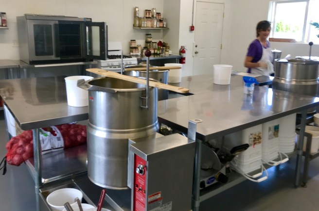
The coolest thing in the place? An iron lung in an employee only back room. When I was growing up, Polio still existed, and I remember hearing about polio victims being put on iron lung machines. When a couple of the employees saw how interested I was, they invited me back and plugged it in, so I could see how it worked.

As I rode on, I passed by some cool sights, including the Jackson Homestead, founded by a John Jackson in 1847 to house his young family. It’s location on the Cowlitz Trail, halfway between Puget Sound and the Oregon Trail, made it a natural rest stop for travelers, a civic and social hub, a grocery store, post office, hotel and U.S. District Court. All in that little tiny cabin. Can you believe it?

On down the road were a cool barn and farm truck, Lewis and Clark State Park, a Minion made out of tires (who will help me make one for my grandkids?), and a water tank with a cool mural on it.

Of course it goes without saying that along my entire route, again, were more tree farms. Big trees, little trees, perky trees, saggy trees, Christmas trees, and commercial lumber trees.

Toledo, the oldest settlement in Lewis County, is the gateway to Mount St. Helens. I considered taking a day to cycle up to Mount St. Helens, but decided that needs to be part of a separate trip.

In Toledo, the route changed directions and started following the Cowlitz River. then near Vader, it turned again to follow both the river and the railroad. You know what that means, right? That means it became less hilly and more flat, which is a nice way to end the day.

8/27/18 – Shelton to Centralia

59.8 Miles

1378 ft Climbed

You know my late start problem isn’t always my fault. The cheap motel I stayed in, last night, had already shut down their laundry facility when I arrived, so I had to wait for them to reopen it this morning at 9 AM to do my laundry. And then there was the problem of my dozing off while trying to catch up on two days of blogging. But that is all water under the bridge now. The fact is that I hit the road late again, so I felt pressure to keep moving to avoid arriving at the motel late. But once I got going, I kept finding reasons to stop.

The first stop of my day was in the town of Elma. The train monument in front of the post office is what caught my eye, initially, as my two year old grand baby, Lily, loves anything having to do with “choo choos”. When I stopped to take a photo, I noticed a couple of really cool monuments that told what the town is about–logging.

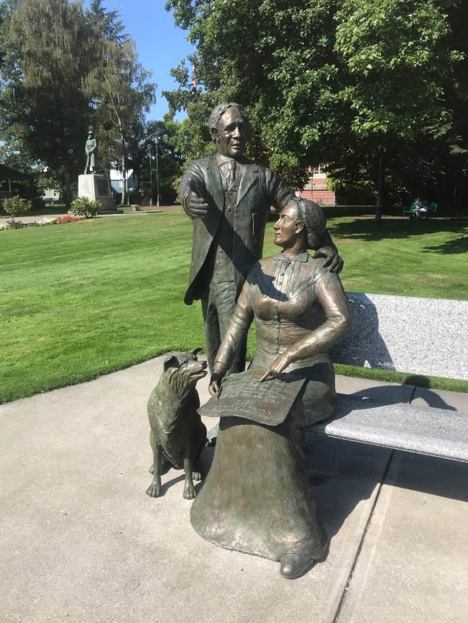
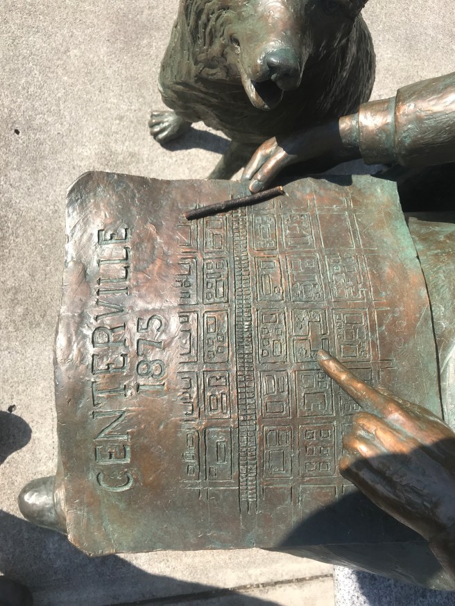
It is hard to see the detail in the bronze of a man. It corresponds to that statue in Blaine honoring the sacrifices of families of seamen, except this one honors the sacrifices of loggers–every day they do their jobs.

Moving down the road, the next town I came to was Porter, which, no doubt, is somehow in honor or memory of my friend Lloyd Porter. Even if it’s not, I thought of him as I passed the Porter bar which was next door to a cannabis shop.

It was at this point that I had to decided whether to take the winding ACA route, which potentially had a lot of needless hill climbing, like yesterday’s route did, or take a US highway that runs alongside a railroad track. Obviously, the route along the railroad won out. It passed through miles and miles of commercial tree farms and had spectacular views of the Chehalis River.

The town of Oakville claimed to be Timber Town USA, and I’m a believer. It had a couple of timber operations where a gazillion freshly cut logs were being processed.

I then passed trough the Chehalis Indian Reservation, with its very own casino. I had to stop to read the electronic billboard to see if I like any of the entertainers scheduled to perform there. I’m not into Randy Travis, but the “Fire Kitchen Buffet” caught my eye. But I was focused on the finish line, so I kept moving and staved off hunger with some chocolate chips and nuts from my feed bag.

My motel is next to an outlet mall, so I walked around the shops before grabbing dinner at Denny’s–my new favorite cheap restaurant.

8/26/18 – Kitsap Memorial State Park to Shelton

6.8 Miles

2569 ft Climbing

Did I mention that I packed a dress and dress sandals so I could go to church on Sundays when there is a church nearby? Today would have been one of those days, but I was still sleeping and spending time with Catherine and Nadia. We went to Denny’s, so I could load up on carbs and eggs, then they took me back out to Kitsap Memorial State Park to pick up where I left off yesterday. I hated to say goodbye.

This was the late start of late starts (12:30 PM), and I was facing down a 70 mile day with lots of climbing. I spent a few minutes studying the ACA route and Google Maps, then decided to shortcut the scenic route, so I could get to my motel in Shelton at a reasonable hour.

The first part of the day was hilly and wooded. I was so busy pounding the pavement to make up for lost time, that I didn’t stop to shoot photos. When I arrived Bremerton, I made a quick stop at Winco to resupply my hot cocoa and Gatorade, then rode through the old section of town near the shipyard.

The route followed Sinclair Inlet before heading toward Belfair.

For several miles, as I left Bremerton, the shoulders were littered with nails, screws, and metal parts and pieces, any one of which could have easily slaughtered one of my tires. I couldn’t take my eyes off the pavement for a second for at least an hour, which was nerve wracking. In Belfair, the Dairy Queen called out to me, so I took a break to make a couple of phone calls.

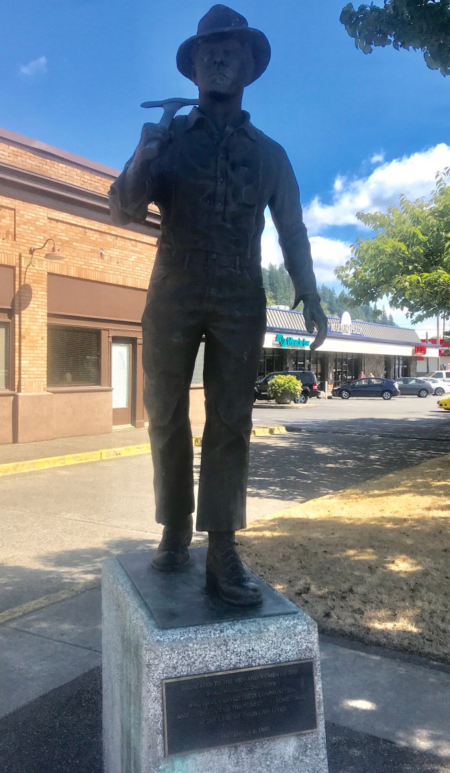
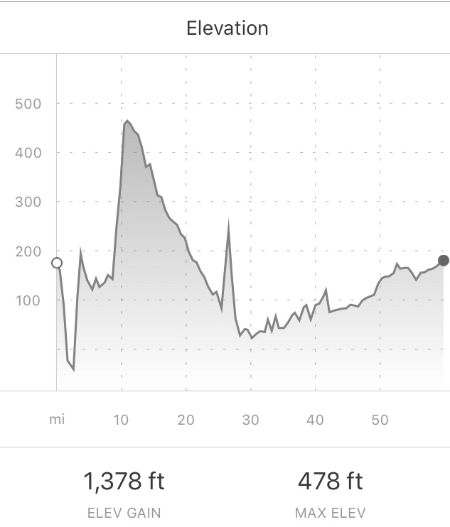
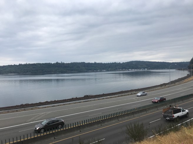
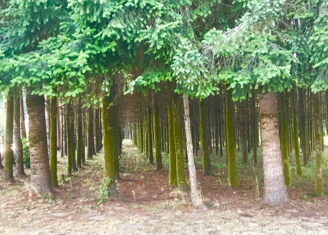
Once back on the route, I decided to go back to riding the ACA route. BIG mistake. Within minutes I was riding along a scenic section of the Hood Canal into gusty winds.

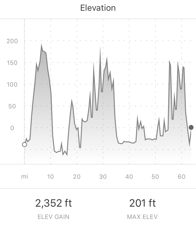
But there was hope, because after a few miles of that, I was going to turn inland, where there would be some tree cover. I was so looking forward to that, but as soon as I turned the corner to go inland, i was also going upward at the rate of what I think was a 15% grade (my Garmin wouldn’t even register it). Then came the ominous signs. Lovely.

To make matters worse, it started raining. I’m not complaining, but who ordered up this weather, and shy did ACA choose this road? Was God punishing me for not making it to church this morning? Thankfully, after a difficult mile or so, the road leveled out into rideable rolling hills covered with pine trees in various stages of growth.

I made it into Shelton before nightfall. I’m on a string of nights indoor that I’m afraid will spoil me. Hey, I deserve to be spoiled for a few nights.

8/25/19 – Deception Pass to Kitsap Memorial State Park

64.5 Miles

2277 ft Climbing

Another late start. What is it about me and late starts? It is just plain hard to drag yourself out of the sack for another long day in the saddle, but I had something to look forward to at the end of the day, so I did it. After heating up some oatmeal, I hit the road and started riding in morning mist.

The first town of the day was Coupeville, where there was a McDonalds, so I stopped for a bite of real food: a Bic Mac, a strawberry cream pie (thank you Dale Garcia for my newest craving) and a couple of cookies. I figured I would save the cookies for a snack later, but forget about later. I snarfed all the food down and was still hungry. My appetite is crazy right now.

I passed through an estuary, past a bunch of “Government Property Keep Out” signs (must be something top secret going on there, eh?), made a couple of wrong turns, then finally made it to the ferry terminal to catch the ferry to Port Townsend.

A group of old guys out for a drive in their cool cars

One of my favorite features of Washington State Ferries has always been the Iver’s Clam Chowder they sell on board. This was a smaller ferry, so I was worried they wouldn’t have food service, but they came through for me. One of the two best parts of my day!
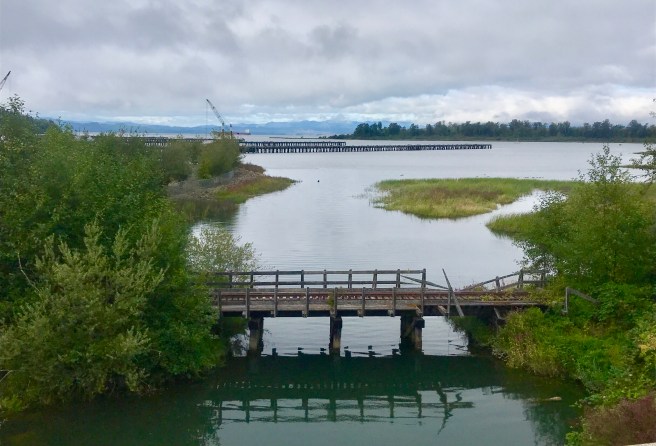
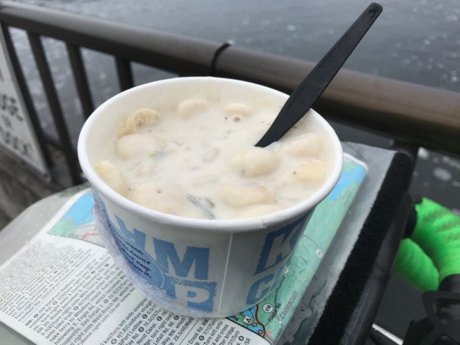
Back on land again, the route wound down to the water’s edge and picked up another scenic non motorized path for a few miles.

Once off the path, I was riding through beautiful, hilly ranch land that continued pretty much till I reached the

A little over a mile after I crossed the Hood Canal, I was at Kitsap Memorial State Park, where I had originally planned to camp. But Catherine Shewear had offered to bed me down at her place. She met me with her van, and we loaded my bike and gear into the back. We ran around to a couple of junk food restaurants to satisfy our cravings, then stayed up past 2 AM talking.

Granted, there is probably a lot of spectacular scenery along the Pacific Coast, but seeing Catherine and Nadia again will surely be one of my favorite memories of this trip. I remember when Nadia was just 10, and the Miami Dolphin cheerleaders came to Eskan Village. Catherine had bought her red pompons, and she was there to get their autographs, because she wanted to be a cheerleader someday. Nadia is now a beautiful young lady, and she has learned how to dish out Middle Eastern hospitality, just like her mother.

8/24/18 – Birch Bay to Deception Pass

63.6 Miles

2352 ft of Climbing

Rough day. I was wasted and couldn’t get out of bed this morning. And it was cold outside. But my schedule through Astoria, Oregon is pretty inflexible. So I drug myself out of the sack, packed up my gear and hit the road…..around noon.

Between Birch Bay and Bellingham, I passed through miles of small farms, Lake Ferrell State Game Refuge (no shots fired, thankfully), and the Lummi Indian Reservation.

Once through Bellingham, what I though was going to be a leisurely ride along the coast surprised me. I ended up climbing up and down on a Chuckanaut Road, which was built in the late 1800s so commerce could move between Bellingham and the southern cities via land. The road is cut into the side of steep mountains that drop off into the ocean, and must have been a delight (heavy sarcasm) to build. I read some info on the construction, and there was no mention of the number of men and animals who died working on the project, but surely there were many. Now, years later, the trees along the road are so tall and dense that you can barely get glimpses of the ocean, which is way, way, way down below. Along the road is Larrabee State Park, which looks like a popular hiking destination. I observed switchbacks and super steep stairways heading straight down the mountain. As much as I like hiking, my legs were burning from all the climbing, so I took a rain check on that.

Teddy Bear Bay was visible in one of the rare openings between the trees.

Once I got out of the mountains, it was back to rural farmlands and little towns. Passing through Bow, there was a sweets shop that caught my eye. I was craving something…anything…sweet. Coffee, no ice cream and little $6 cookies were all they offered. No joy.

Coming out of Bow, the route took me onto the Padilla Bay Shore Trail, a flood control project that is also a nice, little used, cinder walking and cycling path.

I checked the time, and the day was getting away from me. Once I got back onto pavement, it was a race against the clock to get to a campground for the night. I passed through the edge of Anacortes on my way to Deception Pass. Caught a photo of the bridge, before riding on to the campground, which is at the level of the water. Can’t wait to climb out of here in the morning. I’m betting the grade of the hill out of the campground is 12%.

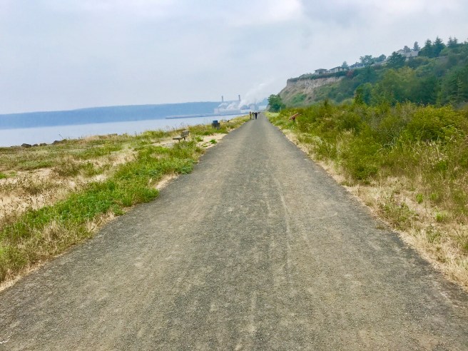
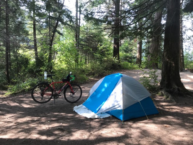
I shared a hiker/biker campsite with a young fella named Jack, who is hiking the Pacific Northwest Trail, a 1200 mile trail that stretches from Glacier National Park to Cape Alva in Olympic National Park. I’ll add that to the list of things I might do some day when I’ve finished all the things I want to do.

Tomorrow, I’m looking forward to meeting up with Catherine Shewear, a friend who made life in Saudi Arabia better for all of us who took her up on the tours and excursions she planned. She is currently living in Bremerton, and has offered to pick me up and take me to her place for a night indoors. Thank you Catherine!

8/23/18 – Vancouver to Birch Bay, WA

57.7 Miles

1935 ft Elevation Gain

Once again, I had a hard time getting my act together to start my first ay of riding. I need a crew!

Dale and I had a hard time saying goodbye to our accomodations for the prior evening. They were the forward and aft cabins on a boat docked in Vancouver Harbor. We both slept like babies, as the waves rocked us throughout the night.
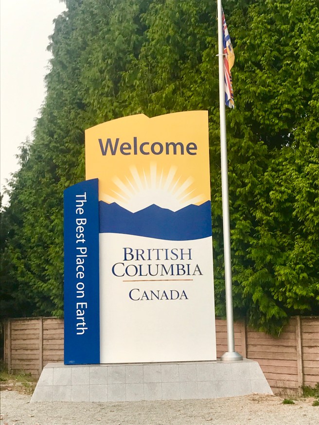
My start point was at Vanier Park, on the shore of English Bay and in front of the Vancouver Maritime Museum. I said goodbye to Dale, and headed out. Here’s the fully loaded rig. In a couple of spots, the ACA maps were tough to follow. The little bit below only makes sense when you’re looking at on a map. What you don’t see is that you are climbing bridge approaches and riding on super narrow sections of a bike path. The circled portion was more like a narrow single track mountain bike trail with about a 13% grade. Once I realized that that trail really was the route, I barely had the strength to push the bike up that baby. 
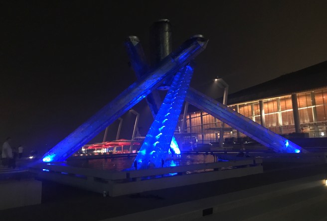
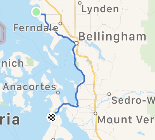
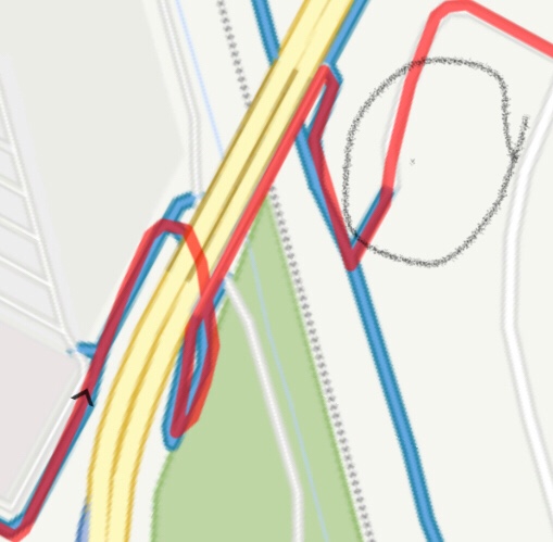
Most of the day’s riding was in city traffic with stop signs and traffic signals. Once I crossed over into the US, that thankfully changed for the better. 
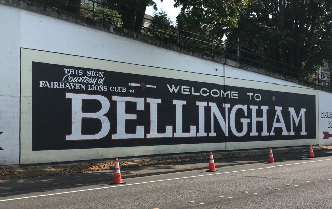
Blaine is a cute little town just south of the border. I took a little side trip to see the Peace Arch, which was completed in 1921 and sits on international land at the border of Canada and the US as a symbol of the many years of peace our two countries have enjoyed. This statue, named “The Vigil,” overlooks the harbor in Blaine and honors the loyal families of seamen.

Once outside of Blaine, there was little or no traffic, which was a nice departure from the first part of the day. The road passed through farm land and then followed the coast as it wound its way to Birch Bay, where I camped in a state park. Back when I crossed the border, the border patrol agent told me about a candy and ice cream shop just outside of my campground, so once I had my tent set up, I headed back to treat myself to a few delectable snacks. Okay, I’ll admit that I not only ate two scoops of ice cream and a large cookie, but I also loaded up on cookies and fudge, so I don’t starve tomorrow

After taking a 3 minute pay shower (that was NOT enough time!), I spent some time making a few phone calls and catching up on route planning before turning in. Long day.

8/22/18 – Portland to Vancouver

Yesterday, I made one more futile pass at shrinking my gear list, then hopped on a scale to see how much I am going to be pushing around for the next month or so. My gear and three days of food weigh 60 lbs, and my bike weighs 37 lbs. Add to that the water in the 4 water bottles, and I am starting out with 103 lbs every morning. That is crazy! Food is overrated. Maybe I’ll stop carrying it once I eat what I’m carrying.

I spent the morning tying up loose ends, so we got a late start on the trip to Vancouver, and the traffic around Portland and Seattle didn’t help. It was horrible.

We finally made it to Vancouver and had a little time to catch a bite to eat and walk around Canada Place, before turning in for the night.

The 2010 Olympic Cauldron

I am both excited and nervous about starting the ride tomorrow. Once I get a few days under my belt, there will be less anxiety–I hope.

8/21/18 – Final Preparations & Portland

If you just received this post out of thin air, back up and read the link above about my upcoming Pacific Coast solo ride from Vancouver, B.C. to Mexico.  It explains how I got to this point, after last year’s transcontinental tour.

Roll the clock forward.  I have been sorting through gear and clothes for a few weeks.  Last week, I packed my panniers and handlebar bag with my final gear choices and went on three rides–fully loaded.  Whoa!  That was a killer in the Arizona heat!  On the first ride, I had to use my granny gear just to get up 4-5% grades, but on my third ride, I was able to do the .4 mile 10-11% hill at the end of Chandler Boulevard without falling over or coming to a complete stop—a sure sign that I am ready for the tour.

Sunday night, I was up all night getting ready for my flight to Portland, Oregon the following morning.  I loaded my handlebar bag and panniers into a large box.  After  disassembling my bike, I wedged the frame and all the parts into a bike case.  Hopping on a plane Monday morning, I was in Portland that afternoon.

Tuesday, I reassembled my bike, hunted down some ultra lite fenders (surely there will be rain on this tour), and had a Performance Bike mechanic check the adjustments on the derailleurs and dropouts.  With just a few more preparations, I will be completely ready for the tour.

I am not including a complete gear list as I will basically be using the same setup I had on the transcontinental tour, last year, with a few improvements.

  • Replaced the Costco down quilt with a real sleeping bag
  • Added a Spot Tracker Gen3 GPS tracker to enable daily satellite communications with friends and family who worry about me
  • Added Tubus front racks and Ortlieb front panniers
  • Added a front and rear fender
  • Added a seatback water bottle holder to replace the bottle capacity lost when the front racks and panniers are installed.
  • Got rid of the orange lunch box that was formerly my racktop bag.
  • Added a cooking setup that includes a butane stove, a titanium pot,
  • Added to my electronics a larger capacity multi-charger and a higher capacity Anker charging blocker, as well as a Garmin Varia Rear Radar unit, a Spot Gen3 Genand an electric toothbrush
  • Added a dress, dress sandals and tennis shoes to my clothing
  • Added a Kindle HD Fire and compact keyboard for blogging

Tomorrow morning, we will be loading my bike and gear into the back of my friend Dale Garcia’s pickup truck and heading for Vancouver.  He will ship my bike case back to Phoenix for me along with the gear I weeded out here in Oregon and the tools that were needed to assemble the bike.  I won’t be needing that box in San Diego, as I’ll be renting a car to drive my bike home to Arizona.  We are hoping to have some time in Vancouver to  take the Hop-on-Hop-off tour of the city.  It will be my last day of goofing off before the pedal hits the metal on this ride.