6/28/2021 – Glacier National Park to St. Mary, MT

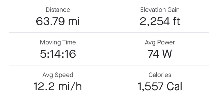
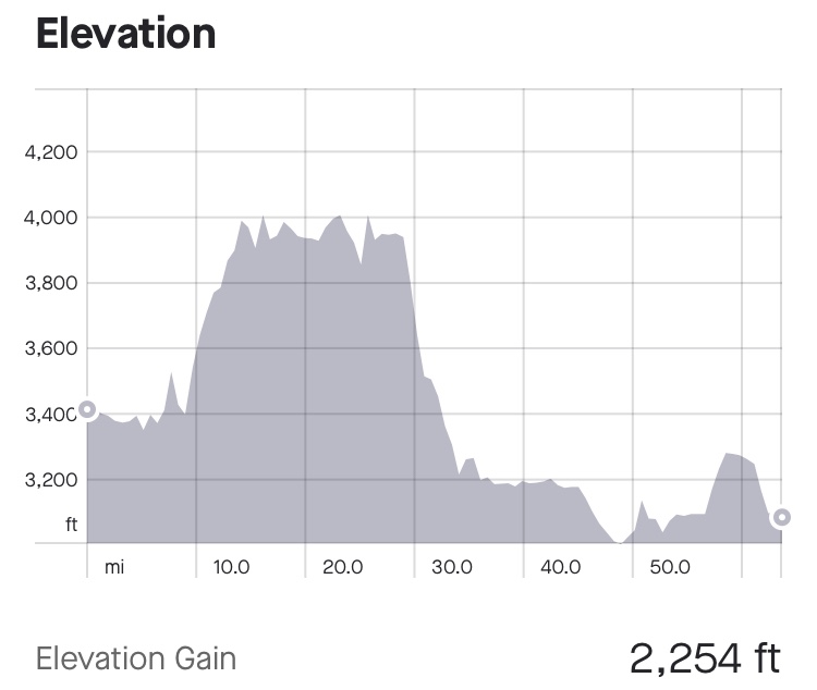
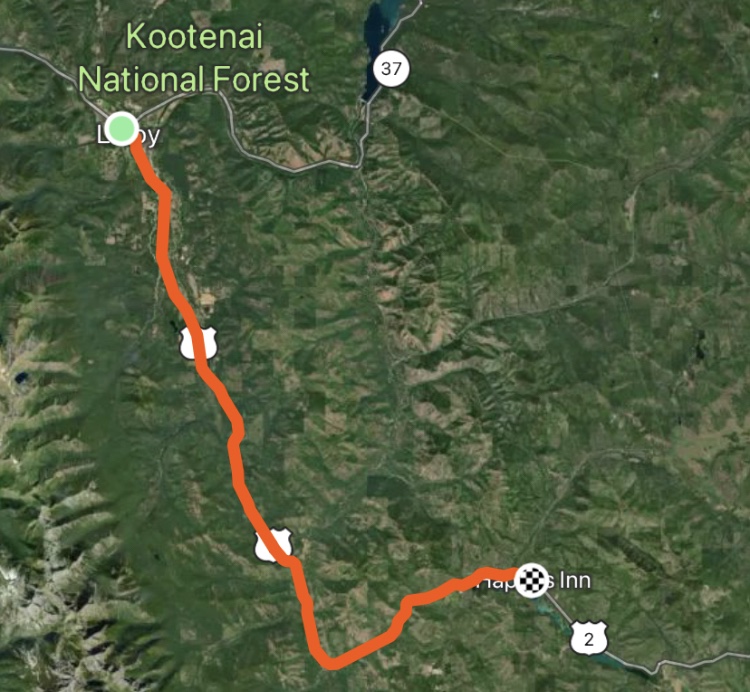
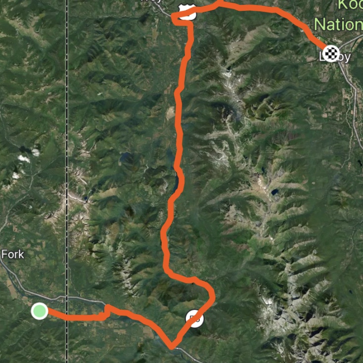
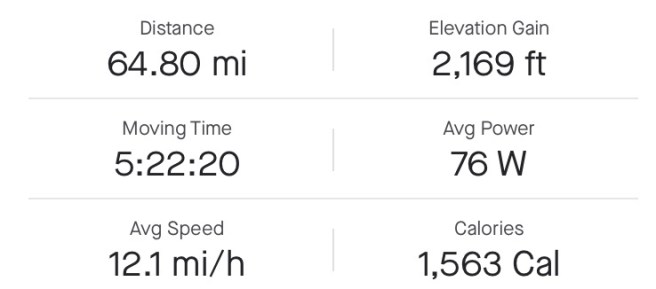
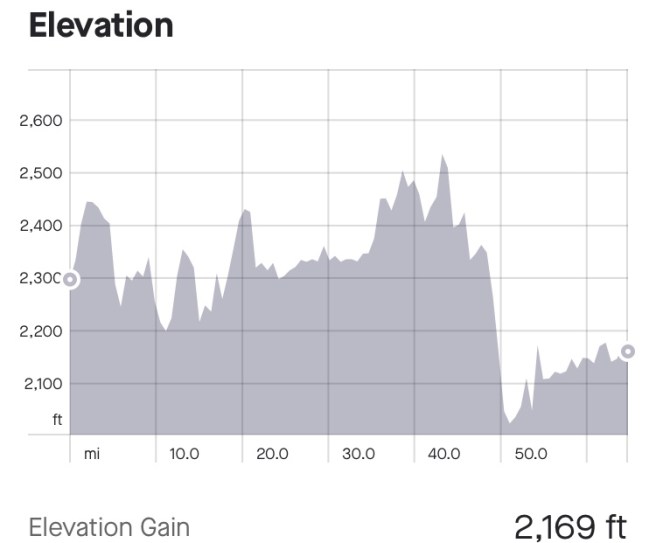
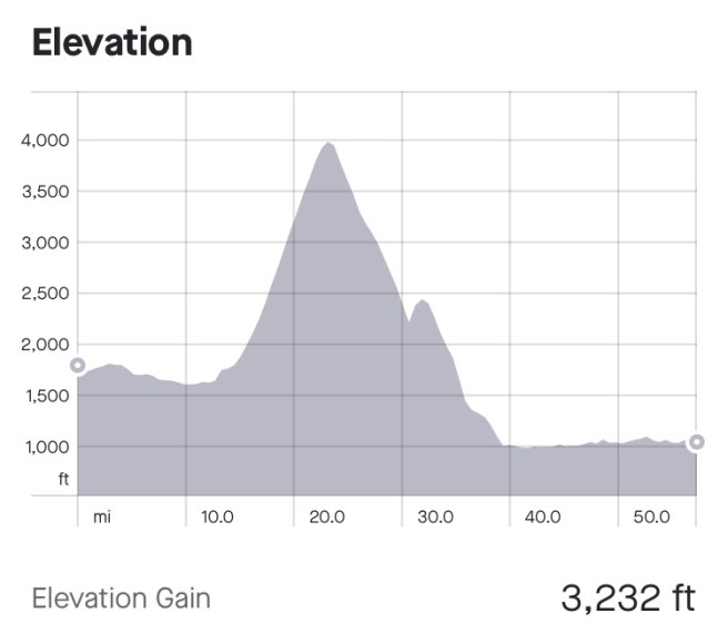
41.35 / 743.52 Total Miles

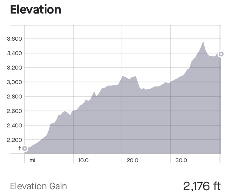
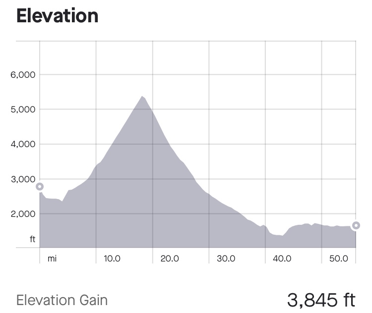
3819 Ft. Elevation Gain / 39,595 Ft. Total Elevation Gain

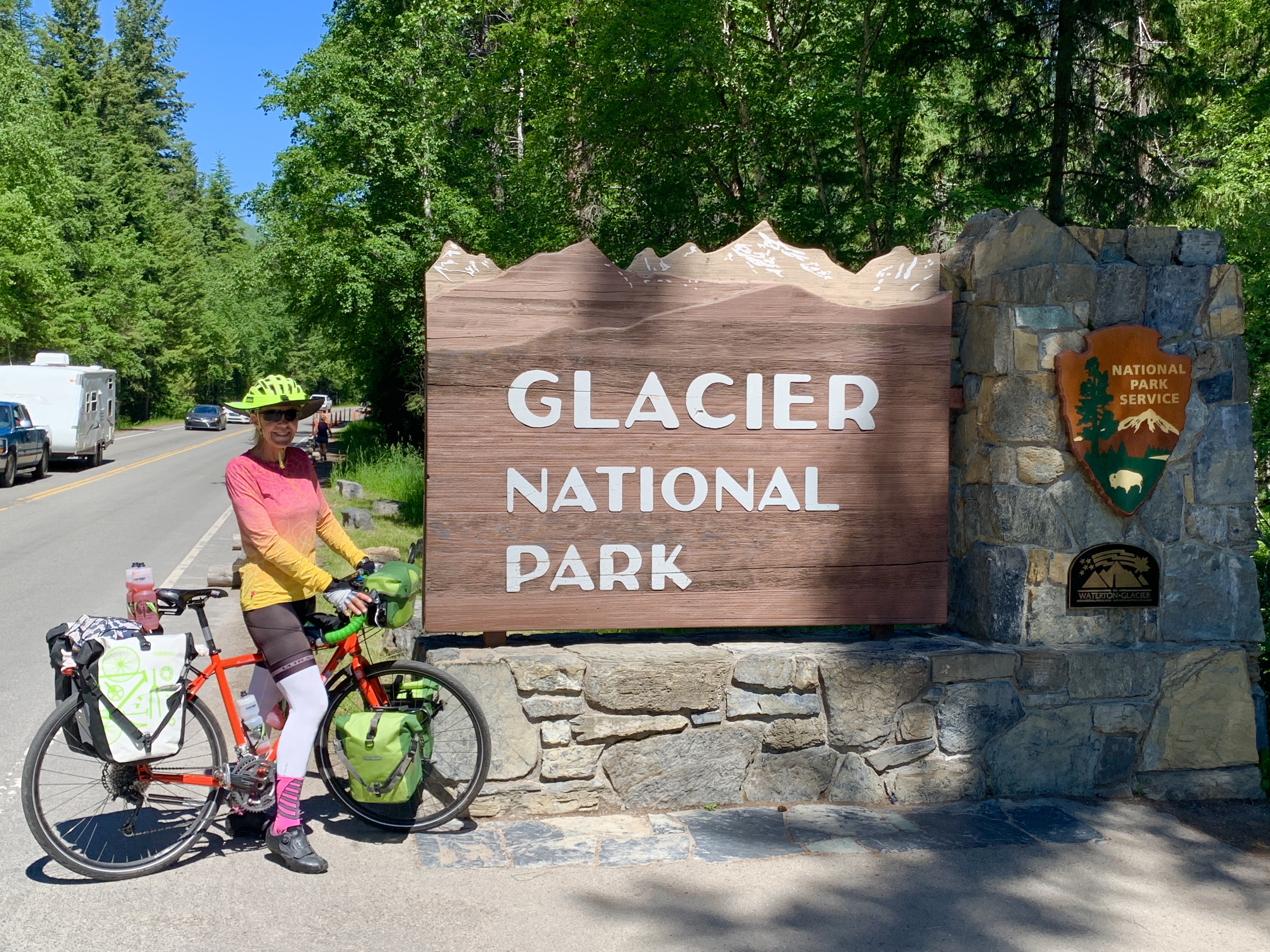
Snow plows have been working feverishly for weeks to clear the road at the top of Logan Pass, so cars and bikes could drive to the top.  About a week ago, the Parks Service started allowing bikes to climb the pass, as long as heavy equipment wasn’t on the road.  Then 3 days ago, the road at the top of Logan Pass was finally cleared, and cars were allowed on the road.  Cars with Entry Reservation Tickets, that is.  It is such a well known scenic drive, that the Parks Service had to find a way to reduce the number of cars going up the pass, so they instituted a reservation ticket that you must have to even enter the park, and a small percentage of the people who would like to drive up to Logan Pass get to.  The 3 days the pass has been open have been very busy, per our campground host, Ed.

Our 4 AM wakeup call, this morning, was to ensure we were on the road by 6:30.  The pressure was on to make it up Going to the Sun Road by 11 AM, when bikes have to be off the road.  When I woke up, it was cold and dark and I knew there were evil mosquitos lurking outside my tent.  I did NOT want to go out there.  So I did everything I could to get ready from inside my tent, then I threw myself on my sword and faced the enemy. And the enemy just kept biting me.  

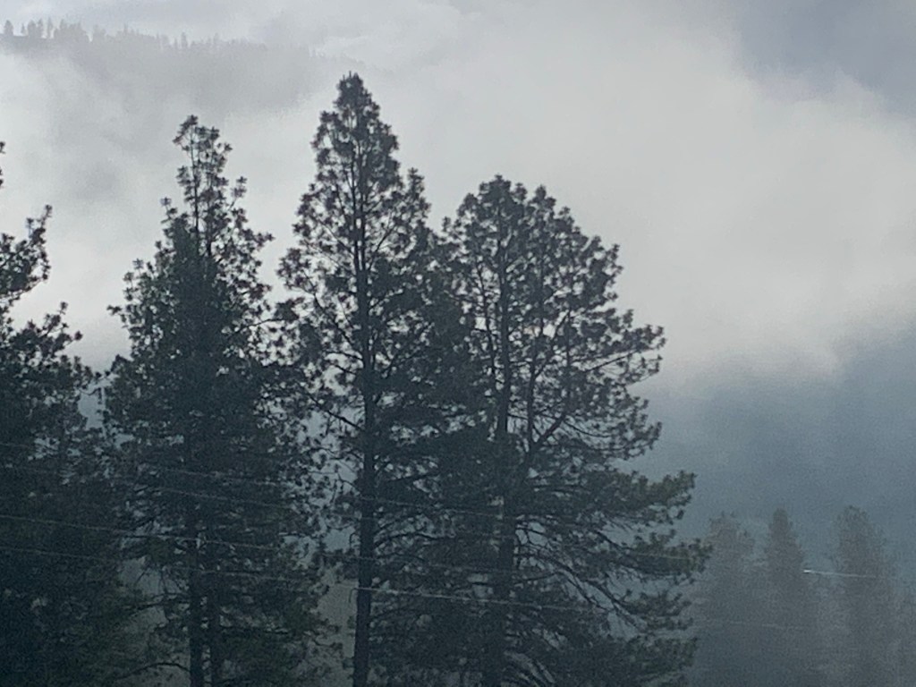
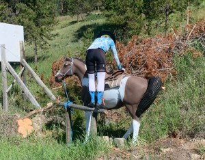
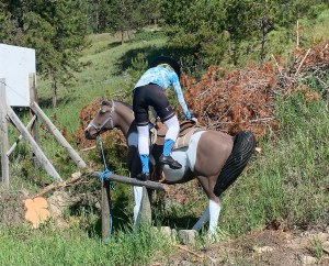
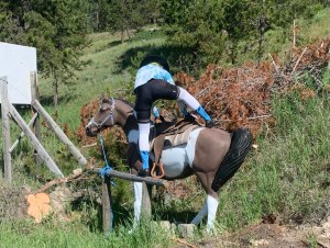
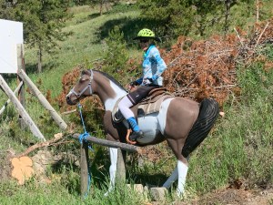
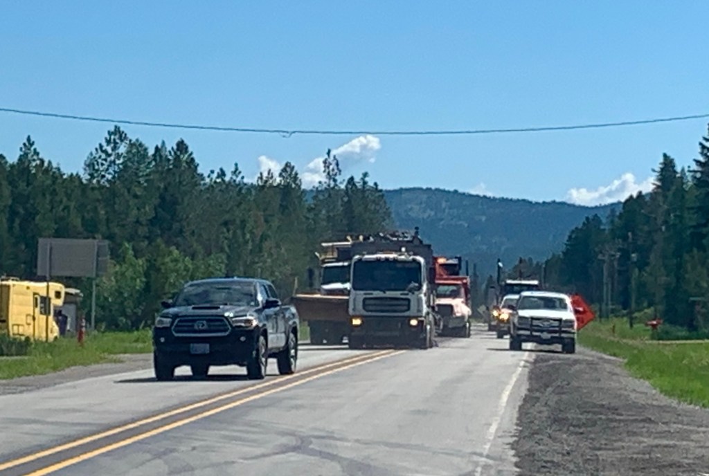
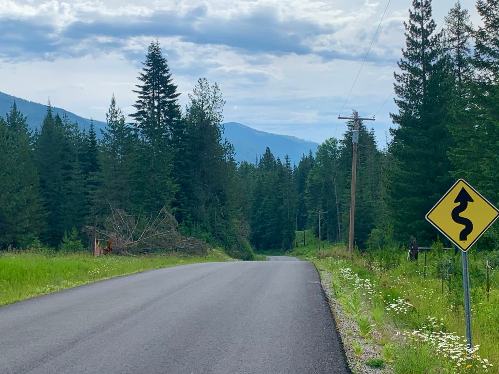
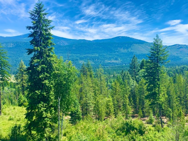
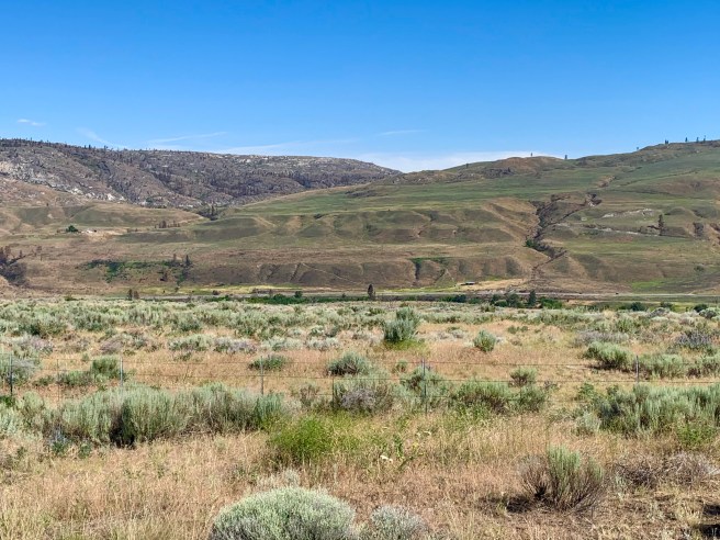
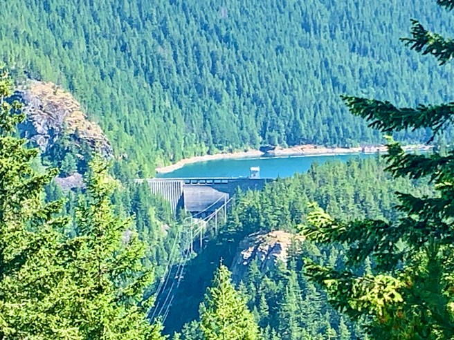
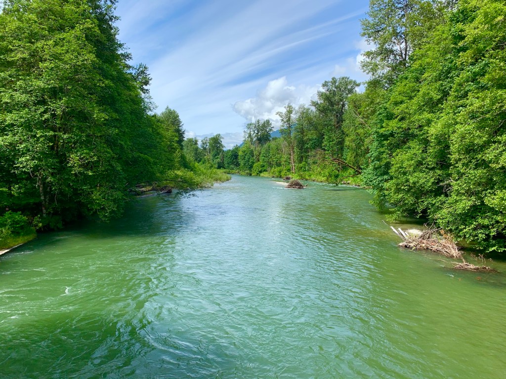
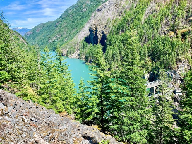
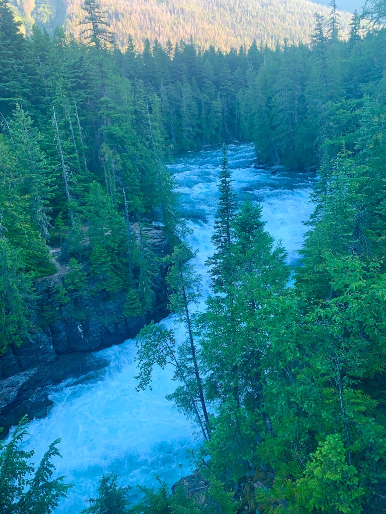
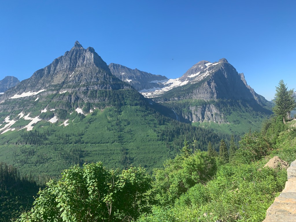
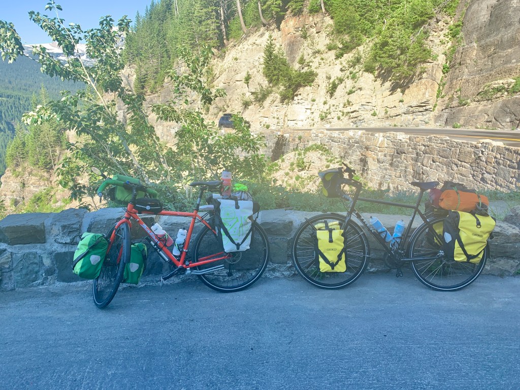
We got on the road at 6:35, and the first 12 miles of the road were somewhat flat, with just a few little rises here and there, as we rode past the northern part of Lake McDonald; jagged, snow capped peaks; cascading creeks and waterfalls; and the raging, roaring McDonald River.  Then the road turned steep, and the climbing began—heavy duty climbing, as in a steady 6% grade, with just a few short sections of 5% thrown in for temporary relief.  The 10 mile climb took us 2.5 hours, and during that time, we were surrounded on all sides by amazing views.  I can’t even guess how many times we stopped to take in the views and snap photos.  Probably a zillion.  

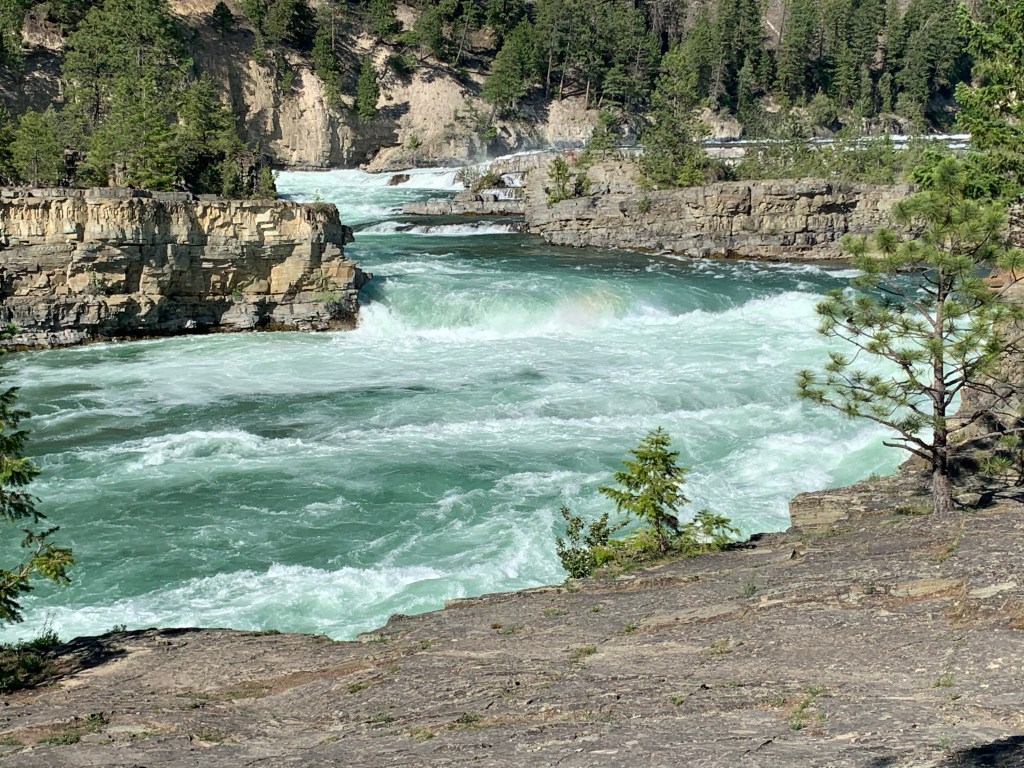
On a bike, you can hear the roaring of the rivers, creeks and waterfalls throughout the climb.  I’m thinking that from a car, you wouldn’t hear most of it, because where cars stop, there are other cars stopping, and the commotion drowns out the sounds of nature.  Also, on a bike, even though you should hug the right side of the road, you don’t want to, because there is a steep drop off, and the barriers are only 18-24” tall.  So we rode out in the lane, and cars had to find their way around us.  We were moving along at 4-5 miles per hour, so pretty much every car on the road had to pass us.  And we appreciated the fact that they were respectful and gave us our space, so we could live to see another day.

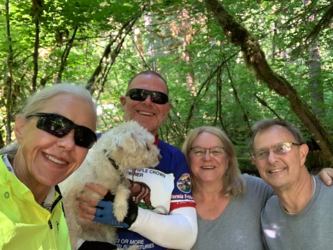
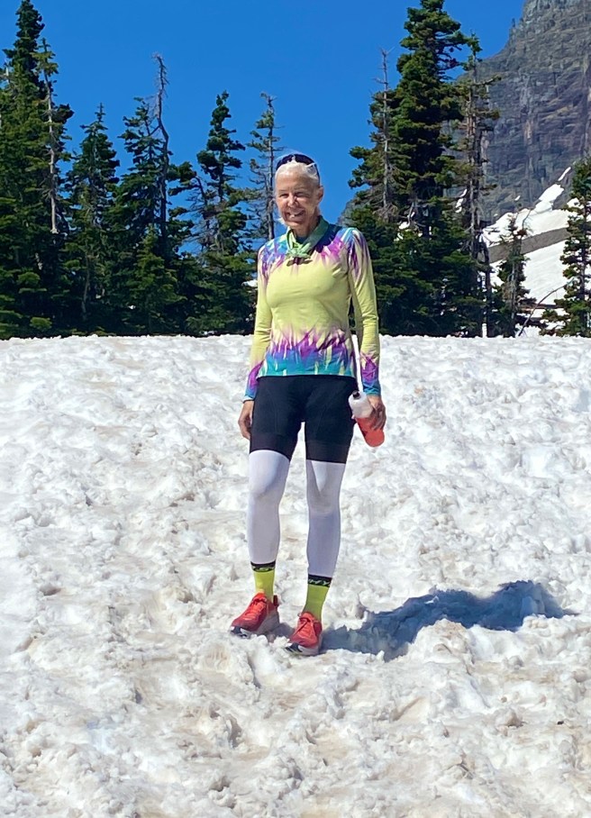
We spent a few minutes at the top posing for photos, looking around outside the visitor’s center, talking to folks about our ride, etc., then we hit the road for an amazing descent. 

We met so many people at the various view points along the road, who stopped to ask us questions about our ride or to just encourage us.  At the top, Diane Levy, who rode her bike across the Northern Tier 30 years ago, approached us to reminisce.  She did this ride before the advent of fancy bikes, ultra lite gear, weather aps, with up to the minute weather forecasts and sophisticated maps and GPS’s, which have definitely made these types of ventures easier to succeed at.  I was super impressed.  

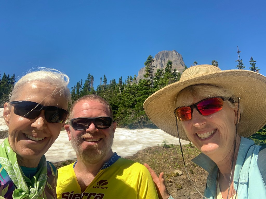
Also, at the top, we met a 77 year old gentleman named C.A., from Wichita, Texas, a suburb of Dallas. He was a super engaging guy who brought his grandkids on this dream vacation, which I hope to still be doing when I’m his age. I need great examples like him. Thanks for looking after our bikes and keeping us company at the top, C.A.

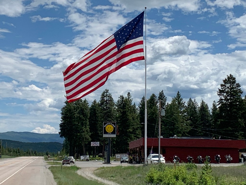
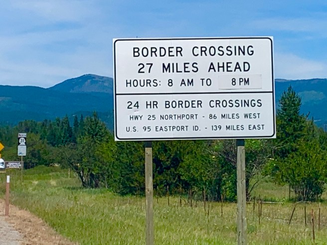
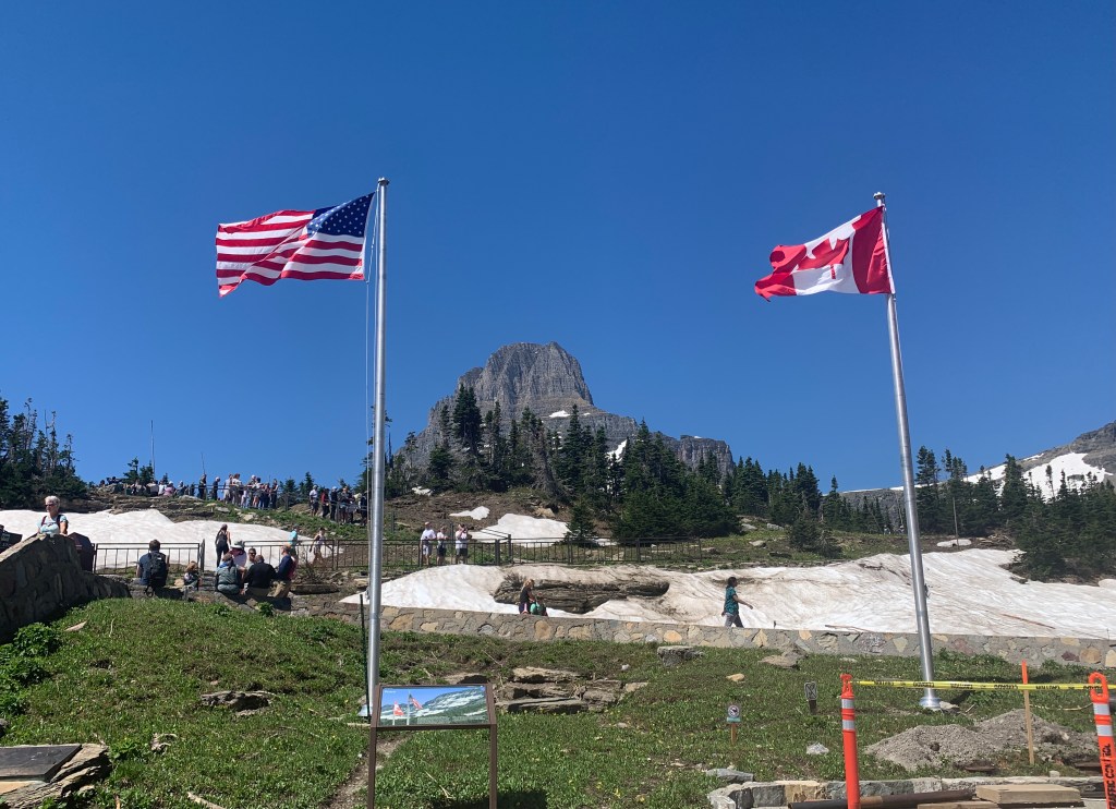
The US and Canadian flags represent Glacier National Park in the US and Waterton Lakes National Park in Canada, which are adjacent to each other, divided only by the international border. The Canadian Parliament and U.S Congress together designated them the Waterton-Glacier International Peace Park.

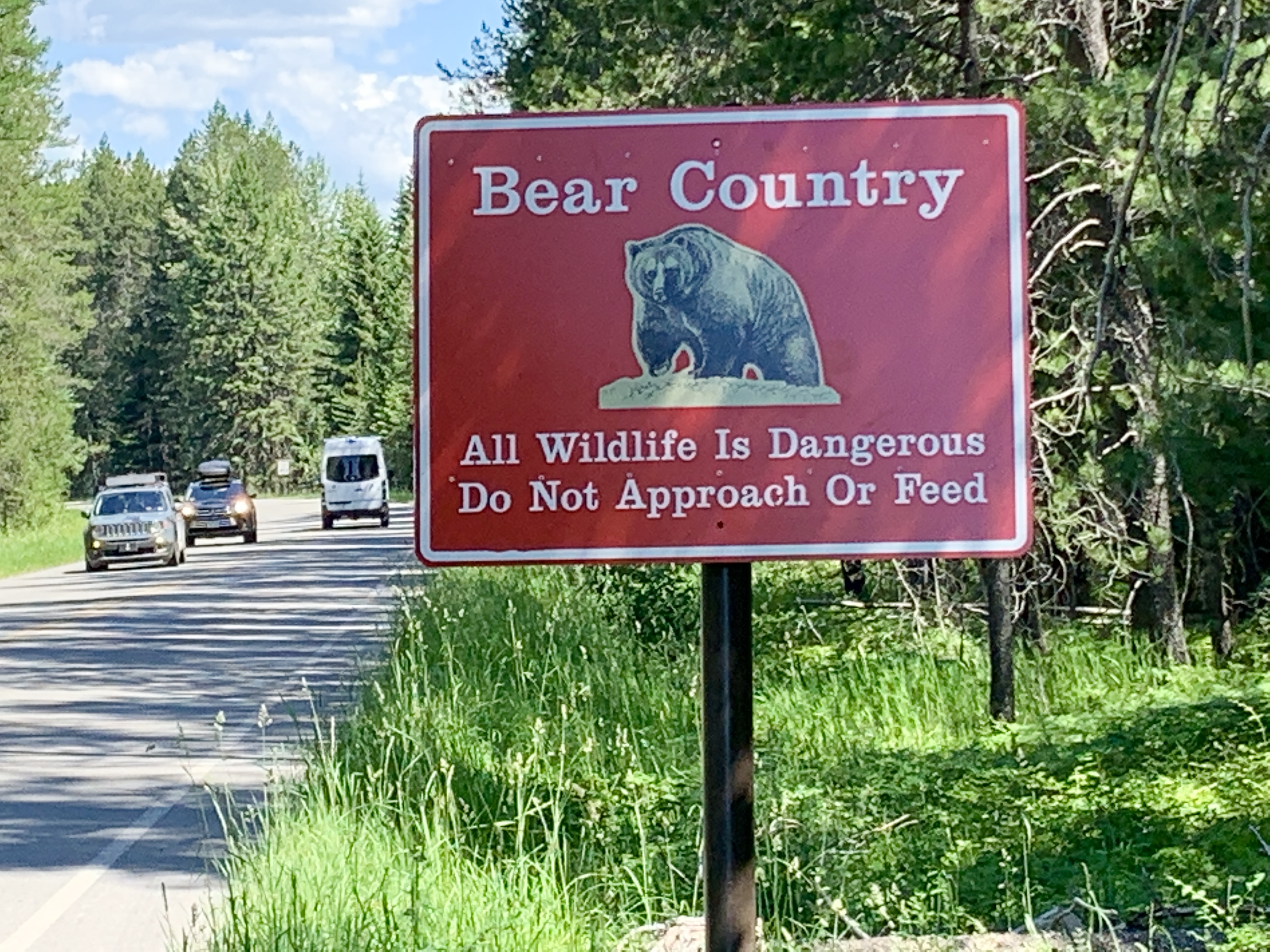
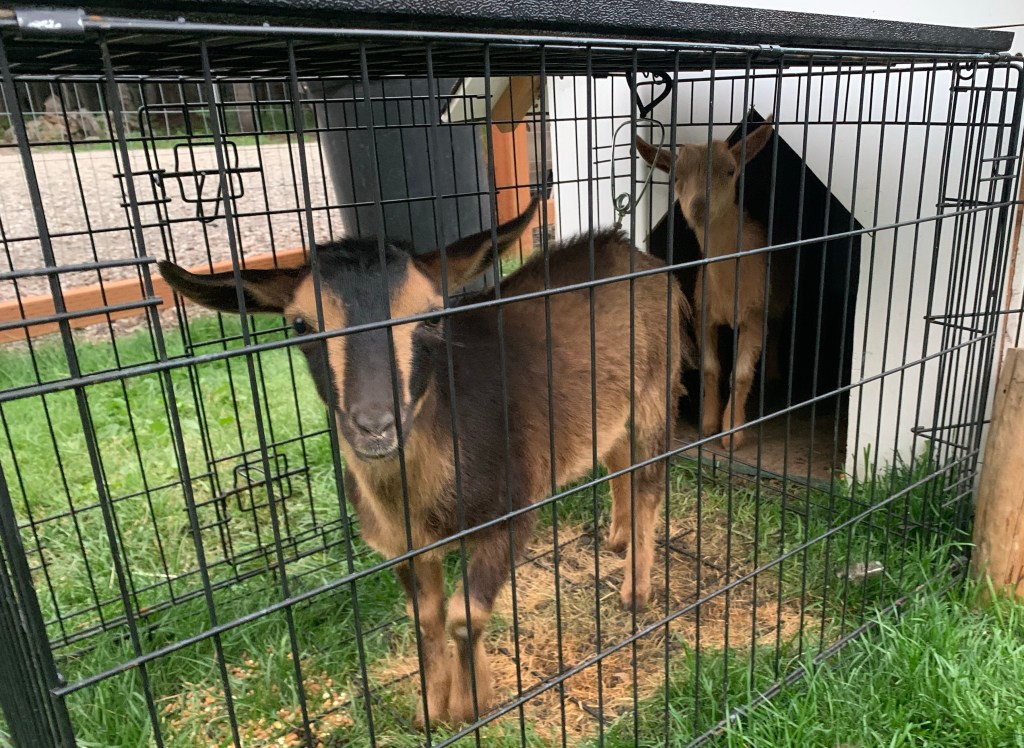
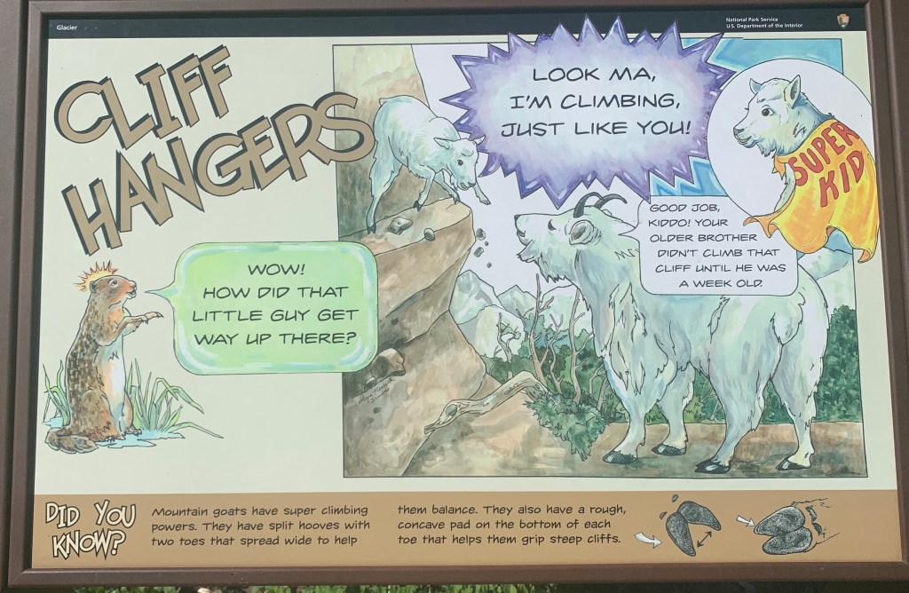
On the wildlife front, I was expecting to see bear, mountain goats and big horn sheep, on the road at some point, but they were hiding out, possibly due to the traffic or heat. I was disappointed to only see one deer, 3 big horn sheep from a distance and some yellow bellied marmots. 

National Park humor.
Crazy Guy on a Bike, Ed Craft, with the closet thing to a wildlife encounter either of us had.
Leaving the parking lot at Logan’s Pass, our destination was St. Mary.

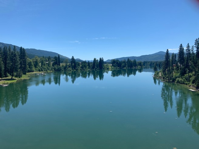
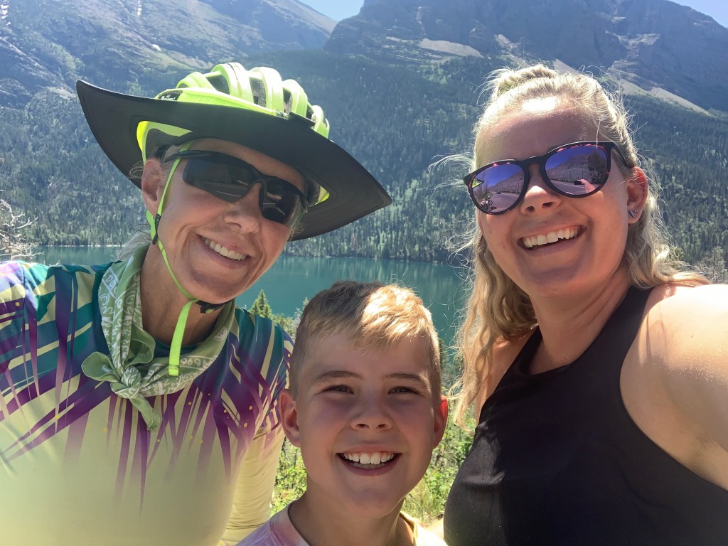
Ed got ahead of me on the descent, because I kept stopping to take photos of the other side of the park and Lake St. Mary.  And as I was pulling out of one of the view points, a little Subaru pulled past me, slowed down, then slowly backed up.  Almost like they wanted to ask me  question.  So I stopped and looked over at the people in the car, and it was people I knew!  Julie and Remington Blackhurst from American Fork, Utah!  It was so amazing to see them here in Glacier National Park on the Going to the Sun Road.  Small World! Julie is a single Mom who does everything she humanly can to see that her son lives the fullest life possible and that he sees and experiences the best things that life has to offer, and today that was Going to the Sun Road. She’s an adventurer, and she’s creating the next generation of adventurers.  Someone has to do it.  I love that girl!  Before we parted ways, she treated me to a few Rainier Cherries and a bottle of cold water, which I ended up needing to make it to the campground in St. Mary.  

Me with Remington and Julie Blackhurst, aka Super Mom
St. Mary Lake
More St. Mary Lake. Wow! It’s beautiful.

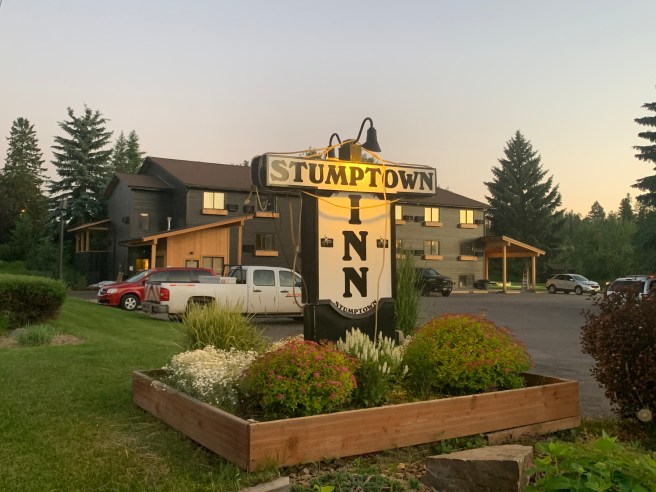
When I finally made it down to the bottom, Ed was waiting for me at the Visitor’s Center. We rode up to our campground, and on seeing the scorched earth and lack of shade, made a split second decision to stay in the cheap motel next door.  Temperatures were in the mid 90s, and it was only 1:30 PM.  No way were we going to sit outside for 8 hours, waiting for the sun to set and things to cool down.  The motel rooms didn’t have air conditioning, but being indoors with a fan still beat sitting out in the heat.  We showered, went out to find lunch, then napped and attempted to work on our blogs, which didn’t work, due to lame wifi.  At dinner time, all 3 of the restaurants in St. Mary were overrun with patrons, so eating out was out of the question. We ended up eating another Hungry Man entree from the grocery store and regretting it. Maybe we learned our lesson, this time.

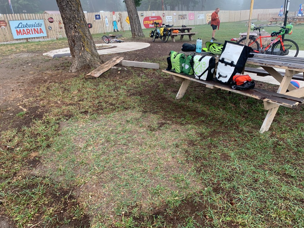
We spent some time today swapping our camping arrangements for motel arrangements for at least the next few days.  To make hot to Maine, we need to avoid heat stroke.

6/27/2021 – Whitefish to Glacier National Park, MT

6/26/2021 – Whitefish to Glacier National Park

43.9 Miles / 702.16 Total Miles

1460 Ft. Elevation Gain / 35,776 Ft. Total Elevation Gain

Our agreement was to be up early and hit the road early, this morning.  Not too early, though, because we had a short day—just a little over 40 miles.  We were headed to Glacier National Park and had allowed extra time to do some sight seeing, but we had a few other things on our agenda too.  As I mentioned yesterday, bicycles can only be on Going to the Sun Road between the hours of 7 and 11 AM.  We were planning to stay in Avalanche Campground, which is as far up the Going to the Sun Road as you can stay, before the point in the road where the cycling restriction begins. That way we would have less miles to ride in that short timeframe tomorrow.  But Avalanche doesn’t have a shower, so we were going to take a shower at the only campground with a shower, Apgar, then cycle up the road to Avalanche, all the while hoping not to break a sweat.  

We were on the road by 7:35, which for me is early, but once again, as were started out, we had difficulty getting going with our navigation.  Ed’s Garmin was telling him to go one way, and mine was telling me to go another.  How is that even possible?  We had to rely on our paper maps and RideWithGPS to figure out which way we should actually go.  Problem solved.  We moved ahead. 

The first part of the day, we rode along the train tracks that pass through Whitefish, till we turned off onto several really nice back roads.  Back roads are the best for scenery, traffic (as in much less of it), and seeing where the locals really live, work and play.  Today’s ride was cool, scenic easy on the legs—just a perfect little Sunday ride.  As we cruised down one of the backroads, we noticed a couple of cyclists up ahead.  The trailing rider had a distinctive Adventure Cycling safety triangle hanging around her waist, so as we approach her, I hollered out, “Where did get that Adventure Cycling safety triangle?”  And she responded, “I’m on one of their rides right now.”  Turns out that she just graduated from high school, and she and her dad are riding one section of the Great Divide Mountain Bike Route together, which is a pretty big undertaking for a youngster like her. I was very impressed!  Needless to say, we blew past them and probably at the next turn, they went the other direction, because we were heading northeast and they should have been heading south toward Helena.. 

Once again, we were close to the Canadian border
The North and Middle Forks of the Flathead River converge here

So with our early start, we arrived before noon at West Glacier, which is kind of like West Yellowstone—a tourist area just outside the park with shops, food, etc.  We stopped to pick up some postcards, SPF lip protection (Ed ran out of his and mine fell out of my top tube bag somewhere today), and a huckleberry shake, then headed down the road to actually enter Glacier National Park.  

Our daily Yeti/Big Foot. Ed actually bought one of these refrigerator magnets.
This place served up the huckleberry shake. It was scrumptious!
We were duly warned, but sadly, we never saw a bear.

Once in the park, we scoped out the wifi and cell phone service.  There wasn’t any to be found, so we set out to do some sight seeing, but there wasn’t much of that either.  We stopped at Lake McDonald, and it was spectacular–beautiful beyond words, but there was no place to put on a swimsuit, and my 16” x 36” pack towel would not have worked as a place to sit or a way to dry off.  So after hanging out for a while and chatting it up with some other tourists, we headed for the visitor’s center.  Wait—what visitor’s center?  What was called a visitor’s center was nothing more than a gift shop, and there was a line to get in.  And we don’t have room to be toting gifts around anyhow. So we decided to have our lunch in the shade in front of the visitors center, before heading to a nearby campground to take a shower.  

As we sat there eating our lunch, we somehow connected with a bushy haired fella named Ed, wearingy a park volunteer shirt, who\ seemed to have the lowdown on the campgrounds and the rules for riding on Going to the Sun Road.  He straightened us out on a few things.  First, Avalanche Campground is closed, due to Covid, so staying there is out of the question.  The next closest open campground before the cycling restrictions was Sprague Creek Campground, 6.4 miles less up the road. Another change:  The entire length of Going to the Sun Road is actually closed to cyclists from 4 PM to 7 AM, and our campground was on said road, so we would not be able to cycle up the road to Sprague Creek Campground until 4 PM.  Okay, so now we had 6.4 mile further to ride tomorrow and an extra 3 hours to burn today, before riding up the road to our campground.  We took our showers, then headed to shady areas of the amphitheater to wait for the road to be open to cyclists, then headed up the road.  And we did break a sweat.  

Me, Special Ed and Higher Ed (they like those nicknames!)

Lake McDonald is huge, and our campground was adjacent to it. And what comes with large bodies of water? Grrrr! Mosquitos! The mosquitos were evil and relentless the entire time we were in the campground.  I felt like I needed a blood transfusion before I even finished setting up my tent, and I couldn’t find my super duper bug spray anywhere, so had to borrow some of Ed’s.  For dinner, we tried 2 varieties of backpacker’s freeze dried beef stroganoff, and my Mountain House entree lost hands down to Ed’s Peak entree.  Then after dinner we headed in separate directions to take a swim in the lake, and as cool and refreshing as that sounds, the rocks we had to step on as we waded out in the water killed our feet. I’m talking serious pain!  I had to get down on all 4 to get back to shore.  I don’t know how Ed managed.

Shortly thereafter, we went to bed, and it wasn’t even dark outside. As most of you know, I’m a night owl, so this is not my way. What is happening to me?

I’ve seen some pretty cool tents, on this tour. At least you don’t have to take this one down, if you have to move your car.

6/26/2021 – Zero Day in Whitefish, MT

Nothing happened today.  No cycling, sight seeing, shopping or eating out— I checked all those blocks yesterday.  Oh, and no laundry, because Ed did the laundry.  Today was a rest day, and I just hung out at the hotel; called my sisters and friends; and caught up on the blog, rest and nutrition.  End of story.  I need more rest days in my life.

6/25/2021 – Happy’s Inn to Whitefish, MT

63.79 Miles / 658.26 Total Miles

2254 Ft. of Elevation Gain / 34,316 Ft. Total Elevation Gain

We woke up an hour earlier, today, so we could attempt to avoid the heat that was forecasted for the afternoon, and it worked–mostly. I forgot to snap a photo of our campsite, so you get photos of our campsite AFTER my tent was packed away. See that nice dry footprint? It rained a lot, last night, and my tent fly was so wet, it probably weighed over 2 lbs after I squeezed as much water out as I could, but everything under it was perfectly dry. We had no access to the bathroom facilities, but thankfully, there was an outhouse (never thought I’d be thankful for an outhouse). Oh, and it was really foggy.

The US flag looked sad, but the happy face was, well–happy.

We must have entered Kootenai River Country through a back entrance, because we never encountered a cool welcome sign with a gigantic fishing lure until leaving it today. It reminded me of the fishing magazines my dad used to read and the hours he spent practicing making lures that, for the most part, never landed a fish. He never quit trying, though.

We had no navigation cues, on account of yesterday’s malfunction, but the route was pretty simple. Follow US Hwy 2 to Kalispell, then take US Hwy 93 north to Whitefish. Both roads had way too many large and super fast vehicles on them, and at times, we had no shoulder. On top of that, a good part of the day was spent climbing big hills, which seemed a little easier with rested legs. We did catch a few quiet traffic moments, now and again, and the scenery continued to be breathtaking.

I”m not sure how productive this waterfowl production area is. And how do you ‘produce’ a water fowl anyhow? We cycled beside it for miles and miles, and I never saw a single bird the entire time.

When we came to this retired feed store horse, Ed told me he’d take my picture if I got on it. He didn’t think I’d do it, and I didn’t realise he was talking about time-lapse photography. Fortunately, the wimpy little hitching post didn’t break and the horse didn’t fall over or break, so I could live to see another day. If any of you know where I could find my own personal retired feed store horse, let one know. I would love to have one in my new back yard. I’m not thinking the HOA would approve it for the front.

Up the road a little ways further, we started to see a lot of fresh black circular tire marks–a sure sign that a road crew was at work. Pilot vehicles were leading cars in both directions, and now, we didn’t even have a shoulder to ride on. We feared another chip sealing project, but lucked out. It was just a small pavement repair. We tucked behind one stream of pilot vehicle cars and made it though the construction zone before another stream came from either direction.

As we approached Kalispell, the volume and intensity of the traffic was increasing. Ed was riding ahead of me and found a section of guard rail to lean his bike against so he could take a break from the traffic and hills. When I pulled up, I thought he was waiting for me, so we could discuss whether to keep riding with the trucks and traffic or take the bike route, per the sign at the turnoff. No, he had been so focused on the guard rail that he missed the sign. We checked our cell phones to see if we could find any info on the bike route, because it could be a gravel road for mountain bikes, and that would not be our favourite road surface. And we needed to know where it ended. Between the phone and a man we flagged down, we determined it was the Great Northern Historic Trail, a paved Rails-to-Trail ending in Kalispell. Easy decision: We jumped on the bike route, and were glad to be off the road for a while. We crossed back over to the road for a short section that had a lot of cracks, then hopped back on when the pavement cleared up, and in no time at all, we were in Kalispell.

If I had a buster graphic, I would overlay it on our lunch stop. It looked interesting, and the huckleberry milkshake was to die for, but the resulting indigestion and gas from the mud burger were definitely a sign to never go back.

After lunch, we had just 10 miles to go to get to Whitefish and our hotel, the Stumptown Inn. On overly full and rumbling stomachs, we started a big ascent on the hill heading out of Kalispell, and that is when someone turned on the heater, because I was burning up. Oh, and now, for the first time since leaving Bellingham, we were riding on a divided 4-lane highway, with crazy, high speed traffic all around us. The road was insane till we arrived Whitefish, where it turned back into a 2-lane road, and we were moving faster than the backed up tourist traffic.

The routine at hotels and motels is that the bikes go in the rooms with all the gear. After setting my tent up to dry outside, I showered and took a long nap, then we walked downtown to check out the shops and find some dinner. It was early to bed, tonight, because these bones were tired. Tomorrow is our much deserved first rest day, after 10 days of challenging cycling.

Downtown, I really enjoyed the modern art, quilts and this stained glass window. And the food.

6/24/2021 – Libby to Happy’s Inn, MT

40.49 Miles / 594.47 Total Miles

2176 Ft. of Elevation Gain / 32,062 Ft. Total Elevation Gain

After a restful night in Libby and breakfast from the grocery store next door, we hit the road bright and early, this morning. The light was a little better, now, so I could actually see the massive metal eagle sculpture at the entrance to our campground. Wow! As we rode through town, I notice eagles everywhere, and that’s when I noticed the City of Eagles banner below. We didn’t see any signs of live eagles, so maybe it’s just their mascot. Nice mascot, Libby!

As we peddled on through town, I noticed something else. There was competition to see who could come up with the coolest commercial sign. Send me a message and let me know which is your favourite. I’m interested.

This Yeti krept in to compete for best sign too.

Today’s route was pretty straight forward–just follow the road, and it would lead us to Eureka, where a motel, wifi and laundry facilities awaited us. Kookanoosa River, then Lake Kookanusa, were to be on our left all but the last 5 miles of the day. Unfortunately, from the very beginning, both of us were having problems with our Garmin navigation, and we were so busy jamming the buttons on our Garmins that we weren’t noticing that the river and lake weren’t on our left, until about 10 miles out of town, when the lightbulb went on in Ed’s brain. There was no water on our left. The problem was that last night’s campground was less than a block past a turn that would have put us on the road we were supposed start out on today, and our Garmins had been telling us to make a U-Turn the entire time, which is why we thought they weren’t working right, but really we should have been listening to them, because now we were well down the road to Kalispell, not Eureka. Huge Blunder. HUGE Blunder.

We stopped to regroup and figure out how to proceed, and fortunately, we had some cellular reception, so we could see our options. Option 1 was backtracking and starting again on the correct road, which would have made for an 90+ mile day, with over 4000 feet of climbing. Option 2 was continuing on the road we were on, which was busier and less scenic, but also shorter, finding a place to camp 40-60 miles out, then going through Kalispell on our way to Whitefish. Option 1 was out of the question. We had been looking forward to a motel in Eureka, but we were pretty worn out, and the mileage and climbing were going to be impossible. Just as we were about to start riding, a fella pulled up across the road and hollered over to see if we needed some help, and we did. We explained our situation, and he resolved all our concerns. The pavement up ahead was good. There were dozens of campgrounds up ahead, and Logan Campground, with showers, was just 35 miles up the road. There was also another stop 50 miles up the road with a lodge, camping, dining, wifi, showers, laundry–the whole shebang. We continued up the road, but the hills were tough and it was getting hot. And clouds were starting to roll in.

At the 30 mile point, we stopped to get some shade and grab a bite in the shade of the Fisher River Valley Fire Rescue building, and we didn’t want to get back on our bikes. I layed down on the pavement to cool off, and below was my view. BTW, the pavement was nice and cool and so comfortable that I actually dozed off for a few minutes, which takes us back to that capacity problem I was discussing a couple of days ago. We were ready to stick a fork in it and call it a day, but we needed to make it another 15 miles to Logan Campground, so we pushed on.

I often ask myself: “Am I lucky or am I blessed?,” and my answer is always, both, as was the case today. As we were peddling along, this huge American flag, with a little happy face underneath it, appeared up ahead, and we both knew something good was materialising. Happy’s Inn was a little restaurant, store, bar, casino, billiard room, and outdoor concert venue, with wifi, showers and laundry. The owner let us camp out back in the huge grass area where people gather for concerts, and in exchange for his goodness, we ate his food, bought his groceries, and paid to use his laundry and shower facilities. Once we were clean and the laundry was going, we plugged in our charging stations and laptops and set up blog central on one of the tables in the bar, and just a few minutes later, a torrential downpour hit. Glad we weren’t on our bikes, because it would not have been pretty. All afternoon and into the evening, all we had to do to hold on to our table was order food and drinks from the restaurant, bar or store. I think I gained 10 pounds from all the rootbeer, strawberry milk, ice cream bars, Hostess Ding Dongs, and whatever else caught my eye.

When we finally went to bed, the rain kicked in again. I was too tired to notice how long it lasted, but things were pretty wet the next morning.

6/23/2021 – Clark Fork, ID to Libby, MT

64.80 Miles / 553.98 Total Miles

2169 Ft. of Elevation Gain / 29,886 Total Ft. Elevation Gain

We didn’t even get out of Lazy Acres, this morning, before Ed had another animal snacking malfunction. This time, he left his handlebar bag open with a large freshly filled baggie of trail mix sitting on top of his stuff. He was completely oblivious–sitting by the dining tent on a comfie chair, talking to his wife on the phone, while the critters were scheming to get that trail mix. I’m not sure which one of those little guys did it, but they got the trail mix down on the ground, and the party was on, until, of course, I busted them. Come on, Ed. Do I have to be your barnyard hall monitor?

When we got on the road, yesterday, we were in our last 4 miles of Idaho and our first few miles of Montana (Yes! We’re in Montana, now!), and I’m telling you, it was the most beautiful place I have ever been. Just unbelievably beautiful. Breathtakingly beautiful. I was thinking that I need to build a family compound and get Camille and Brandon to move up here with the grandkids. They would love this place. Their animals would love this place.

Once we were moving, our route continued down US Bike Route 10, following various bodies of water: First the Clark Fork River, then the Cabinet Gorge Reservoir, then Bull River, then various creeks, till we reached and followed the Kootenai River to our destination in Libby.

These are the Sawtooth Mountains…..

And these are the Cabinet Mountains.

Somewhere, in there, we ended up on a 9 mile stretch of road that a highway crew was chip sealing. We had to follow a pilot vehicle in a stream of cars, but they were driving faster than we were riding, so we had pilot vehicles and streams of cars passing us in both directions, which makes for all kinds of dust and had me wondering why they even needed a pilot vehicle. But at some point, there was the spot on the road where the crews were laying down the chip seal, and the pilot vehicles knew when they needed to stop and when they could pass. Part way into this dusty mess, we ran into a young gal named Zeph, who was on a solo tour from Chicago to Anacortes, WA. We stopped to talk, and she told us of a bar and grill up ahead that was open. That was great news to us. Per our maps, we expected to see no services of any kind on today’s route, so obviously, we stopped to eat, and we were not disappointed. The place was really nice and their food was delicious. Thanks for hooking up up, Zeph!

WARNING: Here comes a story. When we went to leave the grill, a regular at the restaurant stood and talked to me, while I put my devices on my bike, donned my helmet, put my wallet away, turned my lights on, etc. We peddled to the end of the chip sealing, and Ed rode ahead, while I pealed asphalt and rocks off my tires. And it is then I noticed that my cell phone was not on its mount. I had last used it in the grill, so it must have fallen off my bike on that road with the construction, pilot vehicles, streams of cars, etc. I panicked. I looked in my handlebar bag, because sometimes I put it on top of the things in the bag when I am about to use it to take a photo, but it wasn’t there.

I rely on that phone for A LOT! A REALLY REALLY LOT! In a split second, I dropped my bike in a ditch on the side of the road and flagged down a car in one of those pilot vehicle streams to take me back to the grill. No sign of my phone as we drove in that direction. At the grill, I checked with the staff to see if anyone had found a phone in the restaurant or parking lot. Nope. So now I flagged down another vehicle going back in the direction of my bike. We caught up to the construction crew, and I thought that maybe they could have seen my phone and picked it up, instead of chip sealing over it. Nope, but they had found a bike, which they had moved. What?

One of the supervisors offered to give me a ride to my bike in his truck. I was in tears, now. My phone was lost and I didn’t even have the name of the place where we were staying tonight with me, and I had no way to get a hold of Ed or anyone else. And no way to take photos. And what about all the photos that were on the phone that hadn’t been backed up? The guy felt sorry for me and suggested I used the Find My Phone ap to find my phone, which would have actually worked, if there was some wifi service anywhere, because I had my laptop in one of my panniers. So he offered to drive me up the road to a location that had some service, where I could tether my laptop to his phone and use Find My Phone on my laptop. It was a great plan. I was thankful to have encountered such a kind person.

When I went to grab my laptop from my pannier, I decided to also get my wallet out of.my handlebar bag. And when I reached for my wallet, my phone was tucked behind it. The guy talking to me while I readied my bike to leave the grill had distracted me from my normal routine, and I had never put my phone on its mount. And I am telling this story just so you know the mental capacity of the person writing this blog. This was by far my worst senior moment ever in my career as a retiree. I felt like a complete idiot, but I sure was thankful to have my phone!

Lisa Camara had told us that Kootenai Falls was a must see stop on our ride, today. She thought it was as good as Niagara Falls. (Spoiler: It isn’t.) It was getting late, but I wanted to see it, so I stopped. And while I changed into my walking shoes and locked up my bike, a beautiful young lady named Ashley approached me to see what I’m up to, and we started talking. She was from the Seattle area and on a bit of a journey to clear her head and think about some big changes she was considering making in her personal life. As some of you may know, I have made my share of big changes, and there have been some lessons learned. We walked together and as we did, we cut to the the quick on the small talk and had a deep discussion on the impacts of what she was considering. Ashley, I wish you the best with your decision and hope you have the courage to follow through and do what you decide on. I believe we were put together at Kootenai Falls for a reason.

Seeing the falls took even longer than I thought it would, because Ashley and I decided to also walk down to the swinging bridge. On our way, we ran into an Amish family who had just moved to Idaho from Ohio (via train) to promote a multi level marketing nutrition company in a Montana Amish community near here. They had hired a driver to take them on a sight seeing trip, because the only things they drive are horses and buggies. Mom and Dad were dynamos and they had a lovely family. It was refreshing to see such goodness.

All in all, the falls were a fascinating side trip, but now it was time to hightail it to the campground in Libby, set up camp, get some dinner, attempt to blog, get my gear ready for tomorrow, etc. It was our second night in a campground with no shower or electricity, but there was a nice Safeway grocery store just a couple of hundred feet away that more than made up for the inconvenience. I bought myself a package of baby wipes and took a baby wipe bath. I felt sticky all night, but hopefully I was clean.

We stayed in this campground. Sorry, but I forgot to take a photo of our tents.

6/22/2021 – Newport, WA to Clark Fork, ID

58.5 Miles / 489.18 Total Miles

3232 Ft. of Elevation Gain / 27,717 Ft. Total Elevation Gain

Today, WE REACHED IDAHO!!! Still on Bike Route 10, we continued to follow the Pend Oreille River for about 20 miles, passing more amazing scenery, being passed by several huge logging trucks, and crossing through a couple of construction zones with the exact same road crews working on them. What are the chances of that?

The Pend Oreille River
More of the Pend Oreille
Lumber is big business up here.

When we reached US Highway 95, the harsh reality of road systems hit us. We were dumped onto a semi truck packed 4-lane road–headed for Sandpoint. It was a busy road, but it did have a nice shoulder, so I won’t complain too loudly. And it was the second 4-lane we have ridden on since Bellingham. At the causeway to Sandpoint, we had our own pedestrian lane for 4 miles, and it would have been bliss, if there hadn’t been extra large expansion joints every 30 feet. We survived that with no concussions, thankfully,

After chowing down on an amazing burger at the Burger Dock, I ran into this self proclaimed expert on Big Foots/Yetis/Sasquaches. She is prepared to speak at public gatherings and talk about the many she has seen on her remote property in the hinterlands of Idaho or Montana. Sorry. I forgot to get her phone number in my haste to get the heck away from her.

Continuing down the route, we circled the north half of Lake Pend Oreille and tackled some ridiculous hills to get ourselves to Clark Fork. I stopped for a huckleberry milk shake, then pushed on, because there were still 8 miles and a few big hills to go to get to our lodging, Lazy Acres Campsites and RV Park.

Nothing could have prepared us for what we found at Lazy Acres.  In fact, I had a really hard time even finding Lazy Acres, because I didn’t have the address, and none of the neighbors know it exists, but it does.  Trust me.  A gal named Lisa Camara, from San Jose, moved up to Clark Fork for family reasons, found out she loves it up here, and bought a property that had a home, yurt, and garage/outbuilding, and got busy turning the place into vacation central.  She has beefed it up with several tiny houses; an apartment above the garage; two bathrooms, each with multiple showers, toilets and sinks; a guest kitchen and laundry area; a dining tent, where she serves meals for a few extra bucks; a store area, where you can pick up food, snacks and other staples; a playground area; and a menagerie of animals.  We took advantage of most of the above features, but the animals may have taken advantage of us, and that part will probably be one of my best memories of the trip.  Naw, it’s too early to be saying that.

The farm animals pranked Ed today, and it was hilarious! After he set up his tent and left to take shower, they came in to explore. Seems he had put his food bag just inside the door and not zipped the door up. So these two guys were inside his tent helping themselves to his goodies, till I busted them. I mean, come on, Ed. These are goats! They eat anything that is edible, plus a few things that aren’t.

6/21/2021 – Past Colville to Newport, WA

87.08 Miles / 430.68 Total Miles

2874 Ft. of Elevation Gain / 24,485 Ft. Total Elevation Gain

Did you notice the number of miles we peddled today? Insane! It was my longest ride since I left Utah last summer, and I just barely survived it– I swear. Actually, I am getting stronger and stronger every day. I just hope my legs aren’t turning into Popeye legs.

Today’s route was hilly from start to finish, with the first part of the route continuing through the Colville National Forest.The scenery was again–spectacular! Being from Arizona, I just don’t see this kind of beauty too often. I’m not complaining. I love the beauty of the Sonoran desert, the Red Rocks, and Arizona’s high country, but it’s a different kind of beauty. Here, we’re talking about endless creeks, rivers, lakes, pastures, fields, forests, historic barns, etc. etc. etc..

This is how we felt all afternoon.
The rubble from a steel roofed house that burned down. l thought it looked pretty cool.

The little market below is one of just two places we could have picked up a snack, today, in 87 miles of riding. We were starving for food!. Thankfully, we came across the little market at the moment we needed a late morning snack. The guy who owns it also owns and rents vacation cabins, and if we didn’t have a schedule, we would have stopped to relax by the lake behind the market and spend the night in those little cabins. But it was not to be. We had to push on.

We see something about Yeti’s or Big Foot almost every day, up here. Could they be real?

Once we got to the Pend Oreille Rivern (pronounced Ponderey), we headed north toward Canada to the first river crossing, then crossed over to the other side of the river. We spent the rest of the day cycling down 50 miles of LeClerc Road, a quiet 2-laner that meandered along the eastern shore of the river. And no matter where we were, the river was glassy, and the scenery was ________. (Sorry. I’m running out of words.)

When we crossed the Pend Oreille, we were just 20 miles from the Canadian border.
This is what happens when you live on Sunset Drive.

I was impressed by these Stonehenge-like monuments in one of the front yards we passed today. I was thinking a half-sized installation would look good in my new super tiny back yard, and the grandkids would love climbing on them

At least a portion of the Kalispell Indian Reservation is along the Pend Oreille River.

Newport, our destination for the evening, was a big enough town to have fast food restaurants, like Burger King and McDonalds, but there is no way that kind of food could have satisfied the appetites of these two starving cyclists. We bypassed checking into our motel and taking a shower, and went straight to the busiest eatery in town, wearing spandex and looking exceedingly grungy. And they didn’t hold it against us. They served up an amazing meal of authentic Mexican food that hit the spot.

P.S. I think my legs are starting to look like Popeye legs. What should I do?

6/20/2021 – Republic to Past Colville, WA

63.06 Miles / 343.61 Total Miles

4619 Ft. of Elevation Gain / 21,611 Ft. Total Elevation Gain

We hated to leave Rob and Patty’s homey place, but there is that schedule. We got on the road at 8:33, and Ed was irritated that I had held up our departure by 33 minutes. As I peddled along, I thought about all the little steps required to start the day. I do what I can the night before, laying out food and on bike and off bike clothes for the next day, washing my bottles, putting anything I can away in my panniers, etc. Then in the morning, there is a long list that has to be done to make the ride safe, including filling my water bottles with Gatorade or some other concoction; putting high salt/high carb snacks in my top tube bag; checking the air in my tires; applying chamois creme, sunscreen and lip balm; putting all the bags, lights, devices, tent poles, etc. on the bike; turning on my 3 lights; and I do like to have a healthy visit to the bathroom before departing for a day with no known services up the road, which has been most days, thus far. Let’s see, now, which of these should I cut out to save time?

When we started out, we were routed onto a nice, scenic bike path for a couple of miles. Then when it ended, we were dumped onto Highway 20 to begin the climb into the Colville National Forest and up Sherman Pass, the highest pass in the state that is accessible year-round. The climb was straight uphill, with only one brief moment where one levelled out for a couple hundred feet. Total climb: 18 miles with about 3,000 feet of elevation gain. Ed didn’t think it was that hard, but I thought it was a complete sufferfest. I watched the grade the entire way, and it was a steady 5-6%. Every once in a while, a girl needs a break from all that climbing, but so far, on this tour, there hasn’t been one.

When we got to the top, it was chilly, so I put my jacket on for the descent, and boy was I glad I did. It was downright cold till we dropped to a warmer elevation. On our way down, we stopped at a couple of historic sites. The White Mountain Fire Overlook told about how in 1988, the largest forest fire in Washington’s history, the White Fire Complex, burned over 305,000 acres of forest, miles and miles of which we have been cycling through. The forest has grown back nicely. It’s amazing how trees and plantlife regenerate.

And the Little America site commemorated the young men who worked out of the Civilian Conservation Corps (CCC) work camp located here, from 1934-1941. Initially, to be one of the chosen workers who earned $1 a day to build roads, buildings and other facilities in the National Forests, you had to be an unmarried, unemployed, male aged 17-25, who was of good character. Later, women, veterans and married couples were included. These folks were required to send $25 of their monthly wages home to their families, and they were happy to work hard for this pittance of a wage, free housing and meals. Times sure have changed. I can’t even imagine what it would take to incent our current unemployed youth or even unemployed people in general to work like the CCC guys did.

A few days ago, I got a message from Andrew Wilson, a former Airbnb guest, who stayed at my house in Ahwatukee, with his wife, during the first quarter of 2020, while she completed her final internship for her Doctor of Physiotherapy. Just a few days ago, they were living and working in Hawaii, but now, they are back on the mainland, riding their tandem bike westbound from Spokane to Seattle. I sent my maps and itinerary to them, and Andrew has been tracking our progress. So this morning, I received a message from him that we would be able to meet up in Kettle Falls, which is just across the Columbia River on today’s route. As I got closer, he text messaged me that they were hanging out in the city park for the afternoon, so I headed that way. It was great to see them and to share ideas about gear, compare saddle sores, and discuss retirement and life plans. They are young, but yes, they are now retired and living the rest of their lives very simply. They do have a handful of other belongings, e.g., their backpacks and the suitcases their tandem bike folds down and fits into, that are being stored at Andrew’s parent’s house, but their bike and what they are carrying on it are basically all their earthly belongings. I told them they need to write a book. What do you think?

I hated to get back on the bike again, but I had to get to our accommodations for the evening–the Bacon Bike Hostel. I was not prepared for the amount of climbing required to get there, and it was a killer for my already tired legs. But it was good to have a real bed to sleep in, a real shower to get cleaned up in and laundry facilities. Okay, so the dryer wasn’t working, but Ed and I both have clotheslines with us and were able to hang all of our laundry up to dry. I should have been a Boy Scout.

We ran into the first Northern Tier cyclists we’ve seen along the route, today. A just retired couple from Boise flew by us, just as we were beginning our ascent up Sherman Pass, and then stopped to talk for a few minutes. They were riding with a friend who was joining them for the day, while his wife carried their gear in a vehicle. If you know anyone who lives along this route who would like to do that for a day, tell them we have a great volunteer opportunity for them. The second couple is from Maine, and they are staying at the Bacon Hostel. They are about our age–maybe younger, and they are out of shape. So they ride half as far as we do in a day, then they take a day off after each day of riding. If they have all the time in the world to complete this ride, they may actually be able to finish it.

I threw this photo in for my grandson Jace, who loves trains.

I had a malfunction today that forced me to stop my Garmin before the ride was over, so I had to save the trip from the city park in Kettle Falls to Bacon Bike Hostel separately. That means you have to add the numbers together to get the total numbers for the day. Of course that doesn’t work for the Average Speed.

6/19/2021 – Riverside to Republic, WA

58.5 Miles / 222.79 Total Miles

3232 Ft. of Elevation Gain / 12,724 Ft. Total Elevation Gain

I was up late last night wrestling with WordPress and the pathetic wifi at the RV park, then finally, at 3 AM, I decided to throw in the towel on the whole blog. We’re going to be cycling through some pretty remote places until we get to Wisconsin, which is WAY out in the future, so wifi is going to be a problem for a LONG time! But this morning, it was a new day, and I kept mulling my frustration over, as I cycled, and I talked myself back into keeping the blog going. No clue how that will work. I really need sleep, and the blog is a killer of sleep and dreams..

We got up early and hit the road 10 minutes early, which is rare for me. There’s almost always something holding me up at the last second, but not today. As we left Riverside, we cycled through more ranch land with scorched earth hills as backdrops, then caught up to and rode along the Okanogan River, till we got to Tonasket.

Along the way, we had a sketchy dog encounter, that initially was a little scary. The dog was huge–part Great Dane and part something fluffy, and when he came bounding out toward us, with his deep husky bark, we were worried he would take us down. But he was like gigantic puppy: fluffy, and bouncy and cute. He ran along side us for quite a ways, then stopped and went home.

We passed this guy out training a colt while his little boy cruised around on a balance bike, pretending to train their their dog. I thought it was a cute father/son activity.

When we arrived in Tonasket, I was craving some chocolate milk, so wanted to make a quick stop at a grocery store that was right on our route. But when I went to park my bike, I noticed a fella wearing an American Legion hat,, and then I noticed that there was an American Legion post next to the grocery store. On a typical Saturday morning, most American Legion posts are putting on a hearty breakfast, so I inquired. And the next thing I knew, we were sitting down waiting for a massive second breakfast of eggs, hash browns and ham steak. We were feeling pretty full when we pulled away from our stop, and within a few blocks, our climb up Wauconda. Pass started. We must be living right, because at first it sprinkled, but didn’t rain (hallelujah), then after that, we had cloud cover for a few miles, but in the end, it was hot and muggy as we made our way up the 26 mile climb to the summit. We were completely drenched in sweat and had to stop every few miles to mop off our foreheads and faces.

The town of Wauconda is a couple of miles from the summit, and I was expecting the little grocery to be open so I could get that chocolate milk, but alas, the market and cafe were closed and up for sale, and the place was a complete ghost town. We were impressed at the condition of the phone booth, though–definitely a collector’s item, don’t you think?

The descent to Republic was 17 miles of pure nirvana. We hated to slam on our brakes, when we arrived in Republic, our stop for the evening. It’s a small town with a population of 1000, with some “interesting” historic displays. We took a tour of the main drag, before finding our way to our lodging for the evening.

Coolest feed store ever!

That lodging I just mentioned was at the home of Rob and Patty Slagle, who are Warm Showers hosts. Warm Showers is kind of like couch surfing for cyclists, and this was my first experience with the whole concept. And let me just say up front that Rob and Patty set the bar pretty high for the other hosts we will stay with during this tour. They have hospitality down to a science, but first, you have to pass the cycling test. They live up a super steep dirt road that, for us and any other cyclists who would be staying with them, required dismounting and pushing the 100 pound rig up a steep 1/4 mile dirt road. We briefly relived the extreme sweat of the climb up Wauconda Pass, but a shower was imminent . Our hosts were out at an anniversary party, when we arrived, so they left their door unlocked, and we were able to put our bikes in their garage, get settled and take a shower, before they returned home. We each had our own bedroom, with fresh towels and truffles in a basket. Nice.

For dinner, they invited a young doctor and a couple of their grown kids to join us for a delicious feast of lasagne, salad, homemade cookies and ice cream . After spending a couple of hours being entertained with their stories, I buckled down and started working on my blog, which kept me up till 3 AM, which is never a good thing for someone my age.

6/18/2021 – Winthrop to Riverside, WA

57.76 Miles / 280.55 Total Miles

4268 Ft. of Elevation Gain / 16,992 Ft.Total Elevation Gain

Today started out with breakfast at the hostel, then a trip to the bike shop to get our spokes repaired. We arrived before they opened, in hopes that we could get our bikes on the repair stands and not have to wait all day for them. Sure enough, the two repair guys put our bikes at the front of the line and had both repaired in about an hour. We headed back to the hostel to load up our gear, and we were on the road by 11 AM. Ahead of us was another big climb: Loup Loup Pass. As we headed out of Winthrop, we cycled on Bike Route 10, which made for little to no traffic.

The road wound its way through ranch land and farm houses till we arrived in Twisp, where we had been advised to check out the grocery store. The first thing we noticed was the GREAT deli. We ordered up sandwiches and I downed some potato salad, a few giant shrimp, a large soft drink and a pint of strawberry milk. This body needed fuel, and it got some. Then there was a little shopping to be done for crackers and cookies to graze on while cycling.

The taxidermy displays were pretty distracting. I somehow kept myself on track to pick up the things I needed, but there really was a lot to take in here. The only other place I’ve seen this many trophies is Jackson Hole, Wyoming.

A few miles past Twisp, we entered the Okanogan National Forest and began our climb. Todays climb was 9 miles long, with over 2500 feet of climbing– much shorter than yesterday’s climb, but also a LOT hotter. There was no snow to cool us down, and during most of the climb, there was zero shade. Why? Over 305,000 acres of the Okanogan forest were burned down in the 2015 Okanogan Fire Complex, another one of the largest wildfires in Washington history. We rode through miles and miles of this recovering scorched earth scenery.

As we descended from the summit, the landscape changed from lush forests to what I think of as high desert. We were now on what is known as the dry side of the Cascades. We passed a few orchards and farms, but otherwise, things were, well, dry.

After passing through Okanogan, we entered the Colville Indian Reservation, where there were some crazy aggressive drivers and a few dogs with fantasies of chasing us down and biting our ankles. Between Ed’s yelling at them, and my sweet talking them, we somehow dodged that bullet..

Margie’s Tent and RV Park, in Riverside, was our destination for the evening. There was only one business open in town that had food, and that was a tiny grocery store. We weren’t going to take any chances on missing out on dinner for a second night, so we headed over to the store before taking our showers. Dinner was a frozen pizza, canned peaches, a pint of chocolate milk and a soft drink–just like Mother used to make. (Just kidding. She would have never served frozen pizza or those beverages with dinner). We were able to do laundry, and Ed got lucky with the wifi, so the evening was a success.

6/17/21 – Diablo Lake to Winthrop

63.89 Miles / 185.46 Total Miles

5315 Ft. of Elevation Gain / 9492 Ft. Total Elevation Gain

There has been a lot of anticipation and anxiety leading up to today. The plan for the trip has been nailed down for months, and this is by far the hardest day of the tour, so I have been fretting about the climbing and distance for quite a while. Ahead of us was over 5300 feet of climbing, mostly in the form of one very long 32 mile uphill, to conquer Rainy and Washington Passes all in a day, all in just under 64 miles of cycling. Near my home in Arizona, there are only three places within 25 miles where I can climb a hill, and to build up to this, I have been taking myself to them and climbing up and down the same hills over and over again till either my legs cramped up or I felt that heat stroke was imminent.

So this morning, I woke up before the 6:30 alarm to be certain I would be ready for an early start on what I knew would be a long and gruelling day. We packed our gear, ate breakfast (hot cocoa and oatmeal), aired up our tires, and (dah dah dah DAH!) got a sendoff from our neighbors, Lee, Dee and Zoe. It was so nice to see them one last time. We plan to reconnect with them when we get close to Rochester, New York on day 56 of our trip. In spite of the early wake up, we still were not on the road till 9 AM. Go figure.

The climb was on as soon as we pulled out of the campground. We had a 2-mile section of killer 7 and 8 percent grades that is not even part of the 32 mile ascent. Once we wound down from that, the real climb began, and it was gruelling. We stopped every 2-3 miles to refuel, then went back at it again and again and again. We had heard that the road would have a lot of logging trucks flying by, but there were really only a few of them, and their wash cooled us off and pulled us up the hill, so I would have been happier with more of them. What cooled us off even more was the snow on both sides of the road, and shade from trees. Still we were sweating profusely.

We first reached the summit of Rainy Pass, where the Pacific Crest Trails crosses the Cascades, then 5 miles later we reached the summit of Washington Pass. And as you know, what goes up must come down. The descent was glorious! Eighteen miles into the descent, we stopped in Mazama to eat some dinner and pick up a few grocery items, then hit the road again. Very little peddling was required to get us to our destination for the evening, the Bicycle Barn, a highly rated bike touring camping facility that we read about on several blogs. And that’s when disappointment started setting in. At the street entry, a sign was posted saying that the place was closed due to Covid. But wait. Ed had left a message with the owner earlier in the day and checked the Bike Barn website, and nowhere was there any mention that the place was closed. Grrrr. Changes like this are easier to take when you are driving a car. On a bike, you have less capability to be flexible. In this case, we had no choice. We had to move down the road to Winthrop.

Here’s where the Pacific Crest Trail crosses Highway 20 at the top of Rainy Pass

The Cascades are spectacular! On our long slow climb to Rainy and Washington passes, we had plenty of time to take in the beauty of the jagged, snow covered peaks jutting out of lush forests, with waterfalls and springs everywhere. People come from all over the world to drive on this scenic highway and see the beauty here.

Another dam and power generation facility today–this one at Ross Lake.

A lot of water is not always a good thing. We passed one mudslide site and many rock fall locations as we moved down the road. The divots left by falling rocks reminded me of the divots in the concrete walls of the barracks at Hickam AFB that were strafed by Japanese fighters during the attach on Pearl Harbor.

I need to back up a little here, because I forgot to mention that when we topped off our tires, this morning, Ed discovered a broken spoke. He used some of my duck tape to buddy tape the broken spoke to another spoke, so the dangling spoke would not ruin other mechanical components of the bike. Then later, at one of our rest stops, I discovered that I also had a broken spoke. When we finally had some cell phone service, we called ahead to the nearest bike shop, which happens to be in Winthrop, and discovered that they are the only bike shop between here and Spokane. In talking with the bike shop rep, they were pretty clear that they were working on a 6 month backlog of repairs and couldn’t make any promises on when they could get to our spokes. We thought that as cross country cyclists, we should get a front of the lines pass on repairs, but we weren’t the ones making the rules here. So now the rest of the story will make sense as we return to the Bike Barn situation.

Winthrop was 7 miles up the route for our tired little legs. When we arrived there, we located the bike shop and lobbied the owner for mercy tomorrow morning, when we bring our bikes in to get the broken spokes replaced. She talked more about the 6 month backlog of repairs, then went inside to check with the mechanics on their schedule. When she came out, things sounded a little more hopeful. They ‘might’ be able to move our bikes up the list for repair, but they couldn’t make any promises. We were starting to think we might need to stay in Winthrop another day, but we would have to cross that bridge when we came to it. So we headed toward the local hostel and arranged lodging for the night. After putting our gear up and showering, we set out to find more food to snack on. We’re talking about the type of food that two people with VERY hearty, ravenous appetites would eat. Sadly, the find food part of that equation was a big flop, as every place that served or sold food, including the kitchen at a bar that serves drinks all night, closed at 8 PM. What do you do for food and entertainment in the evenings, when you are in a town that closes down at 8 PM? We headed back to the hostel, worked on our blogs and went to bed. There’s yet another tough climb ahead of us tomorrow.

6/16/21 – Rockport to Diablo Lake

That Adirondack, last night, was so appreciated! Torrential downpours pounded us the entire night, which would have had us packing up wet tents in the morning. On top of the rain, it was freezing cold, so neither of us slept very well. I say that, but I know that Ed slept a little sounder than I did, as in right through some loud rustling and crunching coming from our picnic table. I knew it was a critter getting into some food left out by one of us, so I hollered and blasted it with my headlamp, and that’s when I discovered that it was a huge feral cat. It just sat there and looked at me while it kept on munching. Can you believe it? It really only stole a few bites out of the packet of Ramen noodles, because I got out of bed and chased it away. And Ed heard none of this! On top of the rain, it was REALLY cold all night, so neither of us slept very well. Because we had a short day (38 miles), today, we stayed in bed till it warmed up a little and got a late start.

Our route for the day was, of course, scenic, with yet more lush green forests, more river views, and more beautiful ranch land. We cycled on quiet little two lane roads that skirted the Skagit River for the entire day.

Just after the confluence of the Skagit and Cascade Rivers, about 12 miles into our day, we arrived in Marblemount. We had been looking forward to a hearty lunch in one of the two restaurants there, but both were closed for the day–on a Wednesday, with a ton of tourists in town and full campgrounds all around. We were shocked and disappointed and above all hungry. We had no choice but to buy food at the little convenience market in town, and the choices were limited. Ed ate an extra huge microwave burrito, I ate a Banquet “Mega” frozen entree, and both of us were suffering later. On a positive note, while shopping in the store and sitting outside eating our lunch, we met several really nice people, like the couple below from the San Francisco area who had a LOT of questions about the details of our trip.

Another 12 miles down the road, was the Visitors Center for Cascade National Park, and as you may already know, we specialize in checking out museums and visitor centers, so it was also something we were looking forward to. Once again, we were disappointed to find it closed–on a Wednesday. Seriously? The only sign of life, besides a bunch of other disappointed tourists, was this taxidermied bear.

We had to pass through some tunnels today, and because this state is very pro-bike, they have special lighting installed and special speed limits for when bicyclists are in many of their tunnels. Of course you have to trigger the lights by pushing a button.

Ed demonstrates pushing the bike safety light button outside the tunnel.

The Skagit River is a huge watershed for the electric company in Seattle, so today, we passed a dam and power generation facilities. They even have a company town with houses for employees, like the Arizona copper mines used to have, back in the old days.

When we got to our Diablo Lake Campground, we set up camp, then went looking for water and showers. I was hoping our neighbors with the New York license plate knew where the closest water spigot was, so I struck up a conversation. They turned out to be some of the nicest people with the cutest dog ever. Lee, Dee and Zoe invited us to join them for a four course dinner, featuring cod they purchased on the Quinault Indian Reservation, and not only did we enjoy the meal, but we also enjoyed a delightful evening with them.

Zoe doing her circus elephant pose.
8265810

6/15/2021 – Bellingham to Rockport, WA

63.96 Miles

2192 Feet of Climbing

Last night’s flight to Bellingham arrived late, but I had already decided against assembling my bike in the Airport, so it didn’t really matter. I ordered up a good old fashioned Yellow Cab van and was dropped at the curb of the local Days Inn. It only took about 40 minutes to reassemble the bike, after which I lost track of how long it took to get all the grease off my hands. This morning, Ed woke up early, but he knew how sleep deprived I was and kindly let me sleep in. After cramming all my gear back into its various bags and hefting it and the bike down the long flight of stairs, we finally hit the road at 9 AM. Before starting our first day of the tour, we headed downtown for breakfast and the traditional wheel dip in the Pacific Ocean.

It’s not my way, but we cycled downhill to Waypoint Park to dip our wheels, followed by a ride back up the same hill.
The “Acid Ball” at Waypoint Park. It is the main feature in really cool laser light shows held here.
George, a fella who just moved to Bellingham from LA, stopped to hear about our adventure.

Washington is green and lush and beautiful. We spent most of the day riding on two lane roads that wound through trees, past wildflowers and grazing farm animals, up and down endless hills, along Whatcom Lake and Skagit River, and past some spectacular vistas. Did I mention that we even saw a Sasquatch? And then there was that section of a Rails to Trails trail that lasted almost a mile, before we found a better alternate (let it be know that pea gravel is not our preferred riding surface.) And I could really get used to this cool weather. This was my first ride in a long time where I didn’t worry about getting heat induced cramps in my legs.

In Sedro-Woolley (who names these towns, anyhow?), we stopped at the last grocery store on today’s route to get some snacks and provisions for our next couple of meals.

A little further down the road, we took a little side trip to see the town of Concrete. The local history museum was closed, which is lucky for us, because if it had been open, we would have stopped, which would have put us in danger of riding in the rain for the last part of our day. The 5 PM weather forecast called for rain in Rockport.

Pushing on toward Steelhead Park, our camping spot for the evening, the rain came early. After four wet, cold miles of drizzle, we were partially drenched and not looking forward to setting up our tents on wet ground, knowing there was going to be more rain. I called the phone number on the door of the campground office and pled for mercy, and just like that, our tent site was upgraded to an Adirondack. I frequently ask myself–am I lucky or am I blessed? And I can tell you, I am both.

06/13/2021 – The Countdown is On

The countdown is on as Ed Craft and I prepare to begin our 75 day cycling tour of the ACA Northern Tier bike route. If this is the first you have read about this ride, click Here to catch up on happenings in general, plus the map, plan, parters in crime, etc. Ed Craft, my riding partner, flew into Bellingham, Washington this morning,, and I arrive at 8:44 PM tomorrow night.. He will already have his gear squared away, and hopefully mine will be packed in a squared away fashion, because by the time I arrive there, I’ll be out of time to do anything but reassemble my bike and catch some sleep.. I’ll have a van take me to the local Days Inn for one last night in a comfortable bed before embarking on our trip the following morning.

In the middle of my training for this ride, I threw a monkey wrench into the works by having a home built. I moved into the new house in Gilbert, Arizona a little over a month ago and immediately put my house in Ahwatukee on the market. During the final stretch of my training, I have also been contending with realtors, home inspectors, electricians, plumbers, pool repair guys, painters, more plumbers, more electricians, and worst of all–increasingly hot temperatures. On the positive side, I have awesome new neighbors, Mat and Lucy Willett, who have offered to watch my house and check my mail while I am gone. With them on the scene, I have zero anxiety over leaving town for 75 days, which as you know has been problem in the past. The Flood of 2017 and its Aftermath threatened to shut down the Southern Tier ride for me, but I trusted my insurance company and just kept riding. Bottom line: After training for an entire year, quitting was not an option.

Best Neighbors Ever! That’s Mat, Grayson and Lucy.

We would have started this trip in May, to avoid the heat and humidity in the Midwest, but my Granddaughter Ella was being baptised and confirmed into the Church of Jesus Christ of Latter-day Saints, yesterday, and I could not miss that for ANY reason. The ceremony was awesome, and we are all so proud of her! Following the baptism and a little get together at my daughter’s house, life returned to my current normal of scurrying around to wrap up final details.

One very important detail has been getting my bike in tip top mechanical shape. A new neighbor at my old house, Jonathan Simonetti, is a bike mechanic extraordinaire who drives around town in a fancy Sprinter Van. He went over every square inch of my bike, repacking bearings, replacing the chain, bar tape, cassette, chain rings, shifting cables and tires. Friday, he did one final adjustment on the shifting and braking cables and gave me a refresher on how to adjust them myself, something I’ve never been good at. And now I’m on my own with maintaining the bike, again. Wish me luck!

The Gear

Yesterday, I was finally able to get my gear laid down, and here it is. I know this looks like a lot of stuff to haul around on a bike for 75 days, but it packs down nicely into my panniers and handlebar bag. The bags on each side of the bike are balanced weight wise, so the bike will manuever not just safely, but optimally. Total weight: 54 lbs. Ouch!

Bike:

  • Salsa Marrakesh
  • Fizik Bar Tape
  • Grab On Maxi Foam Touring Grips
  • Water Bottle Cages (4)
  • Schwalbe Marathon Supreme Tubeless Tires
  • EO Gear Top Tube Bag
  • Cable Lock
  • Safety Triangle

On Bike Clothes:

  • Performance Ultra Cycling Shorts (4)
  • Pearl Izumi Sun Legs
  • Bontrager Sun Legs
  • Bandanas (4)
  • Swiftwick Vision 8 Socks (4)
  • Terry Soleil Jerseys (4)
  • Descente Thermal Leggings
  • Patagonia Torrentshell Rain Jacket
  • Columbia Rain Pants
  • SealSkinZ Rain Oversocks
  • Craft Active Exteme X Long Sleeve
  • Craft Ventain X Wind Cap
  • Patagonia R1 Hoodie
  • Shocktek Cycling Gloves
  • Pearl Izumi Waterproof Over Gloves
  • Pearl Izumi Thermal Toe Covers
  • Lake Cycling Shoes
  • Giro Helmet
  • DaBrim Helmet Visor
  • ESS Ice Sun Glasses
  • ESS Ice Hi-Def Yellow Lense Glasses

Off Bike Clothes:

  • Swimsuit
  • Hiking Skirt
  • Leggings
  • Underwear (4)
  • Jockey Sport Bra (2)
  • Swiftwick Aspire Zero Socks (3)
  • Long Sleeve T-Shirt
  • Short Sleeve Dress Shirt
  • Shower Shoes
  • Hoka One One Rincon Running Shoes
  • Reading Glasses

Electronics:

  • IPhone with Quadlock Mount
  • IPod Nano
  • Garmin 1030 Edge
  • Garmin Heart Rate Strap
  • Garmin Speed Sensor
  • Garmin Cadence Sensor
  • Garmin Varia Rearview Radar
  • Lezyne Power Drive 1100 XL Light
  • Cateye Rapid X Tail Light (2)
  • Anker Multi Charger
  • Anker Battery Pack (2)
  • Off Brand USB Chargeable Headlamp
  • MacBook Air 12″ w/ Charger

Sustenance:

  • Camelbak Podium Water Bottles (4)
  • Platypus 2.5 Liter Hydration Bag (1)
  • Gatoraide Powder
  • SaltStick Fastchews Tablets
  • Various Other Supplements/Vitamins/Minerals
  • Hot Cocoa
  • Oatmeal Cereal Packets (8)
  • Dehydrated Meals (3)
  • Sweet & Salty Bars (4)
  • Life Savers (a bunch)

Hygiene:

  • Hair Dryer
  • Tiny Hair Brush
  • Extra Hairbands
  • Oral B Electric Toothbrush & Charger
  • Toothpaste
  • Dental Pics
  • Neutrogena SPF 100 Sunscreen Spray
  • Neutrogena SPF 70 Sunscreen Stick
  • Shaver
  • Tiny Bar of Soap
  • Deodorant
  • Travel Sized Bottles of Shampoo, Conditioner, Face Soap, Lotion, Etc.
  • Q-Tips
  • Wet Ones
  • Lipstick
  • Laundry Soap Pods & some Quarters
  • Freshette (if you’re curious, ask Google)
  • Pee Bottle (don’t ask)

Toolkit:

  • Spin Doctor 16 Multi Tool
  • Nylon Twine
  • Rubber Gloves & T-Shirt Squares for Chain Cleaning (a bunch)
  • Lillylube
  • Tire Boot
  • Spare Tubes (2)
  • Tire Levers (2)
  • Valve Stem Remover & Extra Valve Stems
  • Missing Links (2)
  • Loctite Thread Locker
  • Extra Silicone Bands
  • Velcro Zip Bands (6)
  • Electrical Tape
  • Duck Tape
  • Tiny Swiss Army Knife
  • Sewing Kit
  • Saddle Cover
  • Tent & ThermaRest Repair Kits
  • Various Sizes of Zip Ties

Touring/Camping Gear:

  • 1/2 of the Adventure Cycling Northern Tier & North Lakes Mapsets
  • Ortlieb Backroller Back Pannier (2)
  • Ortlieb Sport Roller Front Pannier (2)
  • Ortieb Handlebar Bag
  • Revelate Designs Feed Bag
  • Granite Gear Backpackers Wallet
  • Granite Gear 12 Liter ZippsaCk (3)
  • Sea to Summit 8 Liter Ultra-Sil Dry Sack (2)
  • Granite Gear Drysak 7 Liter (Tent)
  • Big Agnes Copper Spur HV UL2 Tent with Footprint
  • Tyvek Landing Pad for Tent Vestibule
  • Cocoon Silk Mummy Bag Liner
  • Therm-a-Rest NeoAir Xlite Air Mattress
  • Therm-a-Rest NeoAir AirTap
  • Exped Air Pillow
  • ThermaRest Down Pillow Cover
  • Mountain Hardwear 35/50 Sleeping Bag
  • Clothesline
  • Tiny REI Camp Towel
  • Toaks Titanium Cup
  • Fozzils Pack Flat Bowl/Plate (2 sizes)
  • Sea to Summit Spork & Spoon
  • Tiny Silicone Spatula & Pot Holder
  • MSR Pocket Rocket Camp Stove
  • Tiny Bottle Dawn Dish Soap
  • Various Sizes/Strengths of Baggies for Food & Gear
  • Headnet
  • Mylar Emergency Blanket
  • Repel 100 Insect Repellant
  • First Aid Kit (Tums, Ibuprofin, Eye Drops, Bandaids, Triple Antibiotic Ointment, Etc.)
  • Passport & Original Covid Vaccine Card (look out Canada!)

Resupply:

I am leaving a resupply box behind with Lucy and Mat that they will mail to a destination TBD about halfway through the ride. It will look like this, but could include more or less items, depending on weather and other factors.