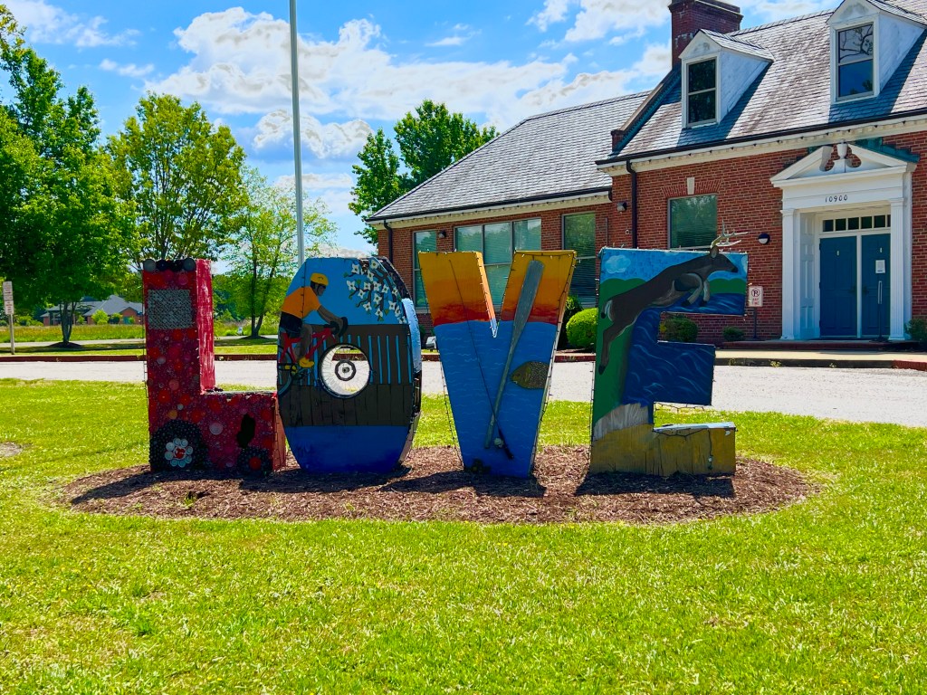
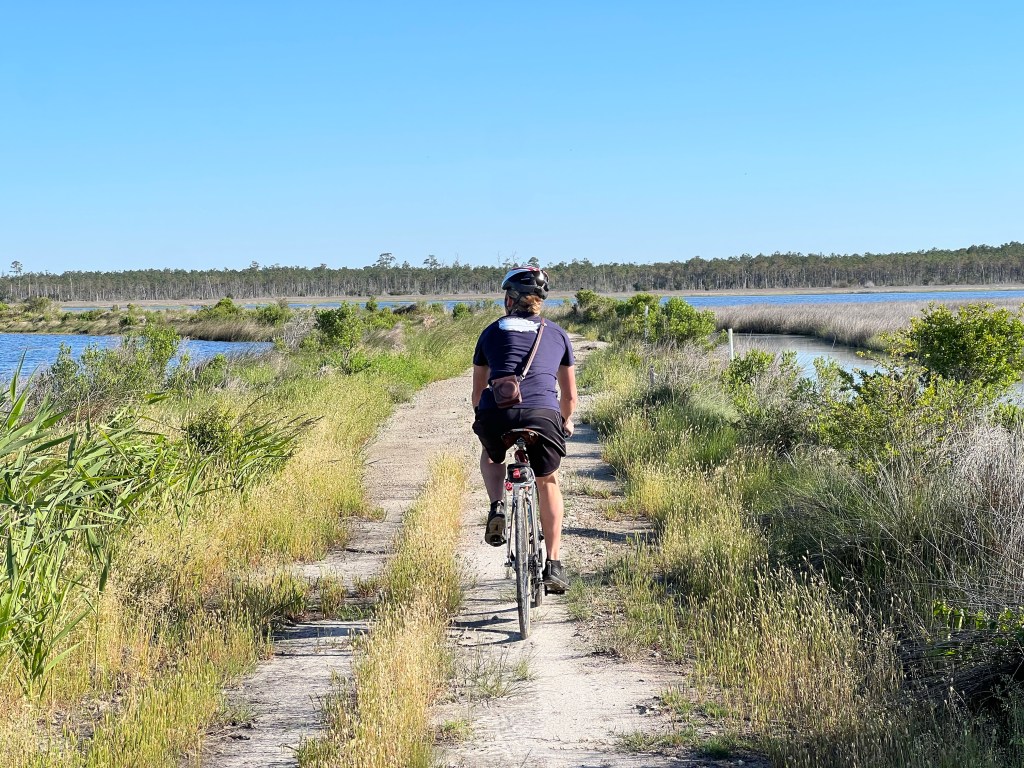
Today was one of my favorite days of this trip for cycling. I’m not including the elevation profile with this post, because it makes it look like we climbed a steep 850 foot mountain, when really we rode up a gentle 1% grade rail trail for 15 miles, then slowly descended the same distance, also on a rail trail with a -1% grade. The temperatures were in the 60s and low 70s, and we were riding in the shade of tall trees for the majority of the day. What more could you ask for when you’re from Arizona, and the temperatures there are hovering around 100?
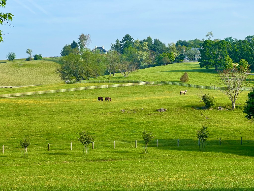
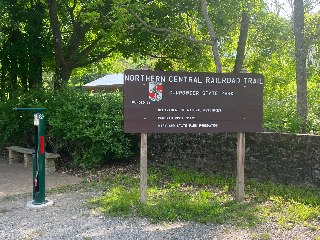
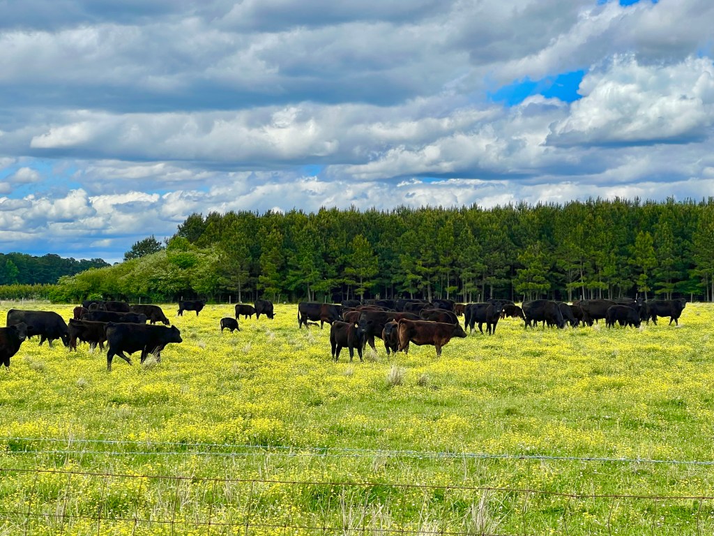
After leaving Glyndon, we rode through farmland and historic little towns, like Reisterstown, Wards Chapel and Marriotsville, before taking the turn onto the North Central Railroad Trail.
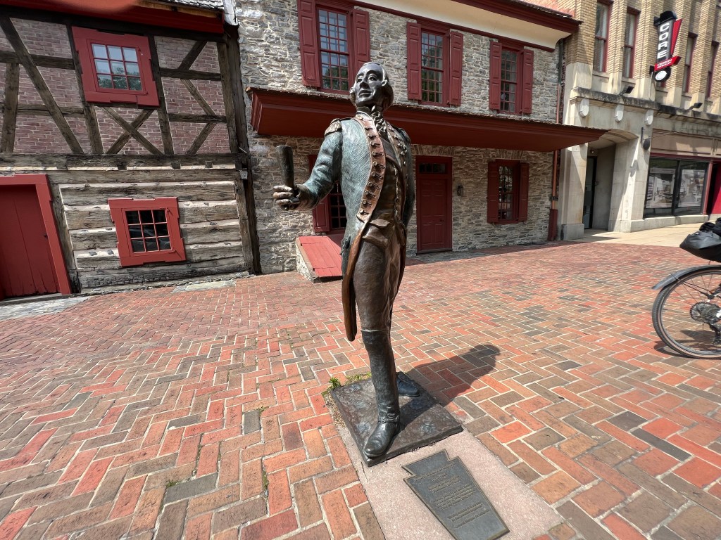
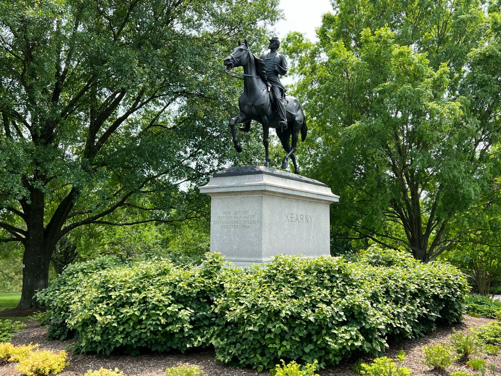
This is the site of the Battle of General Mills.
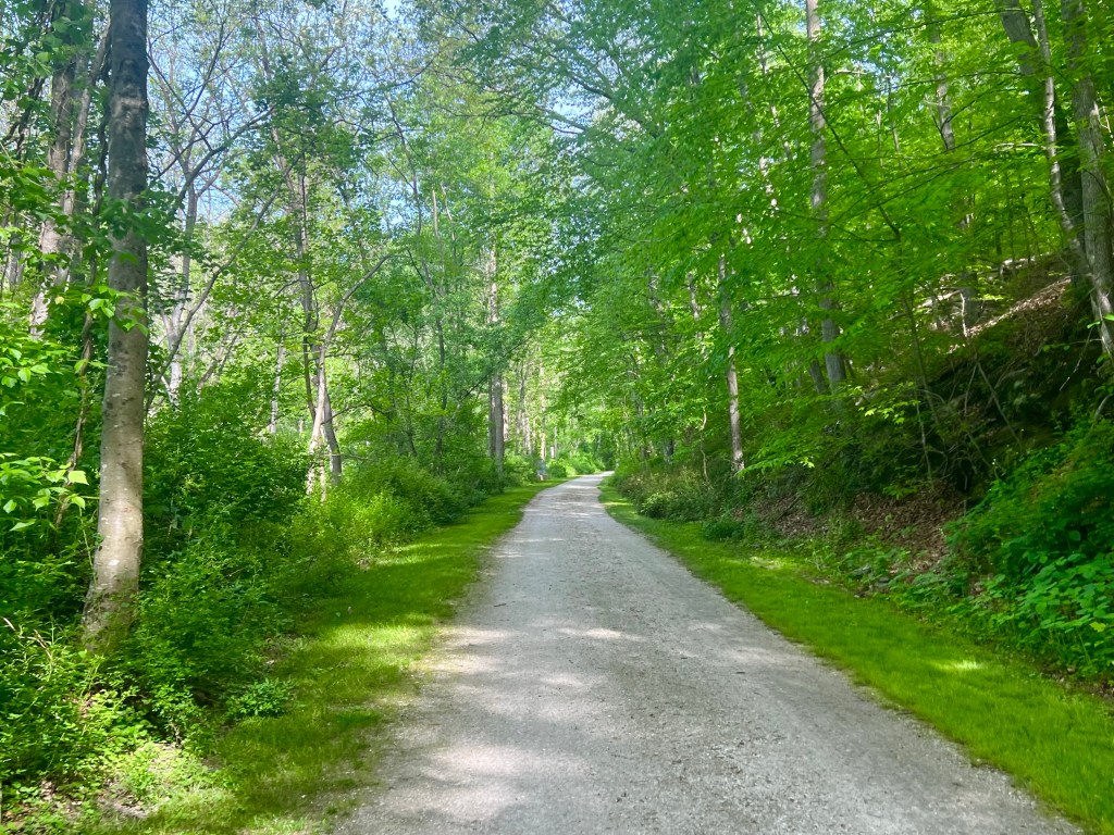
For the first 3 miles of the trail, we rode alongside Big Gunpowder Falls and through Monkton, enjoying a nice cinder and assault path. The next 10 miles passed through White Hall and Freehand, before we hit the Mason Dixon line and crossed over into Pennslvania. BAM! Can you believe how fast we are moving?
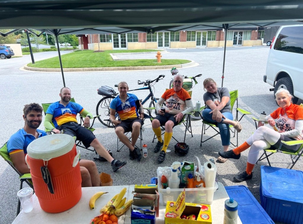
In White Hall, we had a rest stop along the trail where Connor set up the popup shade with a sign offering water to other trail users, and a lot of them stopped to chat. One guy mentioned that he used to donate to one of his friend’s MS fund raisers, so I asked him if he wanted to donate to ours. After chatting a while longer, he rode away. A few minutes later he came back and handed me a $20 donation. Very Nice! Thank you for your generous donation, Mr. Sullivan!
And this is where I Segway to my brief but shameless pitch for donations.
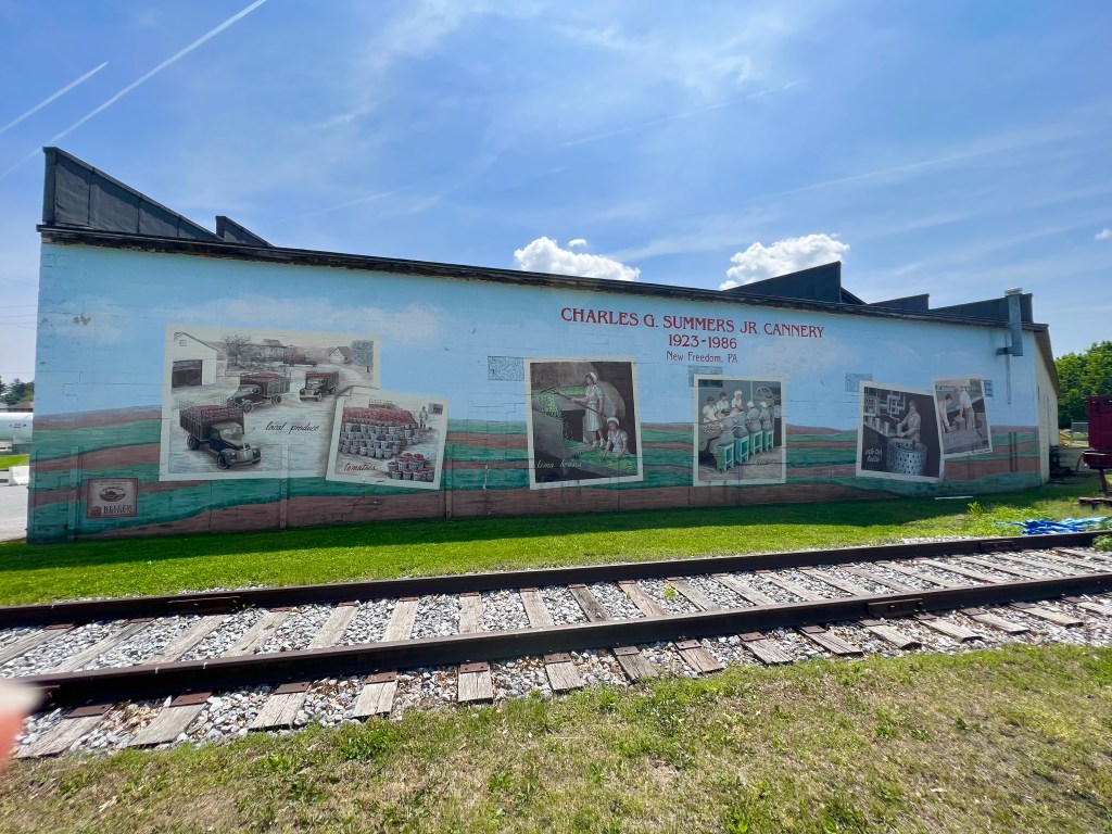
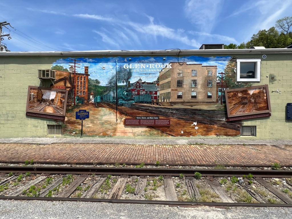
In Maryland, the trail changed names to the York County Heritage Trail and continued for another 22 miles, passing through New Freedom, Railrock, Glen Rock, Hanover Junction, and Seven Valleys.
As we continued on to York, we passed through the Howard Tunnel, which was pitch black inside. Sorry, no photo of the inside of the tunnel.
This is the spot where French General Lafayette made the speech that stopped a planned insurrection to replace George a Washington.
In York, I was craving ice cream, and there wasn’t going to be any up ahead in Hallam, so I stopped at a grocery store and they just happened to have a pint of my favorite Ben & Jerry’s flavor, which had to be eaten right then and there before it melted. I called my best friend Jean and chatted with her, while I savored my New York Super Fudge Chunk, but when the ice cream was gone, we had to cut our call sort so I could finish my ride.
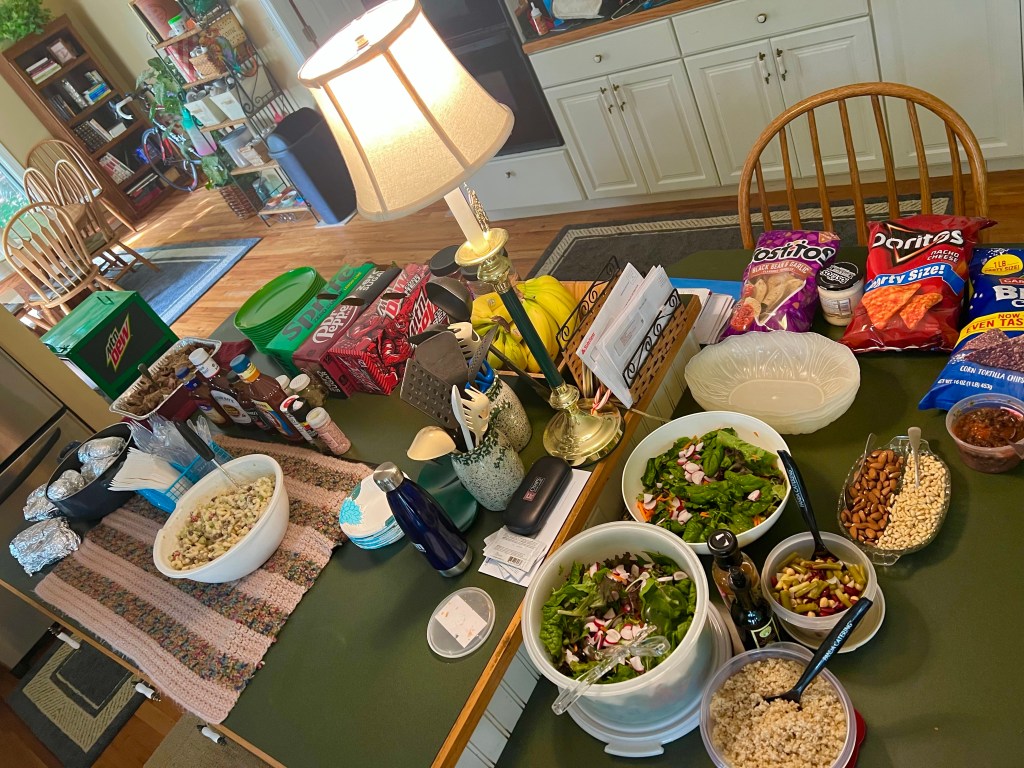
We stayed at another church, where a couple of BTUSFMS alumni and a couple of their cycling friends drove about 20 miles from Lancaster, PA to feed us a wonderful spaghetti dinner, salad and desserts. This church had so many classrooms that each of us had a private room for the evening, which is always a treat.
After a great night of rest, I hit the road, ready to knock out the 60 miles planned for the day. The relatively low miles sounded pretty easy. NOT!
Following a Google Maps course back to the Capital Crescent Trail, I found the spot where I left off yesterday and started moving northward toward our destination for the day. And I was moving along nicely, when suddenly the trail dumped me out onto a busy street. Every direction I went, my GPS told me to make a U turn and go back. So I started asking people where the trail was, and the ones who weren’t also tourists explained that what used to be the trail is now being turned into a subway line, and the real trail continues somewhere up north at a place they don’t know. Lovely. Here’s the thing. All of us who were riding our bikes had this same experience, and we all had to figure out a way around it.
I noticed signs for a detour of the Georgetown Branch Trail, and started following them, but at some point, I had to be sure I wasn’t headed in the wrong direction, so I started asking people on the trail if I was headed in the direction of the next trail I needed to get on—the Rock Creek Trail. One woman, who is also a cyclist, looked at my map and gave me directions to the Rock Creek Trail, and within 20 minutes or so, I was riding up on Ed, who had also received similar directions. What a relief, but so much time had been wasted!
The Rock Creek Trail avoided cars, but it was narrow, winding, bumpy and hilly. The roads that it looped away from were straighter and flatter, but sometimes the trail wound into the woods and came out next to a different road, so jumping on the roads wasn’t an option. I can’t believe I was hoping for a paved bike path to end, but when it did, I was actually relieved.
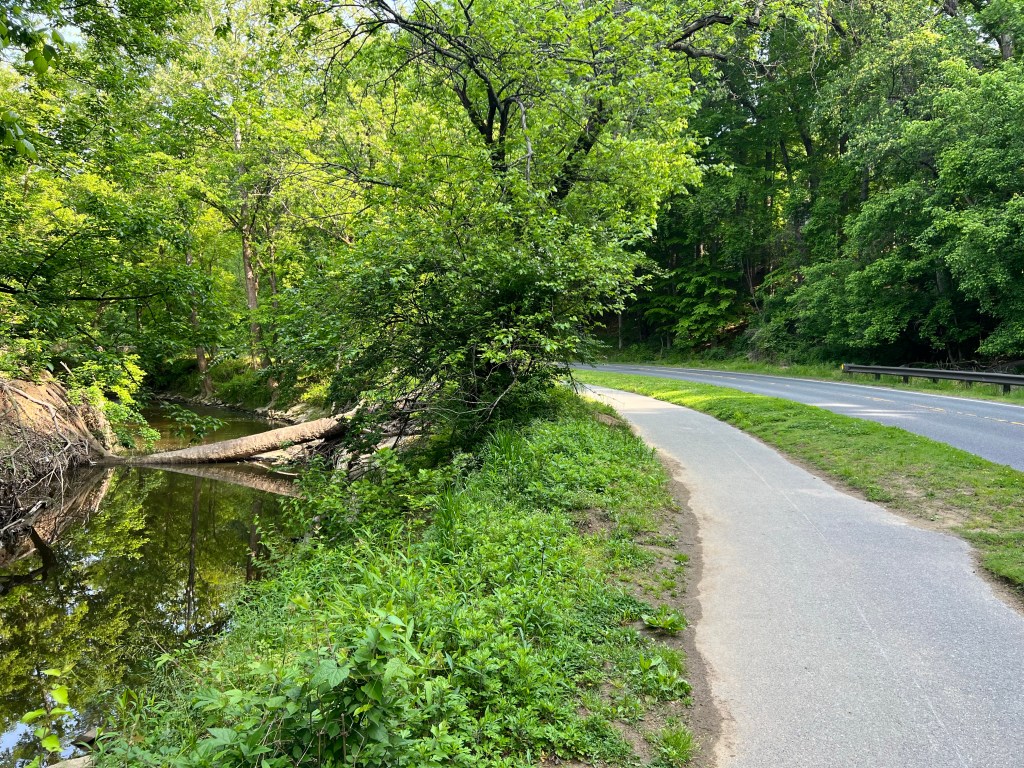
This is Winding Creek.A deer trying to avoid being photographed.
A couple of miles after the trail ended and we were riding on real roads again, we hit our first rest stop and had a chance to vent about the map and GPS malfunction and the winding, hilly, bumpy trails. We’re in the 21st century, you know. Things should be better than this. Enough of that, though. We had to get moving again.
Once we got back on the road, the roads were all hilly, with about half of the hills having at least a short bit of 9-10% grade, which is steep for a bicyclist. In the first few of miles, I ran into this cabin that housed slaves, back in the 1800s.
Twelve or more slaves may have lived in this cabin at one time. The cabin tours were not operating, so we couldn’t see how they pulled that off
After a couple more miles, a gentleman cyclist who appeared to be a couple of years older than me came up behind me and struck up a conversation. He was a strong rider and a big talker (as in he could talk, while I gasped for air on the uphills), and he kept my mind off of about 21 miles of climbing up and around the country roads he rides on all the time. He joined us for a snack at our second rest stop and took this photo.
Photo credit: Hank Koran, who rode with me for a bit today and took my mind off my gasping on the uphills.
And that’s the last photo of the day. My brain was fried, but the hill climbing continued on till we arrived at the Glydon Volunteer Fire Department—our hosts for the evening. I asked the other guys if any of them had taken photos, so maybe I could use a couple of their photos, but the other bloggers were also too wasted to take photos. Sorry folks.
It had been a tough day for all of us. We took turns showering in the one and only shower at the fire station, rounded up dinner from nearby stores and restaurants, got our gear ready for tomorrow and turned in early.
Last night, I reached out to Mr. Chase, my boss at the US Military Training Mission in Riyadh, Saudi Arabia, back in 2014 and 2015. He had been living in the Washington D.C. area and working for the Navy, but I wasn’t sure if he was still in the area. Luckily, he is. He replied back, and this morning picked me up from the church and took me to a nearby IHOP for breakfast. He is the funniest, most intelligent person I have ever worked for or with, so it was fun to be around him again and to hear his insights on a wide variety of things. Hghlight of my week, Mr. Chase! Thanks for taking the time to come get me and further enlighten me.
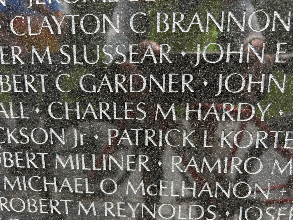
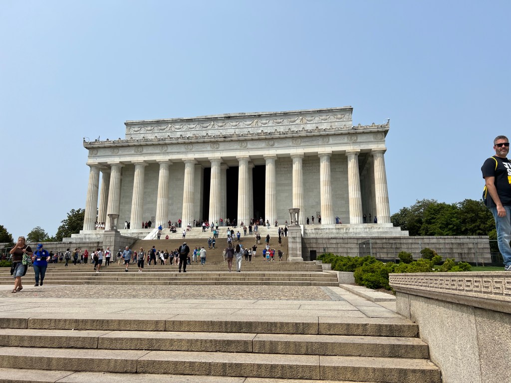
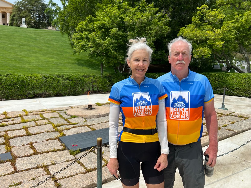
After he dropped me back at the church, I hopped on my bike and headed to the Capitol Mall. Ed was already there, and we were going to ride around and see the memorials together, starting with the Vietnam Memorial. I had sent the team the panel and line numbers where my brother’s name is engraved on the Wall and the link to his page on the Wall of Faces
I brought up the bottom item on page 1 of Chip’s page on “The Wall of Faces,” posted in 2017. “Final Mission of PFC Charles M. Hardy,” tells what happened the night he died, gives the names of the other 19 Soldiers who died with him, and tells the lessons learned. And believe me, the failure on the part of the personnel who designed and built the LZ (landing zone), where he and 19 other Soldiers died in the very first enemy attack, is very sad and makes me cry every time.
The names on the wall are arranged on order of death, so we looked for the names of the men who died with my brother, and sure enough, the 19 other names all surround Chip’s name.
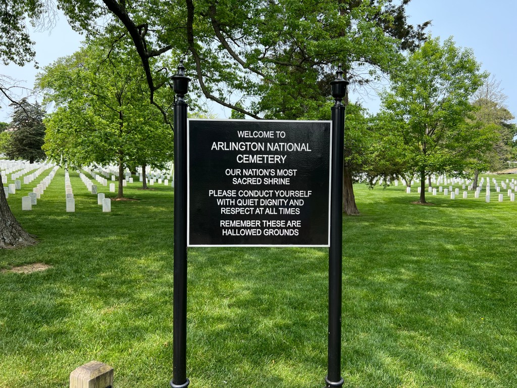
Our original plan was just to ride around the Mall and see all the Memorials. We saw a few memorials en route, but the original plan went out the door when we got to the Cemetery.
While we were standing there, Jon and Craig from our group arrived, and Jon announced, “We’re here for you!” I showed them Chip’s name and read them the Final Mission and cried some more. John went over and picked up some paper and a pencil so I could etch Chip’s name, and another of our riders pulled up just before Ed and I left to go see Arlington Cemetery. It was a sweet moment.
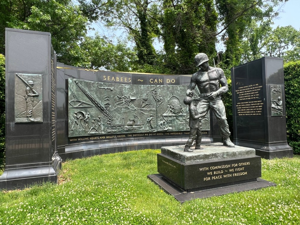
The inscription on this US Navy Seabee Memorial fits all of my girlfriends and sisters. “With willing hearts and skillful hands, the difficult we do at once, the impossible takes a bit longer.”
Touring the home and slave quarters of Robert E. Lee, which is a really nice exhibit, took quite a bit of time. There was so much information we had never heard or seen before.
Nearby was the Civil War Tomb of the Unknown Soldier.
Then we went to the gravesite of John F. Kennedy, Jacki O and their two infants who died at birth, as well as nearby graves for Robert, Edward and Joseph Kennedy Jr.
After which we checked out a bunch of the huge ornate headstones that are in a section of the cemetery for high ranking officers.
And then we headed over to watch the Changing of the Guard at the Tomb of the Unknown Soldier. After looking up the timing and number of steps taken by the Soldiers of the Old Guard as they pace in front of the tomb, pivot, and reposition their weapons, we were experts in the regimen they follow.
On our way back to our bikes, we stopped at the new Women of the U.S. Military Memorial. I’m standing by the only monument we saw. More of an exhibit, the memorial was pretty interesting.
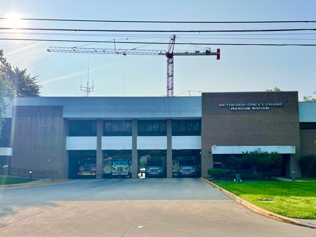
At this point, we were out of time. We checked Google Maps for the route to the Bethesda-Chevy Chase Rescue Squad, that was hosting us for the evening, and rode on the Capital Crescent Trail for the majority of the route there.
At the fire station, the fire chief was heating up the barbecue to cook hamburgers and hotdogs for us.
A 35 year old firefighter, who recently found out that he has MS, came to the barbecue along with his wife, who is 7 months pregnant with their first child. I didn’t get a chance to talk to him, but I wonder what his outlook is, with his diagnosis.
Perfect segway for this link. Please consider donating, if you haven’t already.
Several other friends of the firefighters also came to the barbecue, including the owner of a nearby bike shop, his wife and 8 year old daughter, who brought a couple of side dishes for the dinner. Before dinner, he asked if any of us need help with our bikes, and I did. My valve stem has been leaking air every time a attach a pump to it, and yesterday, my rear tire got down to 20 lbs pressure while I was riding, which is VERY low. I’ve been wanting to change out the valve core of that tire, but we don’t have the high capacity pump with us that might be required for the job. So this guy had me follow him a couple of blocks to his shop, where he checked my sealant level and replaced my valve core in less than 5 minutes. Naturally, he refused to let me pay him for helping me out. SUPER nice guy.
When dinner was over, I walked to a nearby grocery store for a few items, then set up my bed, started charging all my devices and laid out tomorrow’s gear and clothing. We slept upstairs above the bays where the Rescue Trucks are parked, and the firefighters went out on calls all night long, while I slept like a baby. Even sight seeing is exhausting.
There are surprises every day, when you are bicycle touring. Today, rain caught all of us off guard, and we all got soaked and cold. There was a 20% chance of rain when we left our host’s house, but within 1/2 hour it was drizzling then raining, and it kept that up for over 5 hours. I’ve decided to give in to the weather and not let it get to me, so I don’t let rain, cold or heat make me panic. The problem today was that I didn’t have anything with me to keep me dry and only had my vest to keep me warm, so I adapted. I kept my rest stops short and rode hard to generate as much body heat as I could. Oh, and when I found ice cream at one of our rest stops, I ate it indoors. Smart, eh?
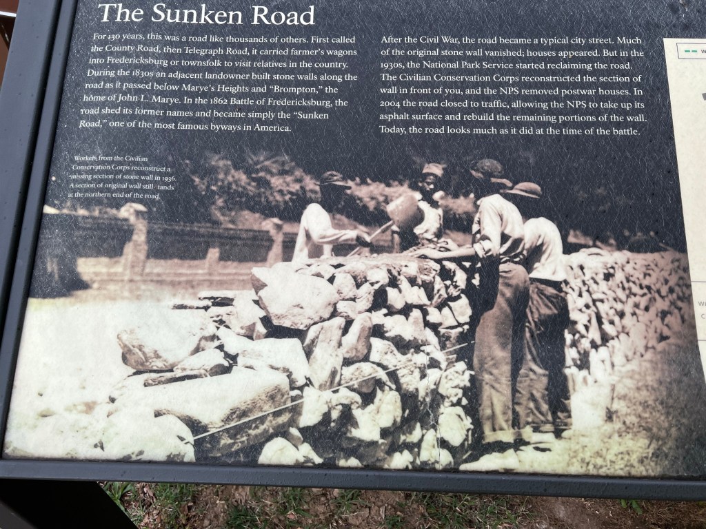
In the first few miles of our day, we rode through part of the Fredericksburg Battlefield and by the Visitors Center, but it was too early in the day for it to be open. I stopped at the Memorial Cemetery and Sunken Road which are always open.
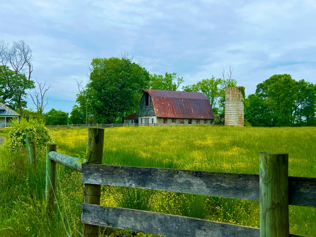
Then we had several hours of winding, low traffic, country roads—passing through farm land, by cool barns and abandoned farmhouses as well as rural homes and progressively more luxurious homes. We also passed Fort Belvoir and a training range for Quantico.
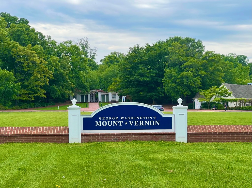
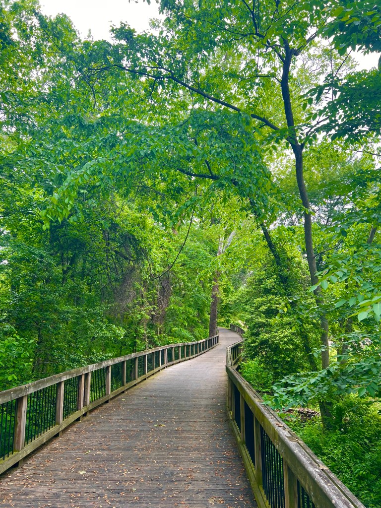
Entering Alexandria on the Mount Vernon Trail, we wound through hilly woods and stayed koff of the busy, shoulder-less roads. The bike path took us by Mount Vernon, where I considered spending an hour or so. The $28 admission killed that idea.The trail took us through parks and wooded areas along the Potomac until we reached Alexandria.
When I left the Mount Vernon Trail and started navigating to the Good Shepherd Lutheran Church, our home for the night, I was led into a neighborhood of cool, very old row houses and hip shops and restaurants, And even though Chippotle is not especially hip, I was craving it, so I pulled over and did a Google Maps search. Just a few blocks away, I stopped and picked up dinner, then just a few minutes later, I arrived at the church.
Top priority was feasting on that well deserved dinner, but then I had to get to my chores. I set up my bed on the rug in one of the preschool rooms, hand washed the jersey I was supposed to wear for a group photo tomorrow, took a cold hose shower in the shower tent (the gas water heater was out of gas), cleaned and lubed my chain, laid out my food and gear for the morning, then vegged out and fell asleep.
Tomorrow will have better weather, and I’ll be better prepared, in case it doesn’t. We only have a 20 mile day to allow us time to see the sights in Washington D.C.
Yesterday was a day off in Richmond, and other than catching up on my blog, the only thing worth writing about was the wonderful congregants at the Lakeside United Methodist Church.
I tried to get to church, earlier in the day, but church for the entire area was the dedication of the Richmond Temple by Dallin H. Oakes, so I tried to get to that. The broadcast in a local chapel was too far away to drive to, so I ordered up a $25+ Uber. Well that was a big fail, as the driver took me to the wrong location. By the time we got to the right location, the dedication had started, and all doors to the building were locked. A family that was also unable to get in the building gave me a ride back to the Methodist Church. It all was very disappointing. Next Sunday, I have another day off in Conshohocken, PA, so maybe things will work out better there.
Then later, at the Methodist Church, the men’s group rolled out the BBQs to grill hamburgers and hotdogs, while the youth group and/or their parents put the side dishes and desserts together for another really great meal. I spent some more time with a really cute couple who are 2 weeks from their 16th wedding anniversary—Jobeth and Zach. The night before, Jobeth’s Mom had filled me in on the details of her daughter’s life, but there was no Mom around last night. Ed and I sat with them, and at the end of the evening, we both commented on what exceptional people they are and what a great thing they have going together. I put the invitation out to Jobeth to come out to Arizona and visit sometime. That’s a serious invitation, Jobeth. I would pick up up at the airport, have you stay in one of my guest rooms and show you and Zach some amazing sights. Things like desert, cactus, red rock canyons and the Grand Canyon.
Jobeth & MeI did take a trip to the grocery store and learned a new way to get your cart to your car without walking. Guy is riding some kind of electric bike.
Nothing super spectacular happened today on the ride to Fredericksburg. It was a little trafficy leaving Richmond and arriving Fredericksburg, but in between those two sections of the ride, we rode on little country roads the entire time, as we wound around the countryside of Virginia through miles of hilly farmland, separated by tiny towns and short stints of forests and swamps. The sky was clear and the temperature started out cool, but heated up to 80 degrees with humidity, as the day wore on—nothing a girl from Arizona couldn’t handle easily.
Our first stop was for breakfast in Ashland, where there are train tracks running in both directions going right down one of the 2 main roads through town. And there was non stop train travel on both tracks. Beautiful historic houses and later shops in the downtown area faced the tracks.
We did have one last stop before heading to our host’s home: The death site of Stonewall Jackson. The farm office is the only building left standing of the Fairfield plantation.
Our hosts for the evening were a wonderful couple, Bruce and Vicki, who are BTUSFMS alumni. They are big time cycling enthusiasts who make a difference in the cycling world. As Boy Scout Leaders, they have changed the lives of many young men, planning and leading groups of up to 25 boys across the US on bicycles. On their own, they do some significant bicycle travel and are now involved in the 911 Trail organization where they plan an annual ride of either all or part of the trail that stops at various impactful places along the loop trail that connects the Pentagon, Shanksville, PA and the World Trade Center. Bruce had me in tears a few times, as he spoke about the rides and the people and places they see along the way. Just added another ride to my bucket list.
I met this future bike traveling partner, Katharyn, at Bruce & Vicki’s.
Another really great thing they did was let me stay in their guest bedroom on a real bed. A night in a real bed will be AMAZING!
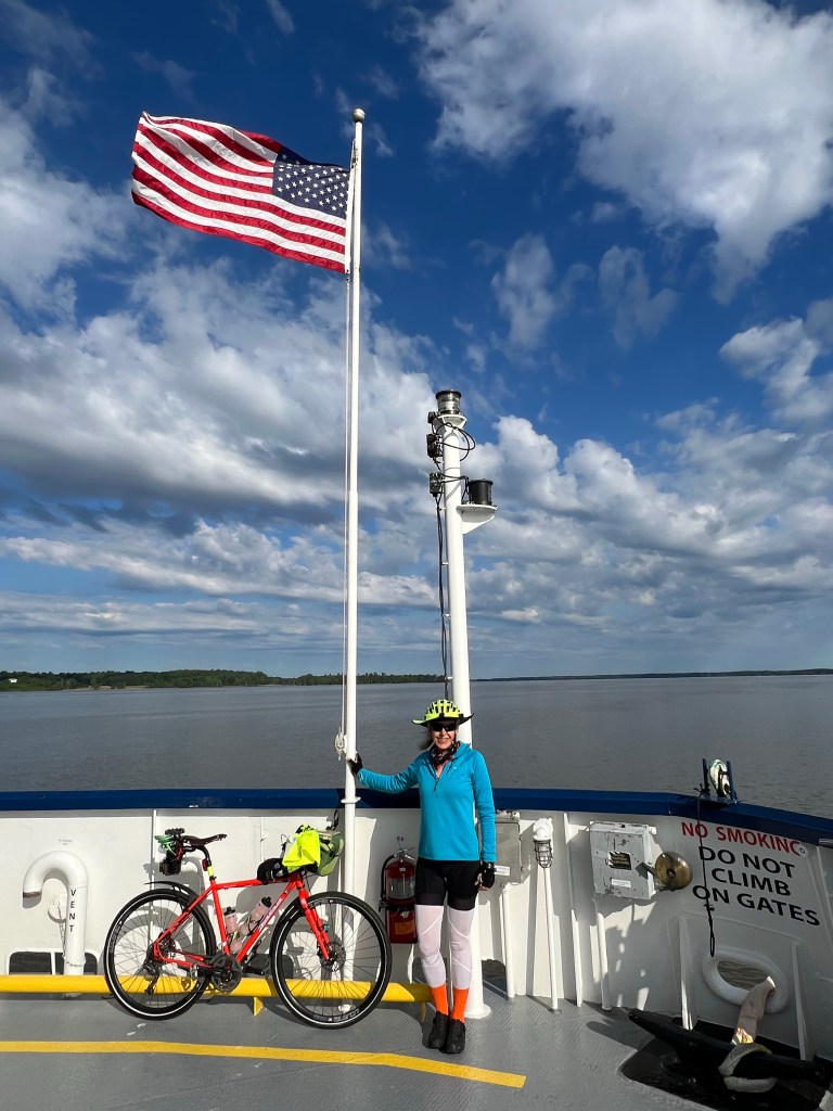
If you looked at yesterday’s map, you would have noticed that we camped close to Jamestown. Well this morning, within about 3 miles of leaving our campground, we hopped on the Jamestown Ferry and crossed the James River to get to Jamestown.
On the ferry, I enjoyed chatting with a couple of beautiful sisters from Georgia, who were headed to Maryland for a wedding. It was such a pleasure to meet you two, Susan and Cathy. Hope you enjoy the rest of your trip and have safe travels home.
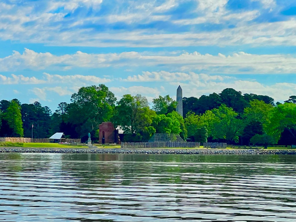
This is Susan & Cathy with me, of course. From the ferry we could see the monolith and remains of a church in Jamestown.
The weather today was a little nippy, so I started out with 4 layers of clothing, gradually pealing off 3 layers over the course of the day. As for the terrain, yesterday we had a couple of hills, but today was a lot more hilly. Nothing steep, thankfully, but by the end of the day, I was feeling it. Spoiler: My legs are about to get even stronger, and how do I know this? Because this is just the beginning of the climbing that is up ahead as we continue toward Bar Harbor.
Just after we got off the ferry, we rode into the parking lot of the Jamestown historic site. It, Williamsburg and Yorktown are all connected, and I will see them with my grandkids some time in the next few years, so I didn’t stop.
The starting point of the Virginia Capital Trail is just across the street from the historic site, so I jumped on the trail, and began 50 miles of smooth, well maintained paths. Bikes dominated the trail use, but there were a few walkers and runners.
There were hundreds of historical markers along the trail, and though I had a fascination with reading all of them on the Southern and Northern Tier rides, I didn’t stop for a single one of them, because if I did, I’d never get anywhere. I just glanced at them and kept moving. I love history, but there may be too much of it posted all around you on the East Coast. Instead of them, I payed more attention to things that stood out to me. Like…..
Typical plantation house with its own farm.
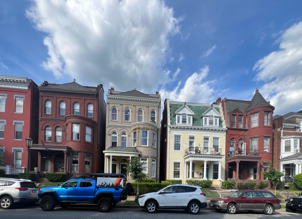
The Capital trail ended when I arrived in Richmond, and so did my ACA map and Garmin course, but in spite of that, I saw some really cool things in town.
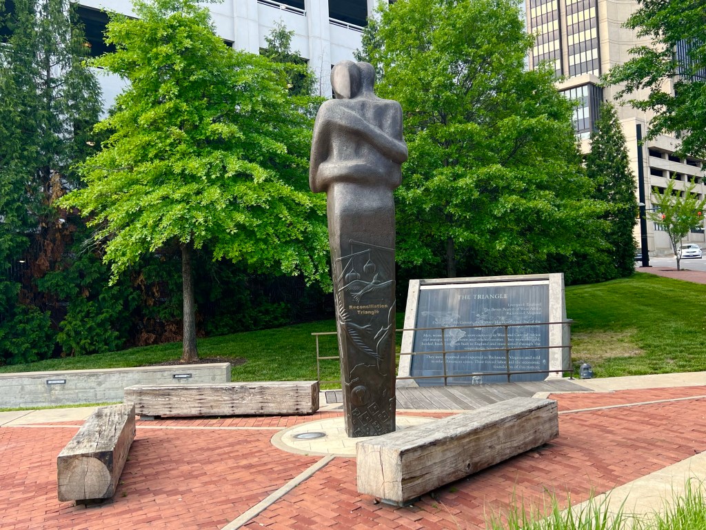
A community garden adjacent to some condos. For $60 a year, you get your own plot. Identical Reconciliation statues are located in Liverpool, England, and Benin West Africa, which along with Richmond represent the three regions of the world that profited from slave trade. The Richmond State Assembly building was designed by Thomas Jefferson.
When I loaded up the new course, there was something wrong with the starting point, and navigation suddenly because more difficult. After stopping at a bike shop to get a new headlight, then treating myself to some ice cream across the street, I now was ready to fry my brain figuring out where I was on the maps. My GPS kept sending me down roads that were closed or one-way streets going the wrong direction. I’d follow it anyhow, and then it would flash the “Of Course” message. I finally caved in and plugged the address of the Lakeside United Methodist Church into Google Maps and went with those directions. A few miles later, I was pulling into the parking lot of the church, and dinner was about to be served.
The members of this church are the nicest people. They prepared a wonderful meal and desserts, then sat and talked with us during and after dinner, like we were long lost friends of theirs. And this particular evening, we needed that and the pastor’s dinner prayer, because something really sad happened on the Virginia Capital Trail a few miles ahead of me, today.
Nick, the doctor on our team, was riding ahead of the rest of us, and as he came up over a little rise,150ish meters up ahead he saw a guy fall from his bike and a few people quickly gathering around him. The first 3 on the scene were women, one of whom was a nurse who quickly checked his pupils and made the assessment that he was dead. When Nick got to the guy, he noticed that the cyclist’s neck was broken and his head at a unnatural angle that at the very least would result in paraplegia, then he too noted that the guy was dead. The paramedics arrived, started doing CPR on the dead man and basically told Nick to get out of the way, that they do this all the time.
The guy had hit a bump on the trail, possibly a tree root, ridden off the trail a foot or so and gone over the handlebars. He just had a bad landing, and his life was over. Nick was pretty shaken up, and as word passed between us riders, we were all shaken up too. I hope I never see anything like what Nick saw, and I likewise hope such a thing never happens to me or anyone I know. By the time I got to the location of the cyclist’s death, there was no sign that anything had even happened—no accident scene tape—nothing. I heard about it at my next rest stop, and it put a sad, somber cast on the rest of the day.
No pressure, but if you can afford to make a donation to MS treatment and research, the cause for which I am doing this ride, it would be greatly appreciated.
I can’t tell the whole toilet seat incident story, because I have sworn an oath to myself to not say anything derogatory about one of the team on my blog, but I can say that at 4 AM, I found my way into the women’s restroom, and when I went to sit on the toilet in the semi dark bathroom, I fell all the way into the toilet, because one of the men had used that toilet during the night and had left the toilet seat up. I managed to not scream, but I was so furious, I was never able to fall asleep again, and I was REALLY tired. Grrrrr.
Note to reader: This is not the actual toilet. Another toilet posed for me later.
I had 2.5 hours to contemplate the situation. The door to the mens room was only about 3 ft from the door to the women’s room, so it would have taken a little more effort to walk all the way to the mens room, right? I came up with schemes to get back at the offender—pepper spray on the mens room doorknob at night was one of them, but that might affect some of the other guys, so I had to rule that out. In the end we all know who did it. In the morning when I asked the guy I thought had left the seat up to please put the seat down when using the women’s toilet during the night, he feigned innocence. More Grrrrr.
Now that I have that off my chest, I can talk about today’s ride.
Thankfully, the wind eased up, finally, so for the majority of the day, there were just a 5-6 mph head or cross winds, which are doable without too much struggling. Toward the end of the day, it picked up a little, and also, toward the end of the day, there were a few hills thrown into the mix. I’m a wimp, so both of them together wore me out.
We spent the majority of the day in rural areas with very little traffic, and just a bit of time on busier roads that connected the rural roads. It was wonderful!
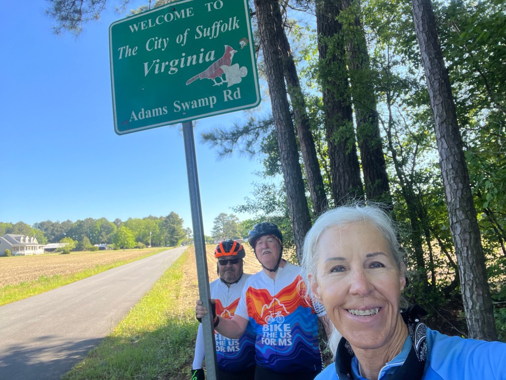
Pretty early in the day, we crossed over into Virginia (Yay!) We were on such a rural road, that there was no ‘Welcome to Virginia’ sign, just the Suffolk County l, Virginia sign. Ed, Jon and I were at the back of the group, and the guys up front all breezed by the sign, so they definitely did not notice it. We took note.
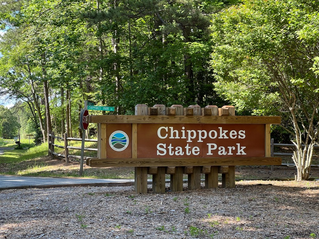
Chippokes State Park was our destination for the day —our second and last tent camping night of the trip. (This is so cushy!). I was thrilled that the campground had a laundromat, as I had hand washed kits 2 nights in a row, for lack of laundry facilities. Also, it had nice, clean, hot showers. After gathering around a big campfire to get warm, roast marshmallows and make smores, we turned in pretty early.
For days, I had been hearing that it would be 40 degrees tonight, and I was worried, because my sleeping bag is only rated to 40, and that is a survival rating, not a comfort rating. I went to sleep dressed in long tights, long sleeve shirt, socks and my Patagonia R1 hoodie, and I was super comfortable all night long. In fact, it was the best night of sleep I’ve had on this trip.
Please consider donating to the cause I am riding to raise funds for. I am riding in honor of my Aunt Betty who died of MS, but I meet people almost every day who have MS, and sone of them are bright young people in their 20s. A cure needs to be found for this disease, and it takes money to make that happen.
I decided to put my shameless request for donations here so you can’t miss it. I need to raise $1240 more to reach my $5000 goal. If you can donate one week of lunch money or your allowance, it would help get me to my goal. Thanks in advance for your donation!
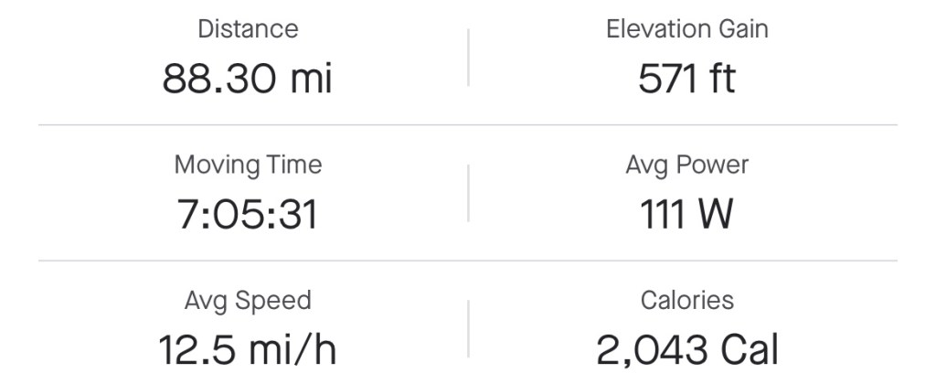
Miles: 88.3 Today / 1514.56 Total Elevation Gain: 571 ft. Today / 15,299 ft. Total
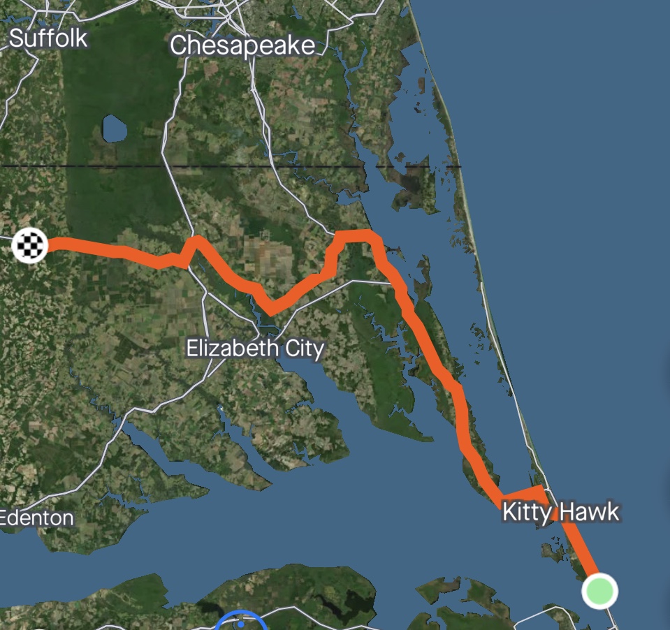
Today was going to be a long long day with a 10 mph headwind throughout the day, according to the weatherman. We started out with clear skies, lots of wind, and a temperature of 52 degrees, which is pretty nippy for this Arizona girl.
We traveled through several miles of beach vacation homes and rentals on both sides of the road that lasted till just before we got to Kitty Hawk.
There, we turned west and crossed Currituck Sound. Did you notice anything? No mention of the Wright Brothers in Kitty Hawk? That’s because I somehow passed the Wright Brothers National Memorial and was so focused on fighting the wind that didn’t even notice it, which is a sad state of affairs. The name of the bridge across Currituck Sound is Wright Brothers Memorial Bridge. I knew I’d screwed up, but there was no going back at this point.
Once over the bridge, the beach scenery came to a complete screeching halt, and now we were looking at lush tall trees, farmland, more swamps and more farmland. I’ll bet you weren’t expecting that.
As the day drug on, there were a few points in the route when we were traveling with the wind at our side instead of our faces, which took some of the load off, but for the most part, it was a complete sufferfest.
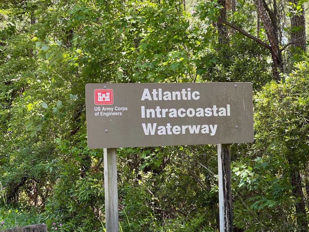
Once again we crossed the Atlantic Intracoastal Waterway. I need to read up on that some day when I have wifi and some free time.
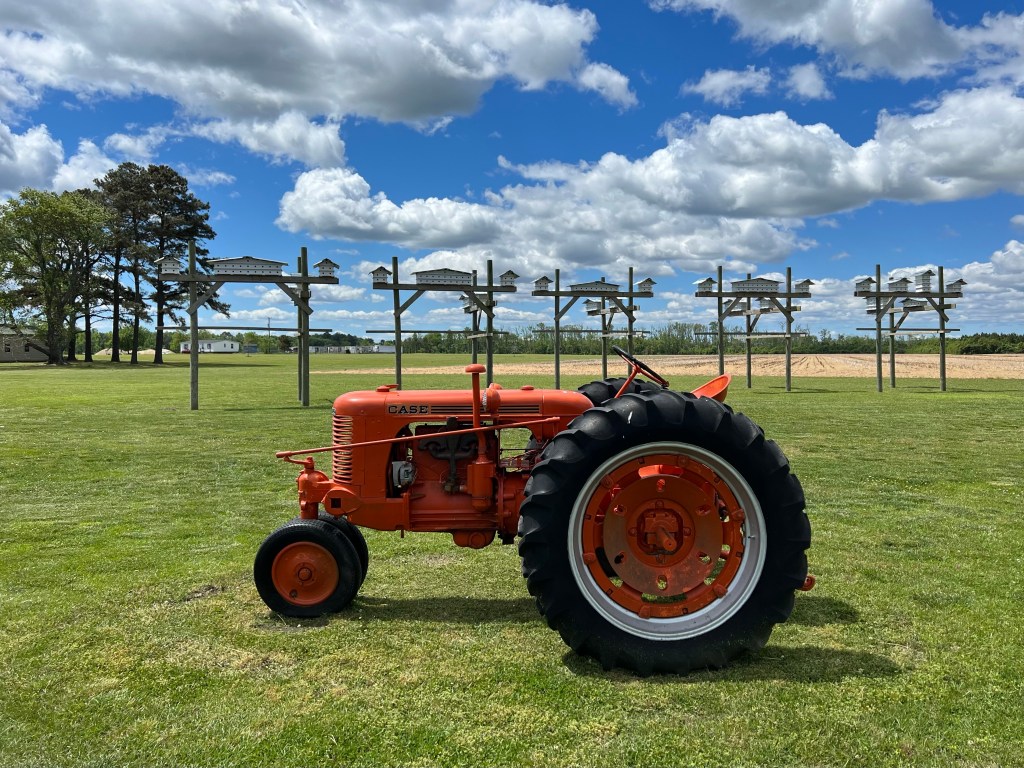
Those are bird condos in the background. We saw a lot of these in the Northern Tier.
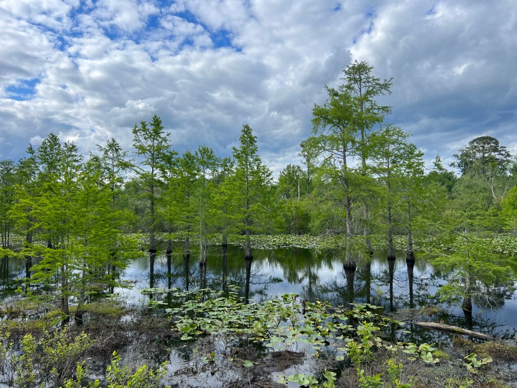
Later in the day we came up on a location I’ve seen up ahead on my map and have been looking forward to—The Great Dismal Swamp. This is a real place. Seriously. My first clue that I was arriving there was the crossing of the Dismal Swamp Canal, also part of the Atlantic Intracoastal Waterway and entrance to The Great Dismal Swamp Wildlife Refuge.
I heard a lot of birds, but only saw a few of them. The guys spotted a lot of turtles that I completely missed. The swamp itself? Really cool and beautiful place. It had all kinds of plants, wildflowers, fallen trees, interesting shadows, murky ponds, etc.
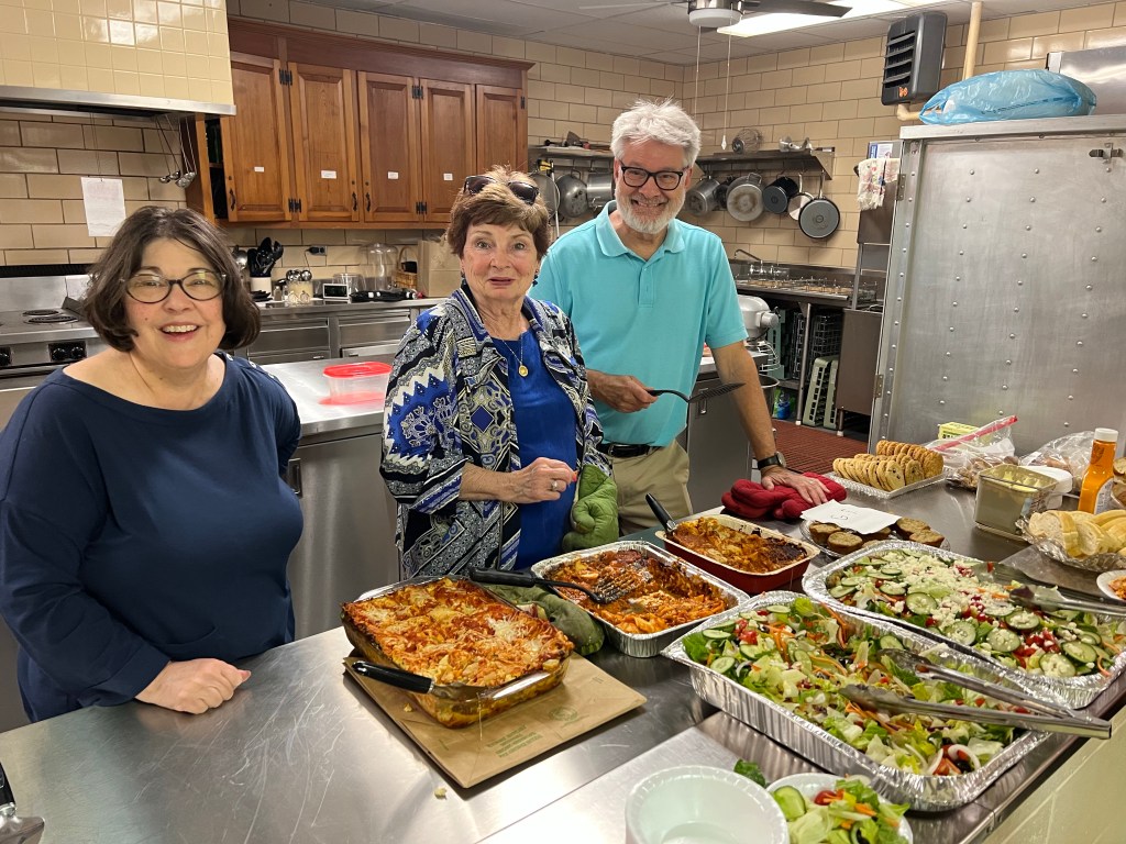
The road along the swamp lead us to Sunbury, where we were sleeping in the Fellowship Hall of the Beulah Baptist Church. The pastor was a really great guy who made a point of speaking to each one of us individually. And he did some other really nice things, like prearrange with the fire department to let us use their showers, and have a some lovely congregants there to welcome us and have an amazing dinner waiting for us: lasagne, tossed salad, garlic bread and homemade brownies and cookies. These are some truly awesome people.
The wifi was too weak to do anything, so it was early to bed. Tomorrow wasn’t going to be a long day, but it was going to be a cold day, and I needed to rest up. Only three of us were sleeping indoors—Jade, Nick and me. It seems that most of the guys are choosing tenting outside over sleeping inside on the floor, due to someone’s snoring, which has me a little worried. What if I’m the loud snorer they’re tenting to avoid? Lol!
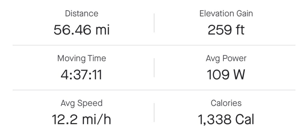
Miles: 56.46 Today / 1426.26 Total Elevation Gain: 259 ft. Today / 14,728 ft. Total
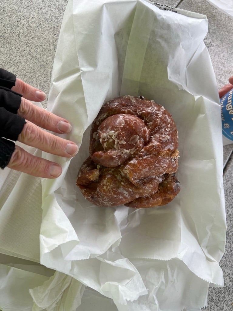
The temperature was 52 degrees, this morning, with a forecasted high of 62, so I abandoned the idea of swimming in the ocean, today. On to plan B, which started with a quick stop to Orange Blossom Bakery & Cafe for a renowned Apple Ugly pastry. It was like an apple fritter, except that it wasn’t greasy and it was as tall as it was wide. The thing was like a huge knot of light pastry, apple filling and cinnamon with a scrumptious glaze. I was going to try eating just half of it, but got carried away. I saved about 1/3 for later, but never got to it.
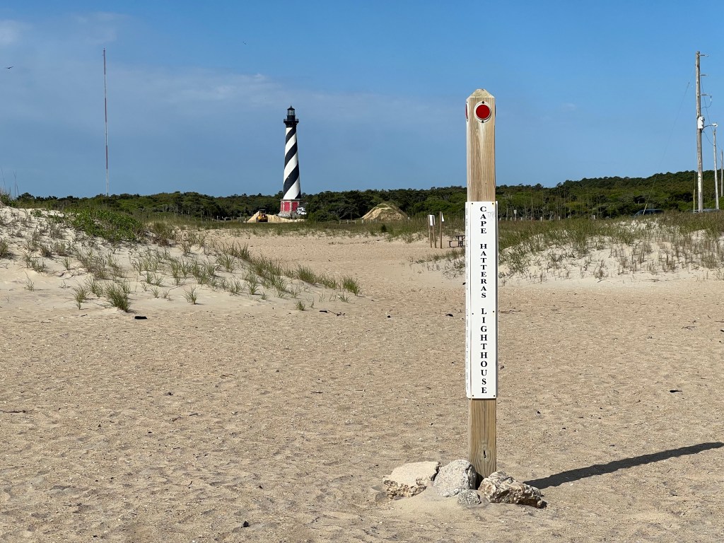
Just a few miles outside of Buxton was my first stop—the Cape Hatteras Lighthouse, which at 208 ft tall, is the tallest lighthouse in North and South America. Storms, wind and water cause the ocean coastline of barrier islands to naturally migrate westward, and in1999, the coast had migrated almost 1500 feet from where it was when the lighthouse was originally built to within 60 ft of the lighthouse, putting the structure at risk. The National Park obtained funding to move the lighthouse and all of its adjacent structures 2900 to the southwest, which was a huge undertaking. The process they used to move it is fascinating, but too detailed to write about here. Ask me about it, if you want to know all the details, and I will tell you all about it, complete with visual aids. I met a local woman on the beach who was there when they moved the lighthouse, and she said it was an amazing thing to watch. The move was so carefully engineered, that there is no way it could fail, which is hard to imagine, considering how tall and heavy the structure is.
After spending a couple of hours checking out the lighthouse museum, I rode over to the old lighthouse location and beach, which happened to be pretty nice, then hit the road.
Hard to visualize it with a photo, but the lighthouse is 2900 ft from this marker where it used to be. This is how far the lighthouse was from the ocean before it was moved.
I rode over several really long bridges today, some connecting islands and some just bypassing parts of islands that are so narrow, you couldn’t build a road there. And as I rode along, the headwind was picking up and rain clouds rolling in.
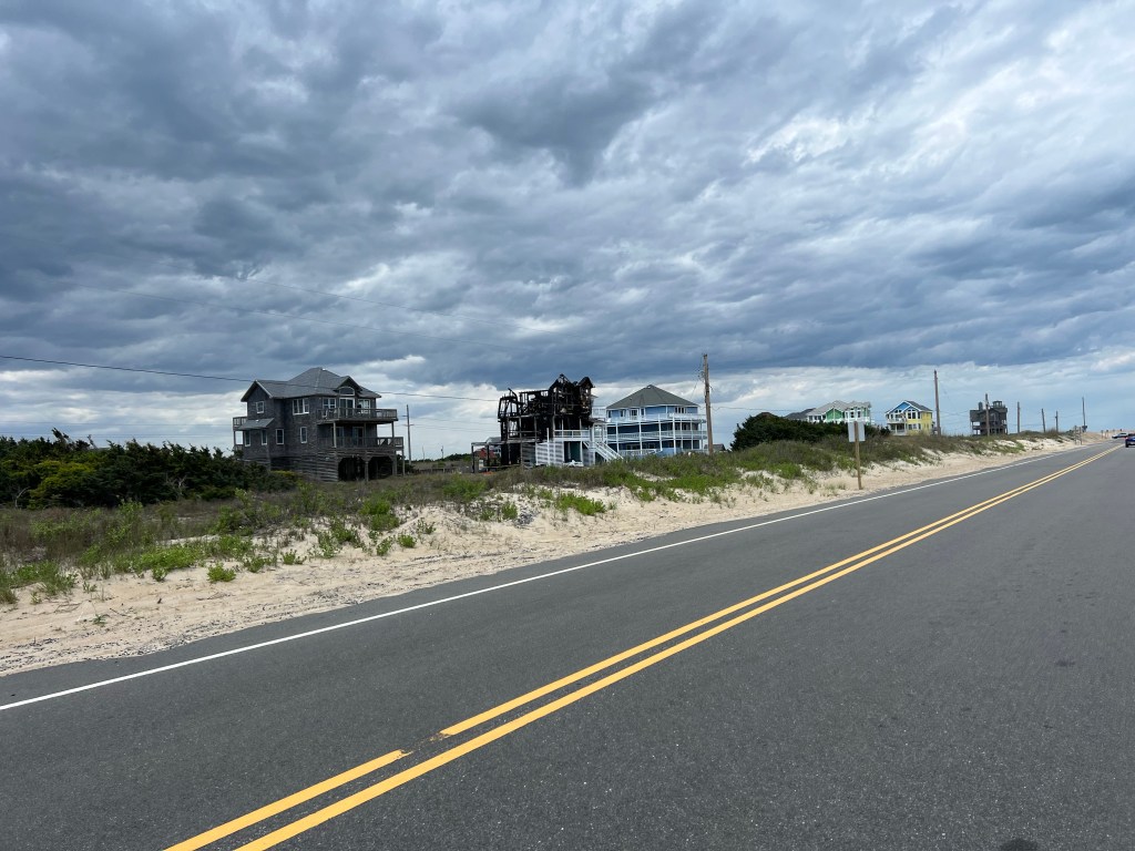
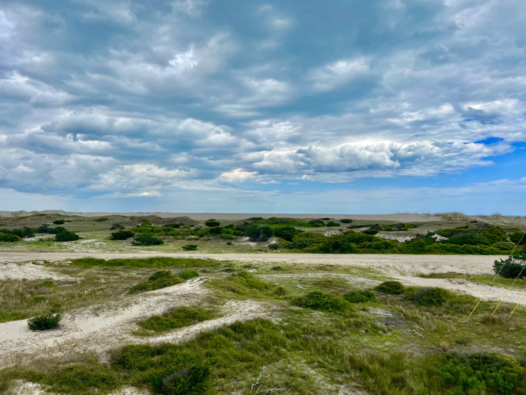
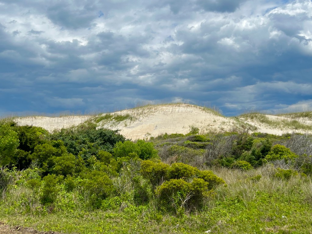
The scenery was varied. Beachy vacation homes, dunes, beaches and just lush green grass and plants.
Typical vacation homes, but also the only one I’ve seen that was burned down.
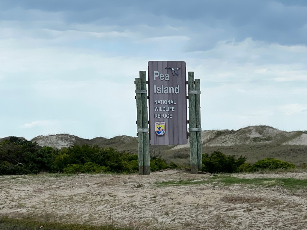
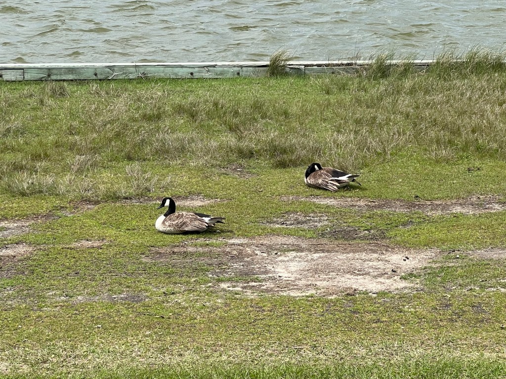
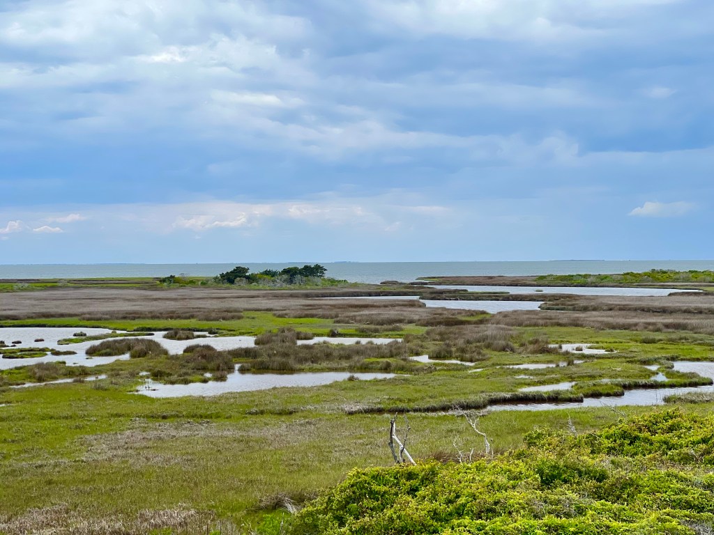
On Pea Island, I stopped at the Pea Island National Wildlife Refuge and spent over an hour in the visitors center and walking out a boardwalk to a platform from which you can view wildlife—mostly birds. I probably saw 12 birds, ducks and geese in that time, which was a little disappointing. Maybe they’ve all migrated, or maybe they were all taking a nap. Who knows. They just weren’t out where I could see them.
Once I left the refuge, the headwind turned vicious and it started to sprinkle. Oh, and I received a text message informing me that our group was being treated to dinner at Mulligan’s by an alumni, and dinner was in 1.75 hours. Not this again! Another last minute change that I had not anticipated. I had 19 miles left to ride, which would normally be doable in that timeframe, but not today. The wind was not cooperating, and instead of going 16 mph, the gusting headwind had me moving at about 8 mph, and that was with me putting 100% of my strength into it.
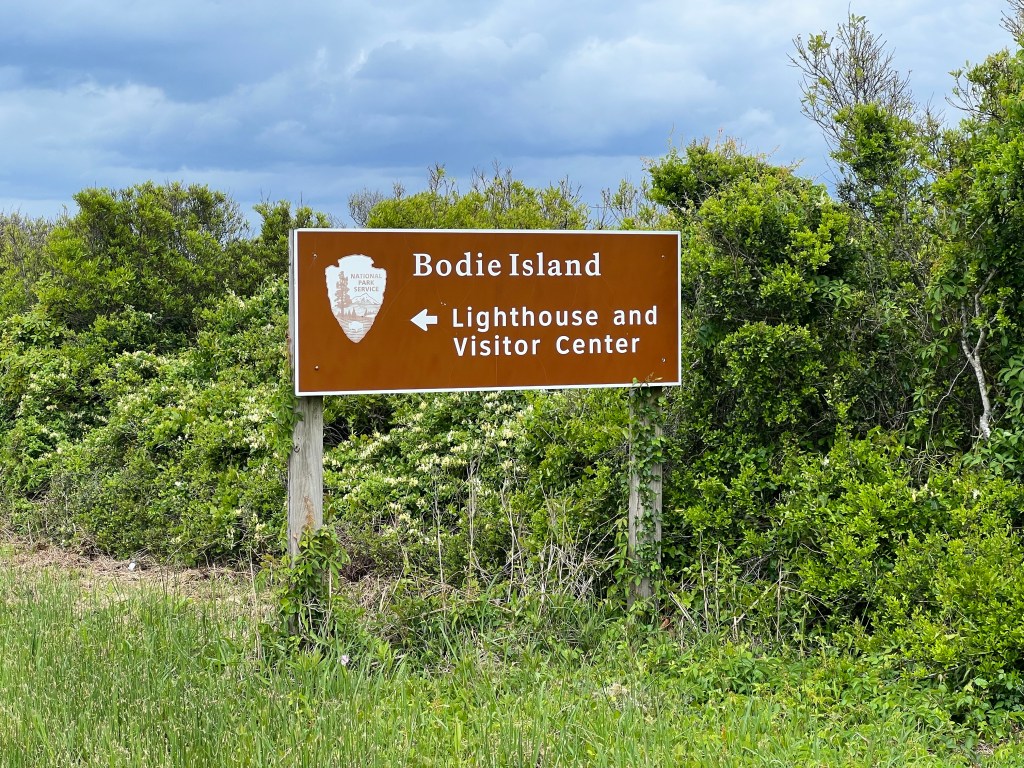
About 5 miles into this insane push, I crossed the 2.8 mile long Mark Gasnight bridge from Hatteras to Bodie Island. Riding on any bridge with that kind of wind is truly scarey, and this was no exception.
Another 4 miles down the road, I started seeing the Bodie Island Lighthouse. Dang it! I wasn’t going to have time to ride the 2 mile round trip route to get a closer look at it—just had to get my bet shot from the road I was traveling on. And that’s when it started sprinkling, which had not been forecasted. Who came up with this script?
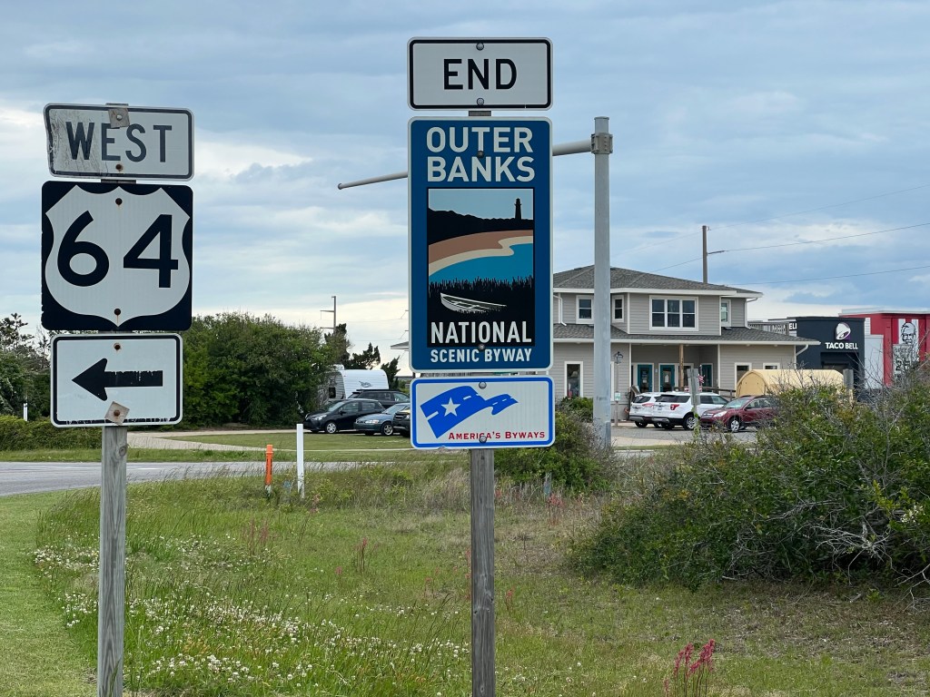
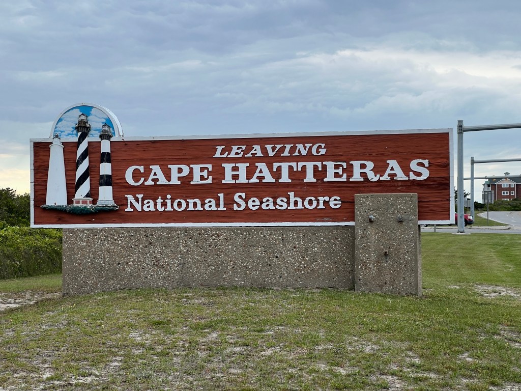
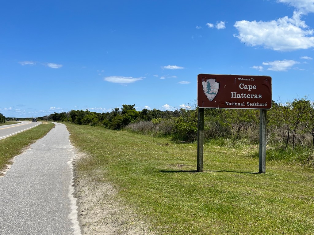
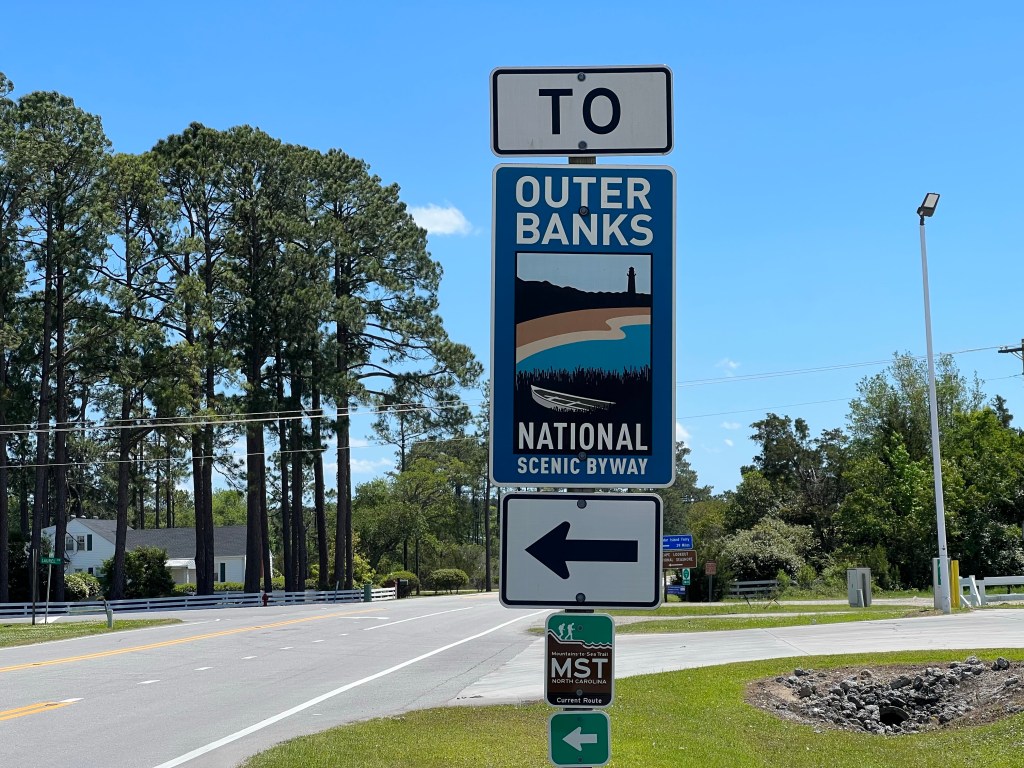
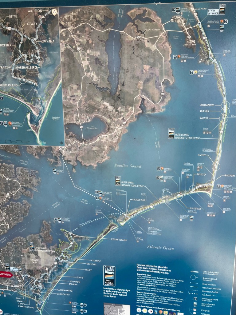
Before I arrived Nags Head, Outer Banks National Scenic Byway ended as did the Cape Hatteras National Seashore.
I ended up having to send a message to the route leaders to tell them I would be late for dinner. While I rode, I came up with my strategy for transforming from a sweaty, sunscreen slathered mess to a presentable human in street clothes. When I arrived the Nags Head Church, one of the guys who arrived shortly before me was just heading in to take a shower, so I had a few minutes to change in the trailer, wash my face, clip up my hair and put on some makeup.
Dinner was heavenly. As I looked around the dinner table, every one who had been cycling was wind burned, and it turns out that the entire team was exhausted from fighting the super gusty headwind that picked up after the wildlife refuge.
If you are enjoying reading this blog, please don’t forget that I am riding to raise money for MS research and treatment. Any donation you can make to the cause is greatly appreciated!
Miles: 36.0 Today / 1369.8 Total Elevation Gain: 623 ft. Today / 14,469 ft. Total
Today was a photo filled day, so I just spent over an hour sorting, editing, organizing, and deleting photos, and now I’m out of time to write anything. Hope that’s okay with you.
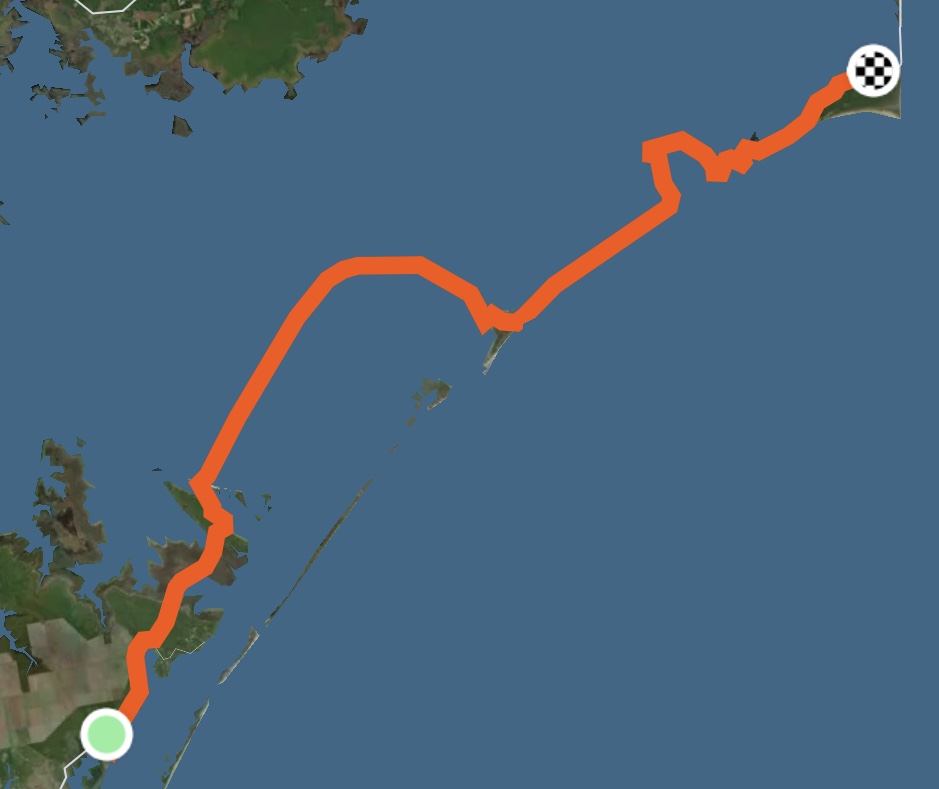
We had a lot of extra time, this morning, because the ferry we were taking was 19 miles away, which takes less than 75 minutes to reach. The problem with this particular ferry is that it only runs twice a day: In the morning at 10:30 and in the afternoon at 4:30. The word, as we pulled out of the 1st Baptist Church parking lot was that we needed to be at the ferry no later than 10:15. That allowed time to go check out an Estuary that Connor stumbled upon yesterday when he went out for a run.
So he led the way and we rode a mile or 2 down dirt roads, passing a few No Trespassing signs and driving up what looked like a private driveway, but was really just a dirt road. We came upon large pools of water that were marshy and swampy, with ducks, swans and other foul floating around.
And that is where Connor announced that it was going to take another 3 miles to loop around the marshy, swampy water we were looking at. I told him I wasn’t up for that, mostly because it was more of a mountain bike excursion than a touring bike excursion, so he suggested riding in 1/4 mile, to which I agreed. Well when we got in there, it was such a cool place, that I said I’d do the whole 3 miles, and off we went, and It was slow going, with lots of stops to take photos. When we finished circling the estuary and got back to the route we were now under the gun to make it to the ferry. We were going to have to be pedal to the metal the 18 remaining miles to the ferry to make it by 10:15.
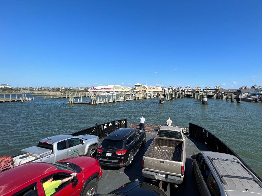
I had to get my navigation going while riding like a maniac, then I decided to also check my text messages, in case the route leader sent us an update, which he or she did. The update was that all of our group now had to be at the ferry by 9:50 am, or our entire group would lose it’s reservation. Talk about pressure. I was pushing myself at 100%, and I would have made the 10:15 time easily, but this 9:50 time? No way! So I sent a text message to both of the route leaders who were driving the 2 vans today to let them know I wouldn’t be making that new time. In the mean time, Connor had called them, and one of them was on his way to pick us up and get us to the ferry so the team could use its reservation. And that’s how my bike got on the rack here.
Connor was about 3/4 mile up the road from me, and he just crammed his bike in the van to save the time required to put it on the rack. Jeremy, the route leader driving the van, drove like a maniac and we just barely made it to the ferry ticket booth at 9:50. Whew! So to be clear, this has compromised the integrity of my ride. I will never return to ride the 8 miles of the route that I didn’t cycle, today. I will throw on 8 additional miles somewhere along the way to make up for the miles missed. I can do that easily with a couple of navigational errors.
The entire team boarded the ferry together, which was kind of fun. During our almost 2.5 hour ride, some of the guys played cards and others sat around and chatted, checked the internet or napped. I worked on stitching my silk sleeping bag liner back together where it is falling apart, so I don’t trash the inside of my sleeping bag, which isn’t nearly as washable as a sleeping bag liner.
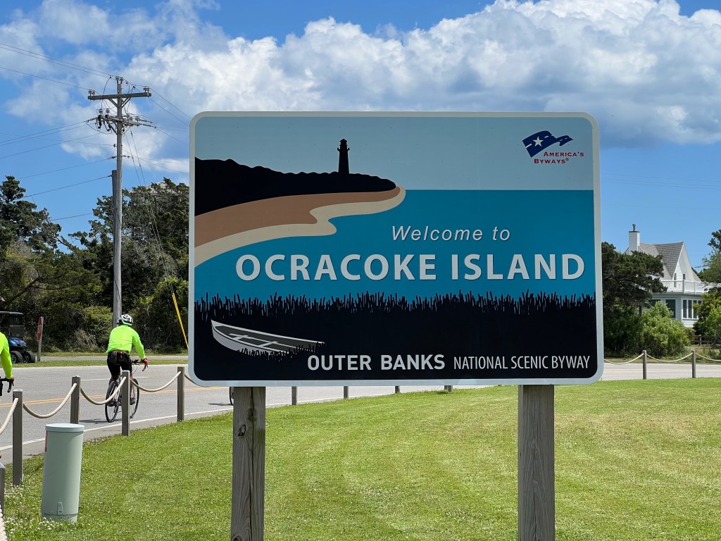
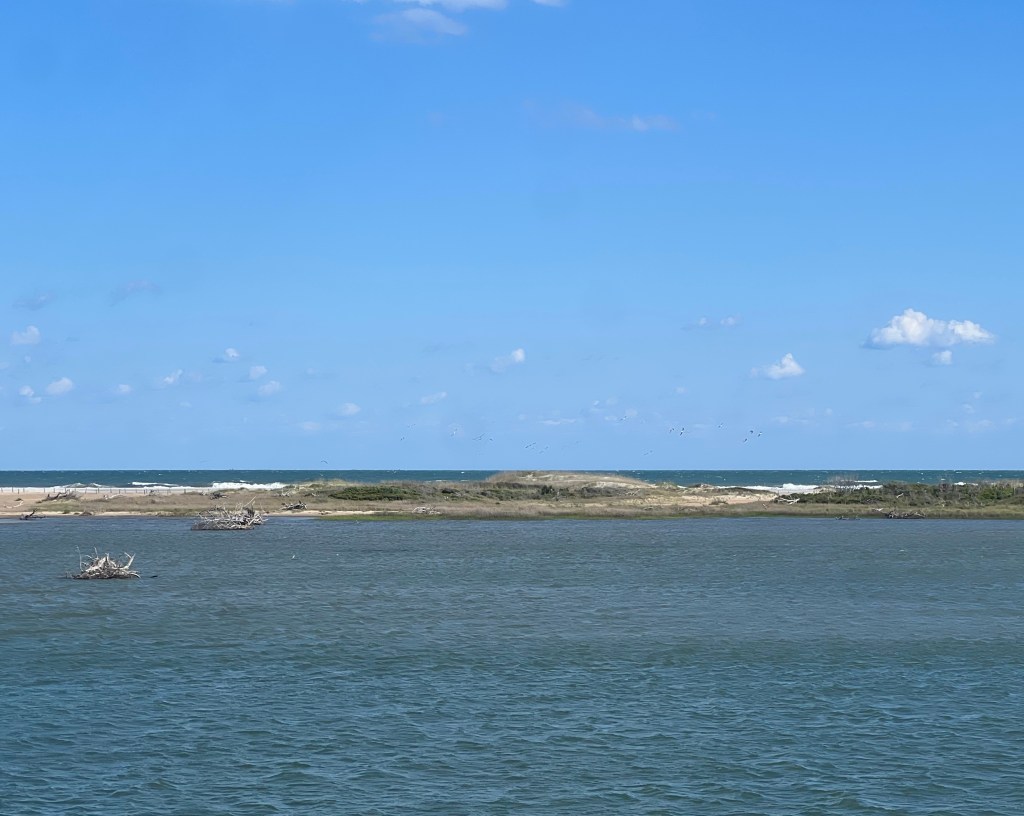
That’s the Ocracoke lighthouse. It’s the second oldest lighthouse in the country.
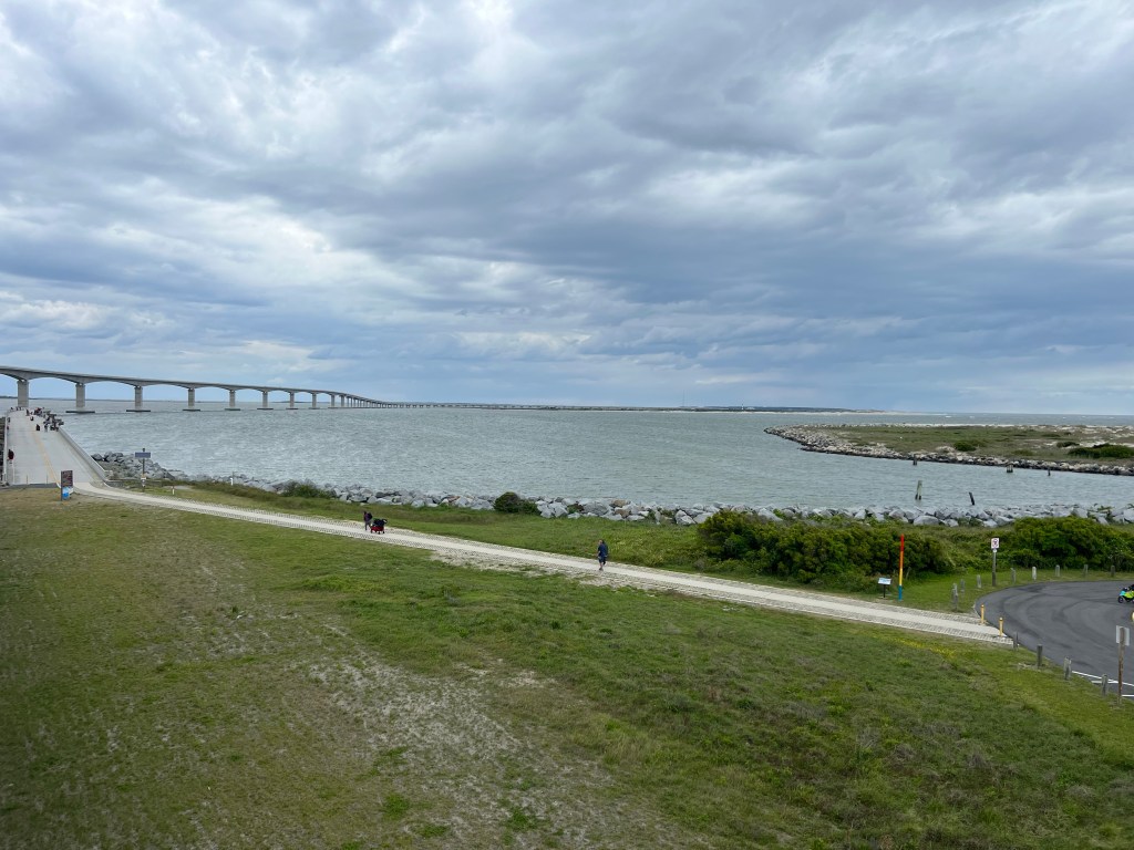
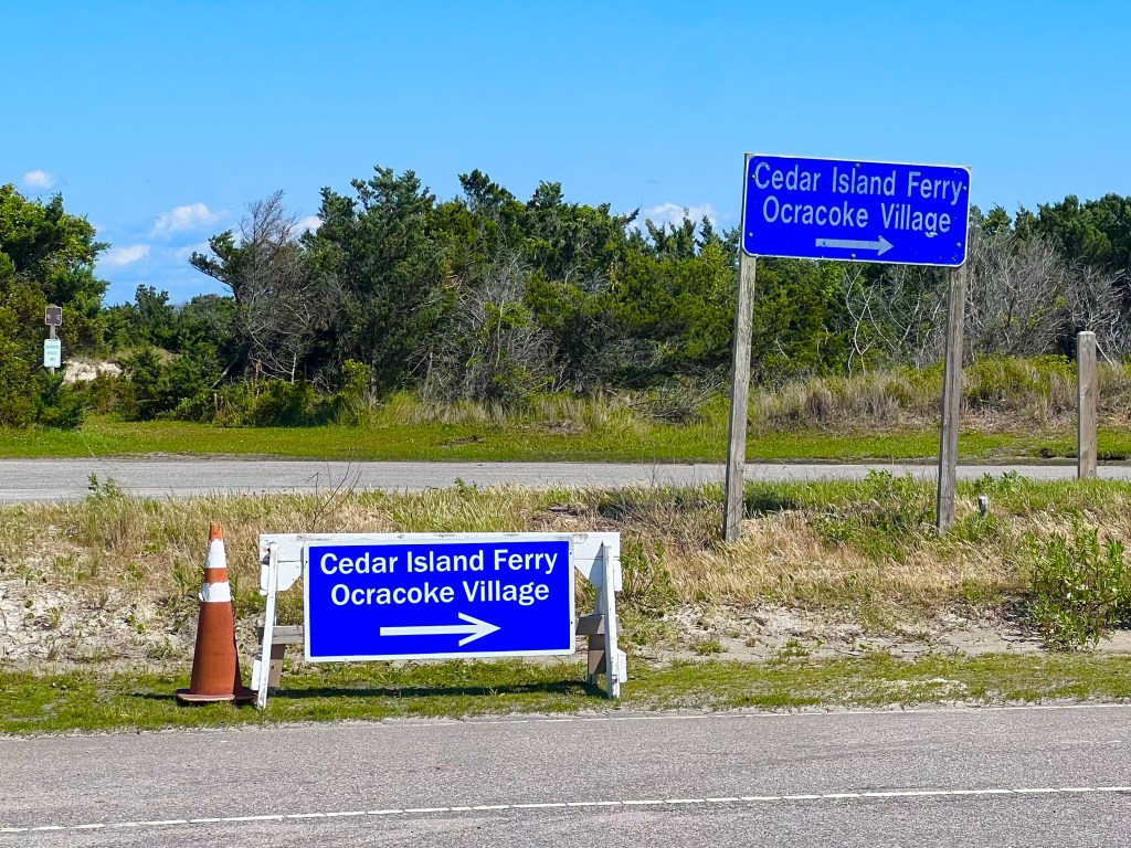
When the ferry landed in Ocracoke, we had just 15 miles of riding with a nice tailwind before the next ferry.
Of the the 3 islands we saw today, Ocracoke was my favorite. It had very few tourist space and very little civilisation overall, seemingly entirely by the Okracoke harbor, where there were a lot of really enticing restaurant, shop and activity choices. Jade, Connor and I stopped for lunch at a local eatery and bellied up to the bar, enjoying a nice meal, before peddling down the route again. After lunch, I pealed off to explore and take photos.
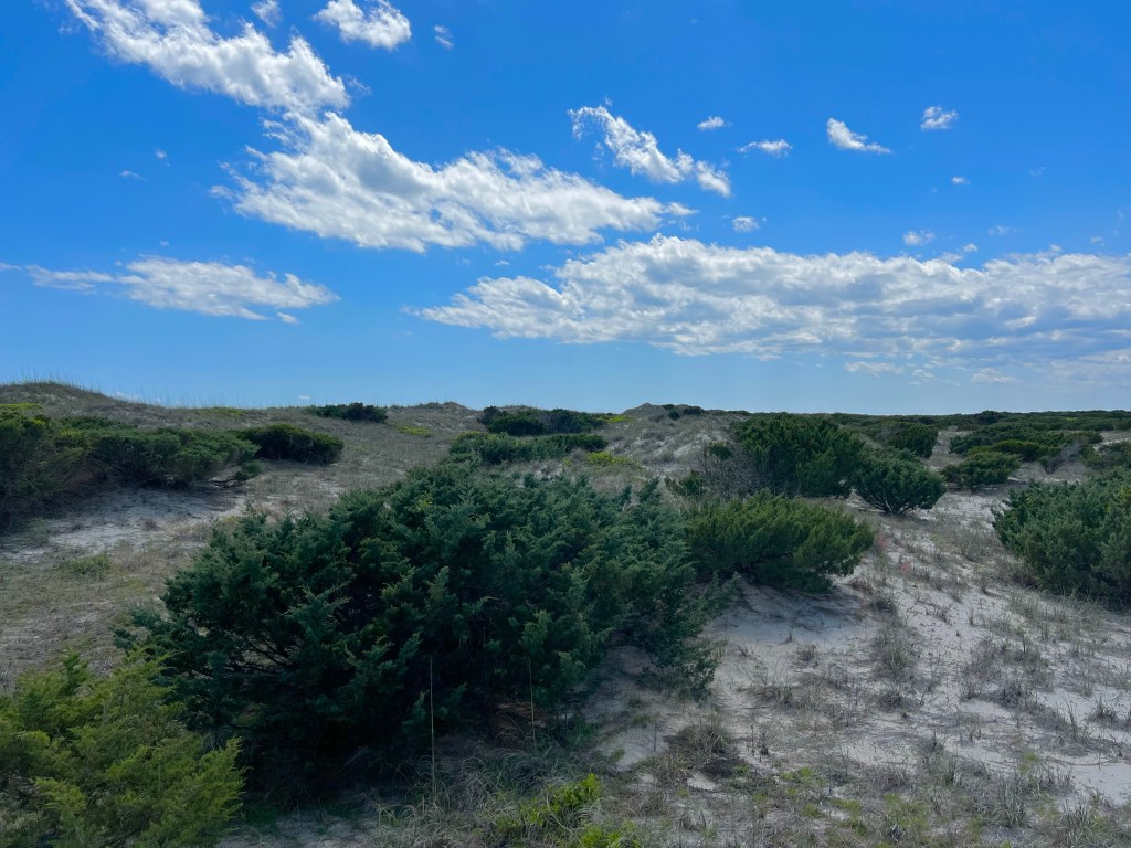
If you remember, yesterday I theorized that the scenery was about to change. Here is proof of that it did—-all going northbound on one island.
After enjoying the sights, I met up with 6 from our group at the next ferry terminal on the north end of Ocracoke Island.
The ferry from there to Cape Hatteras runs every 1/2 hour, so there wasn’t much of a wait for it. Everyone else either slept or phoned friends and family, during this 60 minute ferry ride. I got a call from my daughter Camille, and we chatted for a good part of the ride, which was the highlight of my day. Probably the highlight of my week, actually.
On my way out to get back on my bike, the ladies who had been parked in the van next to my bike for the ferry ride asked me about our bike ride and it being for MS. Turns out that one of them, a beautiful gal named Tracy Morgan, who was sitting in the back seat, has has had MS for 43 years. She didn’t look much older than that, but it turns out that she is actually 59, so has been battling this disease since she was just 16 years old, bless her heart. I had them open the door so I could give her a hug and get a photo with her.
Tracy, if you want to have a dream trip around Arizona, message me, and we can make a plan for a guided tour of some of the most beautiful places in the West. Bring your girlfriends. You and people like you are the reason I am doing this bike ride.
If any of you reading this would like support the cause I am riding for, here is the link to my donor page.
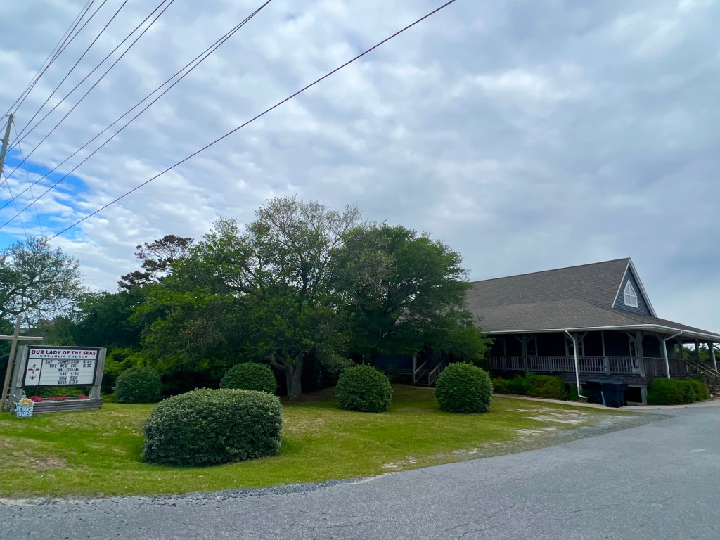
Once on Hatteras, the group rode together for the 11 miles to Our Lady of the Seas Catholic Church community center. This island is heavily occupied, but has a lot of nice quiet places with no people too. The tailwind was so nice, that we moved over 15 mph effortlessly and were at the church in no time at all.
Some super kind and generous ladies from the church plus a husband, daughter and au pair had a delicious meal awaiting us, when we arrived and joined us for dinner.
Afterwards, I took a walk to the waterfront, which was just a 100 meters or so from the church, and waited for the sunset. Found this horseshoe crab also waiting for the sunset. Actually, I have no idea what the crab was doing out and about. It looked like a little armored tank.
We took our last Outer Banks ferry today. Tomorrow, we will just be cruising northward. I’m bringing my swimsuit and towel and will hopefully be able to take some time out to enjoy the ocean.
Miles: 75.70 Today / 1333.8 Total Elevation Gain: 764 ft. Today / 13,846 ft. Total
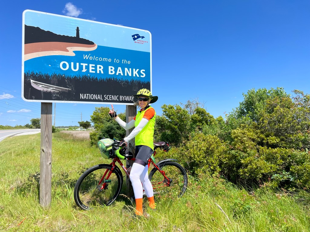
Today reminded me of the day we rode on the the Erie Canal, when I was riding the Northern Tier, 2 years ago. We’d been riding across the country for almost 3000 miles, and all of the sudden, we turned onto this canal we’ve read and learned about since elementary school. Well today, we opened a new map, and took the “Alternate Route,” which goes through the Outer Banks, which I’ve read and learned about since elementary school. I never thought I’d get around to seeing either one of these places, so it’s pretty exciting to be here.
The scenery since Florida has been beaches, lush trees and swamps. The further north we go, the trees get more lush and foresty (is that a word?) and there are less and less swamps. I suspect that I’m about to see a big change, but I won’t know what it is until tomorrow.
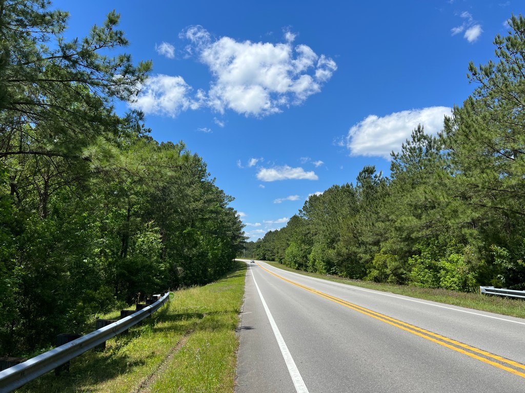
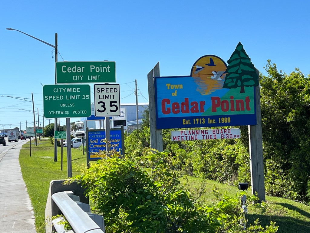
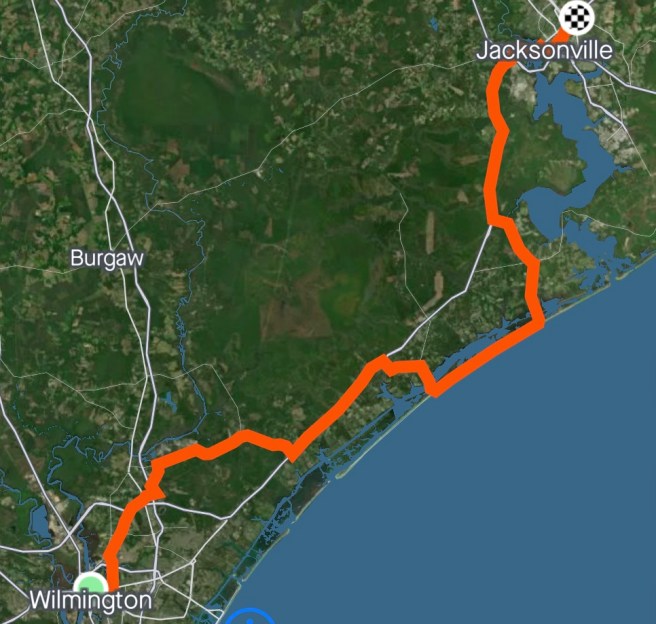
Jacksonville was a busy, trafficy place, when we got on the road, this morning. Once out of town, the alternate route put us on busy Highway 24 and sent us eastward toward the coast again, but as a consolation, a nice tailwind kicked in, gently moving us on our way. We made great time getting to Swansboro, Cedar Point, Cape Carteras, where we had our last major grocery store resupply (we think) for a couple of days. After Bogue, we turned inland to get off of Highway 24 (Hallelujah!) and wound around some scenic country roads.
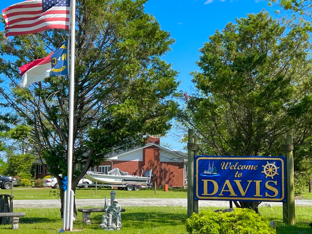
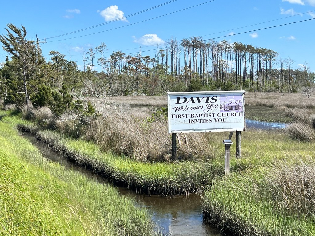
About 60 miles into our day, we turned off on the Outer Banks Scenic Byway, and that tailwind pushed us pretty quickly through Smyrna and Williston to Davis and the 1st Baptist Church that was hosting us.
I did my chores, then settled in for the night.
I am sleeping under the grand piano on the stage of the sanctuary, while my sanctuary buddy, Ed, is sleeping on a bed made of 6 chairs, his blowup mattress and his sleeping bag.
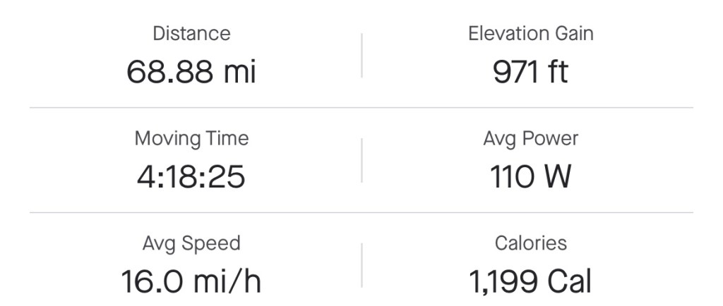
Miles: 68.88 Today / 1258.1Total Elevation Gain: 971 ft. Today / 13,082 ft. Total
Sadly, another Sunday passed by with little opportunity to attend or stream church. I was able to hear parts of two talks, and I listened to the Gentry Station and part of Lamb of God to get my mind in the right place, but it was raining and there was loud traffic racing by me and assaulting me with puddle splash.
It rained a lot, last night, then this morning, the weather forecast didn’t show rain until 2 or 3 PM. Here’s how reliable the weather forecast is: Before we even left the church, it started raining. I wore rain gear till the initial rain cleared, then took it off and stowed it, but when the rain stops, you don’t really stop getting wet. The road is still wet, so the bike tires spray water on you, and there are puddles, and cars love to race through puddles and spash bicyclists, or so it seems. Overall, the drivers were pretty nice, but large trucks aren’t even aware of what’s going on around them. I avoided puddles and veered as far away from trucks as I could.
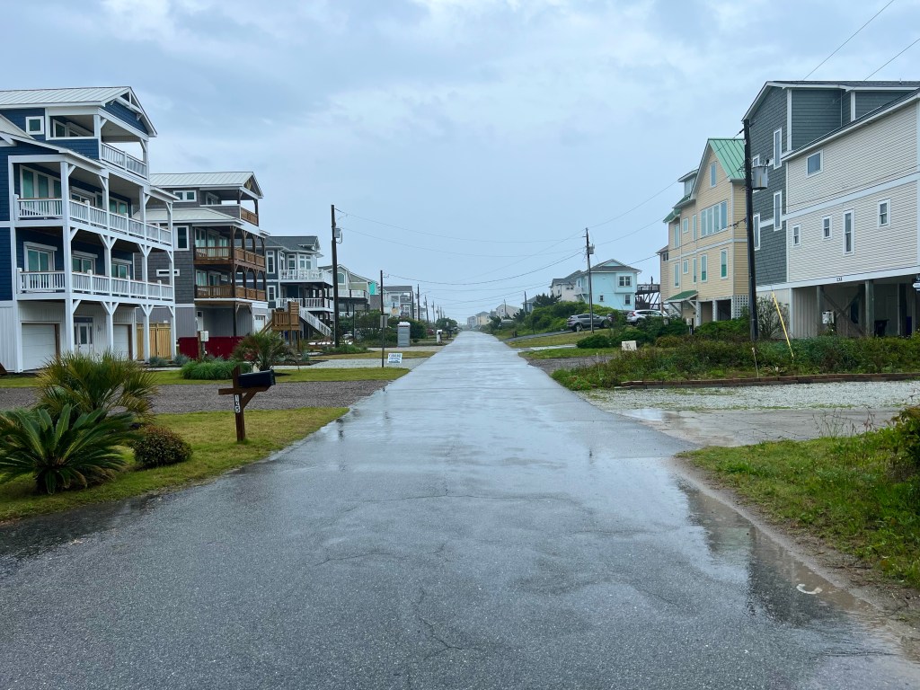
Today, we cycled through Hampstead and the beach towns of Surf City and North Topsail Beach.
At our first rest stop, dark clouds rolled in and it started sprinkling, so a couple of the guys and I decided to wait it out—a very bad move. We should have first checked the weather radar, because it would have shown us that there was about to be a 2.5 hour torrential downpour. No point in waiting anything out. I put on all my rain gear and pushed off in the downpour. Within a minute, I was soaked, and my shoes felt like they were having a flood.
When it’s raining, taking photos is pretty much out of the question, because it messes with my phone. I cheated, though, and sneaked in a few photos of the rain, just to prove I rode in the rain—something I would NEVER do in Arizona.
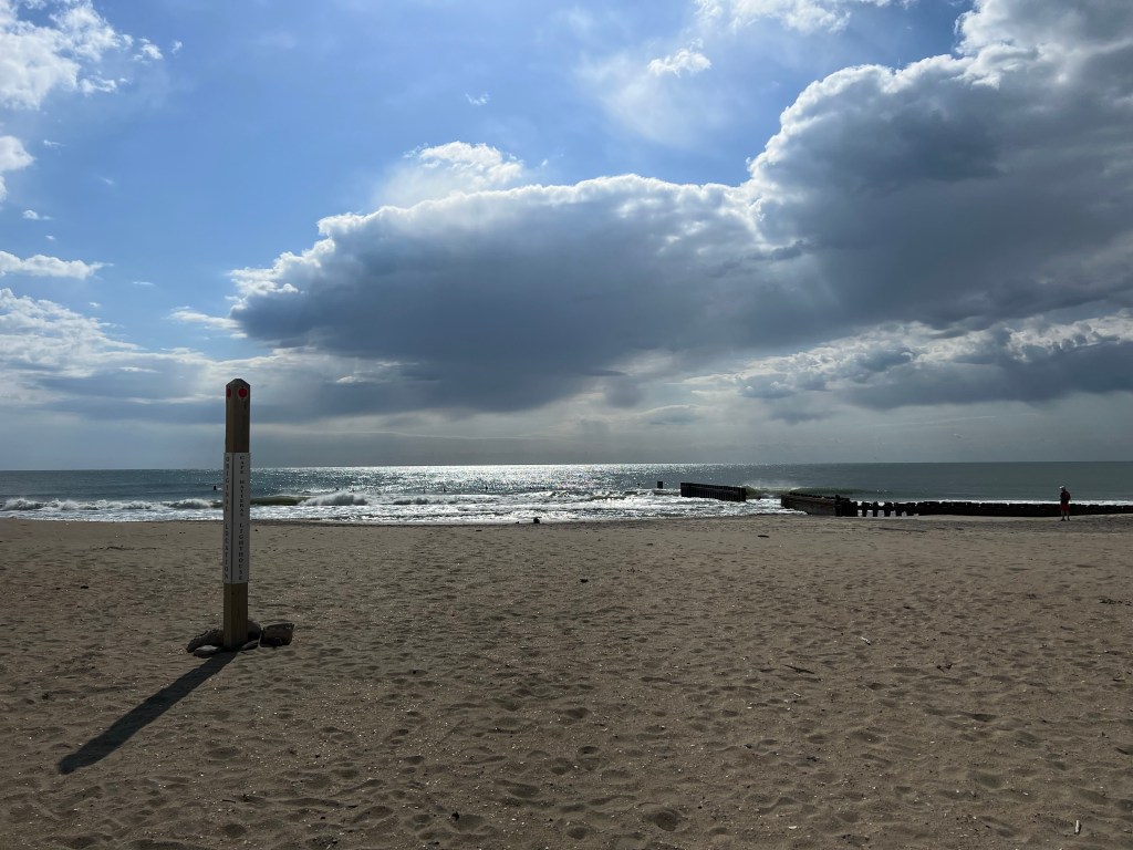
I rode right through Surf City, but the rain was too heavy to even think about stopping for photos. It was lightening up when I got to Topsail, so I took my chances at keeping my phone dry. The beaches were completely empty. See?
When the downpour ended, a few miles past North Topsail Beach, the tailwind picked up, but I was hungry, so before jumping on that tailwind, I stopped for lunch at a Dairy Queen. While I ate lunch, I dried out and warmed up in the sun and changed into dry socks and gloves. After stowing my wet clothes and gear, I shoved off. With a healthy tailwind, I made great time for the rest of the day, cruising at over 18 mph.
When I rode up in the Welcome to Jacksonville sign, I learned that this is the home of Camp Lejeune. Do you think I should avoid drinking the water?
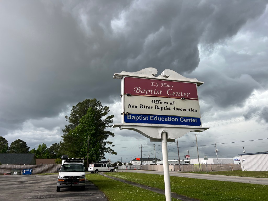
We’re staying at the E.J. Hines Baptist Center—not a church, a center. I’m sleeping in a room where they do group counselling, and I think the guys are staying in a couple of classrooms.
While I was settling in for the night and cleaning my bike, the dark clouds rolled in yet again, and another torrential downpour dumped rain for an hour or so. Glad I wasn’t out in it!
Tomorrow, we will start riding The Outer Banks, which is pretty exciting!