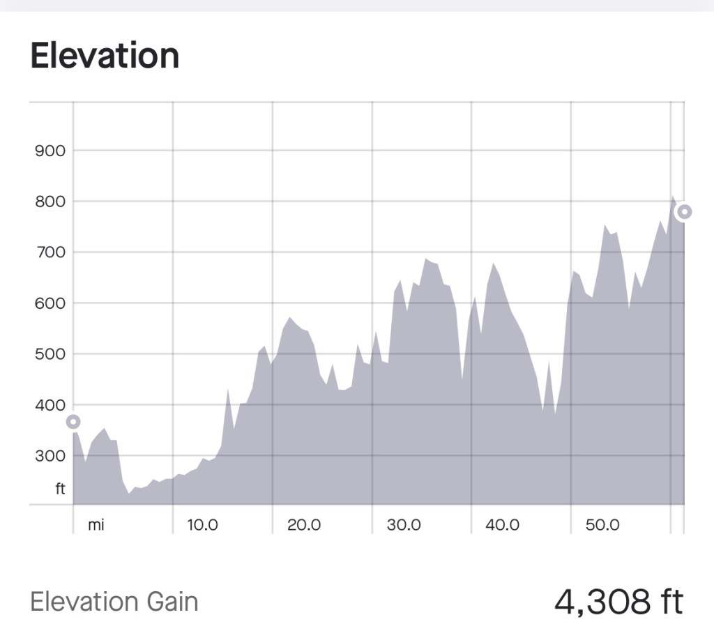
Miles: 61.41 Today / Total 1887.32
Elevation Gain: 4308 ft. Today / 37,573 ft. Total
After a great night of rest, I hit the road, ready to knock out the 60 miles planned for the day. The relatively low miles sounded pretty easy. NOT!
Following a Google Maps course back to the Capital Crescent Trail, I found the spot where I left off yesterday and started moving northward toward our destination for the day. And I was moving along nicely, when suddenly the trail dumped me out onto a busy street. Every direction I went, my GPS told me to make a U turn and go back. So I started asking people where the trail was, and the ones who weren’t also tourists explained that what used to be the trail is now being turned into a subway line, and the real trail continues somewhere up north at a place they don’t know. Lovely. Here’s the thing. All of us who were riding our bikes had this same experience, and we all had to figure out a way around it.
I noticed signs for a detour of the Georgetown Branch Trail, and started following them, but at some point, I had to be sure I wasn’t headed in the wrong direction, so I started asking people on the trail if I was headed in the direction of the next trail I needed to get on—the Rock Creek Trail. One woman, who is also a cyclist, looked at my map and gave me directions to the Rock Creek Trail, and within 20 minutes or so, I was riding up on Ed, who had also received similar directions. What a relief, but so much time had been wasted!
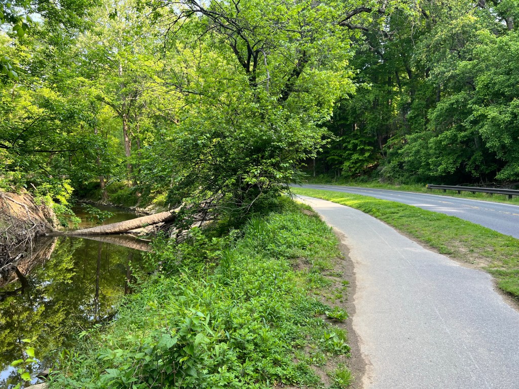
The Rock Creek Trail avoided cars, but it was narrow, winding, bumpy and hilly. The roads that it looped away from were straighter and flatter, but sometimes the trail wound into the woods and came out next to a different road, so jumping on the roads wasn’t an option. I can’t believe I was hoping for a paved bike path to end, but when it did, I was actually relieved.


A couple of miles after the trail ended and we were riding on real roads again, we hit our first rest stop and had a chance to vent about the map and GPS malfunction and the winding, hilly, bumpy trails. We’re in the 21st century, you know. Things should be better than this. Enough of that, though. We had to get moving again.
Once we got back on the road, the roads were all hilly, with about half of the hills having at least a short bit of 9-10% grade, which is steep for a bicyclist. In the first few of miles, I ran into this cabin that housed slaves, back in the 1800s.


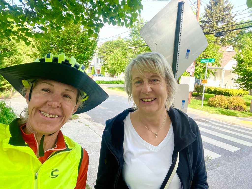
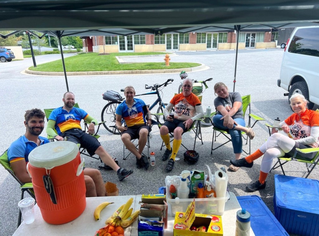
After a couple more miles, a gentleman cyclist who appeared to be a couple of years older than me came up behind me and struck up a conversation. He was a strong rider and a big talker (as in he could talk, while I gasped for air on the uphills), and he kept my mind off of about 21 miles of climbing up and around the country roads he rides on all the time. He joined us for a snack at our second rest stop and took this photo.
And that’s the last photo of the day. My brain was fried, but the hill climbing continued on till we arrived at the Glydon Volunteer Fire Department—our hosts for the evening. I asked the other guys if any of them had taken photos, so maybe I could use a couple of their photos, but the other bloggers were also too wasted to take photos. Sorry folks.
It had been a tough day for all of us. We took turns showering in the one and only shower at the fire station, rounded up dinner from nearby stores and restaurants, got our gear ready for tomorrow and turned in early.
Be sure to check out the elevation profile below.


Hi Elieen, It’s me Jo Beth. If you need any directions my husband has a map in his head and owns books of maps. He used to live in the area and run alot, so he can help you. I don’t actually know how to get in touch with you other than this way. So I don’t suspect that we can be of any help.I am still following you all and sharing your great adventure the only way I can
I am going to Oak Island next week for some rest and a family wedding. I am so excited for my cousin . I will still keep up the reading of your groups adventures. I am a addicted now to keeping the adventure going in my head.
LikeLike
Must be nice to be married to a kind genius! And enjoy your trip, Jo Beth!!
I have 3 different maps with me at all times , but it can be hard to make sense of them and figure out which way to go. I added another GPS source on my phone yesterday, when my Garmin quit working. I had all these ways to get directions, but no way to get the exact directions the team is using so I could stay on track with them. So frustrating, but I figured out a way around it
LikeLike