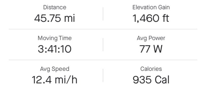
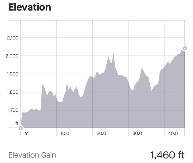
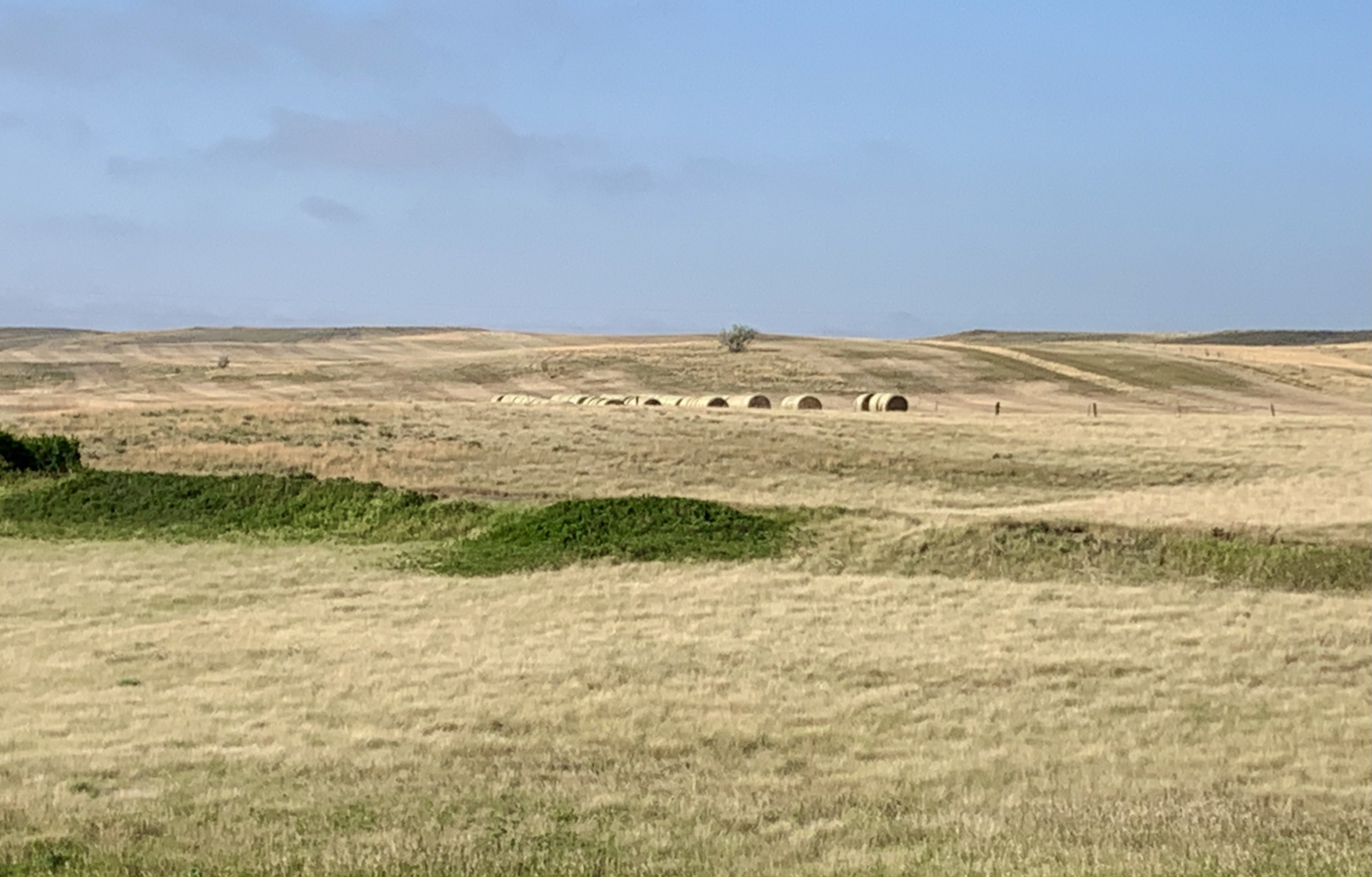
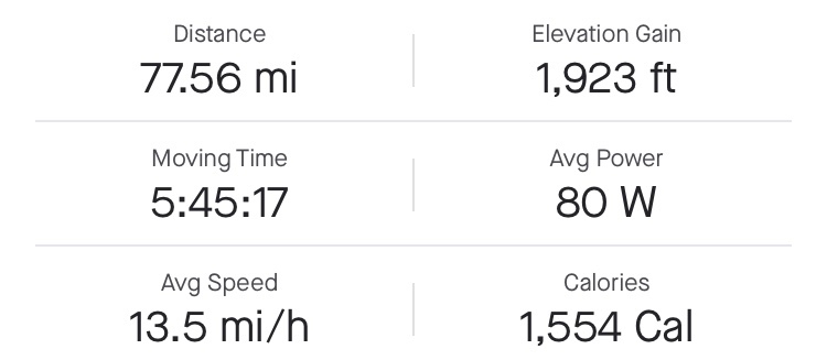
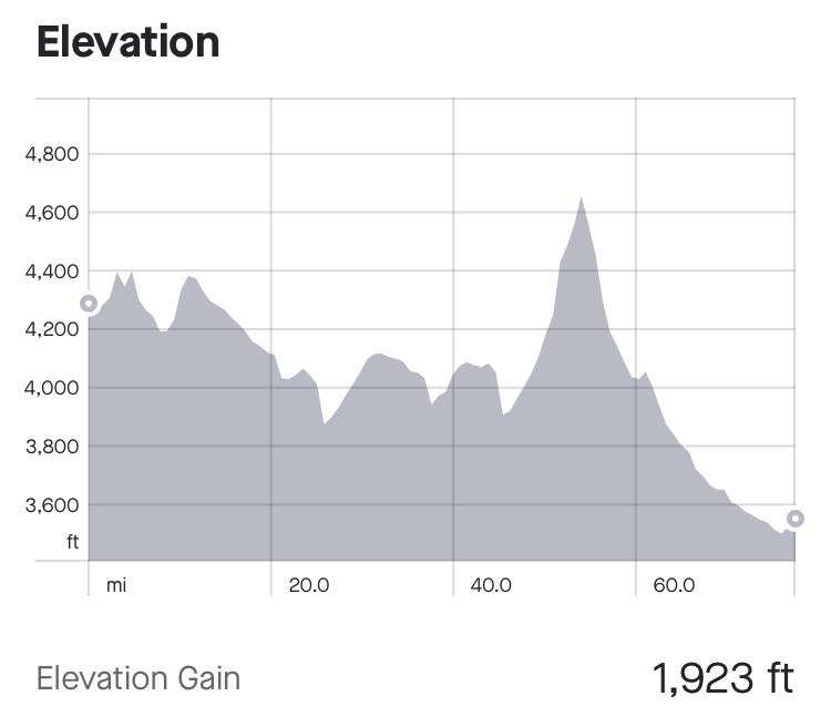
1460Ft. Elevation Gain / 66,325 Ft. Total Elevation Gain
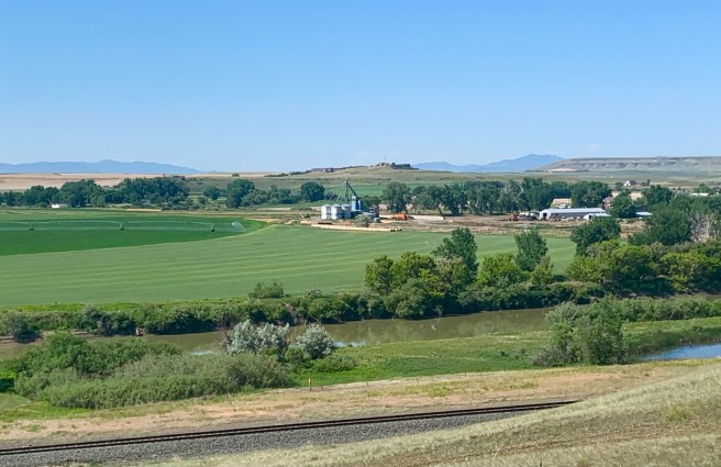
After a nice comfie night in a hotel bed, with gazillion thread count sheets and pillow cases, and eating a free hotel breakfast, we made a quick stop at a grocery store, before heading down the road for an easy 45 mile day. The weather prediction was great: 6 mph wind–nothing to be too concerned about, with a high of 80 degrees. We spent the day on mostly quiet 2-lane roads, passing crops and cattle.
There are rows of trees everywhere, to break the wind. This photo shows 7 or 8 rows.
I was noticing, today, that the cows in North Dakota aren’t as social as the cows in Montana. When we ride by, only a few of them face the road and watch us, where in Montana, they all faced the road and watched. Maybe there is a charm school for cows, somewhere, where these cows can learn some social graces.
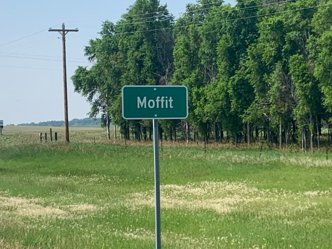
A few miles before Moffit, our half way point, I stumbled upon a butcher shop in the middle of no where, with beef jerky listed on its sign. I had to stop. Beef jerky gets stuck in my teeth and drives me nuts, but I didn’t care. I wanted some anyhow, just because it was there. So I parked my bike and went inside. And that’s where I learned that this beef jerky is different. It has to be refrigerated, because it doesn’t have all the additives the jerky in the stores have, and it is actually juicy. The lady working the counter just gave me some jerky–wouldn’t take my money, no matter how hard I tried to give it to her. And it was delicious.
Passing through Moffit, a few miles later, there were no signs of a town. None. Shortly after that, we learned that we were on the Lawrence Welk Memorial Highway, honouring Lawrence Welk, who was born and raised in North Dakota and started his career here. When I was a kid, my parents tuned into his Saturday night show, while Mom put curlers in the girls hair and Dad polished his shoes. Those were the good old days.
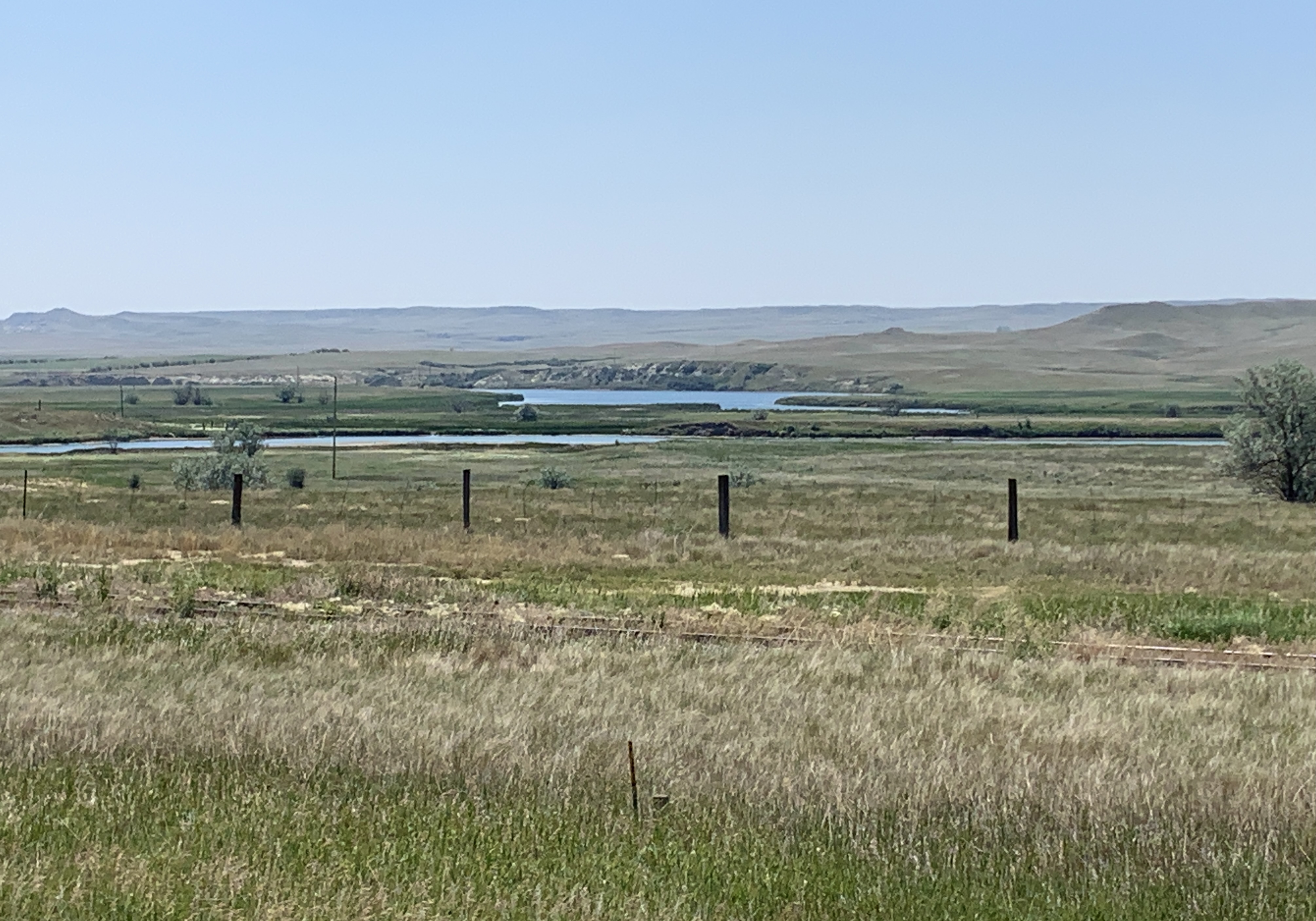
Long Lake, which is part of a huge wildlife refuge.
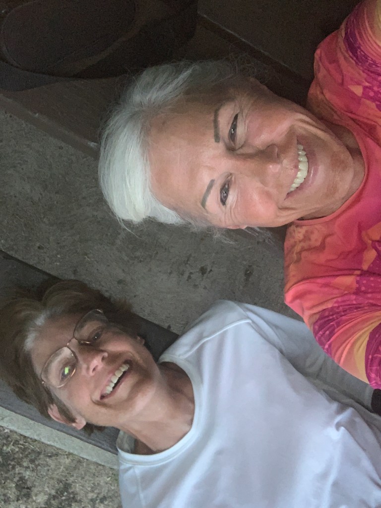
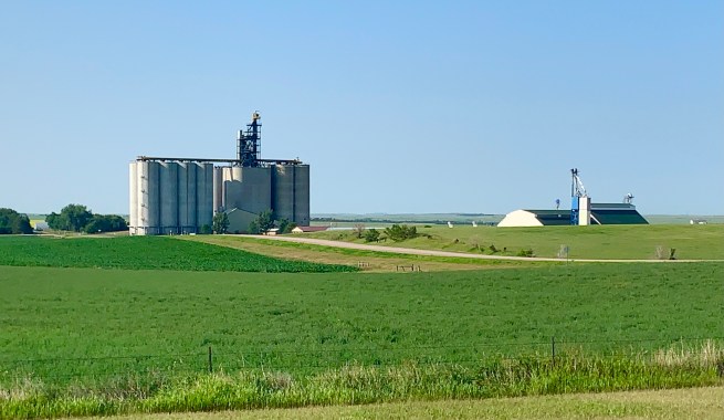
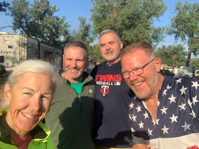
When we arrived Hazelton, we headed straight for the city park, because that’s where we were camping. And there waiting for us was our friend Sue, setting up her tent and getting settled in. It was good to see her again.
It’s hard to take a selfie with someone who’s resting on a picnic table, but we figured it out.
We relived our Pampalona moment in Teddy Roosevelt National Park, and had some laughs with her. After setting up my tent and taking an ice cold shower (that’s right–there’s no hot water in the bathrooms), she and I took a walking tour of the town, while Ed napped, then we all ate dinner together at the Road Hawg Grill.
Hazelton felt like it was right out of the Twilite Zone. The prices on groceries and restaurant food were normal big town prices, not the ridiculous small town prices we’ve been paying most of this trip.
1280 Ft. Elevation Gain / 64,865 Ft. Total Elevation Gain
While we sat at under the ramada blogging, .last night, the wind was picking up and it turned downright cold. I had to dig into my cold weather bag to pull out a jacket. By the time I went to bed, I’m thinking the wind was 20 mph, so I put my tent fly on to keep from getting cold. It’s a good thing I did that, because it rained early this morning, while I was sleeping.
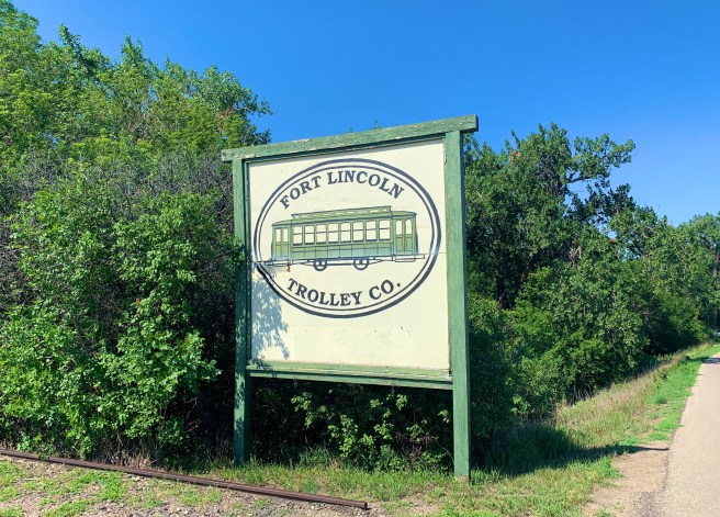
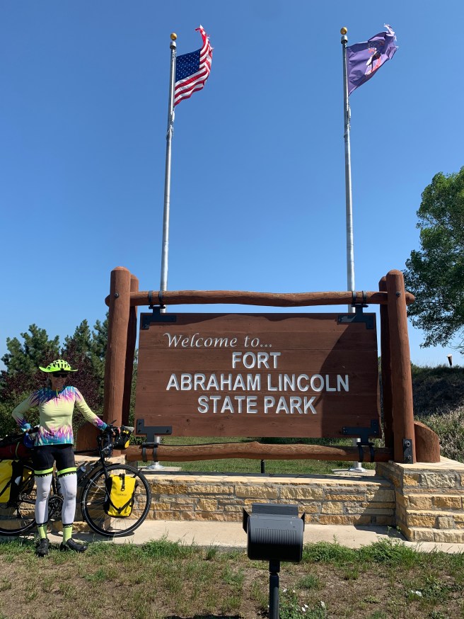
We slept in, a little, because we had a pretty short day ahead of us. We had split an 80 mile day into 2 days and added little side trip on to see Fort Abraham Lincoln State Park. The plan was to head toward Bismark, but at Mandan, we would go off route a little over 6 miles to check out Fort Abraham Lincoln State Park, then camp there. Everything was peachy, with a nice quartering tailwind, as we headed east toward Bismark, then when we turned south at Mandan, that turned into a dead on tailwind. Throughout the day we had been climbing some pretty big rollers, with the tailwind giving us a boost. As we rode the 6 miles toward the park, I started having thoughts about how it might just be a hoaky little picnic area, with not much to see. Ed was also secretly having the same thoughts,, but neither one of us spoke up, and if we had, I”m not sure we would have turned around. With the six miles down, we turned at the sign for the park, and now had to ride north for 1.5 miles directly into what was now a 12 mph headwind. Even if the park had nothing to see, with that headwind, I was not going to want to backtrack those 6 miles back to the route and move down the road,
Well guess what. The park was hoaky. We bought ourselves some cold drinks in the gift shop, .to The thing is, if we did turn around, we would be facing 6 miles of rollers, with a pretty stiff headwind.
1765 Ft. Elevation Gain / 64,865 Ft. Total Elevation Gain.
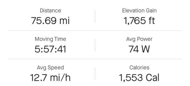
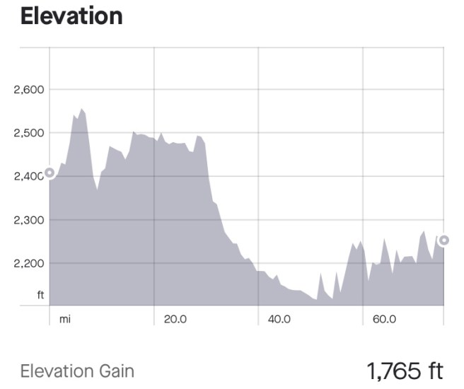
We had a 76 mile day ahead of us, so we woke up at 5 AM to try for an early start. The hotel served breakfast, so no need to set up the stove or worry about washing dishes. I don’t know what took so long, because we didn’t get out the door till 7:25. Our route followed Old US Highway 10 Scenic Byway, for the most part, with slight cross winds, very nice pavement, and lovely scenery. Since it was Sunday, there was no large truck traffic and hardly anything was open in the towns we passed through. I was hoping we would arrive in one of the towns on our route around the time they had a church service–any church service–so we could go to church, but that didn’t work out.
Blast from the past! We spotted a Yeti!
The scenery was little towns (Taylor, Richardton, Hebron and Glen Allen) separated by crops, cattle, large grain silos, and wind turbines.. At about the 2 hour point, we are usually ready for a cold drink, but nothing was open anywhere, so there was no way to get a cold drink. Ed was running low on water, so he filled his bottles with water from the spigot at a cemetery we passed, and now his water tasted like embalming fluid.
In Taylor, I decided that I need to take a welding course at one of the community colleges, when I get home. Really cool metal signs and yard art were abundant.
In Richardton, we visited the historic Assumption Abbey, home to 59 Benedictine monks. Communion was going on, when I stepped in, followed by a lovely musical number performed by 6-8 men playing recorders. Yes, cheap little plastic recorders. It sounded peaceful and lovely.
Crops and art of a wind farm
In Glen Ullen, we finally found a Cenex gas station and convenience store that was open on Sunday, and they were serving delicious, hot single serve pizzas and cold beverages. After a little break, it was time to get back at it.
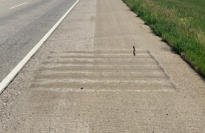
After a pleasant day of riding on mostly smooth roads, our route put us on the interstate for 13 miles, because there were no other paved roads to take us east. The traffic was heavy and the rumble strips were INSANE. Instead of a 6-8 inch wide strip running alongside the white fog line, these rumble strips were almost the width of the shoulder, with 6–10 inches of space to the left of them and 12-18″ to the right. And they weren’t really a strip. They were a grid that was stamped in the asphalt every 40 feet. When we passed the rumble strip on the right, often there were plants hanging over the shoulder, and sometimes plants have stickers, so that did not work for me. On the left side, there was sometimes only 6 inches of space between the white line and the stamp. For 13 long miles, I had a death grip on my handlebars, and looked at nothing but my rear view mirror and the rumble strips in my path. Okay, I’ll admit that I occasionally glanced to the right and left to see if there was anything out of the ordinary to look at, but there wasn’t.
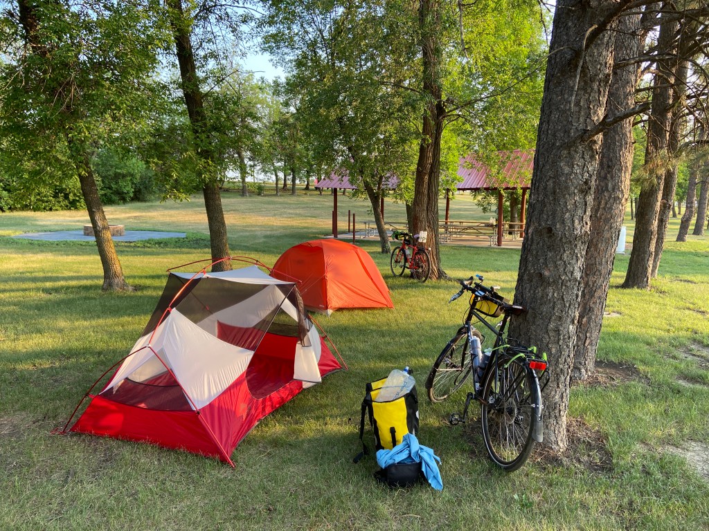
In New Salem, we set up camp in the city campground and had access to water, electricity and a porta potty–a nice, clean porta potty, complete with hand sanitizer. Ed did some checking and learned that the city pool has a shower, so we grabbed our swimsuits, some fresh clothes and a few hygiene items, and headed out for a swim, so we could shower. Then we were off to the local Cenex gas station, hoping they served some hot food, which they did. They even had some delicious scoop ice cream, so I left there a happy camper.
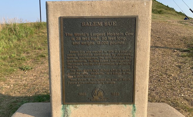
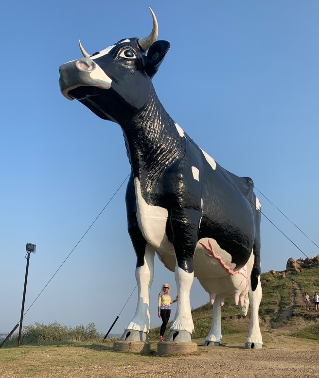
On the way back from the Cenex, the huge cow on the hill in front of us reminded us that this is the town where we were supposed to look for Salem Sue, the World’s Largest Holstein, at 38 ft. high and 50 ft. long. She was way WAY up hill, but it looked like there was a road up that hill. So we took our freshly showered and fed bodies and put them to the task of climbing a steep dirt road to get to the top of Salem Sue’s hill. It was totally worth the effort.
We dosed ourselves with bug spray and sat at a picnic table under the ramada, till bed time. And as we sat there, the wind picked up and the temperatures dropped, to the point that I had to don a jacket. By the time I went to bed, I’m thinking the wind was up to 20 mph, and it blew most of the night.
1460 Ft. Elevation Gain / 61.820 Ft. Total Elevation Gain
If you don’t like reading, I suggest you skip this post.
You know, lots of things happen that never make it into this blog. Like this: While hanging out at the bike shop, yesterday, a gal named Sue, from Ohio, came in to buy a water bottle, and I was noticing that her purse was actually a handlebar bag, and that she had an Adventure Cycling map in a clear sleeve on the top of her bag. She was about my height and looked to be about my age. Turns out she was riding a section of the Northern Tier—from East Glacier to Fargo. So later, at the Medora Musical, when people stood up for the intermission, I noticed her in the next section over, and waved until I got her attention.
Roll the clock forward to today. I awoke early, packed up all my gear and walked down a few campsites to fill my bottles at the communal water spigot. And there she was again, camped out right by the water spigot. So we talked for a few minutes, and she told me that she was getting a ride into Theodore Roosevelt National Park at 8 AM, with a friend named Paul, who she met on the route, a few days ago. I asked her if it was Paul the doctor (the one we met in Dutton, then ate dinner with in Great Falls), and it was. Paul was staying with a friend of his who lives outside of Medora, and the friend was letting him use one of his vehicles to see the park, today. Sue’s plan was to sight see for a few hours, then put in a short day of riding, which would get her to Dickenson, just 38 miles away.
I headed back to our campsite to tell Ed about Paul coming to our campground to take Sue into the park, but before I could get to our campsite, a couple of guys in another campsite accosted me and wanted to hear about our ride. They invited me and Ed over for breakfast, and this happened to be one of those days where we were out of breakfast food, so a breakfast offer sounded really good. I told them that I had to check with Ed, and headed over to our campsite, where I told Ed about Paul and the breakfast offer. Ed shot a message off to Paul to see if we could get in on his trip into the park, and we started revising our plan, for the day, to ride 38 miles to Dickenson, instead of 60 miles to Richardton. This would make our next day a 74 mile day, but that was doable and totally worth it for a chance to ride into the park with Paul and Sue and possibly see bison in the area we were not able to ride our bikes to. Meanwhile, Paul was driving to pick up Sue, so he didn’t see Ed’s text message, but we were counting on him to let us come along, because he’s that kind of guy, so we were proceeding with changing our plans for the day, as if we had heard back from him.
We were all packed up, so we had time to head down to eat breakfast with the guys in the other campsite, Paul Lindstrom and Steve Birch, and they impressed the heck out of us. They had cobbled together a couple of mismatched bowls, cups and spoons, and put out all the breakfast food they had—coffee, granola, Pop Tarts and yogurt. They offered to make us peanut butter and jelly sandwiches, and tried to get us to take some trail mix and granola bars of theirs, and would have basically given us the shirts off their backs to help us out.
We enjoyed our conversation with them immensely. They have quite the story: Being best friends since 3rd grade, after high school, they joined the Army and went to basic training together. Both guys love history, but their wives are not quite as enthusiastic about it, so they take vacations together to the places their wives wouldn’t be interested in, which I think is really cool. (I need to find myself a friend like that.) Paul is a high school history teacher, and Steve is a retired US Army Colonel, which Ed and I can both relate to, with our military backgrounds. We had to get going to get ready to meet Paul, but wished we could stay back and camp near them another night, just to hang out with them. Thanks for the wonderful breakfast and conversation, Paul and Steve. You made our day!
Back to our campsite, we checked out of it and locked our bikes to some railing, them sat out front to wait for Paul. When he pulled up in a Jeep, with plenty of room for us, no words were needed. We piled in and another adventure began. Non stop conversation was the background for all of us scanning the terrain for bison and eagles. We saw a zillion black tailed prairie dogs, never saw an eagle, but did see a few bison on top of distant buttes. Paul turned off on some dirt roads that weren’t on the park map (maybe the bison were hiding there), but still no success. When we reached the end of the park road, we turned around to double back on our route.
Prairie Dog Town
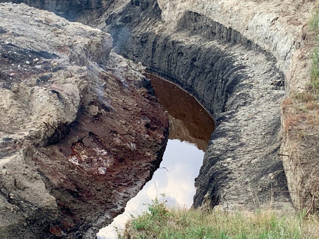
One of the coal vein fires burning in the park right now.
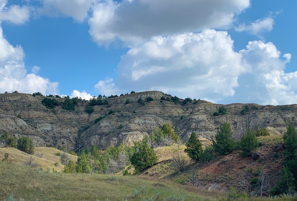
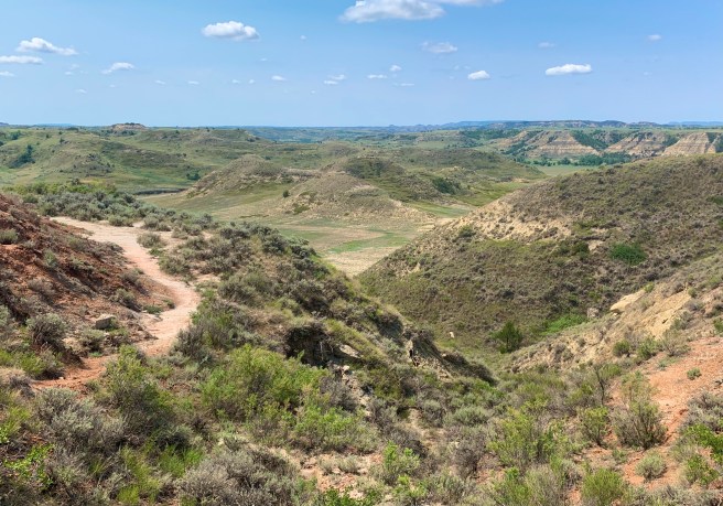
Just scenery–no animals.
Wild horses x 3
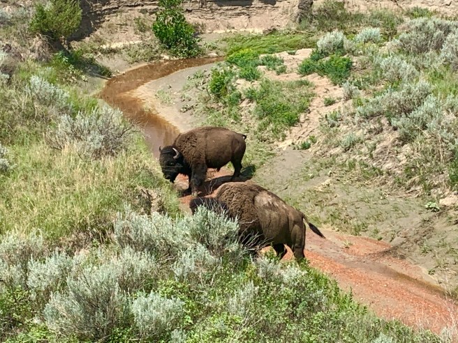
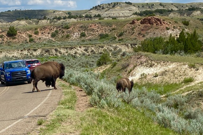
As we rode along, Paul noticed off to the right a large herd of bison. We stopped to take photos, and that’s when we noticed 2 very large bison on the left hand side of the road. They were behind the leafless branches of a dead tree, so we advanced to where we were maybe 90 feet from them, so the leafless tree wouldn’t be in our photos. And that’s when the bison decided to move—closer to us. And they were moving very quickly. We backed off toward the Jeep, but they were advancing on us more quickly than we were backing away from them. We ended up having to run for the Jeep. They crossed the road right in front of our vehicle and headed off to join the herd.
Our need to see wildlife had been satisfied, so we headed back to town to pick up some lunch together, before parting ways. We probably won’t be seeing Paul or Sue again, on this trip, but we sure did enjoy spending time with them.
Here’s where they head our way.
And this is where they cross the road instead of sticking their heads in the open windows of the Jeep. Paul had the keys and was on the other side of all the excitement.
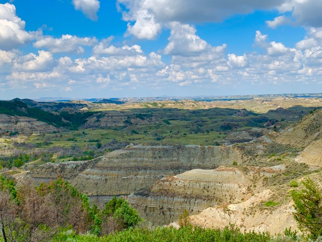
Now it was time for us to high tail it up the route. At 1:30 PM, we had 38 miles to cover, with potential headwinds. But we had a strange form a adrenalin powering our legs up hills and through the wind. We still stopped to see things that caught our eye, like the Painted Canyon Visitors Center, with the best views of the park we had seen yet. Spectacular.
We passed wheat, corn and hay crops; a couple of oil well sites; cattle; and an invitation to bikers for cold drinks, from a place that was closed. Way to hurt us. When we pulled into town, we came up on what looked like a cheap motel and were able to get a room on the ground floor. The lady at the front desk gave us cold water bottles and offered to do our laundry for us (Wow! Amazing people!) All in all it was an excellent day, from start to finish.
1306Ft. Elevation Gain / 60,242 Ft. Total Elevation Gain
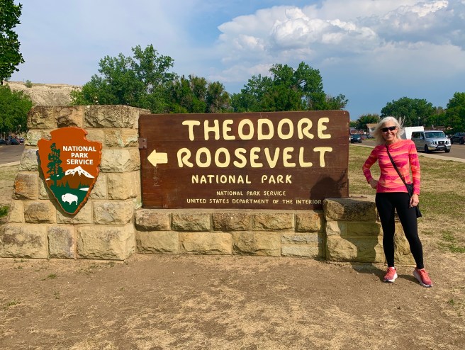
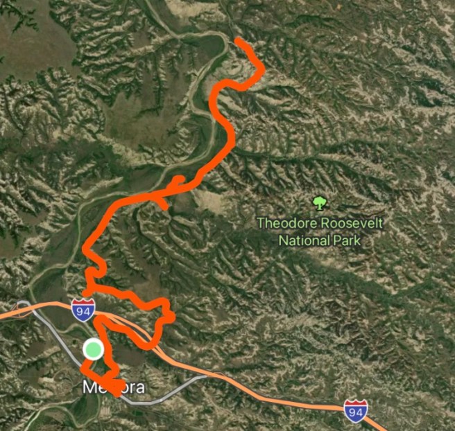
Today was a rest day, so we decided to burn our legs out by going on an easy ride into Theodore Roosevelt National Park, except it wasn’t an easy ride.
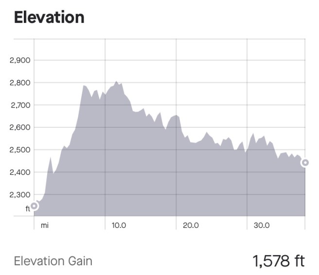
There was no late night blogging to be done, last night, because our RV park’s wifi didn’t work worth beans. So it was a night to call a few friends and family members and get some rest. I woke up when the sun heated up my tent and couldn’t get moving, but it didn’t matter, because we were taking a day off to see Medora and Theodore Roosevelt National Park. Yesterday, we made a quick stop in the Visitors Center, to bone up on the park and come up with a strategy for for seeing it from our bikes. Today, our bikes were unloaded, so they felt pretty light, as we rode 11 miles out the park road to look for eagles, bison and prairie dogs. We were hoping for an easy ride, but that is not what we got. The road was windy and hilly, with grades up to 10% (check the elevation profile). This was supposed to be a rest day for us.
Teddy Roosevelt’s ‘Camp David’ getaway equivalent was the Maltese Cross Cabin, with a small gathering room, a smaller bedroom for one person, and an even smaller kitchen.
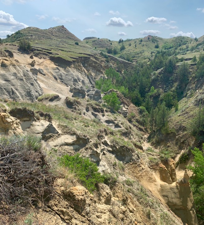
Wind Tunnel Canyon
Prairie dog sighting was a no brainer, as there were multiple prairie dog towns, with hundreds of prairie dogs running around, posing, sunning, eating, and showing us the wave. Black Tailed Prairie Dogs live with their families in underground burrow complexes, and they’re busy little critters. They have some really cute moves, my favourite being a wave similar to what sports fans do. at football and basketball games.
As we poked along on our 22 mile route, we saw zero eagles, one wild horse and one bison–both far, far away on distant buttes. It was a little disappointing.
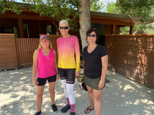
,When we got back to Medora, we split up. Ed went out to lunch, then took his bike to the first bike shop we’ve seen since Winthrop, and I ate lunch with 3 travellers from Philadelphia, who I met while looking for bison in the park. One of them owns a deli and had all the fixings for a wonderful lunch. We talked about our travels, families, and plans for the future, for a couple of hours, then they had to hit the road. So I headed into town to look for some postcards and ice cream, and to air up my tires with a real bike pump at the bike shop.
Linda and Diane from Philadelphia. Photo credit to their friend Kevin.\
The owner of the bike shop, a gal named Jennifer, has owned the Cactus Bike Adventures arm of the now closed Cactus Bike Shop, that was formerly at the corner of 48th Street and Elliot, in Ahwatukee. She and her husband spend their summers in Medora, where they rent and repair bikes and provide a shuttle service on a popular trail. Then winters, they head down to my old neighbourhood, where they rent a house on Piedmont and run their bike rental and touring guide business out of a trailer at the Arizona Grand Resort. Small world, eh? I think Jennifer told me they have been coming down to my neighbourhood since 2005. How have I never seen her before?
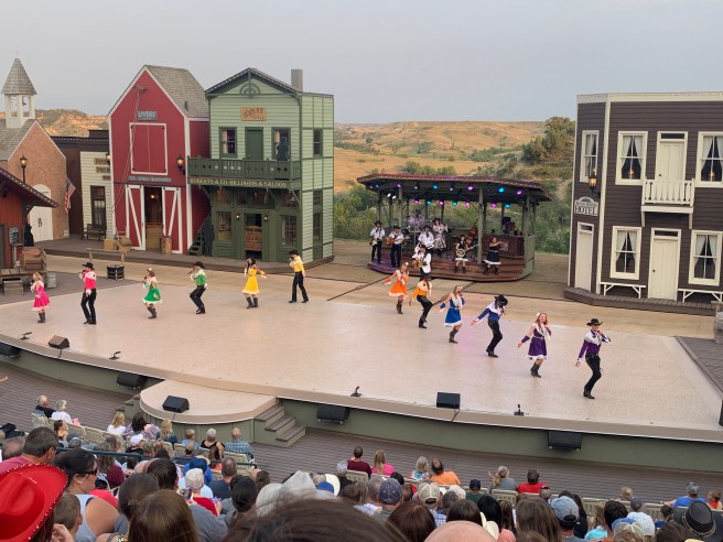
Ed was in the shop waiting for repairs to be done on his bike, when I arrived there, so he and I stepped out to buy tickets for a musical production we’d been hearing about all around town. We also bought tickets for dinner at Pitchfork Steak Fondue, which is right next to the outdoor amphitheater, where the show is performed. We raced back to the campground to shower and get ready, then rode our bikes up a super steep driveway/road to get to the parking area for dinner and the show.
Dinner was delicious, and the show was a delightful, high quality production with live music and top notch performers singing and dancing to a variety of music genres. It told the history of Medora and featured a Teddy Roosevelt look-alike, a magician, horses, and a live band The audience consisted of people from all over the country, but mostly the Midwest. All in all, a nice way to wrap up the day.
The amphitheater and outdoor eating area overlooked the town of Medora.
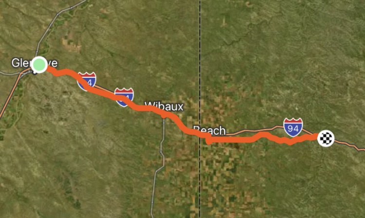
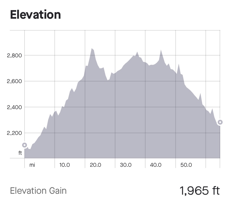
1965 Ft. Elevation Gain / 58,936 Ft. Total Elevation Gain
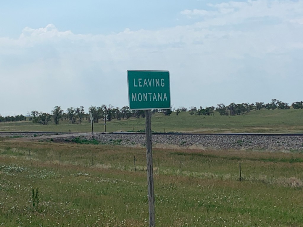
We were up at the crack of dawn to eat breakfast in the hotel cafe, then hit the road. We said goodbye to the cattle and changing landscape of eastern Montana, as we headed for the border of North Dakota. The weather was cooler today, the winds were milder, and there was no rush to get to our destination, so we had time to mosey through all the little towns we passed through.
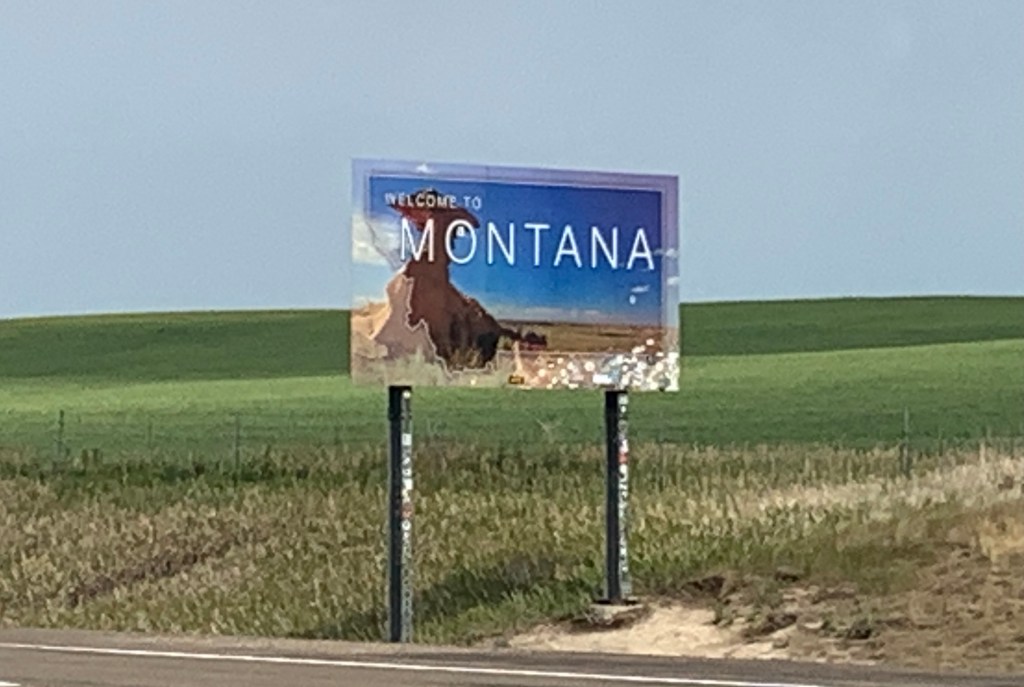
We entered Montana on a back road, so never got a proper welcome to the state.
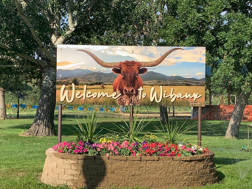
Our first stop in North Dakota was Wibaux, where a couple of Ed’s friends, who rode the Northern Tier, 2-3 years ago, posed on a bike sculpture. Time for a reprise of that pose. Ted, the caretaker of the city park, gave us the lowdown on where to find the Wibaux’s bike sculpture installations, and we laughed our heads off mounting the bikes for photos. After downing a beverage from the local grocery store, we moved on to Beach.
The terrain in South Dakota seemed prettier–no sage brush, but still lots of crops and livestock. Even though there were no rain clouds in the sky, it drizzled on us for about an hour, as we moved down our route.
These cows were all about watching our every move, till it started raining. That’s when they turned their backs on us. I may have to read a book on cow psychology to understand why cows do the things they do.
We’re thinking this cute little church isn’t in service any more. The front steps and the foundation are both jacked up.
The Greyhound bus doesn’t stop here any more, and the old fashioned gas pump runs on a trust system. Locals have their own key to the pump and they keep track of what they use, then pay the owner later.
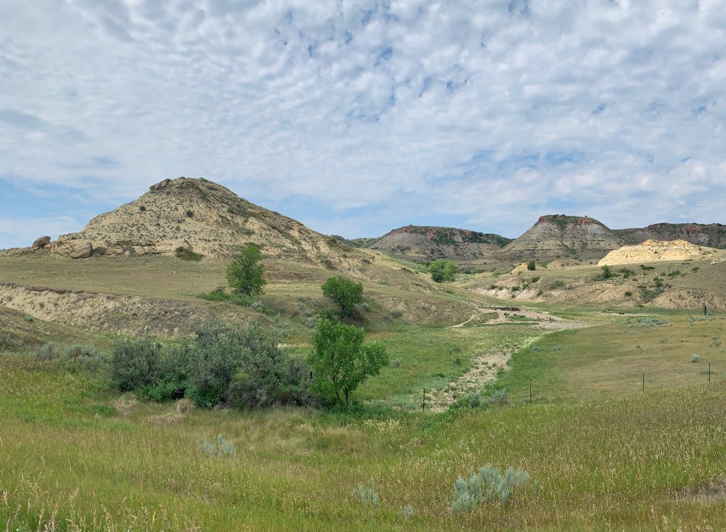
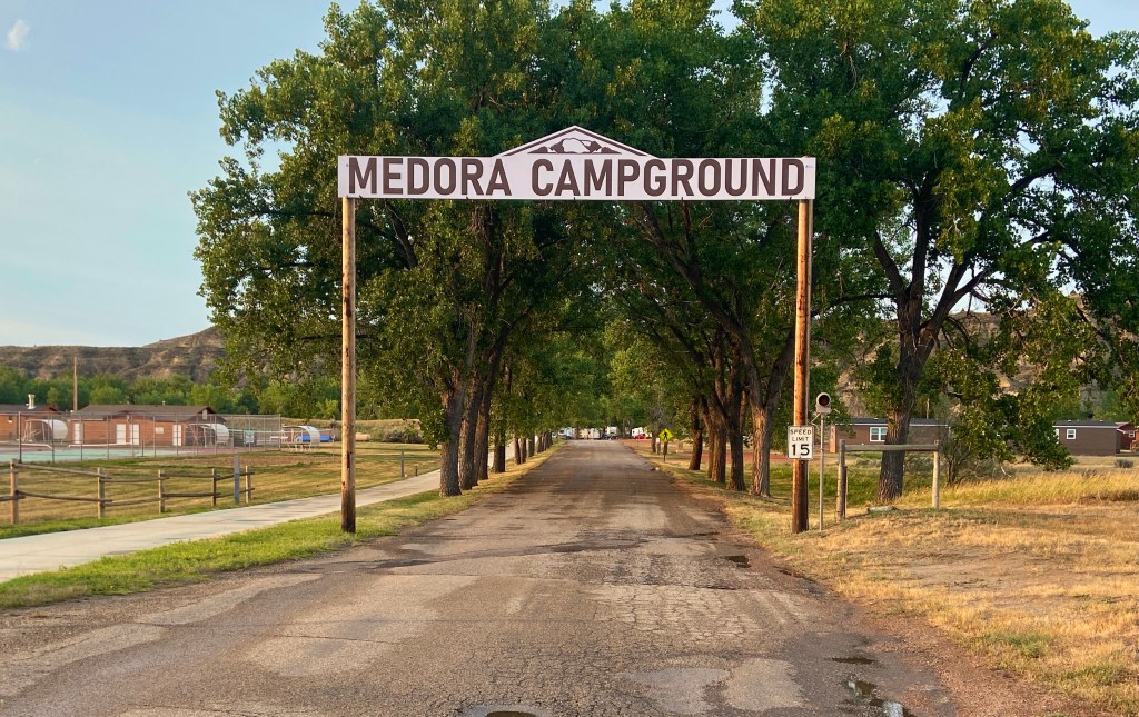
We arrived Medora, set up our tents in the Medora Campground, showered, then headed next door to the Theodore Roosevelt Nation Park, to get an overview of the park. Then we rode another couple of blocks into town for dinner. Sitting outside on a deck, so we could enjoy the views, we ordered our meal But pretty quickly, we had to move under a large overhang, because a torrential downpour kicked in with thunder and lightening. Being on our bikes, we had no choice but to wait it out. While taking cover, we chatted with a couple who run a huge beekeeping operation in North Dakota during the summer, then transport the bees via 30 semis to California for the winter. They know our upcoming host at the Honeyhub Hostel in Gackle, who has a similar beekeeping enterprise.
1102 Ft. Elevation Gain / 56,971 Ft. Total Elevation Gain
Great news! Today there were no close calls. And in case you’ve been wondering, the lady killed by the grizzly bear, yesterday, was not me.
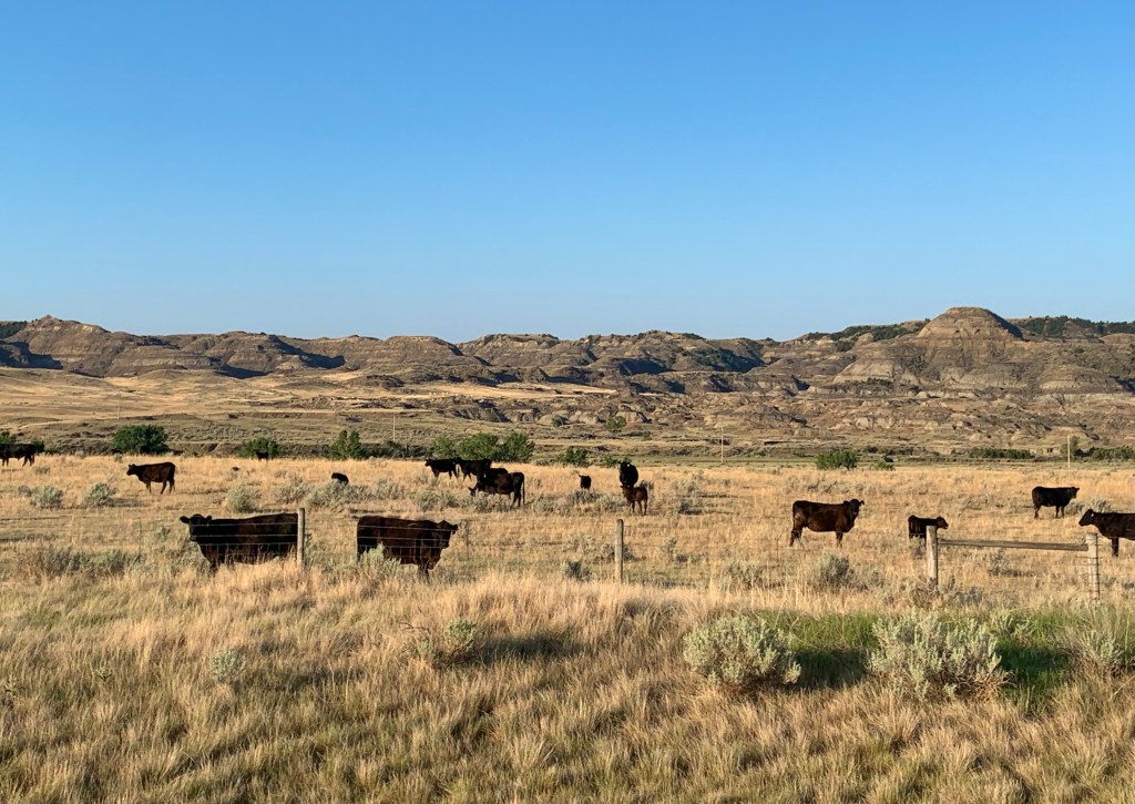
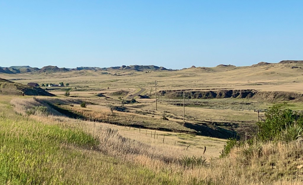
After 14 days of cycling through Montana, this was going to be our last full day here, before moving on to North Dakota tomorrow. Montana was breathtaking, in the beginning, and the farmland and livestock in the middle of the state were fetching, but all the sagebrush and monotone coloured terrain and the rollers and headwinds have worn me down. Stick a fork in me–I’m ready for another state. .
Today, we started out with more rolling hills and the worst headwinds we’ve had yet. If we hadn’t had someone to take turns drafting with, we would have died. When we reached the top of the day’s big climb, we were treated to a 1% descent that lasted the rest of the day, which sounds dreamy, but that descent came with a headwind, so it wasn’t as much fun as it sounded. I took note of the scenery, one last time. It was mostly rolling hills covered with hay, grain, cattle and horses, but there were increasingly more small mountains and volcanic features
We ran into 3 westbound cyclists. The first, a gentleman riding solo, made sure we had the lowdown on the great lodging stops ahead–we already had them in our itinerary. The second was actually a couple from Glens Falls, NY, riding a Co-Motion tandem–Margaret and John Sawyer. She had ordered matching jerseys for them, but now wished she had long sleeves, like mine, and sun legs. She’s a nurse and he’s a doctor, so they spend most of their life indoors and probably don’t worry about getting too much sun very often. That tandem bike sure looked fun. I’ll put that on my list of things that would be easier to do an epic bike ride on–right up there with an electric bike.
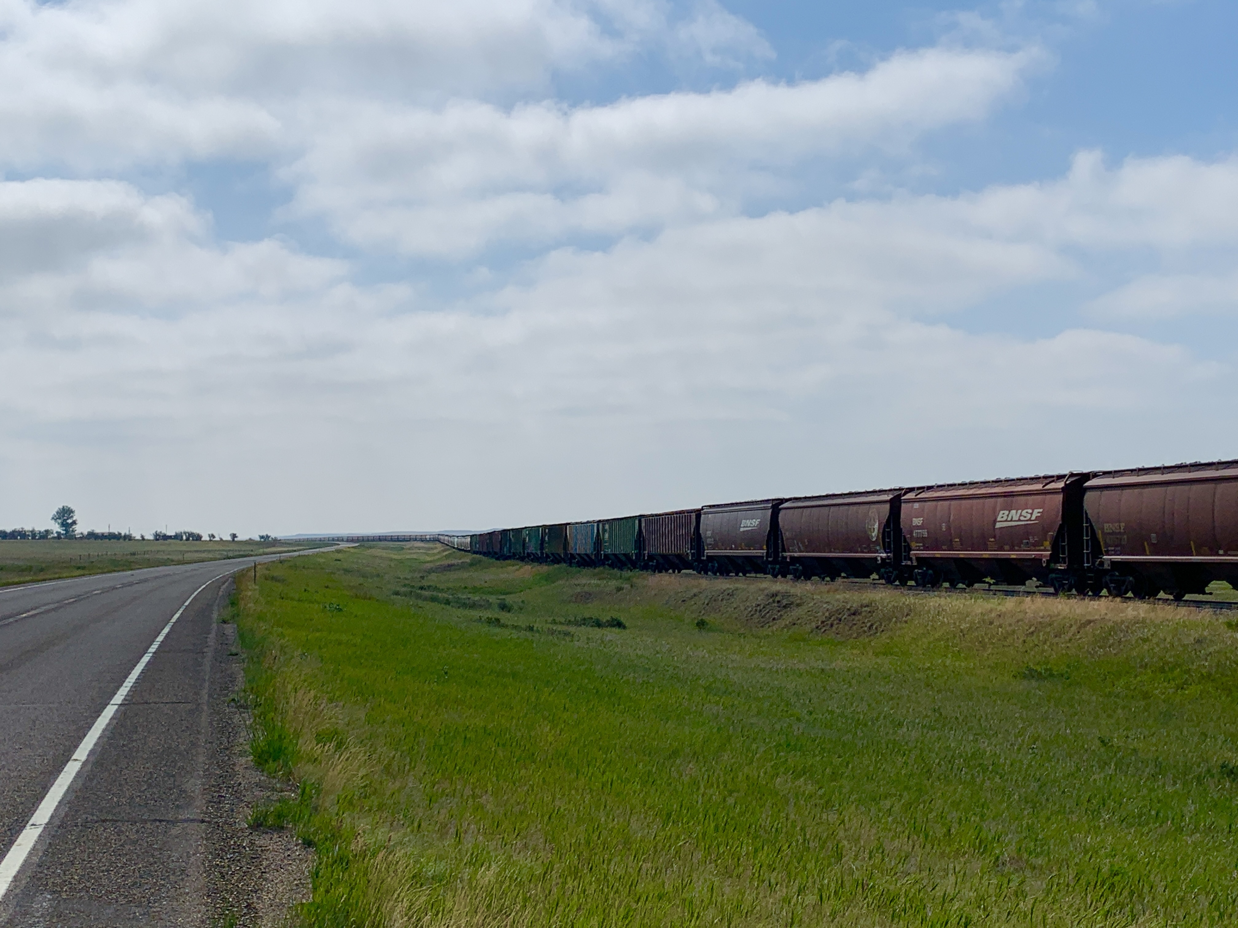
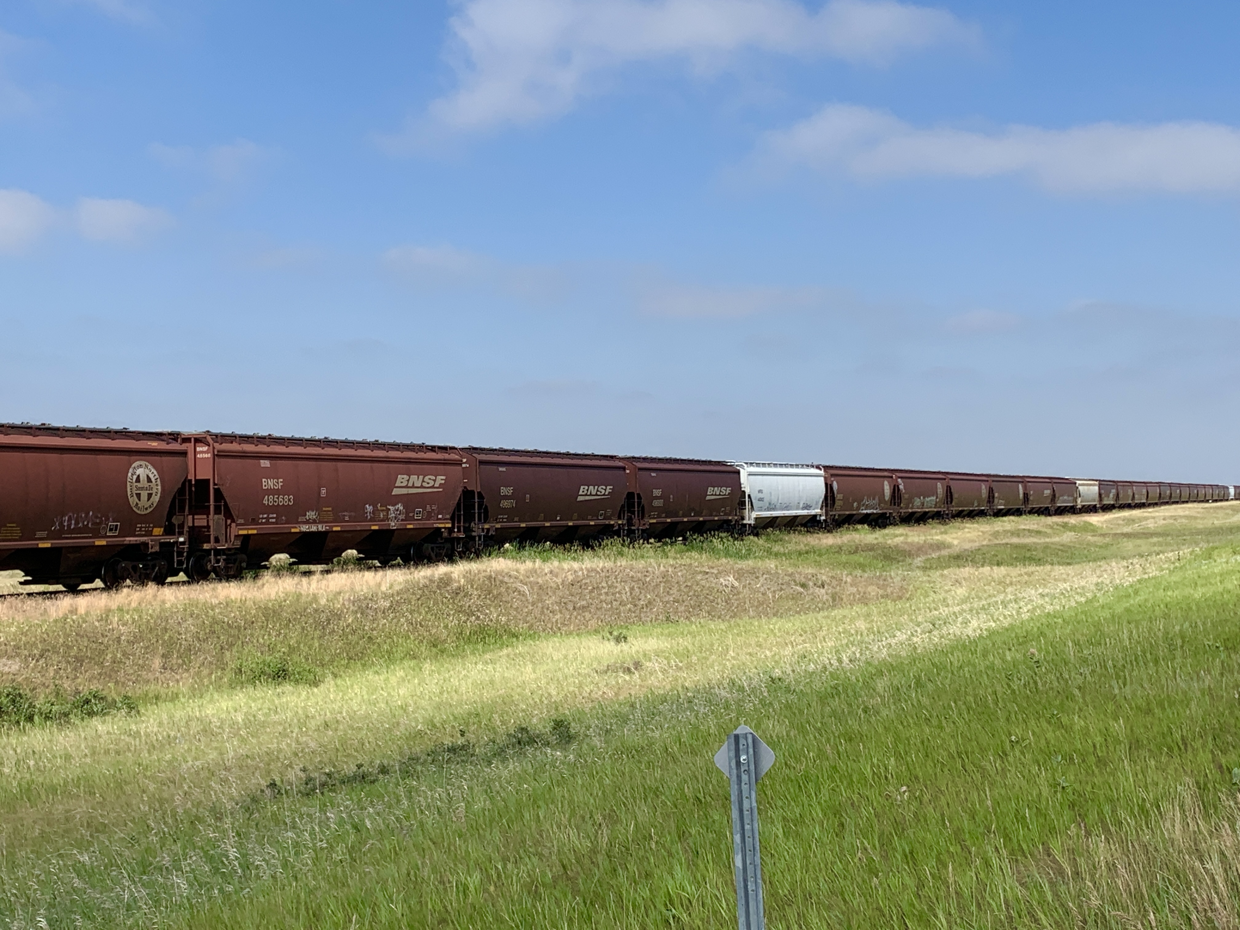
We passed several miles of train cars that haul grain. The cars were separated and a break left for every road and driveway that crossed the tracks. I thought the cars were a lined up to pick up and transport all the wheat and other grains from all the silos we’ve been passing, but I was wrong.
This engine was delivering more cars to be stacked with the miles of cars already on the dead track.
In our entire 50 mile day, our maps only indicated one stop with services, and that was the Prairie Ag Co-op, in Lindsay. We had been looking forward to picking up a bite to eat, so were disappointed to find just a handful of beverages, ice cream bars and candy bars. The store was mainly a farm/ranch parts supply, so food was not their thing. And the fella behind the counter was not only not friendly, but he was also not helpful. How do people like him get and keep their jobs?
While we were drinking soft drinks outside, a big blue Ram truck pulled up, with the biggest chrome bumper I’ve ever seen. A rancher named Jim jumped out and started up a conversation with us. And we had a chance to ask him about the things we’d been wondering about, like what were all those train cars we just passed lined up for? He told us that they are just mothball/surplus cars. A couple of years ago, BNSF ‘stacked up’ so many grain cars on the same ‘dead’ track, that they stretched 24 miles to the next town. Another interesting detail, from him, was that the Keystone Pipeline would have come through the area we had just been riding through. He explained a puzzling parcel of land we passed yesterday, that looked like a cross between a dirt airplane runway and a large piece of land cleared and graded for a new subdivision. The land was going to be one of several ‘man camps’ near the pipeline, where up to 500 construction workers would have lived in travel trailers, mobile homes and other temporary housing. Facinating stuff.
When we arrived Glendive, we were both exhausted. Margaret and Jim had recommended a stop at the Makoshika State Park dinosaur exhibit, and I wanted to see it, but it was 2-3 miles off route. I knew that if I went to our motel and showered, I would never get back out the door to see it. So Ed and I parted ways, and I headed to the State Park.
My navigation routed me over the historic Bell Street Bridge, the site and cause of 3 ice jams that resulted in flooding that caused the tragic deaths of numerous people and livestock.
The Bell Street Bridge crosses the Yellowstone River.
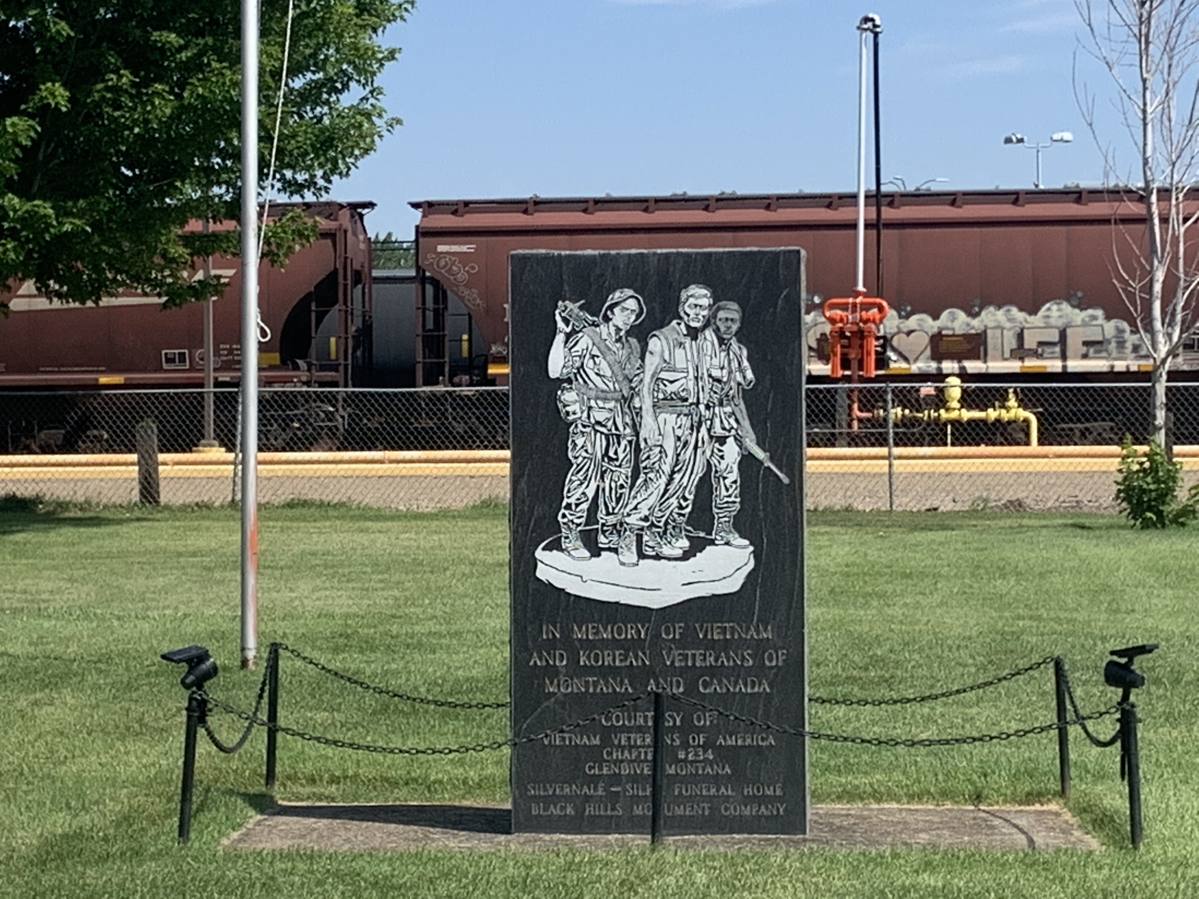
Glendive had a memorial park, but there were no memorials for veterans or fallen warriors of wars after Vietnam.
When I arrived at the state park, there was no explanation anywhere for its name, so I had to look it up. Makoshika is a Lakota Indian word, meaning, ‘bad land’ or ‘land of bad spirits’. Back in the 1930s, the State of Montana tried to get the federal government to designate the land where the park is as Badlands National Park, to bring tourists to the Glendive area, but the federal government didn’t fall for it. So the state designated the land a state park. Around 1991, parts of a triceratops and another less common dinosaur were found in the park. So now Makoshika is a combination Badlands of Montana and a (very) little dinosaur museum. By the time I arrived the park, it was too hot to ride my bike to to see more of the Badlands, but I did spend some time in the tiny dinosaur museum. And I learned some facts I’d never heard of before. For example: When did the K-T boundary become a concept? If it existed when I was in school, no teacher or textbook ever mentioned it. What planet have I been living on?
The bike rack was as close as I came to seeing a dinosaur at the museum.
When we arrived Circle, we stopped to check out the County Museum, swapped our RV park stay for a room at the one and only motel in town (our worst dive yet), hosed our bikes down, cleaned all of our gear, hung wet cloths to dry, cleaned and lubed our chains, and THEN did our normal post ride routine, except there was no time for a nap. We still needed to pick up some groceries and get some dinner. For some reason, when I sat down to work on the blog, I fell asleep. It happens.
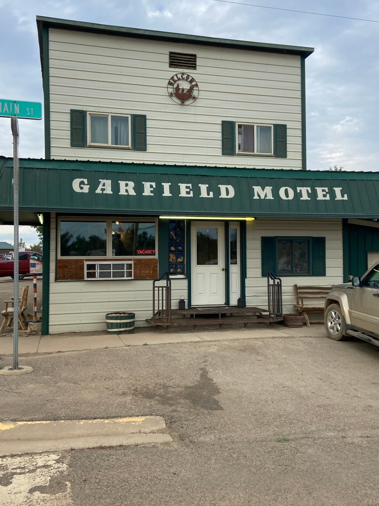
2841 Ft. Elevation Gain / 55,869 Ft. Total Elevation Gain
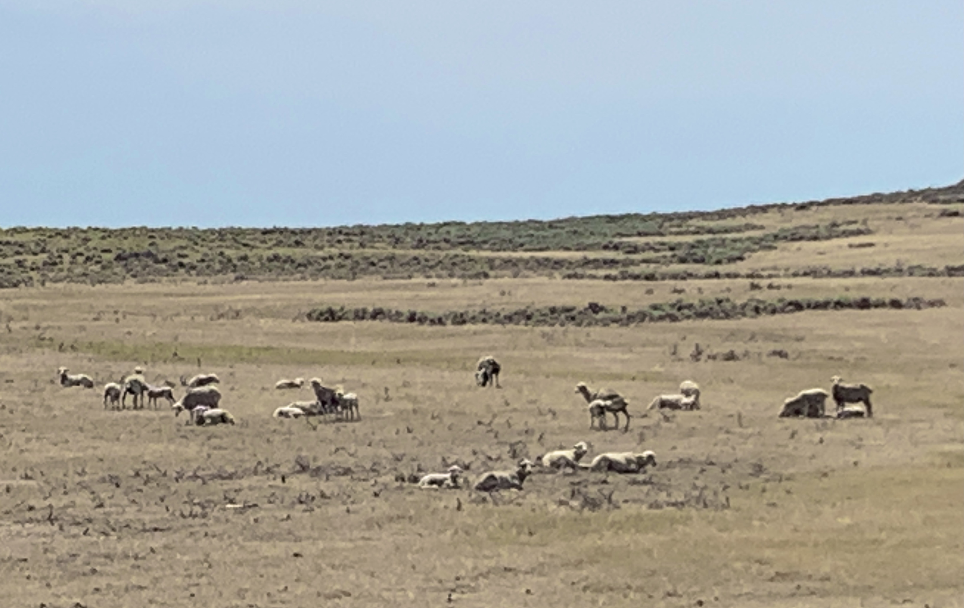
After a good night of rest at the Garfield Motel, we stopped for breakfast, then hit the road around 7 AM for a breezy little 68 mile ride. The weather prediction was cooler temperatures, but 12 mph headwinds all day long. In addition to the wind, we were also facing 52 miles of non-stop steep rollers, followed by what looked like a nice downhill. Oh, and on top of that, Adventure Cycling had provided an update on an 8 mile section of road construction, with a suggestion to get a truck to transport your bikes through it. Yeah, right. We’ll get right on that, next time we come through these parts.
The wind was a killer, from the moment we got on the bikes. We started drafting in one mile or one roller pulls and kept it up till the wind mysteriously died down and it started drizzling. Hmmm. There wasn’t any rain forecasted, so where was the water coming from? When we looked back, the sky was very dark behind us. But the wind was moving toward Jordan and the dark sky, and we were moving away from Jordan and the dark sky, so the rain would never get to us, right? Wrong.
This is what rollers look like. When you get to the top of one hill, there’s another one right in front of it.
As I mentioned previously, it is never a good thing, when you cycle up to a sign like the one below. We were now in a land of unknown construction, in drizzling rain. After about 3 miles of getting wet a little bit at a time, we stopped in a line of traffic to wait for a pilot vehicle to lead us through whatever was ahead. And that’s when the drizzle turned into a downpour. We jumped off our bikes and quickly donned our wet weather gear, and I wish I could show a photo of what that looked like, but from that moment on, things became a little hectic. The pilot vehicle arrived, the traffic started moving, and we had to jump on at the back of the stream of cars and trucks.
About a half mile down the road, the pavement turned to muddy gravel and sometimes, just mud. What a mess. A couple of times, I slipped on the mud and almost fell, but somehow didn’t. As in the past, we couldn’t keep up with the pilot vehicle, because he and the cars behind him were going 35 mph, so he made it to the other end and turned around with another string of cars coming right back at us. All of them splattered us with mud and and water from the road and puddles. The pilot vehicle had time to lead yet another stream of cars by us, before we got back onto pavement, so by the time we found pavement again, we were a wet, muddy mess, and our bikes and gear were coated with mud.
A mile or so past the end of the gravel/mud construction zone, we arrived at one of those high end Montana rest areas and basically occupied the place. We spread wet clothes out to dry, ate our lunch and decided to wait for the rain to stop before getting back on the road. I took my socks and leggings off and washed the mud out of them, in a bathroom sink, then used the hand dryer to attempt to dry them. Oh, and my water bottles–I had to clean them, because they were completely coated with mud splatter. Then I washed the important parts of my bike (chain, gears, brakes, etc.) off with multiple refills of an empty water bottle
When the rain stopped, we felt a lot better getting back on the road, but now the road had no shoulder–just a white fog line. Now some of the big RVs pulling trailers, as well as some of the semis pulling double loads, were having amnesia over how they pass bicycles on a road. A couple of times, they nearly hit us with their trailers, which was really scary, but that was nothing, compared to our near miss with a couple of semis that were suddenly barreling toward us from the opposite direction.
Here we are riding along, minding our own business, already battered, wet and cold from the mud and puddle splatter, just an hour or so ago, and up ahead maybe a half mile away, a semi with a double load of rocks, was trying to pass another semi with the same load. And they were neck and neck with each other, going probably 65 mph, and neither one of them was going to let off the gas to let the other move out front, so the one in the lane we were riding in could move over. A few seconds before they smashed us both to smithereens, Ed and I both bailed off the road and down an embankment into brush and who knows what else. And for the rest of the day, we were both in a daze–wondering what goes through the mind of someone who drives like those two drivers did. Did they even care that they almost ran us over? Or do they just assume the road is theirs, because they are the biggest thing on it? What if that had been their parents, wife or children on a bike? We were both disturbed over the whole incident.
Back when I rode horses, if a horse was acting up, we rode it in a tight circle till it forgot what was making it misbehave. Sometimes we only had to circle it one time, and it straightened right out and was good. So circling around back to the bike ride (see how I just rearranged my brain?)….we of course, got back on our bikes and started peddling again. The rollers and the headwind were an awful combination that sucked whatever wind we had left in us out. Having those 16 miles of mostly downhill at a the end of the day’s ride was just what the doctor ordered for our tired bodies.
Crops were back in vogue again, today–hay, wheat, barley and who knows what else.
These horses snapped to attention when we rode by.
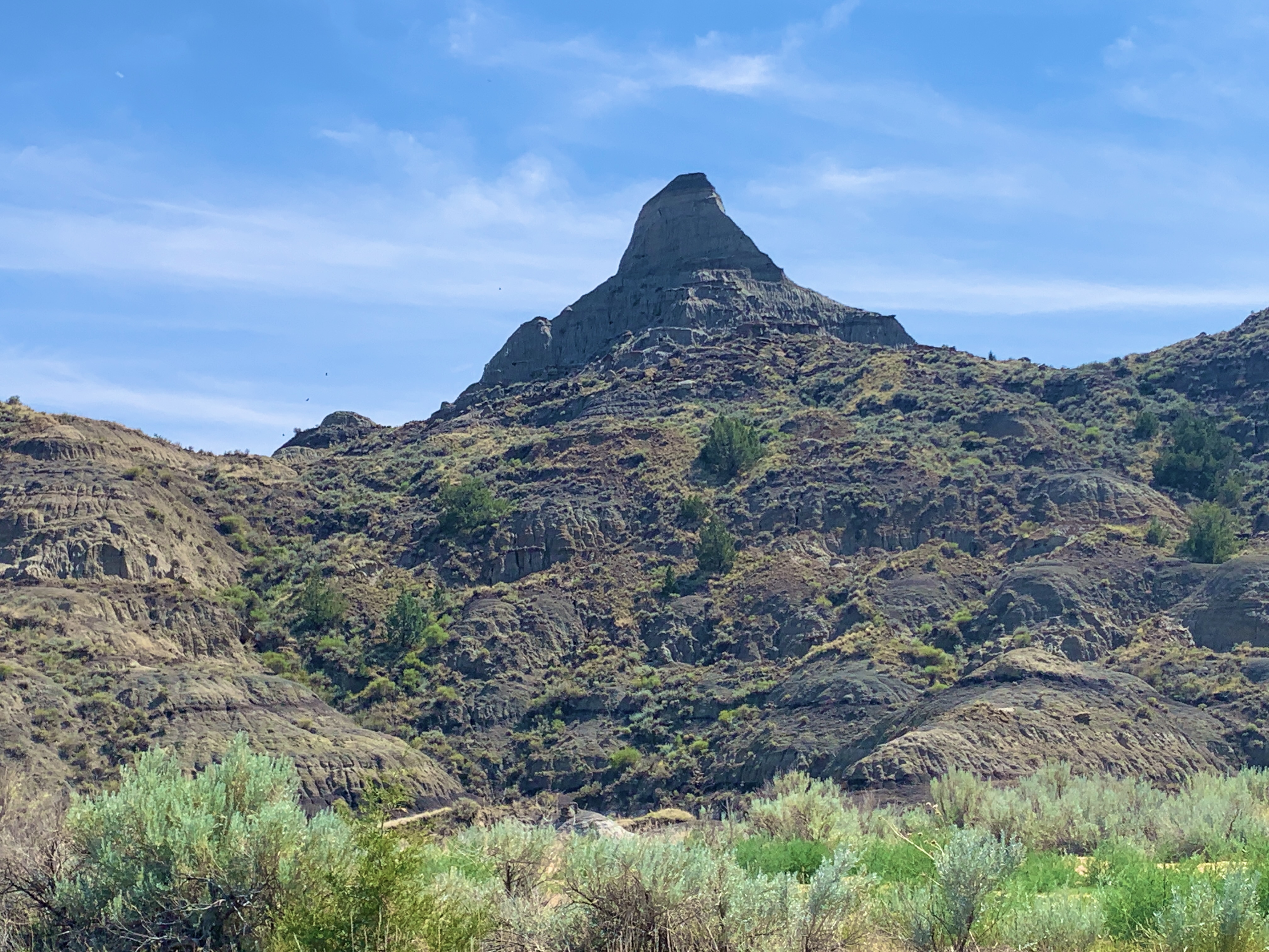
Some of the terrain is starting to look like the Badlands of South Dakota.
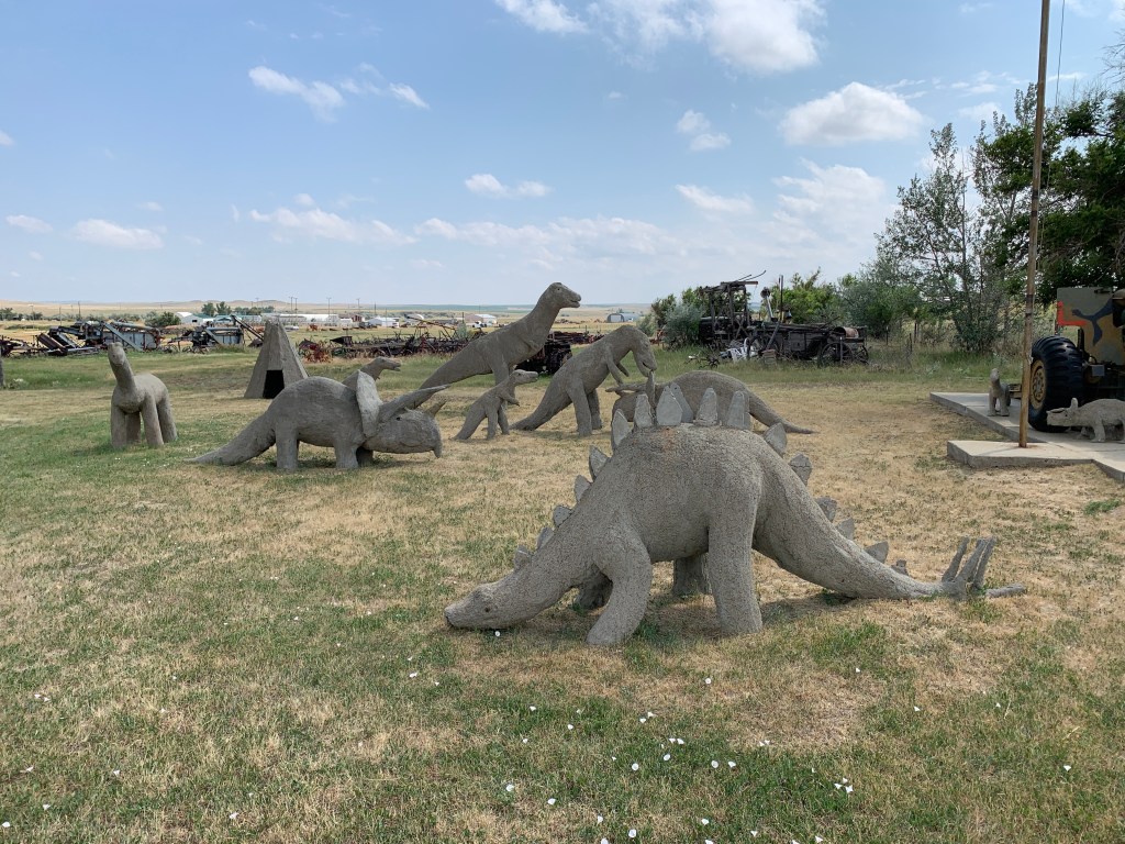
The museum didn’t have much to look at. These concrete dinosaurs and the Veteran’s Memorial, with its very own dinosaurs, were, in my opinion, the best of what it had to offer.
1982 Ft. of Climbing / 53,028 Total Ft. of Climbing
The bed I slept in, last night, was so comfortable, I hated to wake up this morning. Ed and I negotiated a 6 AM departure, today, so we were up at 4:30. Believe it or not, it takes that long to get ready, fed and out the door, when we’re not camping. The Hills know exactly what cyclists need in the morning. Linda had laid out cereal, muffins, bananas, hard boiled eggs, milk, orange juice, sandwich fixings and cookies, so we could prepare breakfast and pack a lunch, this morning. Then, Kevin helped us load our bikes and gear into the back of his pickup truck and drove us back to the road.
Me, Kevin Hill and Ed. Ignore the puffy eyes. They will return to normal some day–I hope.
Kevin heading back up the road.
Dan rode his recumbent down that hill. He’s a lot younger and braver than we are.
Before we even got on our bikes, Gala, Kevin’s wife, drove up with one of those plastic bar of soap travel boxes. It wasn’t mine or Ed’s, so she went after Dan, who had already started down the road. Who would be so nice as to drive a few miles to make sure you have the slivers of soap you left behind? A ways down the road at about the 15 mile point, there was a car parked on the right side of the road, joined by a car on the left. And a fella was getting out of the car on the right walking back and forth to the car on the left as we came speeding up on a downhill. We hollered out to make sure he saw us, so he didn’t walk into us, and as we blew between the 2 cars, we noticed that it was Kevin! He held out the lid to something like a Gatorade bottle and wanted to make sure it wasn’t one of ours. We were going so fast, I don’t think there was even time to say a word as we flew by him. I think he caught that it wasn’t ours. Can you believe he drove 30 miles round trip, in case we left a lid behind? That is above and beyond going the extra mile. I will never forget the kindness and hospitality of the Hill family.
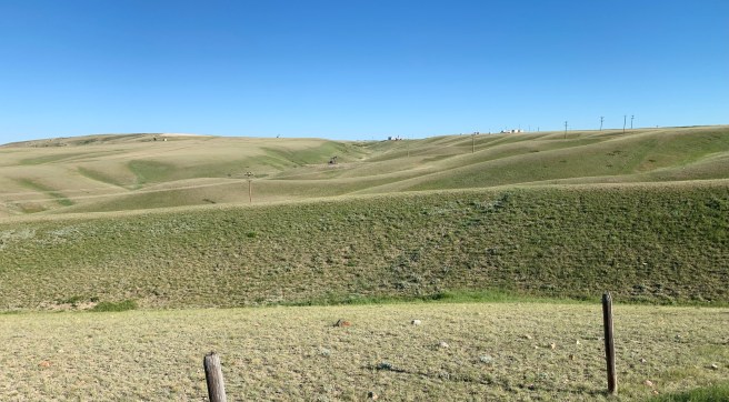
The terrain of the day was just like the terrain yesterday. Hills, hills and more hills–from start to finish; dry prairie grass and sagebrush; and wind, that our weather app said was 20 mph. Actually the wind is where things were different. It started as a gusty quartering tailwind, then turned to a full on cross wind from the left, then went back and forth from being a crosswind and a quartering headwind. And for the last mile or so of the day, we had a full on headwind. At times, my DaBrim acted as a sail. I caught the quartering tail winds with it, and I could watch my speed pop up .5-2 mph. Nice! But it was also pulling my head up and to the side. By the end of the day, I was a little tired of having my head jerked around by the wind. And while we’re on the topic of the wind, it contributed to a near death incident for me.
As we were riding along, we noticed another cyclist coming from the other direction, and conveniently, there happened to be pullouts on both sides of the road at the point we were going to meet up with him; As we all slowed down to cross the road and talk, the pilot vehicle for one half of a triple wide manufactured home flew by, followed by half of the home, which was so wide that it took up most of the road. The wash from that massive load, in conjunction with whatever the wind was doing at the time, pulled me toward the center of the road and sucked me down to the ground in the traffic lane. But wait. The other half of the triple wide was right behind the first half, and I was now laying in the road with my bike on top of me. The driver appeared to be coming right at me, so I raised my hands to attempt to signal to him, because I couldn’t move out of the way fast enough. He may have changed his course slightly, to miss me, but he came awfully close to me. Ed was behind me, so he saw everything that happened, while dealing with the impact of the same wash and wind, which almost blew him off the road. He said that the driver of the second half of the home was on his radio, when he passed by me, and he’s pretty sure the conversion went something like this:
Driver: Hey, a cyclist just fell down in the road right in front of me, and I almost hit her. Boss: Whatever you do, don’t stop, and don’t acknowledge.
Amazingly (is that a word?) I wasn’t hurt, though later I did discover that my chain rings had cut through my leggings and scratched my right leg. I was still laying on the road, and there was traffic coming. Aided by a burst of adrenalin I hefted my 100+ lb bike up and off of me, got back on me feet and got out of the roadway. After mounting my bike, I headed over to talk to the cyclist, who was now stopped on the other side of the road–almost as if this happens all the time.
The westbound cyclist was a fella named Steve, from somewhere near Belfast, Maine, where he began his journey. He was traveling with just one small pannier, because his wife is driving along with a vehicle. She meets up with him for lunch and at the end of the day, but while he’s riding, she keeps herself busy checking out the scenery, sight seeing, hiking and doing whatever else interests her. She’s a good wife. We exchanged information and stories, and one thing Steve told us killed one of my dreams. For days, we have been hearing about the delicious milk shakes at the Sand Springs Store, and I have been looking forward to one of them. The store is just a few miles up the road, and, according to Steve, it was closed when he passed through there, just 20 minutes prior. This cannot be!
When we arrived in Sand Springs, the store looked closed, but I don’t give up on something like a legendary milk shake easily. I checked the door, and the store was OPEN!!!. At 8:30 AM, I ordered an Oreo shake, and it made for a super delicious second breakfast.
Before we were tipped off to yesterday’s B&B, our original plan was to ride 78 miles and camp behind the Sand Springs store. When we saw the store and facilities, we were so glad things worked out the way they did. It would have been windy and dusty, with no shade, back behind the store. Sure there was a shower and bathrooms, but the B&B was just so much more comfortable and homey.
There are a lot of deteriorating and uninhabitable buildings in these parts. I don’t understand why the owners don’t just demolish them.
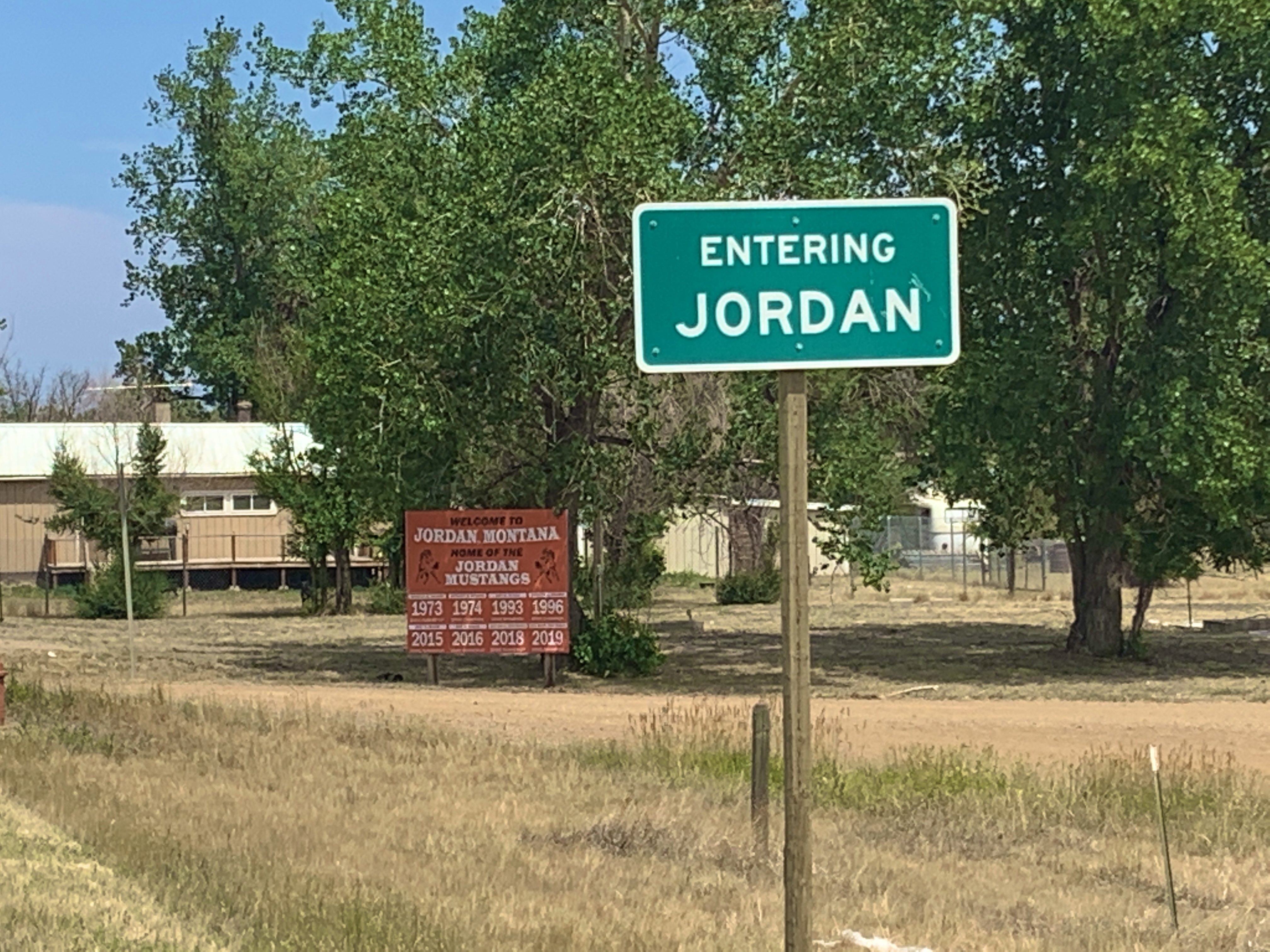
We arrived in Jordan at 12:30, completely missing any heat the day dished out. You know the routine after that. I showered, ate lunch, napped, then started working on the blog.
Taking a break from the routine, I took a walk and found the town’s Veterans Memorial monument, and it was a little sad. Some towns just don’t have as much money as others to build monuments and memorials, and Jordan is one of those towns.
938 Ft. Elevation Gain / 51,046 Ft. Total Elevation Gain
Today was. Sunday, and due to the lack of lodging options up the road, we were facing a long, hot 78 mile day. Our goal was to be on the road by 6:30 AM. We missed that by just a few minutes. Starting out on the road in front of the truck stop, where we camped last night, we cycled back up to the intersection of Highway 87 and turned onto State Route 200–our route for the day. Within 3 miles, we encountered a couple of loaded cyclists coming westbound, and of course we stopped to chat.
Bud, from Oklahoma, and his brother-in-law Andy, from Arkansas, had much to tell us. They started their trek from Maine on May 9th, and Andy, a cardiologist, needs to be back work on August 2nd. No problem there–he has lots of time to pull that off. Bud videotaped us with his GoPro, because he has a VLOG going on some site somewhere. We exchanged quite a few tips, and one key tip from Andy was that there is a really nice B&B, about 46 miles up the road, that is inexpensive, charges $15 for a full dinner, has laundry, etc. Hmmm. A quick change of plans ensued. If we stopped there, we would cut our ride today down to around 50 miles and up the miles on tomorrows ride from 33 miles to something around 55. And we wouldn’t have a long torturous day, today, on Sunday. We were planning to stop and pick up second breakfast in Winnett, just 21 miles up the road, so we made a plan to call the B&B and arrange a stay when we pulled into town.
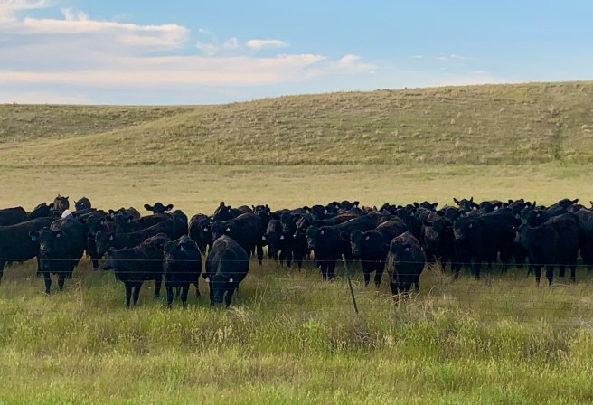
While talking to Bud and Andy, a good sized herd of Angus cattle, who thought we were their meal ticket, starting moving toward us. Ed, who not only plays the bagpipe, but is also a cow whisperer, a fact even his wife probably doesn’t know, let out one of his classic Moos, and I thought we were going to have a stampede on our hands. I was worried they were going to bust down the fence and come after us, but alas, they didn’t, and we lived to see another day.
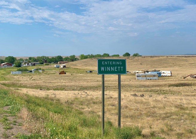
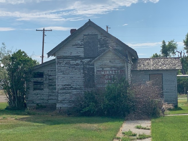
It was only 9:08 when we arrived Winnett and placed that call. The B&B was just 24 miles down the road, so we decided to look for a church where we could attend church services. We rode almost all the way down the main drag and the place was a complete ghost town, with not a car or person on the road, and no cars piled up in front of any building for any reason, and no visible church, so we turned around and parked our bikes in front of the City Hall building, where there was some shaded lush green grass out front. I had cell service, so I tried to pull up my Ward in Gilbert’s church service on Zoom, but unfortunately, that didn’t work. (Bummer.) We ate some snacks, tried to take a nap (Ed succeeded, I didn’t), and we waited for time to pass, before hitting the road again. Arriving at the B&B at 11 AM seemed just a little too early for us. While Ed slept, I made some phone calls and looked for signs of life, but there weren’t any.
The old boarded up City Hall. We were actually in front of the new one next door, but it was an aluminium building that wasn’t quite as photogenic.
While walking around, I discovered my small town meth message of the day.
The scenery of the day started out lush and green, with hay fields and pine trees on the higher ground, but by Winnett, it had transformed to yellowing prairie grass and sage brush. And I need to mention the hills. The entire day was rolling hills–BIG rolling hill that were 1-3 miles apart, where as soon as you reach the top of one, you are descending it and climbing another. Repeat. Repeat. Repeat……
In the midst of all the sage brush was an occasional gully that was green and lush, if it had water in it, similar to an oasis in the desert.
We passed the turnoff for the Cat Creek Oil Field, where oil was first discovered in 1920. We didn’t have the energy to ride the 8 mile round trip to see what goes on there, but later learned that our B&B frequently hosts people from the petroleum business who work on the drilling operation–no fracking here. Apparently, 4 oil fields make up the Cat Creek Oil Field, and per wikipedia, at one time it was all owned by Conoco.
We pulled in to the flashiest rest stop I’ve ever seen (a plaque inside explained that a local rancher, former judge, former congressman, (big time wheeler dealer), had donated the land and over a million dollars so this rest area could be built. Per their instructions, we called our B&B hosts, so they could drive down with their pickup truck to transport us and our bikes up the super steep gravel road to their home. Apparently bicyclists have great difficulty making it up that road, and we’d already done enough climbing for the day, so we were happy they were so kind.
While we awaited our chariot, we read the 3 historic markers at the rest area.
The last 7 lines of this historic marker talk about the Mosby Dome, where the Cat Creek Oil Field is located.
The Hill Ranch Oasis is located on a huge ranch with a sizeable sheep operation and who knows how many acres of land that are leased to cattle ranchers for grazing their herds. The house where we stayed had at least 6 bedrooms in a large, well cooled basement, with a large family room, pool table, and 2 nice bathrooms, and there were more bedrooms and bathrooms upstairs. The proprietor, an attractive little lady who is probably in her 80s, was assisted by her son Kevin (he picked us up in the pickup truck) and her daughter Linda (she prepared dinner). What a delightful family. In talking to them, we learned that they drive 25 miles to Winnett every Sunday to go to church, and today noticed a couple of cyclists sleeping on the lawn in front of the City Hall, as they drove down to their church building, that apparently is a ways down the road from where we gave up looking for it. Dang it! If only we had ridden further down the road.
Three other cyclists, who were looking to hide out from the heat, also spent the night at the B&B, so we had quite a group at the dinner table and lots of interesting conversation. In all that chatter, we talked about the many Northern Tier cyclists we all have run into or heard about. Many of them have stayed at the Hill Ranch Oasis, so the Hill family filled in parts of their stories too. That is where we learned that Bud, the guy with the GoPro, from our encounter this morning, has terminal cancer, and this is basically his last ride. Very sad, but glad he can still do this. And this goes back to why I am doing this. No one knows how much time they will get to live on this earth. It’s up to each one of us to decide how we will live our lives and whether and/or when we will achieve the goals we have set and dreams we have dreamt.
Group photo of the B&B cyclists. That’s Ed, me, Guda (originaly from Germany) and her husband Skip from Hawaii, and Dan from Baltimore.
1923 Ft. Elevation Gain / 50,108 Ft. Total Elevation Gain
Today, we passed the 1000 mile mark of our ride and the 50,000 feet of climbing mark. Wowza! We were on the road a little later than planned–5:28 AM, in time to watch the sunrise over the plains of Montana. Today was going to be a long day in the saddle and a race against time to avoid the heat of the day and crosswinds that were predicted to kick up in the afternoon. Spoiler: We beat the heat and the wind.
The terrain of the day was hay, cattle, and, after we did a long steep climb up the Judith Mountains, pine trees again–but thankfully, no mosquitos.
The scenery in these parts is postcard material.
We’re out of Yeti/Big Foot country, but now it appears we are in Meth country, because here again is a Meth message.
We passed by some little towns with nothing but houses, silos, and dilapidated former houses and former storefronts.
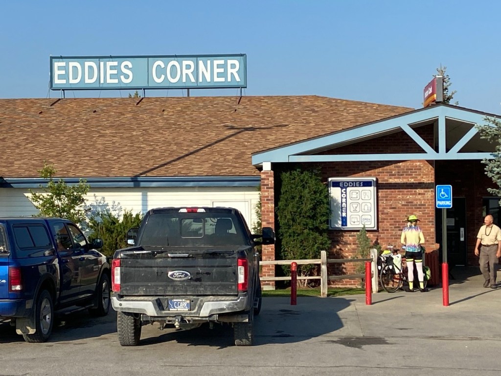
At Moore, we stopped for our second breakfast at Eddies Corner store. I ate a big blueberry pancake and downed a bunch of water to prepare myself for the rest of the day.
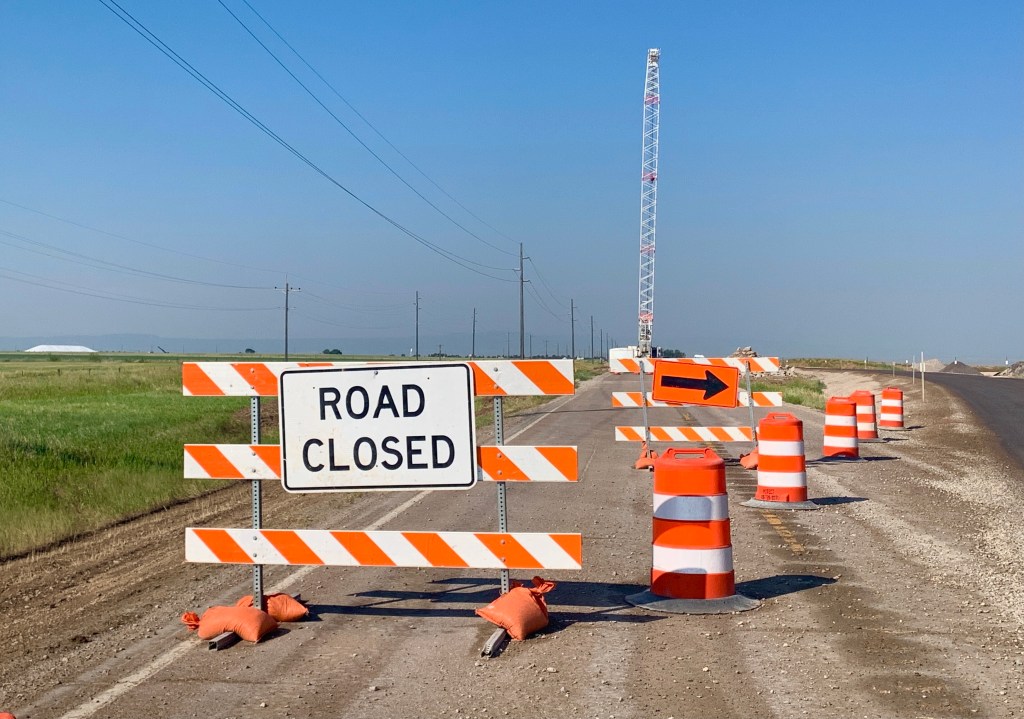
Being Saturday, there was very little traffic on the roads all morning, but as the day wore on, the highway got busier and busier. Adventure Cycling map updates had warned of a 7 mile long construction zone east of Moore, and that warning was spot on. It’s never a good thing when you run into the signs and equipment below. Apparently, someone decided it was time to install dozens of culverts under the highway, on this section of road. We lost our shoulder, weathered some torn up pavement and rode through a few sections of gravel, but we were able to push through the construction zone pretty quickly and painlessly, because there was so little traffic.
When we arrived Lewistown, we were ready for a cold beverage and prepared to stop for any and all historic sites.
The Fergus County Courthouse.
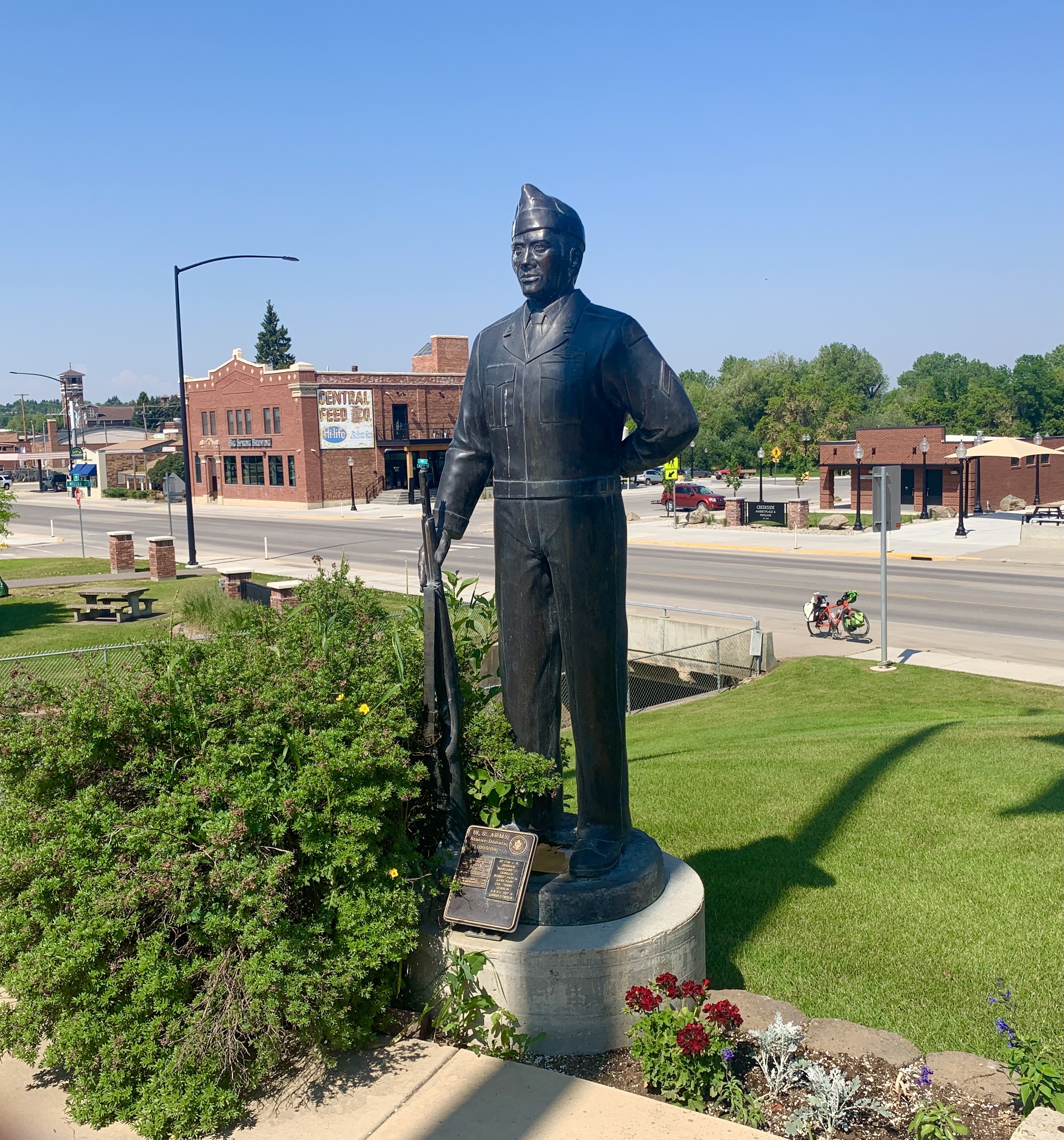
As you know, I’m a sucker for Veterans Memorials, and this town doubled down on them. The Veterans Memorial Park had statues from all branches of service, plus the Womens Nurses Corps, and an empty chair to honor those who did not return from combat. I included the Army and Navy statues for me and Ed.
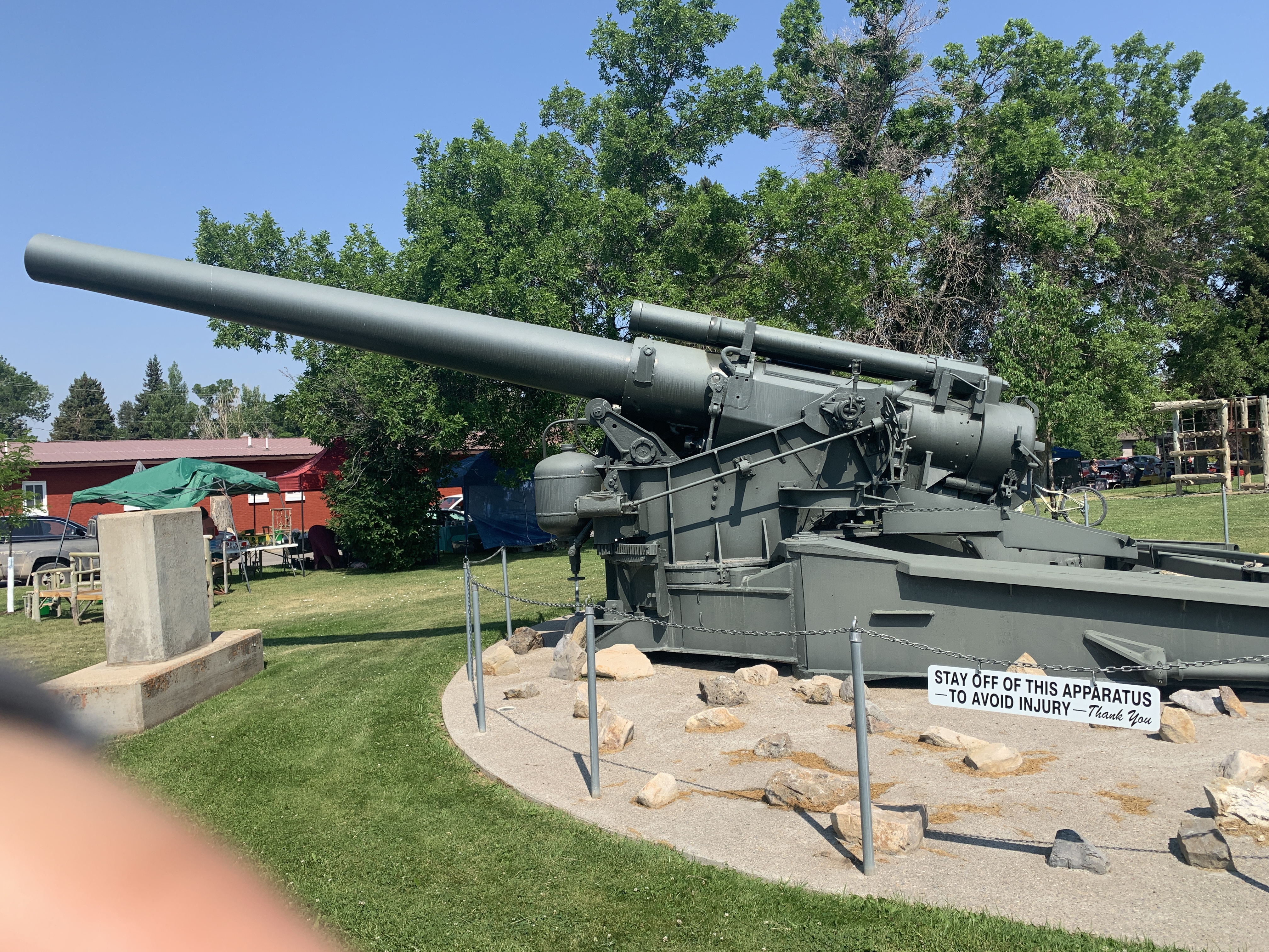
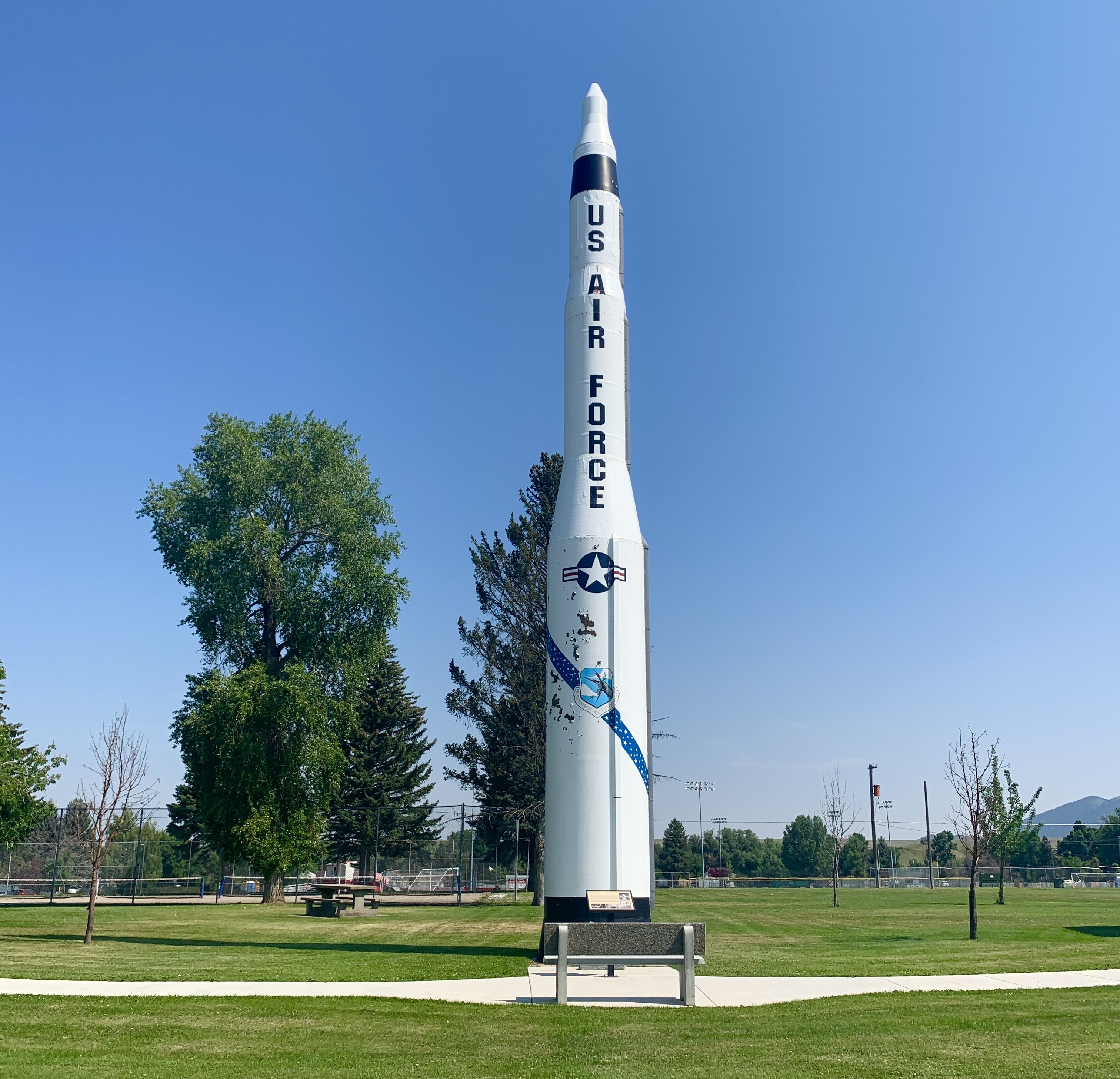
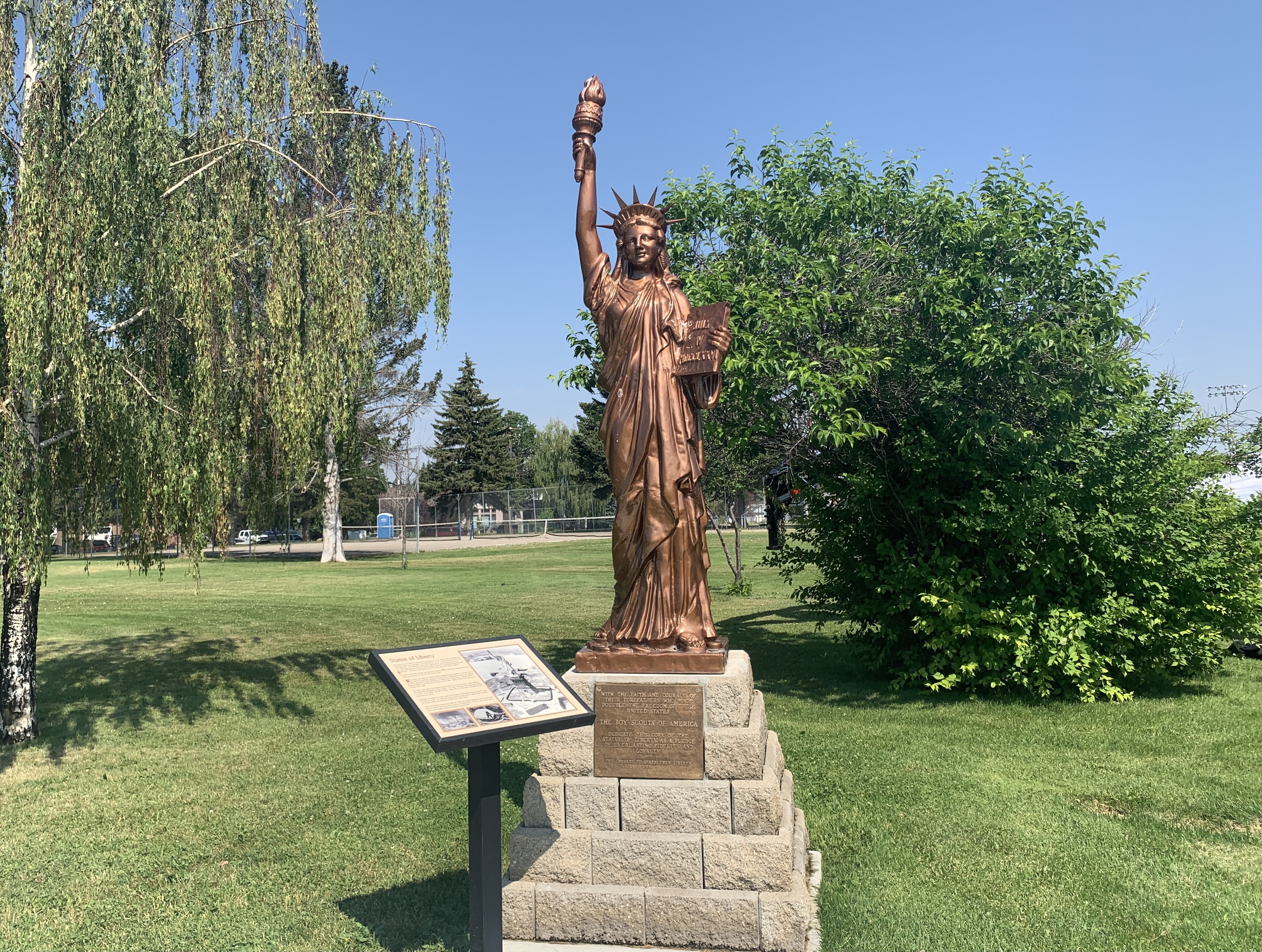
The Veterans Memorial Walk had an unnamed ‘Apparatus’ (read the sign) that I am assuming was some form of field artillery–maybe a howitzer. On the right is a Minuteman Missile. Lewistown purchased the Statue of Liberty replica in 1950 as part of a program to celebrate the 40th anniversary of the Boy Scouts. Don’t ask me what the military hardware and Statue of Liberty have to do with remembering Veterans. To me, it’s just a bunch of cool stuff.
After goofing off in Lewistown, we still had 35 miles left to ride, and it was getting hot, and (da da dah…) the wind had kicked up, and it was a tailwind! As we cruised along, I was a little surprised to see a camel hanging out with a calf all the way up here in Montana. How does he keep warm during the long cold winters?
Shortly after leaving town, we began a 5 mile climb up the Judith mountains to ‘the Divide’. A man at the Eddies Corner Store had warned us about how steep ‘the Divide’ was, but come on. He didn’t know who he was talking to. These legs of steel already crossed the Cascade Mountain Range and climbed up the Going to the Sun Road. There is NOTHING they could not do. LOL.
‘The Divide’ wasn’t steep at all and had some nice recovery sections interspersed to make it even easier on our legs. And we were being assisted by a tailwind. When we reached the top, we knew the elevation profile for the next 25 miles was a steep downhill–25 glorious, tailwind assisted miles.
Our destination for the day was the lower 40 of a little store and gas station in Grassrange, near the intersection of Highway 87 and State Route 19. We set up our tents under a couple of trees, showered inside the store’s restrooms (being extra careful to not let any of our personal items touch the floor or anything else), snacked on food from the store, then ate dinner in their little diner. The big bonus was the nice people working in this establishment and their awesome wifi.
We set up blog central in a back room of the diner, and were busy working on our blogs, when a young fella named Logan popped in to see if the bikes behind the store belonged to us. And that was the beginning of a long and entertaining conversation with this 20 year old young man who is riding the Northern Tier solo, heading westbound. What makes a youngster like him even think of doing something like this? How can he afford it? What do his parents think? Does his Mom worry about him? Does get to stay in motels like we do, or does he have to camp every night to economise? So many questions, and so little time.
Ben, the big fella to the left of Logan, in the below photo, is Logan’s uncle and used to work in this area. He knows the lay of the land, so he volunteered to be Logan’s SAG wagon and tour guide for a week or so, as he cycles through this area. Pretty awesome, eh? Logan told us that his Mom is a Warm Showers host right on the route in Minnesota, so we are going to try to work our schedule around a stop at her place, where we plan to tell her what a great young man her son is. Be safe, Logan!
Little Montana Truck Stop
There were several official historical markers, today, and wild horses could not keep us from stopping to read every single one of them. You can do that when you’re riding a bike. As I said yesterday, Montana sure does like its history. Texas was the same way. I’d love to have the job where you do nothing but write the text for these markers. Of course, first I’d have to learn how to write.
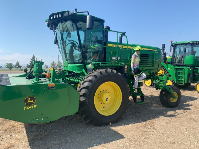
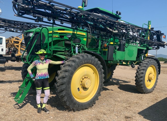
Special section for my grandson Jace Janusz: We came across a John Deere dealership, just before reaching Lewistown, and I thought he might enjoy some photos. Maybe my friend Jean can hook me and Jace up with a tractor tour, when I get home from this adventure.
2717 Ft. Elevation Gain / 48,185 Ft. Total Elevation Gain
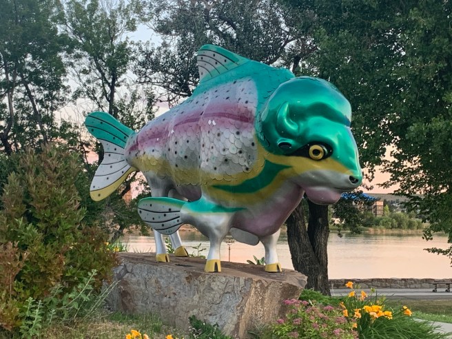
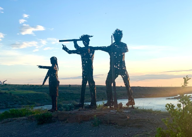
With todays heat and wind predictions worrying us, we awoke at 4 AM to get out the door by 5:30. We were moving down the road by 5:35 in temperatures that were already 75 degrees. And within minutes of leaving our hotel, we were at Riverside Park. After locating the Rivers Edge Trail, a multi-use path that follows the Missouri River for 55 miles, we cycled on the edge of the river for a few miles. The trail led us to several public art installations, including the Fishalo, below. A couple of miles further, we came across the Black Eagle Dam and Falls and then a modern iron statue of Sakajawea with Lewis and Clark. We were seeing so many cool things in so little time, that we hated getting off the trail and onto real roads, but we had 65 miles and a bit of climbing to pound down today. So we headed south along the east side of Great Falls, till we came to US Highway 87, which we’ll be traveling on for the next few days . Before turning onto that beast of a road, we made a quick pit stop at a brand new Walmart Supercenter, to pick up a few items.
Sunrise over the Missouri River
Aaaaaaaah.
Black Eagle Dam and Falls. The falls looked like a fun place to rock climb and cool off, but I have seen photos where they are covered almost entirely with water, so that probably would not be a good ideal
Sakajawea with Lewis and Clark. See how I give her the top billing? They would have been nothing without her!
On Highway 87, we were now travelling with the giants–large semis pulling two trailers, cars and semis racing to get who knows where, and a lot of vacationers in large RVs and trucks pulling travel trailers. And there was a rumble strip between the shoulder and the traffic lanes, with no breaks for crossing over it, when you need to. To be fair, there were some positives about the highway too. The pavement was good throughout the day, there were nice sized shoulders the majority of the time, and those shoulders were relatively free of litter and hazards to our tires.
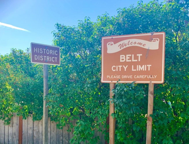
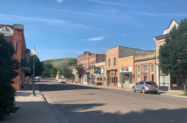
As we peddled down the route, we were chugging along, like someone forgot to put air in our tires. What the heck! The road was a consistent 1-2% grade, which was part of the problem, but there was also a slight headwind–something our weather apps had not predicted. The combination was a killer for us. We worried that if the headwind turned worse, this was going to be one hellacious day for us. Thirteen miles into our ride, the route sent us off the highway, down a super steep and winding downhill, and into a little town called Belt. That downhill had me worried, due to the what goes down must come up principle, but I tried not to get ahead of myself and to have faith that Adventure Cycling would not route us downhill a few hundred feet, only to force us to climb back up again.
In Belt, we were ready for second breakfast, but all the cars in town were parked in front of the Senior Center. Hmm. Maybe they were eating breakfast there, and we could join in. I stepped in to see if it could be true, but no joy. There was no breakfast to be had–just coffee and cookies. The folks at the Senior Center kindly pointed us in the direction of the one and only breakfast spot in town–Jack’s Beans, the coffee shop across the street, with no cars out front, which usually is not a good sign. But sometimes looks are deceiving, and this was one of those times. My smoothie and breakfast burrito were to die for.
The Belt downtown street scene.
Back on the bikes, we were pleasantly surprised that it only took us a few miles and very little climbing to reconnect with Highway 87. After zig zagging through a valley for a few slow miles, we came up over a hill, and a tailwind magically appeared.. And we’re not talking just any tailwind. This was a super healthy blast from behind, that motored us for 30 miles, including up some hills with grades of 5 and 6%. This was our first full on headwind since leaving Bellingham, and we loved every minute of it!
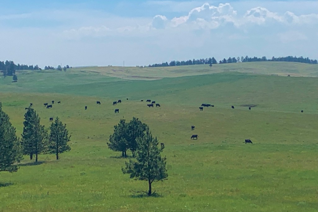
A note about today’s terrain. We transitioned from wheat, canola and hay crops to just hay and cattle. Just like that.
Montana loves its history. These historic markers have popped up every day, as we move through the state. We stop for every one of them. Don’t want to miss out on anything.
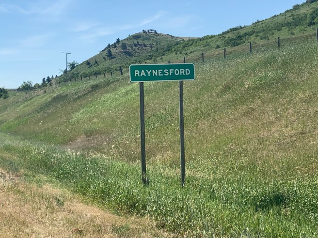
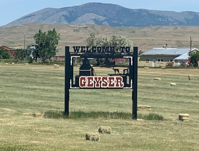
Even with the wind pushing us down the road, as the temperatures climbed, we were getting hot, and we needed to get a cold drink and cool off. The next town, Raynesford, was just homes and silos, so we pushed on to Geyser. Our maps showed that even though it only has a population of 87, it has an eating establishment.
As we rode down the miniature main drag, though, the place was like a ghost town. No sign of anyone anywhere–no cars, no people–nada. Ed walked up onto the covered porch of the Cabin Creek Bar, and there was a note on the whiteboard saying it was open, so he tried the door, and…..it was! Inside, there was no one, until a young gal emerged from a back room. She brought us some soft drinks, which we quickly gulped down. We got our mojos back and were ready to hit the road for our final stretch.
We couldn’t figure out the meaning of this monument at the end of Geyser’s main drag.
Seven miles out from the Cabin Creek Bar, we passed a couple of college aged, fully loaded cyclists, who were headed westward on their tour from New York to Seattle. Our amazing tailwind was their headwind, and we felt really REALLY sorry for them. They had 7 long steamy miles of steep rolling hills and 10-15 mile per hour winds to deal with, before they set their tents up behind the bar and camped without access to a shower or sink.
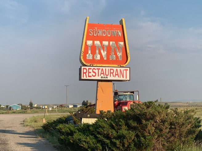
The wind pushed us the last 15 miles to ourdestination for the night–the Sundown Inn in Stanford. The delightful owner, Joy, let us check in early and hooked us up with a delicious dinner at the Watering Hole Saloon. Her little motel looked a bit like a hole in the wall, but inside, it was modern, immaculate, and had all the right stuff for travellers like us.
Before turning in, we negotiated our start time for tomorrow, a 78 mile day with almost 2000 feet of climbing and a high heat weather forecast. Wake up at 3:30 for a 5 AM start. Grrrr!
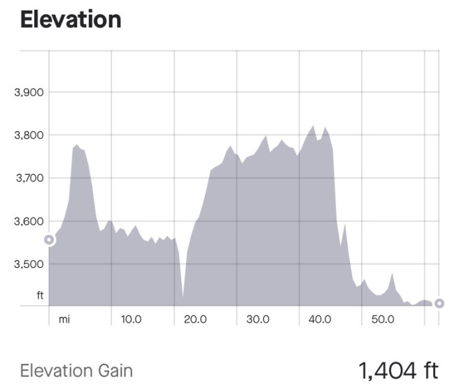
1404 Ft. Elevation Gain / 45,468 Ft. Total Elevation Gain
Did anyone notice that we are 22.7% of the way through our miles and days for this trip? But who’s counting, right? We are! Ed and I are both into numbers, and we met another rider today who enjoys looking at the same numbers we do.
The alarm went off at 3:30 AM, this morning, and I thought I was going to die. Why would any retired person my age want to wake up that early? Here’s why: We had a goal to be out the door by 5 AM, including cooking, eating and cleaning up after our breakfast. I was ready on time, and this time, it was Ed who was just a couple of minutes late. I can’t let it go to my head, though, because I’m not sure I can beat him getting ready more than once. It was still dark, when we hit the road, so when the sun came up over the hay fields, we stopped to watch it.
Sunrise over the hay field.
We spent most of the day riding on a frontage road to US Highway 15. Up here, frontage roads often don’t even run along the freeway–they could be 1/2 mile away, and, at least where we were, there were very few cars and trucks on the frontage road. I thought farmers were up and at it early, but there were no signs of life for 2-3 hours, as we passed miles and miles of crops, silos and farmhouses. We blew through the town of Brady, just 14 miles out from Conrad, where there were only a couple of vehicles on the road and just one farming related business open. I was shocked.
Another 16 miles up the road, was a little town called Dutton. We were needing our morning break and snack, so we decided to look for a place to get second breakfast. There was a diner right on the corner of the frontage road and the town’s Main Street, but it wasn’t open yet, so we headed into town.
Dutton’s American Legion hall had its own Air Force jet. Don’t know how they scored that, and forgot to ask the locals.
And that’s where we noticed a business on the left with several cars parked out front–obviously a breakfast spot. When we pulled up, another fully loaded cyclist was getting ready to leave–a fella around our age from Virginia named Paul. He’s been on the road for 29 days and is taking a more random approach to his ride than we are. He just retired and is taking his time, which means he has time to wing it on when and where to stay and for how long. He arrived in Dutton yesterday, in the heat of the day. But the town doesn’t really have any lodging, so he planned to camp in a park. So he went to the public pool to cool off, and that is where one of the locals found out about his camping plan and hooked him up with a gal who has a 5th wheel trailer she rents out to visitors. Don’t know if Paul paid for a night in the trailer or got a free stay, but he was sure happy to have been so nicely accommodated. It turned out that his host was Lily, the owner of Lily Bean Coffee, where we planned to eat. We exchanged a few stories with Paul, then headed in to order some food.
The people we met both inside and outside Lily Bean were all so friendly. Word had traveled to everyone in town that Paul had spent the night in Lily’s trailer. On our way out the door, we met a young family that was out for a walk. The father is a teacher at the Dutton elementary school, and he was wanting to hook us up with his Dad in Great Falls, because his Dad lives in a really nice home and is a Warm Showers host (and his Mom is the lieutenant governor). Sounded interesting, but it was 5 miles off our route, so we had to politely tell him no thanks.
I fell for this sticky bun, but when Ed ordered a breakfast burrito, I asked for a togo box for the rest of the bun and ordered up a burrito too. It was super delicious and really hit the spot!
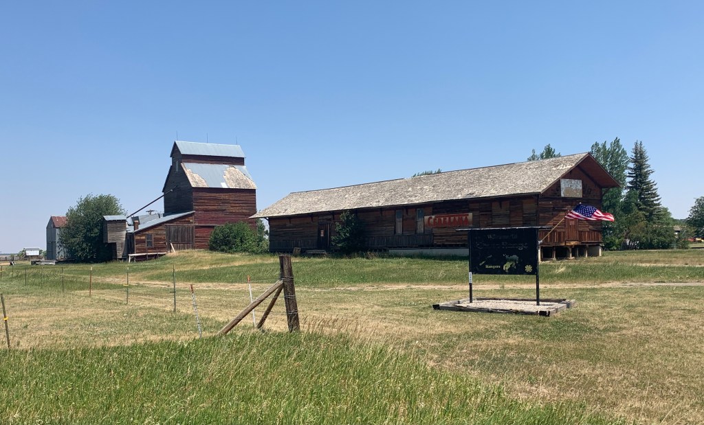
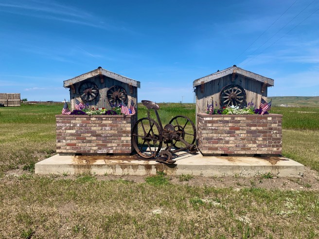
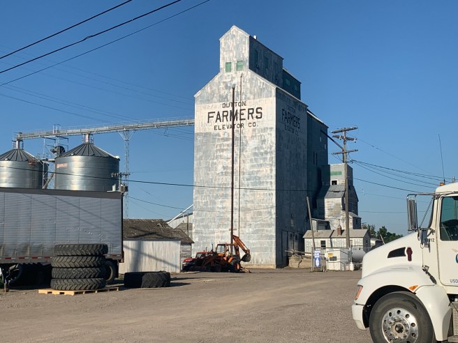
There were multiple of these community grain elevators in town.
The primary scenery of the day: Crops, crops and more crops.
After Dutton, we rode along the Teton and Sun Rivers, as we made our way down the road.
This is some sort of 4th of July decoration. Original, eh?
As we approached Great Falls, the traffic worsened immensely, and it was getting hot. We high tailed it to our hotel, and as we pulled in, there was Paul again. He was also staying at the Travelodge and had just arrived, so we exchanged phone numbers so we could meet up later for dinner. It was only 11:20 AM, but thankfully, the hotel was willing to give us an extra early check in.
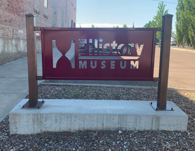
,After getting our bikes and gear situated, we showered then headed out for lunch and a little sight seeing. The History Museum, covered the early history of Great Falls, and was nicely executed. And from what we saw, Great Falls is a nice little town. Some things I really liked about it: The Missouri River runs through the downtown area and has parks and both bike and walking paths adjacent to it, so people can enjoy it; they have butterflies, bees, fish and other creatures painted in their crosswalks; there is a Trail of the Painted Bisons installation, where larger than life fiberglass bison statues are painted by various artists and installed in different locations throughout the downtown; and there are several museums to explore. Unfortunately, when we finished checking out The History Museum, we had reached our daily heat quota, and had to put an end to our sight seeing.
We met Paul for dinner at a diner named Tracy’s and enjoyed sharing stories about our bike travels, gear, difficulties on the road, families, careers, etc. You never run out of things to talk about with a fellow bike traveler, but at some point, all 3 of us had to head back to the hotel to work on our blogs and get things ready for the morning.
We’re moving at a faster pace than Paul, so will probably not see him again on this tour. Safe Travels Paul. We enjoyed meeting and spending some time with you.
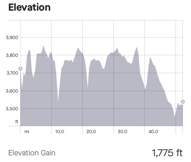
1775 Ft. Elevation Gain / 44,064 Ft. Total Elevation Gain
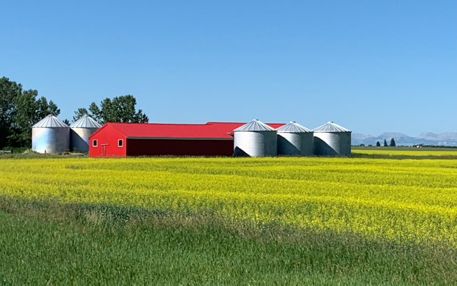
We were on the road, today, at 7:15 AM. After backtracking a mile, we turned left to head south on some very quiet and very smooth roads. We are managing our days and start times based on the weather forecast, and are starting early enough to avoid the heat and the headwinds that seem to increase and change direction during the day. Within that construct, we spent the entire day cycling along wheat and canola fields and a little bit of barren wasteland. I didn’t realize that canola was something you grow. Just thought it was man made from corn oil and other ingredients, or genetically engineered in a vat somewhere.
A few miles from town was the Cutbank International Airport and a nearby sign promoting the War on Weeds. I’m very familiar with the War on Terrorism and the War on Drugs, and am concerned about the potential civil war in Afghanistan, but a war on weeds? That was a new one for me, though I have battled Bermuda grass several times and lost.
We passed a couple of historic markers, while continuing through the Blackfeet reservation. This one remembering Camp Disappointment reminded me of Cape Disappointment in southwest Washington, where another early explorer mistook the mouth of the Columbia River for a bay. I guess the early explorers experienced a lot of disappointment.
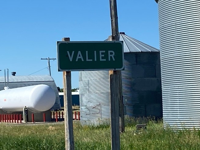
We try to stop every 2 hours for a rest and snack break, but we held off till we reached the one and only town on today’s route: Valier. There, we sat inside a convenience store/gas station and guzzled our beverages of choice, which for me is always either chocolate or strawberry milk. I drink so much watery liquid on the bike, that something with a little more substance feels good going down, every once on a while. What would feel even better would be a nice thick milk shake, but opportunities for them have sadly been VERY limited.
Canola
More Canola
Ed stopped to thank a Sheriff deputy for his service. Side note: Ed volunteers with the Eldorado County Sheriff’s Department
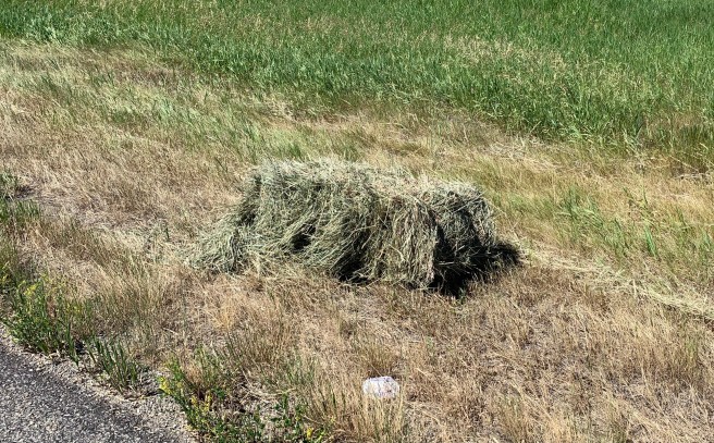
We saw something I’ve never seen before, today. On one long section of road, instead driving one of those tractor drawn mowers down the side of the road to cut the grass, they had a bailer cutting and bailing the grass. Ed was concerned about garbage being packed in the bail, but for the most part, we haven’t really seen any garbage along the sides of the roads up here.
When we arrived in Conrad, it was 12:30 and only 89 degrees outside. Success! We avoided the heat. The owner of the Northgate Motel was a saint. He let us check in early, so we could get out of the sun, for which we thanked him profusely. We showered, then headed down to a diner to grab some lunch. I picked up some beverages and snacks at the grocery store, while Ed visited the barber shop, then we spent the rest of the day napping and being lazy, aka recovering from our ride. We need to spend more time recovering.
Tomorrow, we are going to push my limits on early wake up calls. I thought those were over when I retired from the Army, but not on this ride.
2594 Ft. Elevation Gain /42,299 Ft. Total Elevation Gain
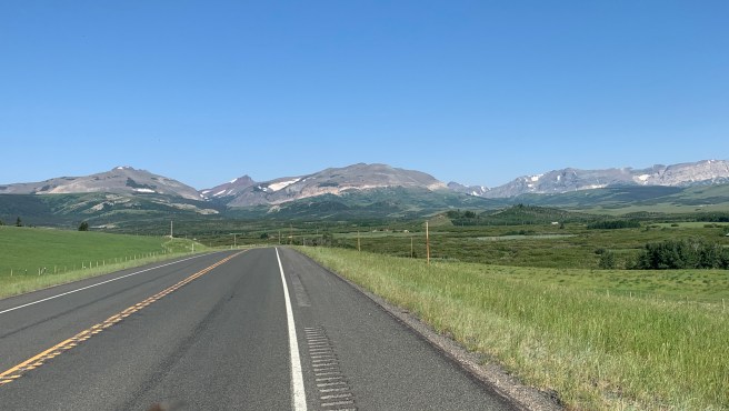
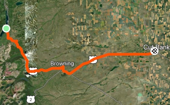
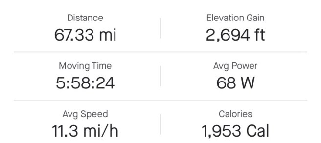
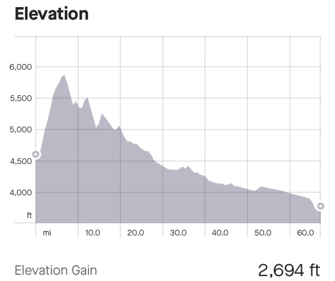
The Northern Tier route goes from Glacier to Cardston, Alberta, but due to the Canadian Covid border closure, we couldn’t ride that portion of the route, so today we were heading southeast toward Cutbank and saving ourselves 2 days of riding. When we got on the road, this morning, it was super chilly out, because it was only 6:12 AM! Can’t believe I pulled that off. There is a record heat wave, up in these parts, and we aren’t taking any chances at not completing this trip. Teaser: Earlier starts are coming.
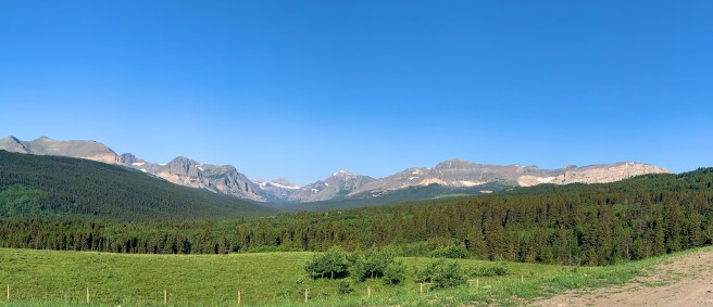
As we rode out of St. Mary, it was good morning legs–a 6 mile climb up a 6% grade. Ouch! The scenery was the back side of Glacier National Park, and I really wanted to snap some photos, but every time we stopped, mosquitos swarmed and dive bombed us. I already have hundreds of itchy welts on my body, so this was adding insult to injury. They were biting me through my clothes, even when we were moving, so I had to constantly grab the fabric of my jersey, shorts and leggings and pull the fabric away from my skin to pull them off. They pretty much forbade any stopping till we got far enough down the road that we left the forest and wetlands and were in the plains of Montana. I tell you all of this so you to know that it took actual human sacrifice to take the following photos.
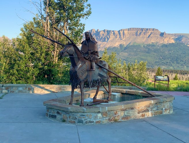
This looked like a really cool roadside exhibit, but we couldn’t weather the mosquito attack to read the signage and figure out what it was about, which was really a shame.
As I keep saying over and over–what goes up must come down. Once we reached the top of that crazy climb, we had a delightful downhill ride into Browning.
But before we reached Browning, Ed stopped for a photo of the view behind us, and I crossed over the road to see what he was looking at, stopping with a few inches of my rear tire out in the lane. And that’s when this Blackfeet Indian Tribe pickup truck pulled up with its lights on. I was busted! But the woman in the truck wasn’t wearing a uniform. She just wanted me to know that I needed to be out of the lane to be safe (I already knew that), and she was super engaging, so I started asking her questions. Like…have the Blackfeet Indians always been the Blackfeet, or did they used to be Blackfoots? Answer: They have always been the Blackfeet. There is a sister tribe across the border in Canada that are called the Blackfoots, but the US tribe has always been the Blackfeet. And she clarified that we had been on the Blackfeet reservation since leaving Glacier National Park. We discussed a bunch of other interesting stuff, then she warned us about a little herd of cows on the road ahead. Hmmm…just the type of thing we love encountering..
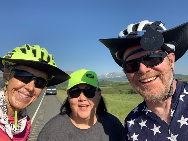
Us with MaryAnn Hall of the Blackfeet Indian Tribe.
As we rode on, the herd was completely occupying the road, but before we got there, a truck pulled up and starting honking its horn. Way to ruin the moment for us, truck. The commotion scared them off the road, and they scattered on both sides of the road, which was sad, especially for the panicking little baby calfs who were separated from their Mommies. Just a matter of seconds after we passed the scattered herd, I looked in my rearview mirror, and they had already reconstituted in the middle of the road.
Further down the road, more cows were hanging out at.a pool of water, with half of them down in the water. When I stopped to snap a photo, by the time I had phone in hand, which only took a few seconds, they were running to thwart my shot. Very clever.
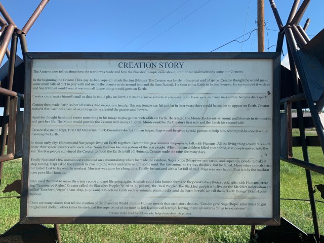
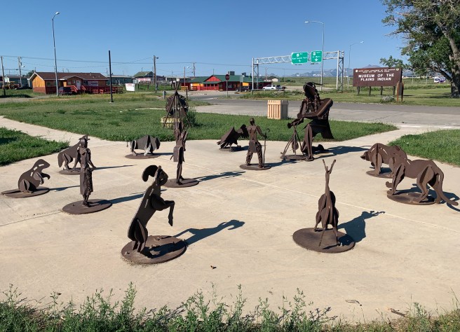
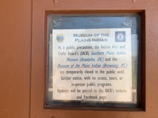
In Browning, we stopped at the IGA grocery store to get a snack, resupply some food and refill our water bottles, then headed over to the Museum of the Plains Indian. After checking out the Blackfeet Creation of Life exhibit, we parked our bikes to see the museum, but once again, their Covid closure interfered. I’m starting to think that Covid is now an excuse to not do things and offer services that the people who control those functions don’t think are essential.
Back on the road, we had 35 miles left to get to Cutbank. We’re talking a solid 35 miles of wheat fields, punctuated by silos. The terrain was mostly what cyclists call “rollers”–little hills that come one after another, and the temperatures were still cool, so the cycling was pretty nice.
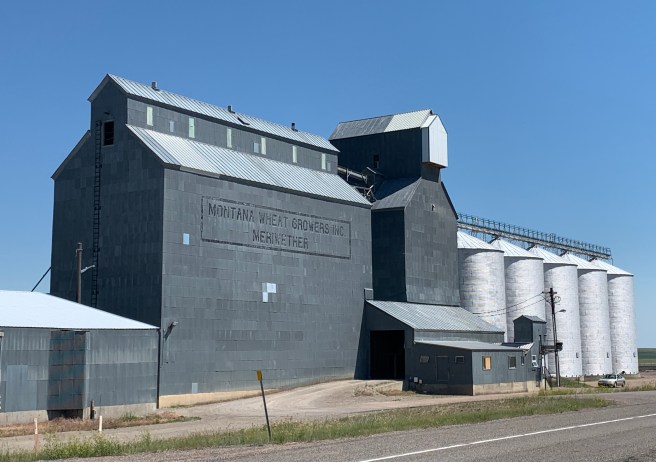
Nice, till it started to warm up the last few miles of the ride. I have been coddling a little saddle sore to keep it from getting worse. Heat aggravates it, so I had to keep stopping to apply and reapply ointment. We were so close to the end of the ride that Ed rode ahead to attempt to get an early checkin at our lodging for the night. Just before town was the official welcome to the Blackfeet nation.
Then after the Blackfeet welcome, there was a short steep descent to cross Cutbank Creek, then a .35 mile super steep hill climb to get into town. I’m pretty sure someone turned the heater on full force, because the temps were up near 100 by the time I made it up the hill. Partway up, on the right side of the road, was the “Welcome to Cutbank” sign, and I would normally stop to take a photo, but not today. The grade was probably 8%, so there was no way I was stopping for that shot. I would have never been able to get going again.
Our Super 8 Motel was just at the top of the hill, which was a good thing, because that hill and the heat sucked all the remaining energy out of my body. I parked my bike and collapsed into a chair near the entrance of the motel. Check in was not till 3 PM, so I had 1.5 hours to cool off in the lobby and gulp down water from their water cooler. After showering, I headed over to the grocery store to buy deli food for dinner and a gallon of soda pop and chocolate milk to rehydrate my body. I did a load of laundry and attempted to work on the blog, but I was down for the count. Had to call it a day.